Earlier this month, I found myself over Presidents Day Weekend with not much to do. So on a whim, I decided to visit all the locations from the 1910 travelogue film, New York of Today.
A remastered version of the short had recently been released, and as per usual, I jumped at identifying all the spots shown. (See my previous investigation into New York 1911.) Most sites were fairly easy to find, with only one real head-scratcher in the bunch.
Produced by the Edison Company, New York of Today was geared towards the European market as a promotion to visit NYC. I don’t know how successful it was in encouraging foreigners to come visit the Empire City, but it did encourage me to traverse the streets in the freezing cold, photographing these recorded spots.
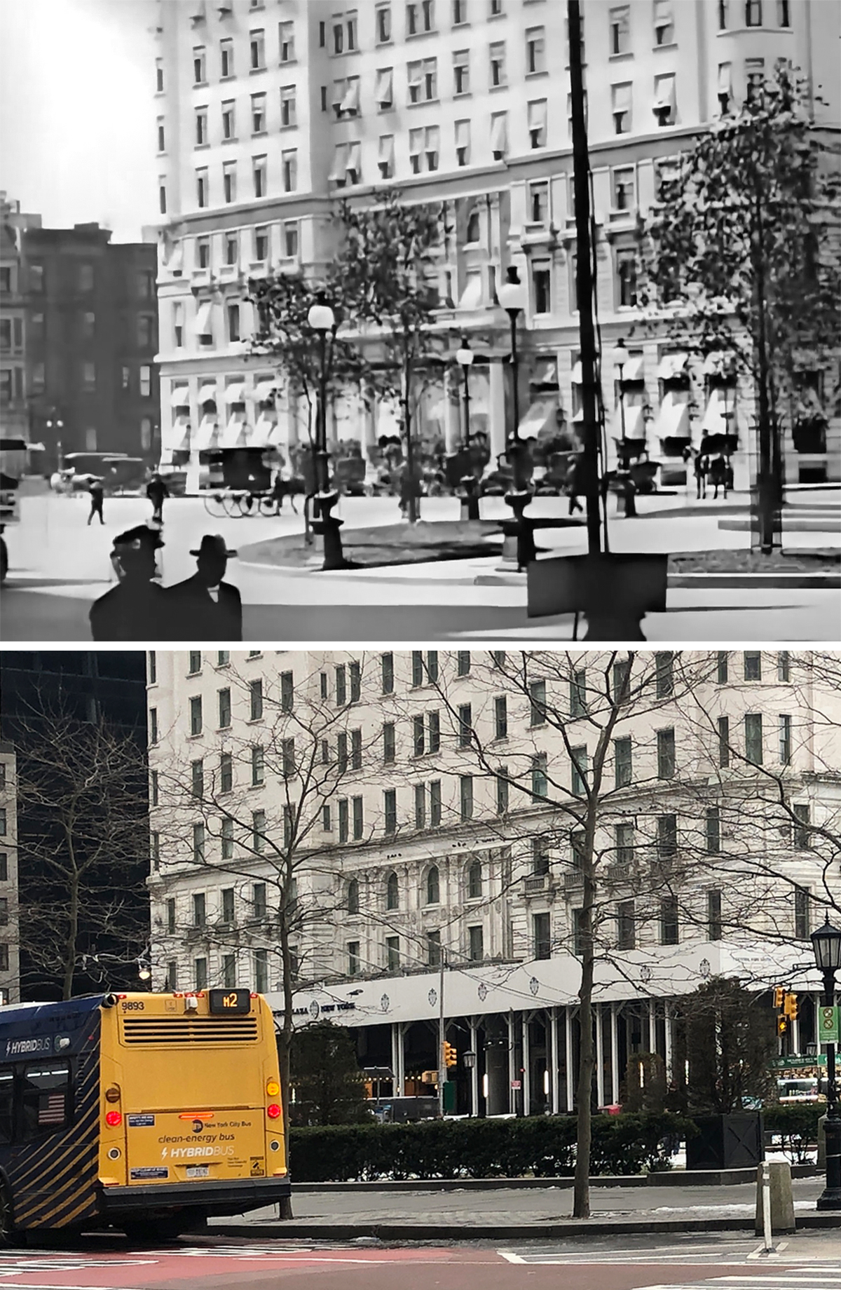
The Plaza
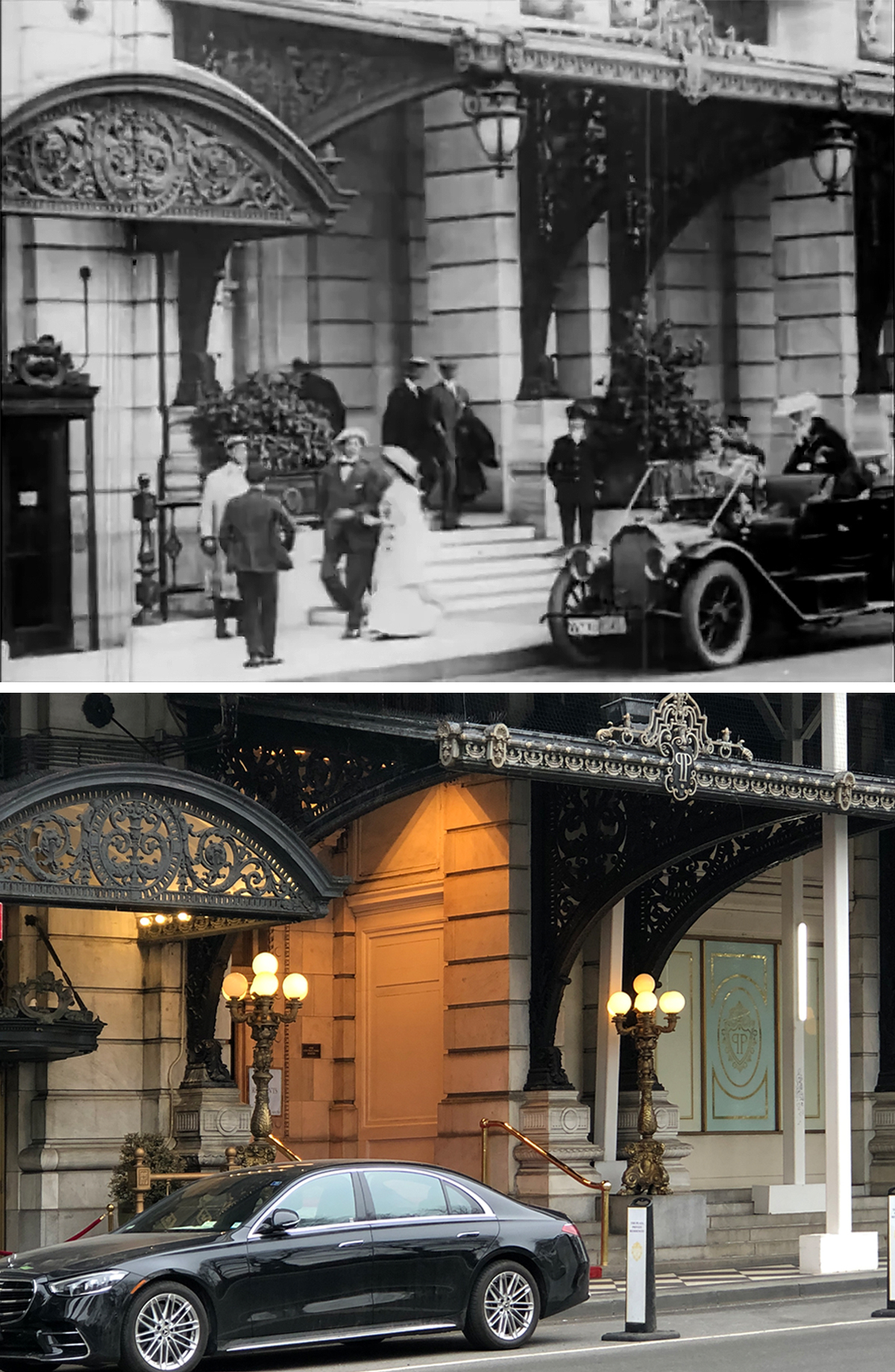
A lot of the locations from this short film were obvious, starting with the iconic Plaza Hotel at the south end of Central Park. The hotel has been featured in dozens of films, but this may be one of it earliest appearances; just five years after it first opened.
It might be noted that the geography in this movie is a bit wonky, jumping all around the city as we follow a pair of visitors doing some sightseeing. It’s this couple and a car advertising “Seeing New York” that are the connective tissue in this one-reeler. In many shots, the couple gets lost in a sea of New Yorkers, but they slightly stand out from the crowd, thanks to their prodigious hats.
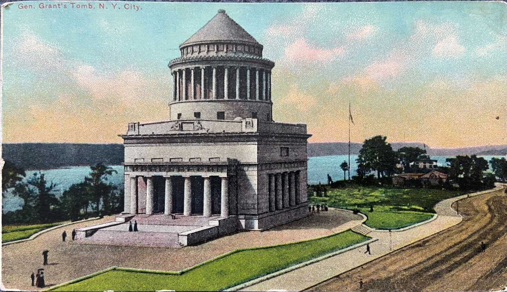
Grant’s Tomb
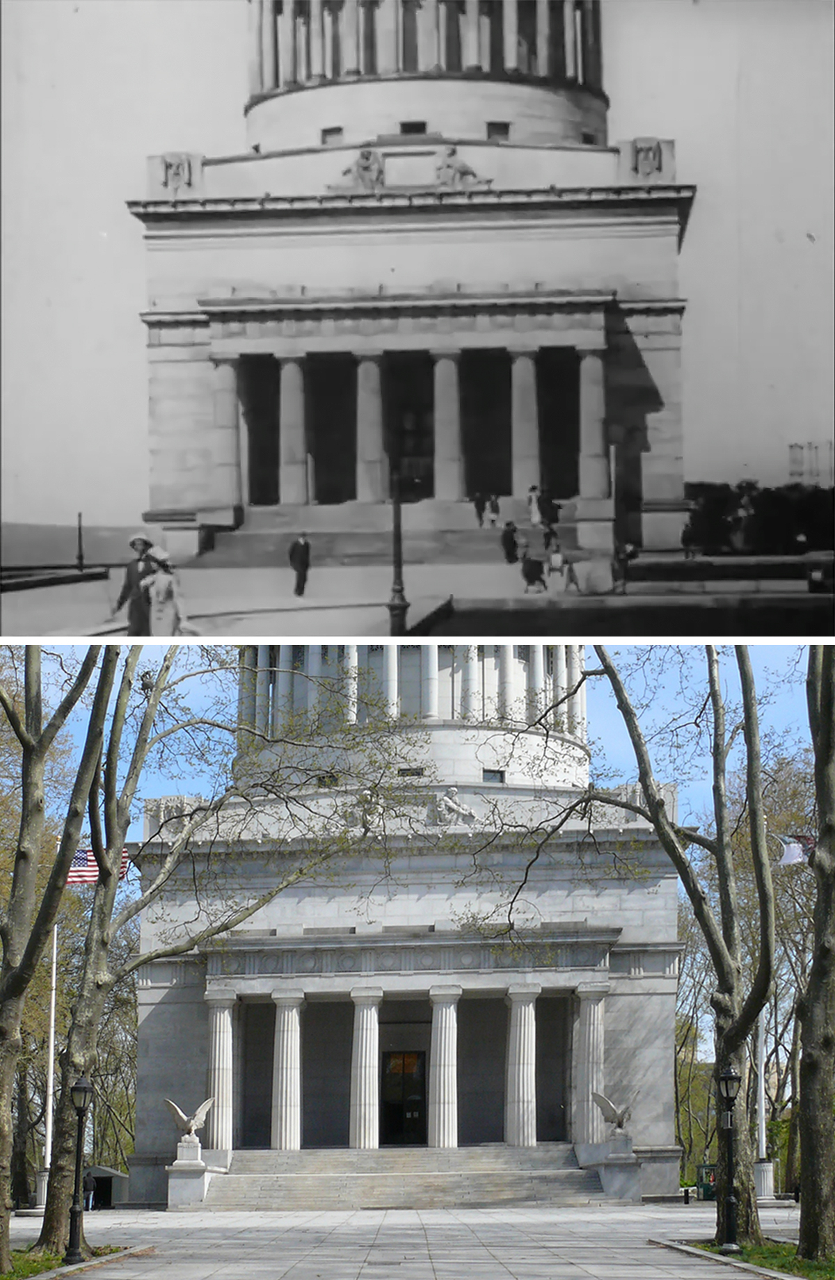
This was another obvious location to identify, it being a major tourist destination… or rather, used to be.
While popular 100 years ago, Grant’s Tomb sees very little foot traffic these days, most likely due to its remote location and a general decline in public awareness of Ulysses S. Grant. That in turn has led to a lack of prominent marketing compared to other NYC attractions, with most tourist websites leaving the 18th President’s final resting place off the docket.
But I’d contend it’s a very lovely destination; a well-maintained historical site in a distinctly bucolic environment. Plus, it’s not too far from several noteworthy Harlem spots that are worth visiting.
Columbus Circle

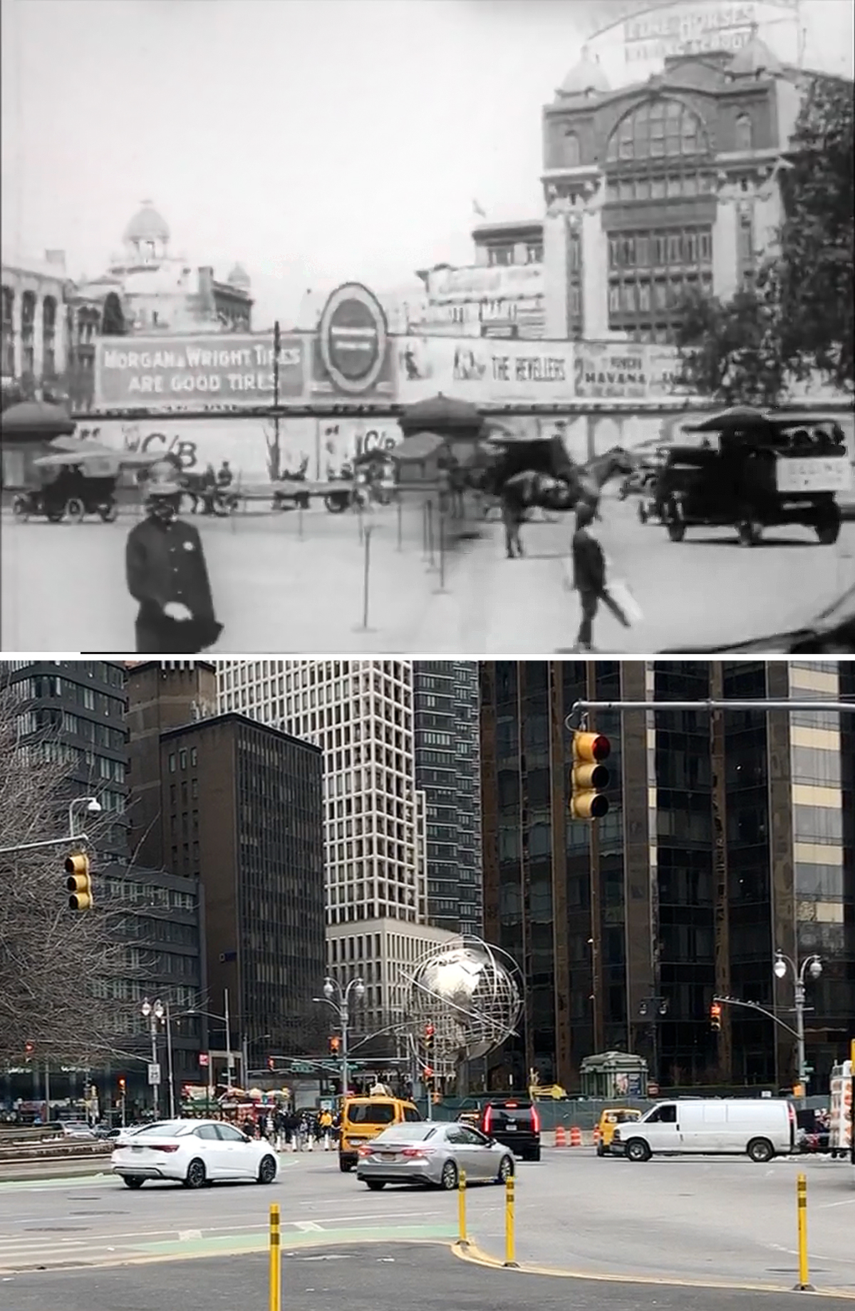
This is the first example of some illogical geography as our “tourist couple” travel from W 59th Street, up to 122nd Street, only to return back to 59th.
That being said, this long panning shot (mostly likely taken from the SE corner of Broadway and Central Park S) offers some nice views of what Columbus Circle used to look like. It’s pretty fascinating since most, if not all, of the buildings seen in the movie are now gone. Another thing missing is the extension of W 59th Street which got eliminated in 1956 when the massive New York Coliseum was erected on the west side of Columbus Circle.
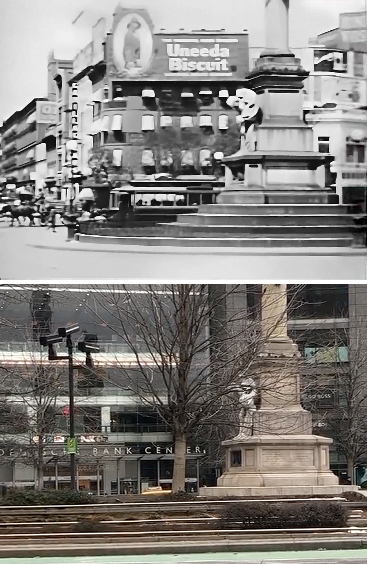
Times Square


This is another significant landmark that was easily identified. Although, the thing that immediately caught my attention wasn’t the building itself but the ornate subway kiosk in front of it. These Budapest-inspired entrances were installed along the original IRT when it was built in the early 20th century, but the only one that was situated in front of a skyscraper like that was the one in Times Square.
While the subway kiosk is long gone, the tower at One Times Square is the same one that was constructed in 1903–1904. Originally built as the headquarters of The New York Times, the building’s design has been heavily modified throughout the years. Sadly, all of its original neo-Gothic details have been removed or covered up.
Today, the building’s primary design is a wall of digital billboards (which were added in the 1990s), making One Times Square one of the most valuable advertising locations in the world.
Brooklyn Bridge
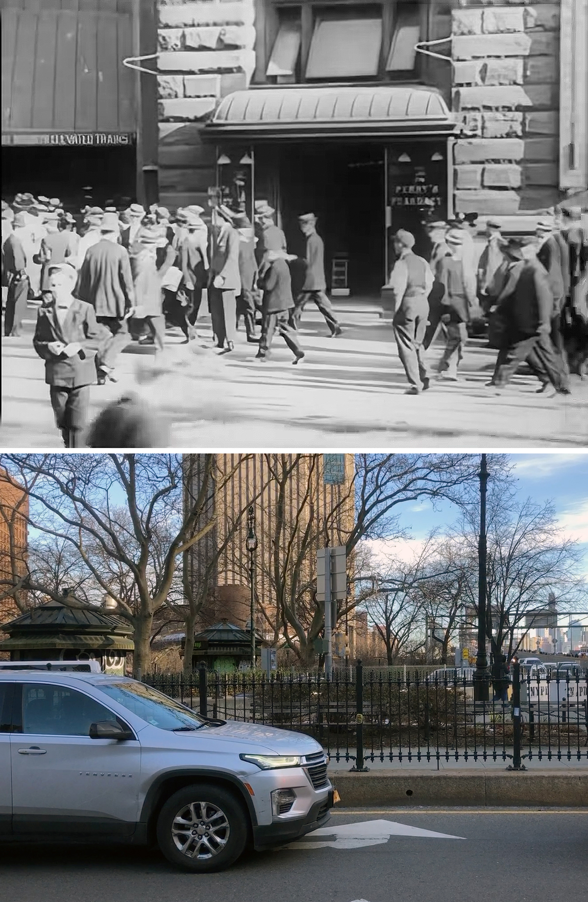
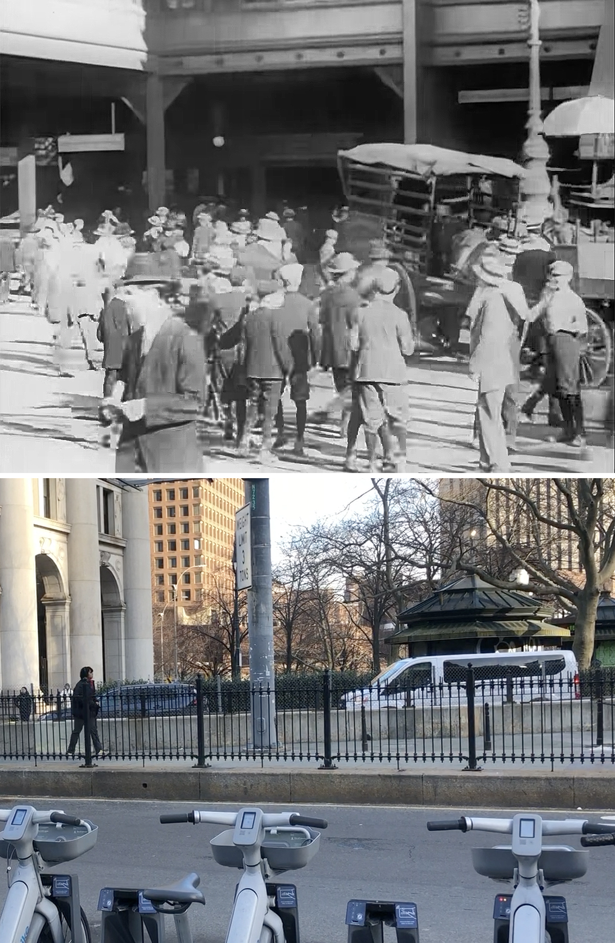
This was one of the first locations to give me a little bit of trouble in identifying, but I was able to resolve things fairly quickly.
Because this panning shot was pretty tight, it was hard to get a fix on the neighborhood, but I had a gut feeling we were looking at the elevated train station at City Hall. This instinctual feeling stemmed from my past investigations into the 1950 noir movie, Side Street, and a 1911 travelogue film, both of which featured a couple shots from the area.
But the thing that helped me confirm this location was a couple vintage photos I found on the NYPL digital archives, showing wider views of the Brooklyn Bridge El station.
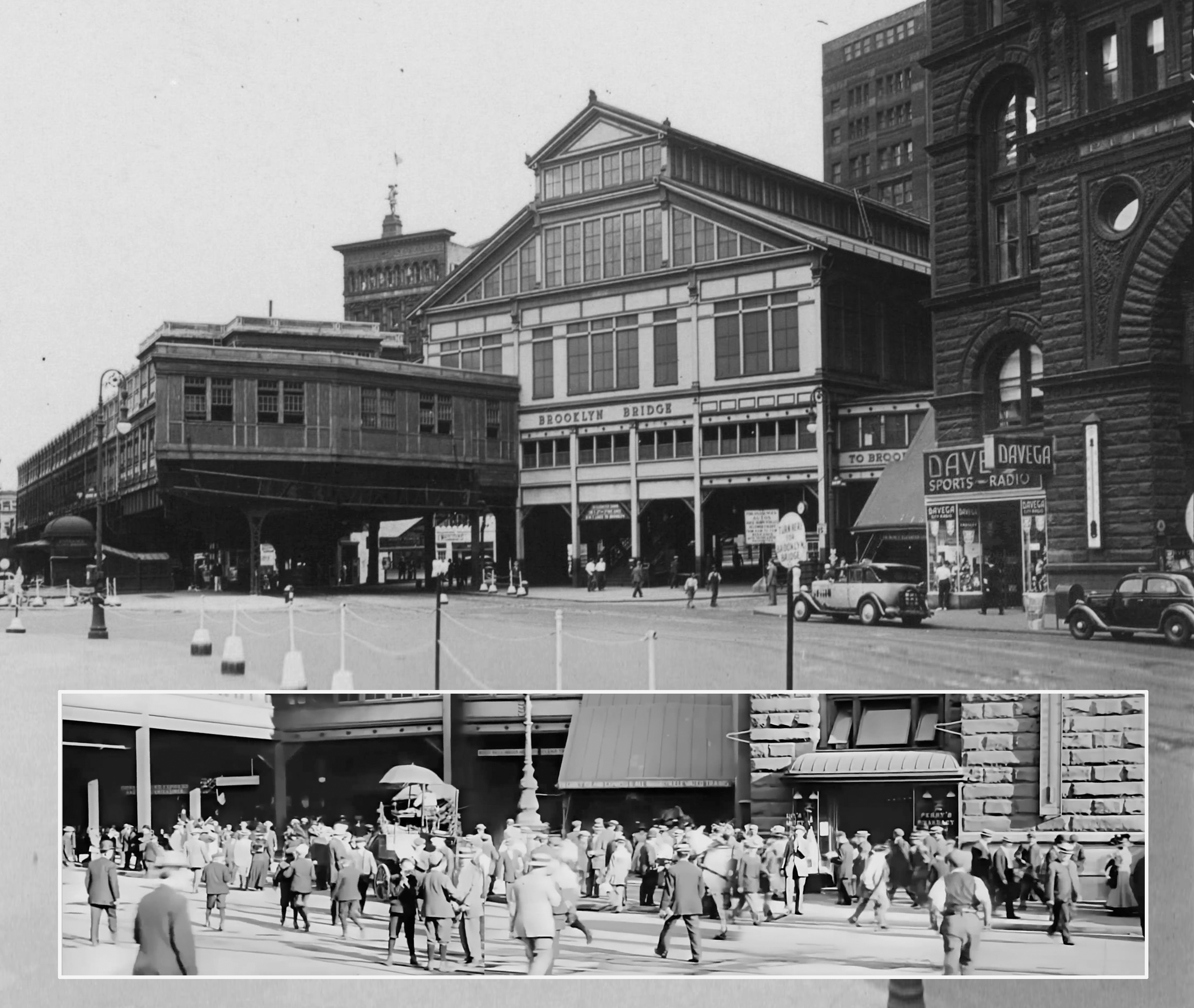
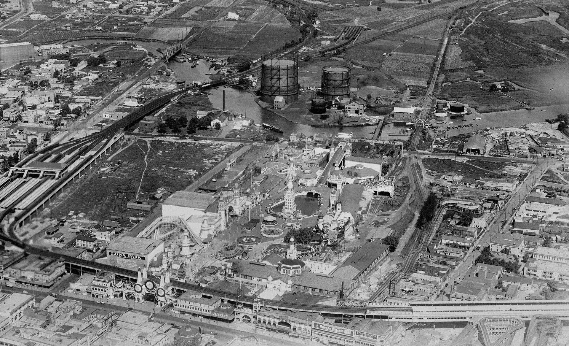
I was able to match up several elements from a 1938 photo, confirming I found the correct place. Then, I used a 1936 aerial photo to give me a general idea of where everything was situated.
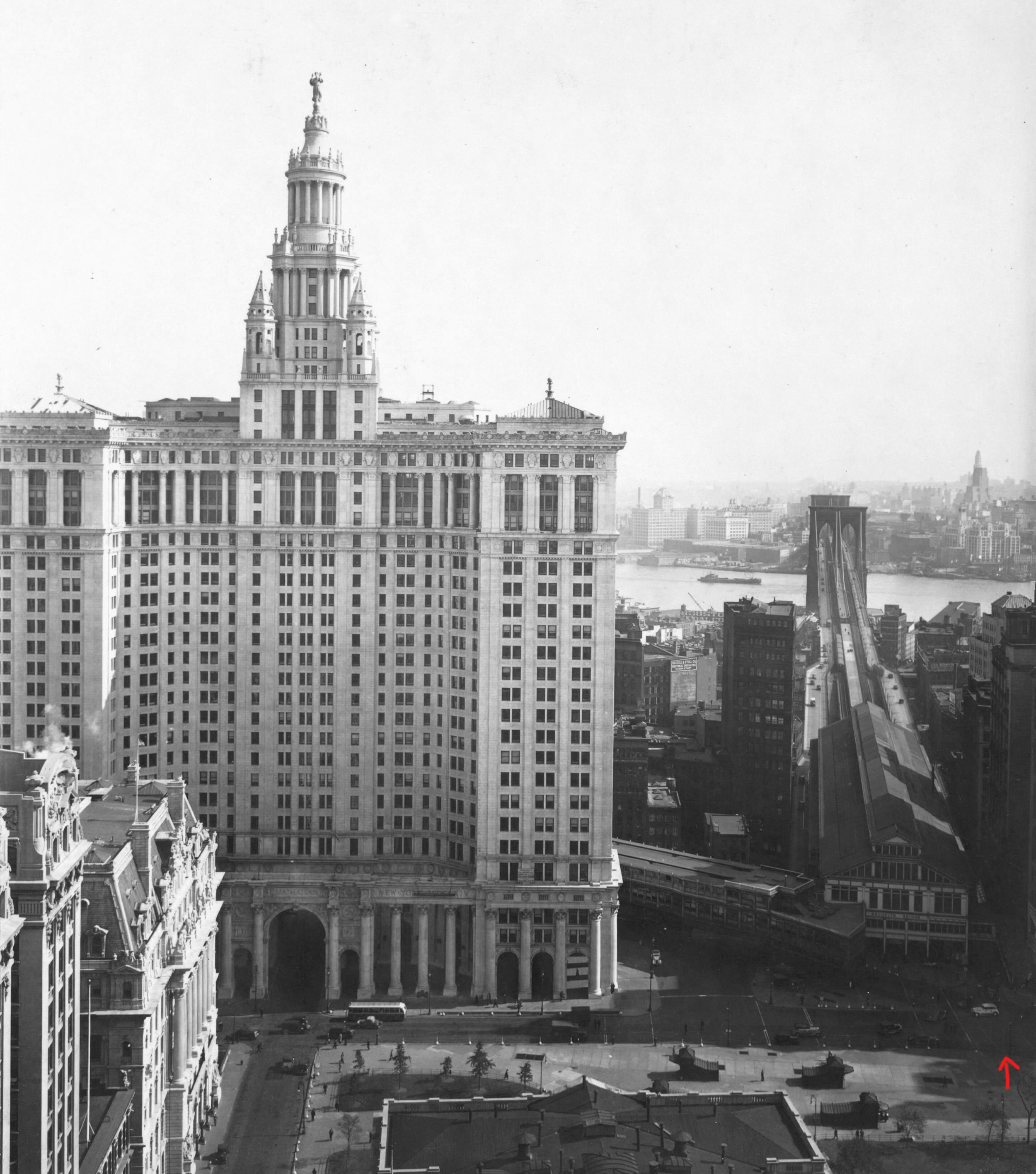
The aerial photo showed the Municipal Building, along with the Third Avenue El station and the train shed from which all Brooklyn traffic started. Using the extant Municipal Building as a guide, I was able to ascertain the approximate location of the camera.
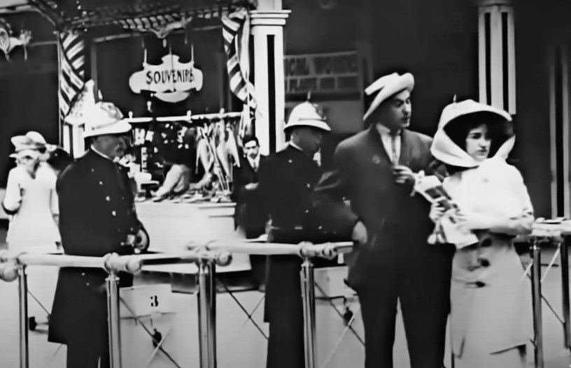
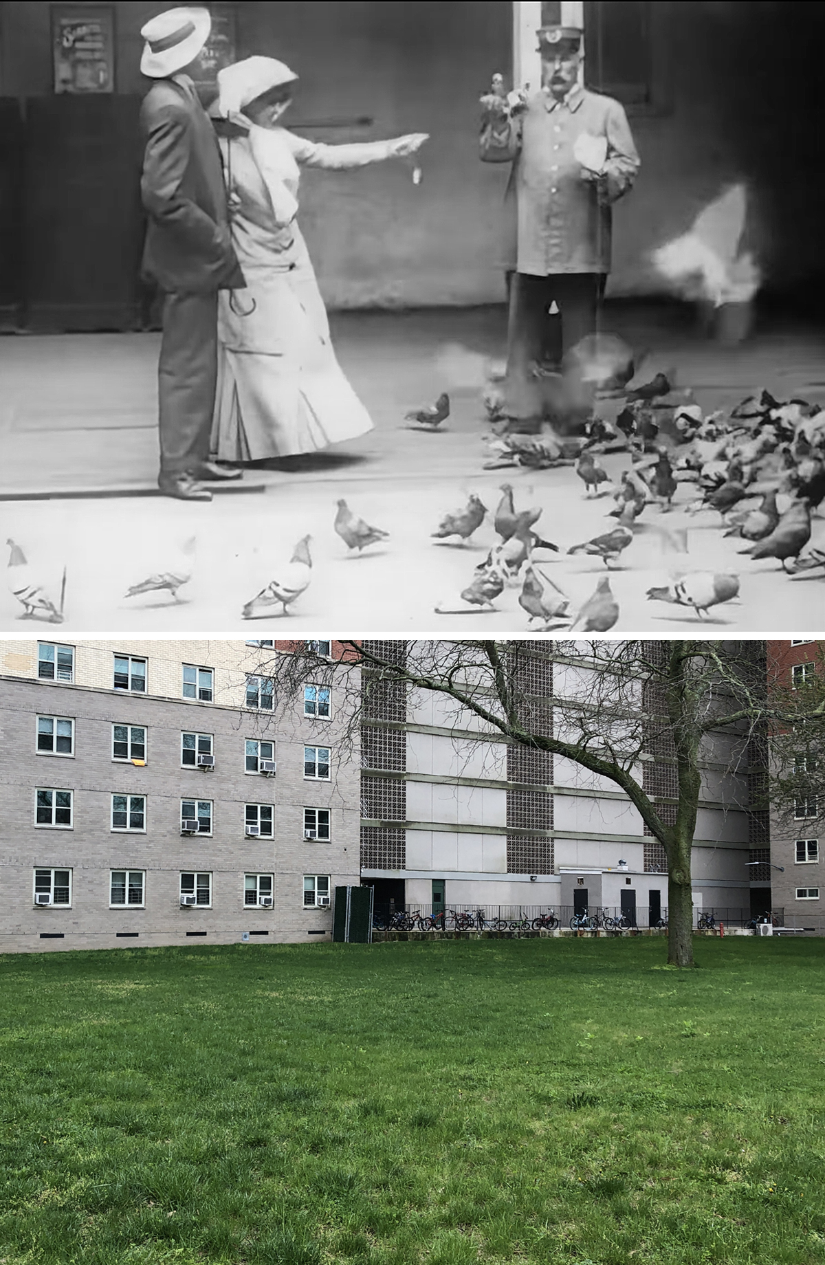
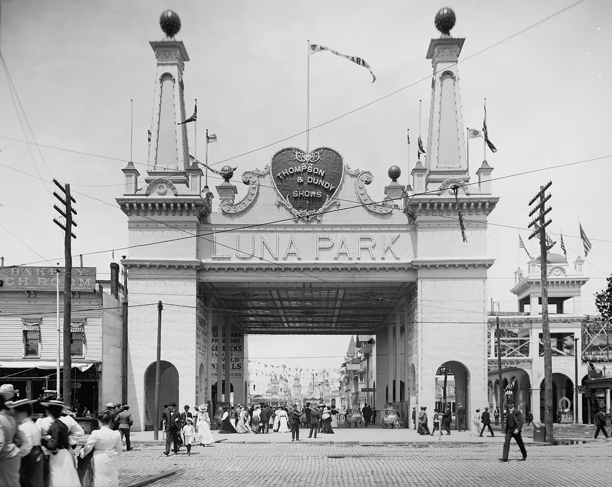
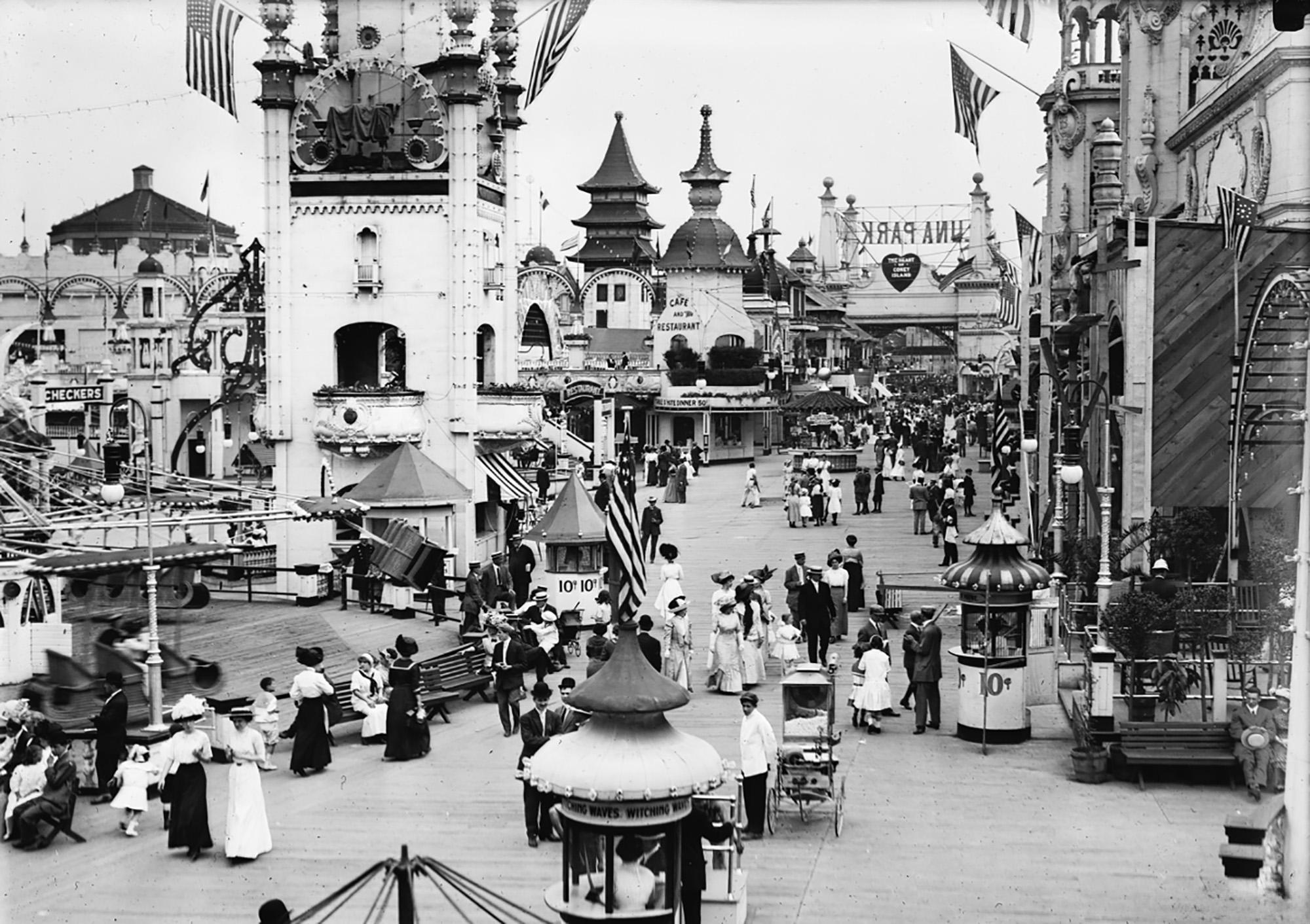
Luna Park
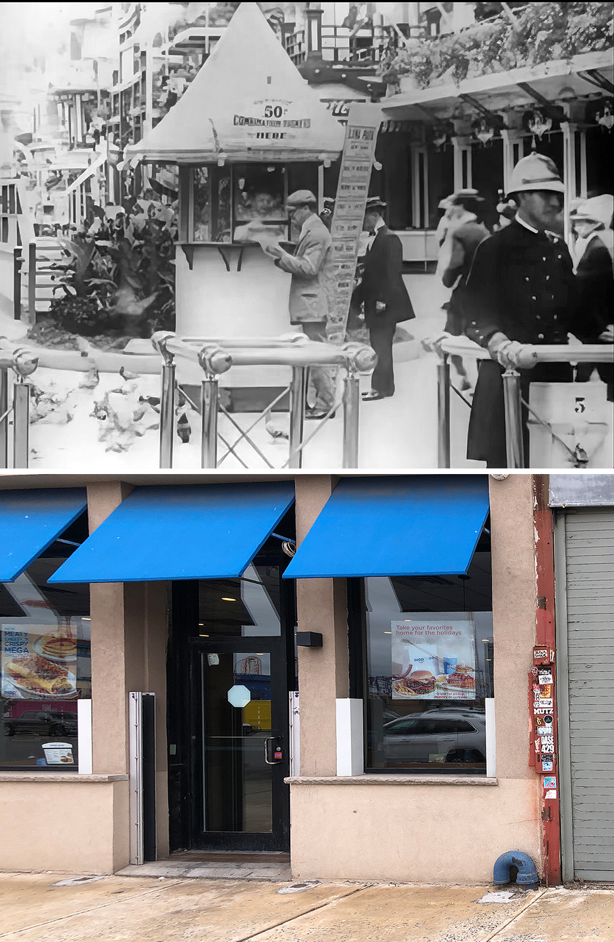

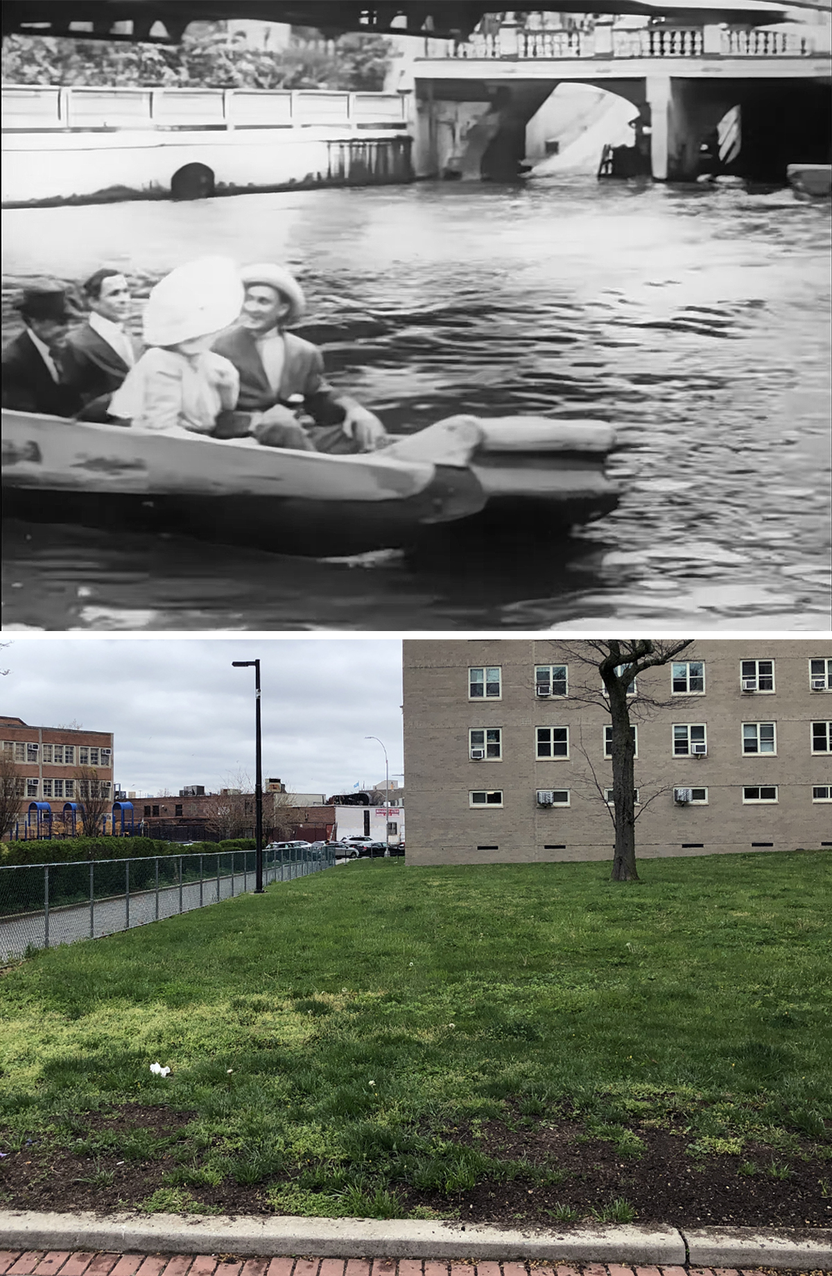
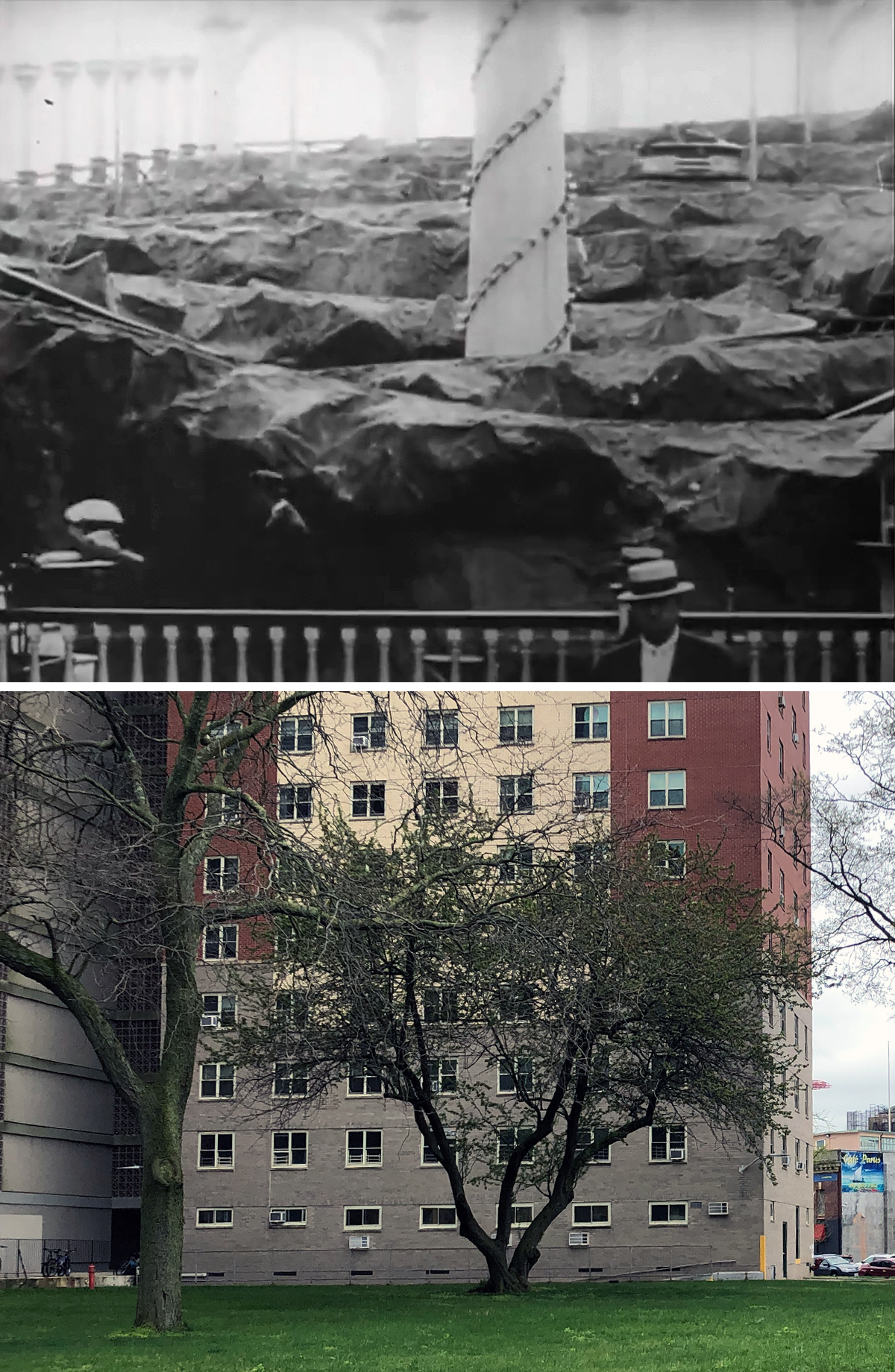
While it was easy to recognizes this location as the former Luna Park in Coney Island, the tricky part was identifying the different rides and figuring out where they were located.
The original amusement park first opened in 1903, and unlike the current Luna Park in Coney Island, the old one wasn’t directly on the boardwalk; it was actually a block north, between Surf and Neptune Avenues.
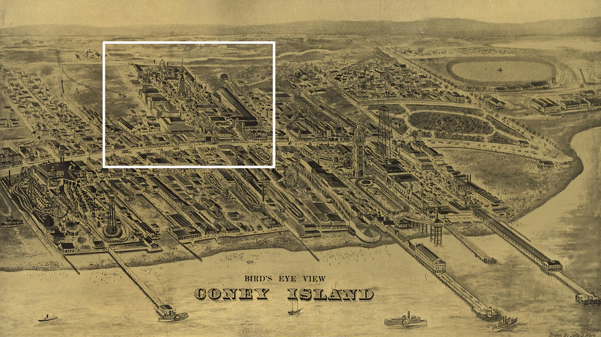
Luna was the second of the three original iconic amusement parks built on Coney Island, the others being Steeplechase Park and Dreamland.
During its tenure in Brooklyn, Luna Park went through several changes and ownerships, swapping rides and attractions along the way.
During the Great Depression, creditors foreclosed on Luna Park twice, forcing the owners to lease the amusement center to a syndicate in 1940, which allowed operations to continue during World War II. Things finally came to an end in 1944 when the park’s western half was destroyed by a fire, and Luna Park officially closed at the end of the season.

The site is now home to a housing cooperative which was completed in 1962 and has no indications of the grand amusement complex that used to be there.
To help give me a general idea of what was where in 1910, I dug up a bunch of vintage images of Luna Park. But it was an aerial photo from 1920 that clearly showed where the Chutes water ride was situated on the property.
I already knew where the park’s entrance was from my research into the Harold Lloyd comedy, Speedy, placing it where an IHOP currently is. So really the only thing I needed to figure out was the location of that winding rollercoaster ride (featured in the last “then/now” image above).
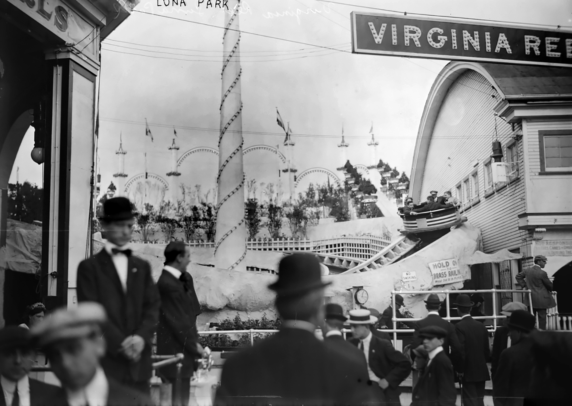
Luckily, I found a website that had a bunch of vintage photos of Luna Park, with one showing what looked like the same ride. The website identified it as the Tickler, however, when I researched that name, nothing that came up resembled what was in the film. That’s when I noticed a sign above the ride that said “VIRGINIA RE–,” which I assumed was the name of that or a neighboring ride.
First thinking it might’ve said Virginia Reef, I eventually discovered it was Virginia Reel, which was described as a roller coaster ride with spinning circular “tubs” that zig-zagged down a track. (The Tickler was a similar type of spinning roller coaster which probably accounted for the confusion.)
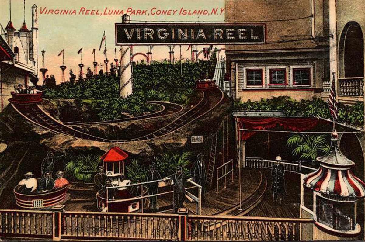
A c 1910 postcard of the Virginia Reel (named after the daughter of the ride’s inventor, Henry Elmer Riehl) gave us a straight-on view of the attraction and confirmed that it was the same ride from the film. Unfortunately, I wasn’t able to figure out exactly where the ride was in the park, but my guess is it was in the northwest quadrant of the property where most of the open-air rides were positioned.
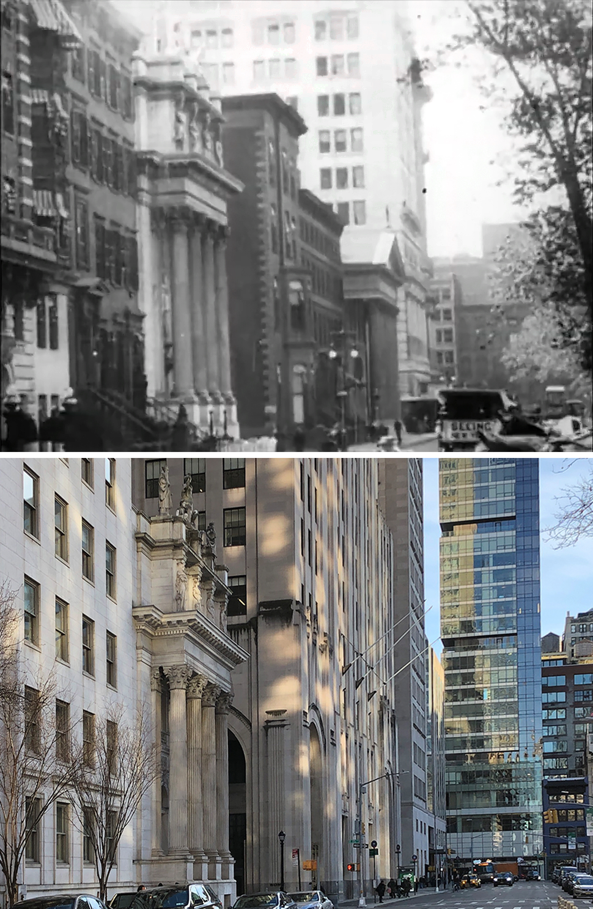
Wall Street
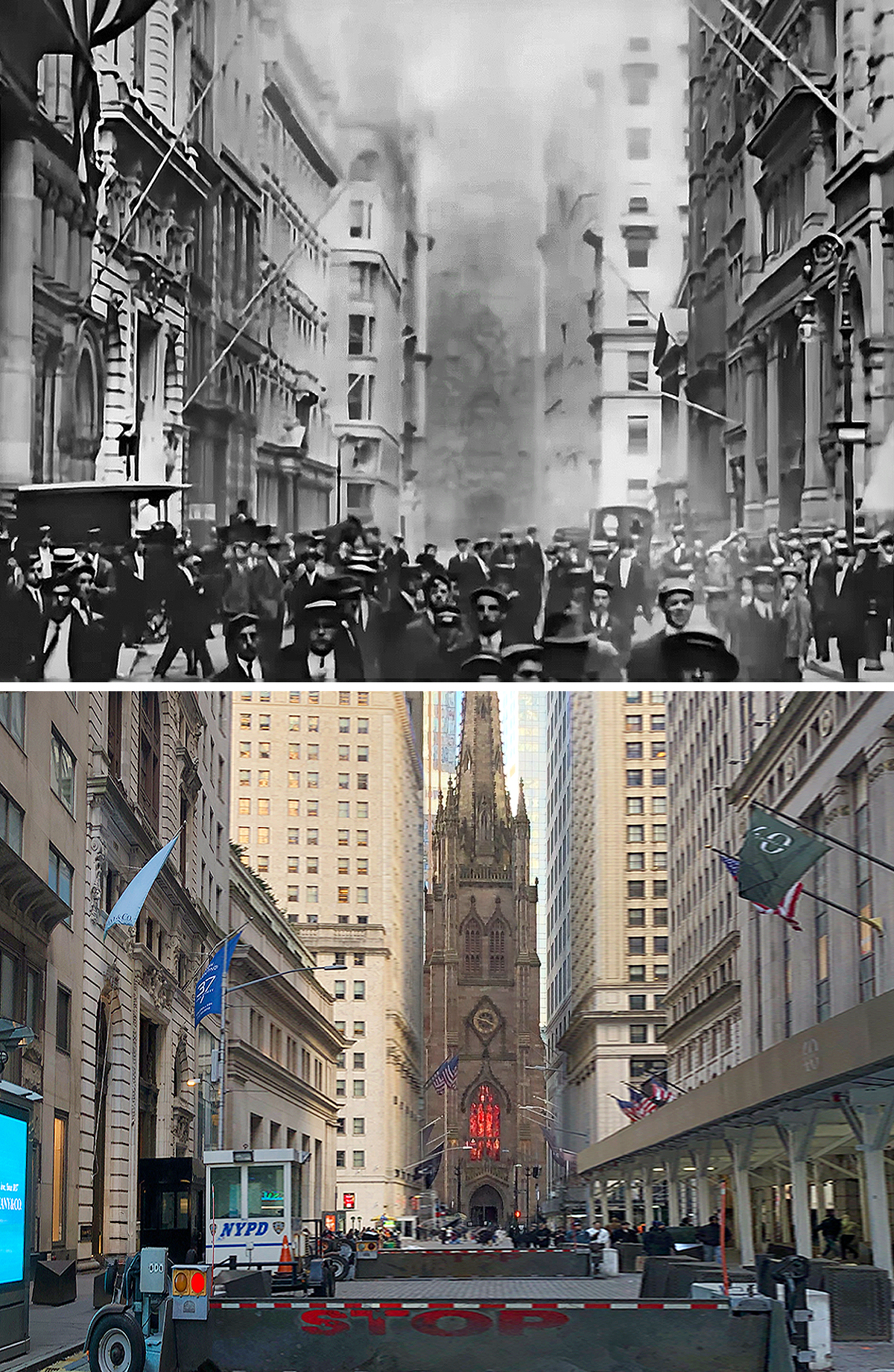
When I first saw this shot of a church at the end of a long street, my first instinct was we were looking at Trinity Church at the end of Wall Street. But a couple things made me second-guess my instinct: one, the image wasn’t very good, so it was hard to make out any details on the church to verify, and two, the buildings on Broad Street didn’t look like the ones in the Edison short.
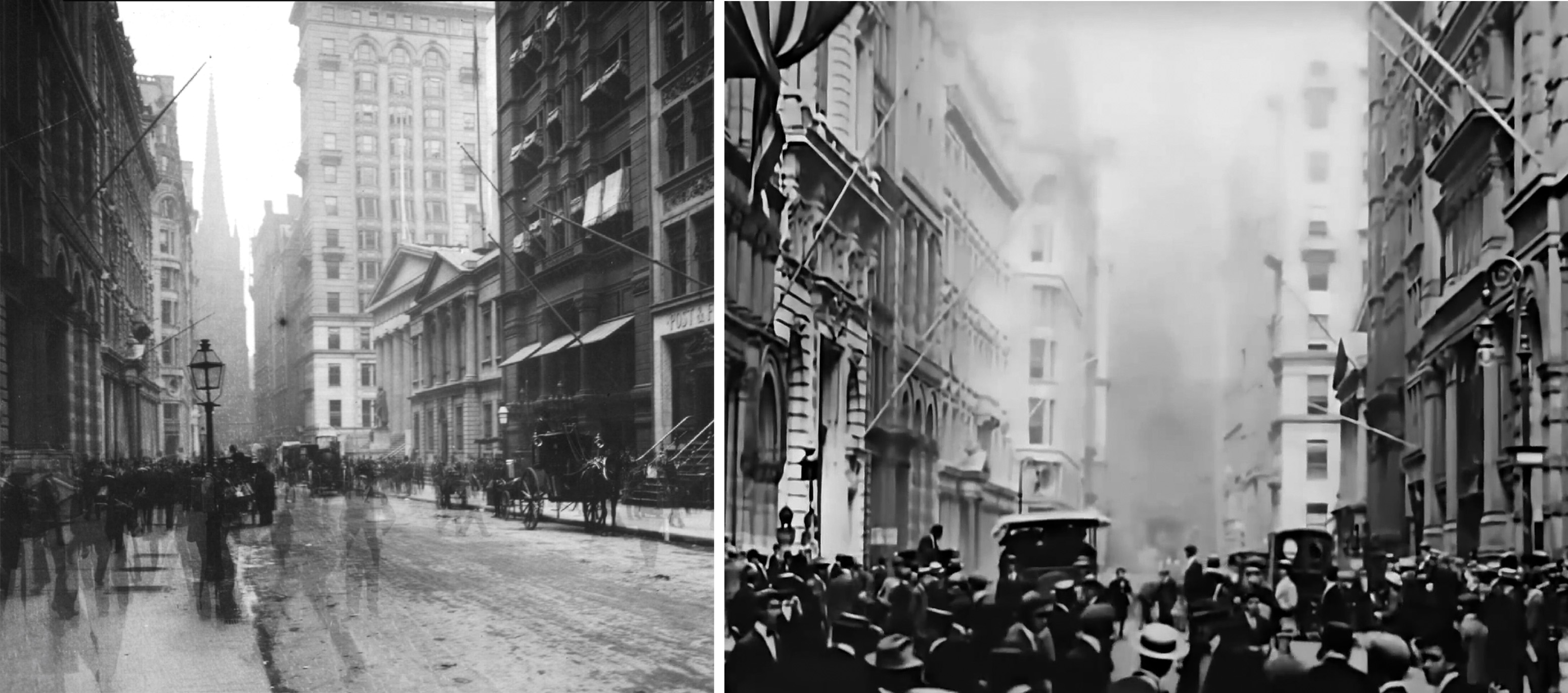
But after digging up a photo from 1904, I was able to match up several buildings with the movie. Turns out, a lot of new buildings went up in the Financial District over the next couple years, replacing much of the blocks along Wall Street.
Lower East Side
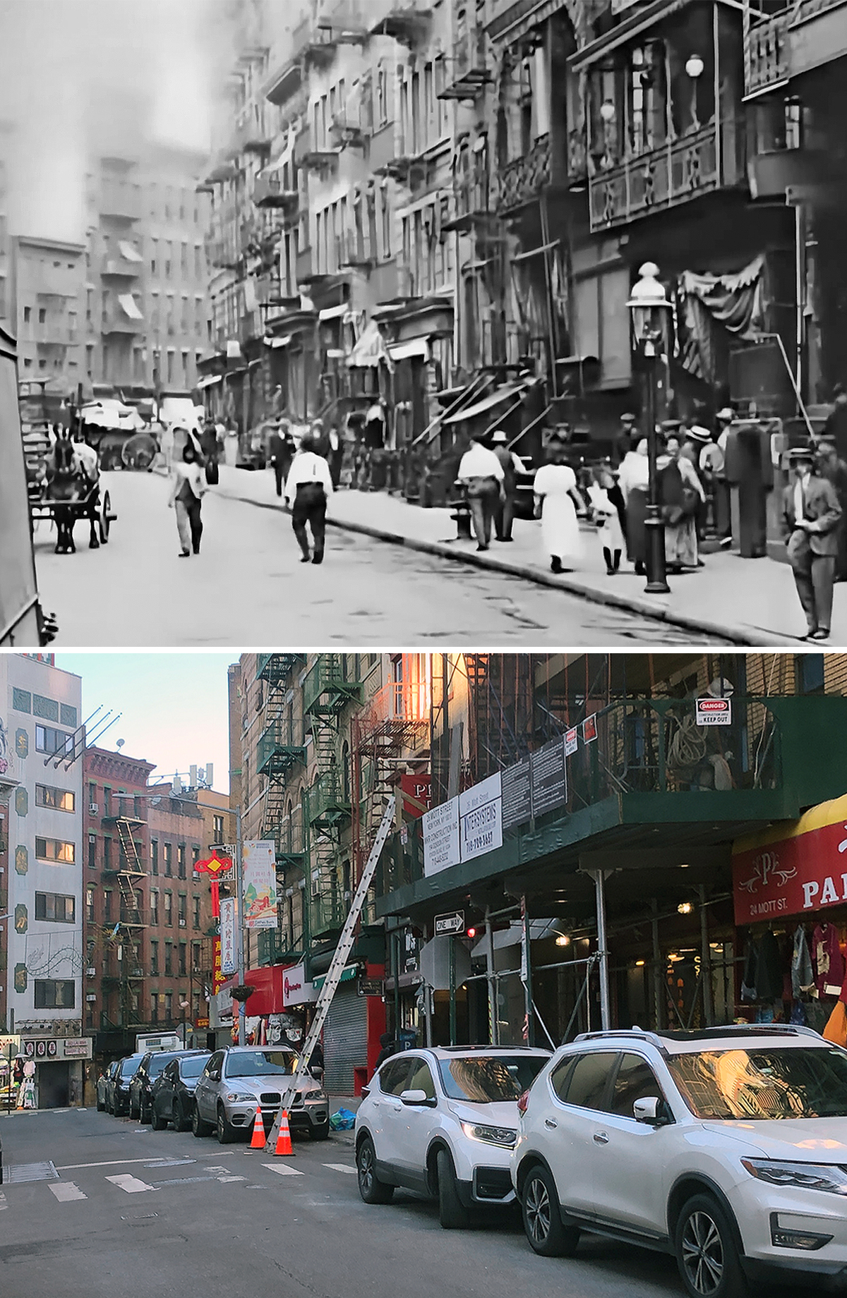
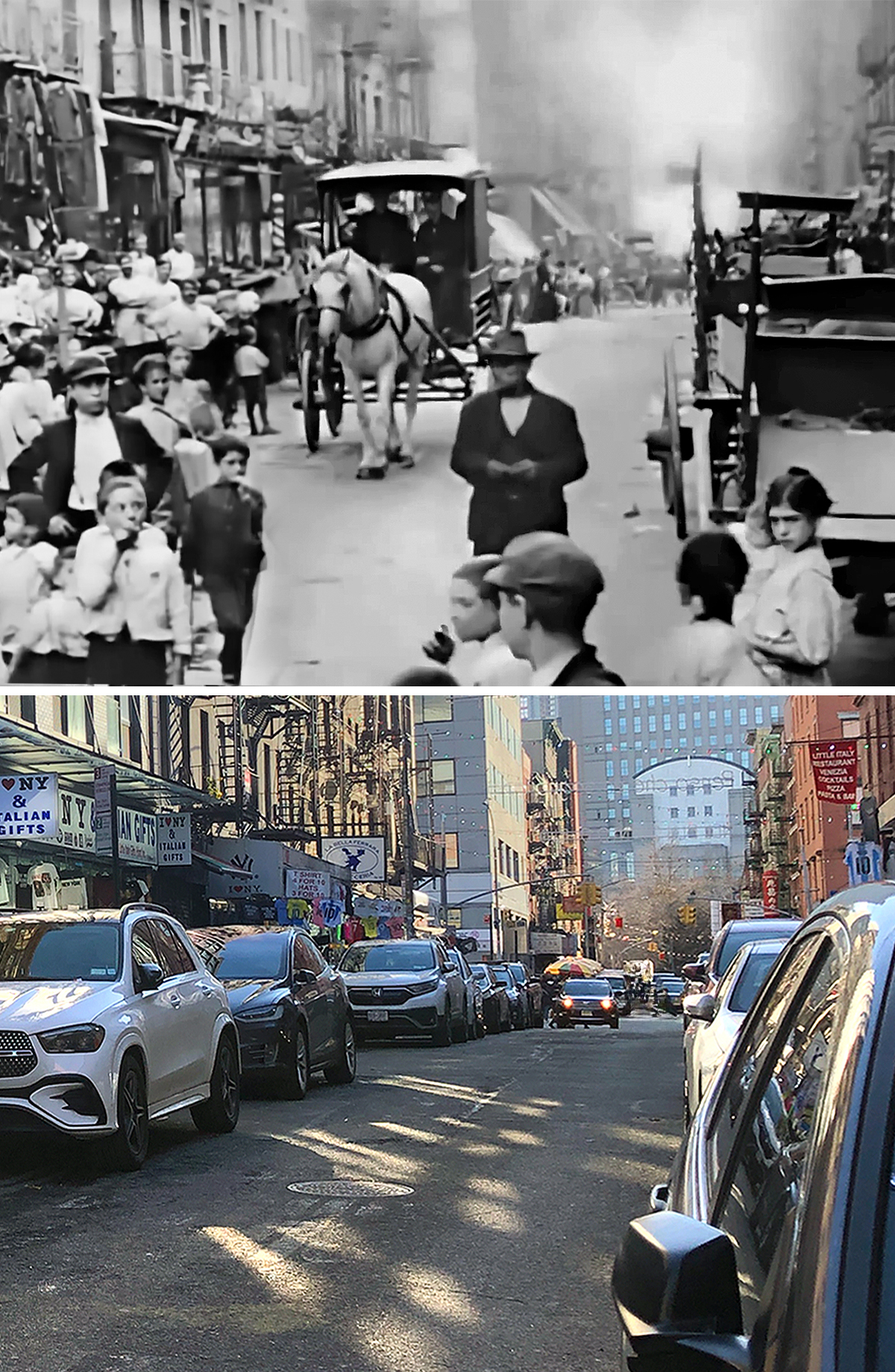
The first location from this section was fairly easy to find, thanks to the distinctive crook in the street. There are a few places in Manhattan that have a bend like that but having watched a bunch of old documentary shorts of NYC, I knew Mott Street was a popular filming destination. And once I looked at Mott on Google Street View, I was able to match several things up.
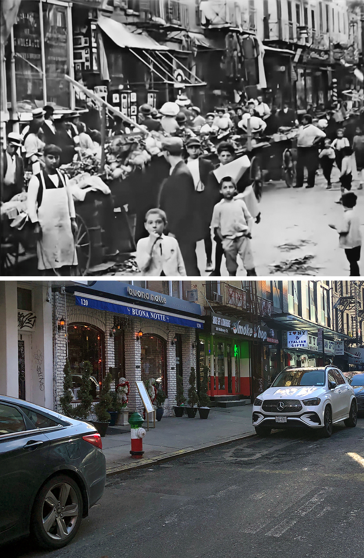
The second location was not as easy to nail down and I’m still not 100% sure if I got it right.
The first thing I did in my search was cruise around a bunch of nearby streets in Google Street View to see if any of them looked like the one in the movie. But that ended up netting me zero leads, so I asked my research partner, Blakeslee, to also take a stab at it.
He almost immediately focused on the window signage on the far left of the frame. It was kind of blurry, but he thought looked like “G Wolea & Co.”
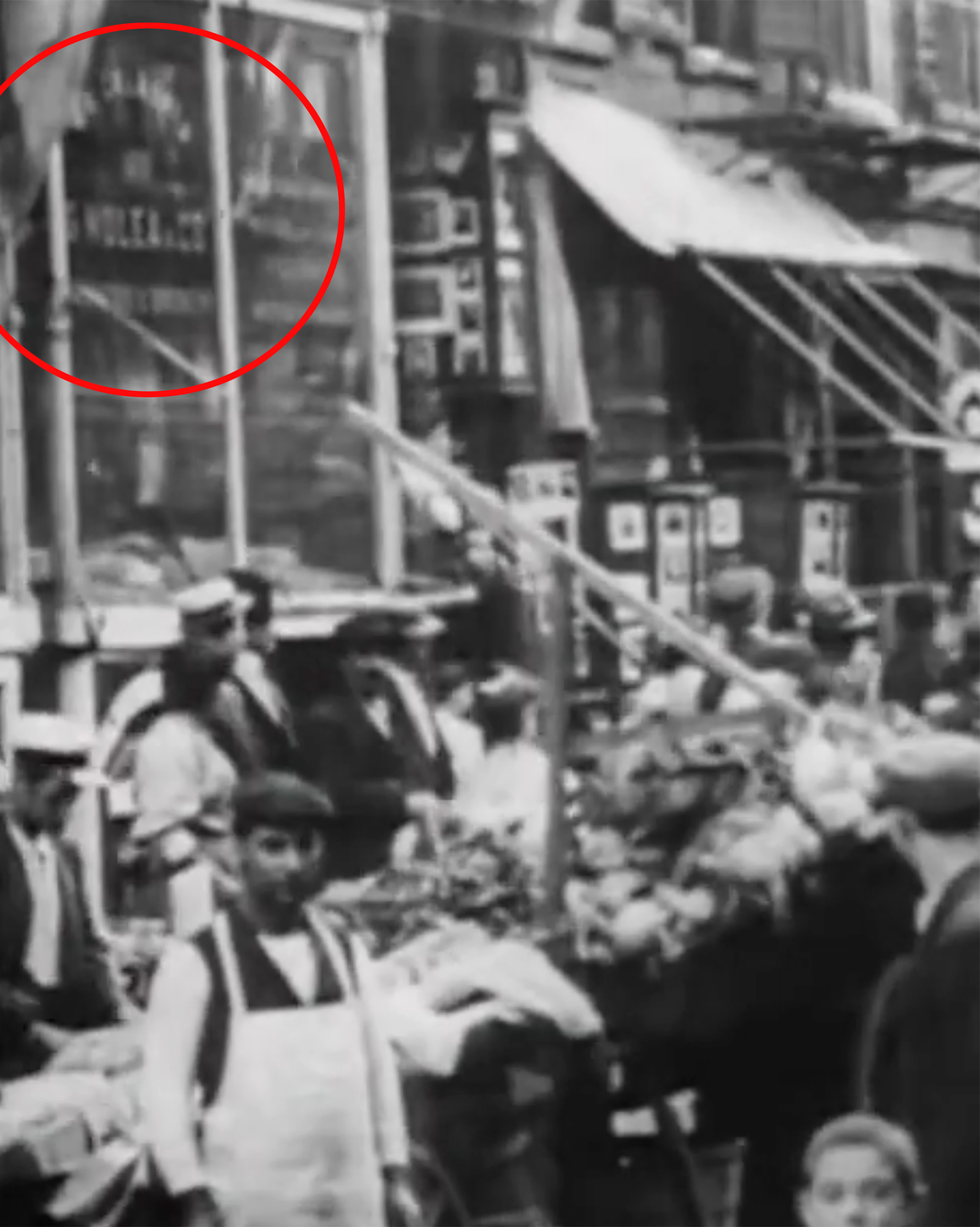
However, he soon reversed his position when he admitted “Wolea” is not a name. Nevertheless, I decided to follow his lead and try out a bunch of different letter combinations to see if any of them made a proper designation.
I eventually landed on the name G Molea and amazingly found a listing in a 1916 business directory, giving the addresses 116 Mott and 175 Hester Street, which are both for the same corner building.
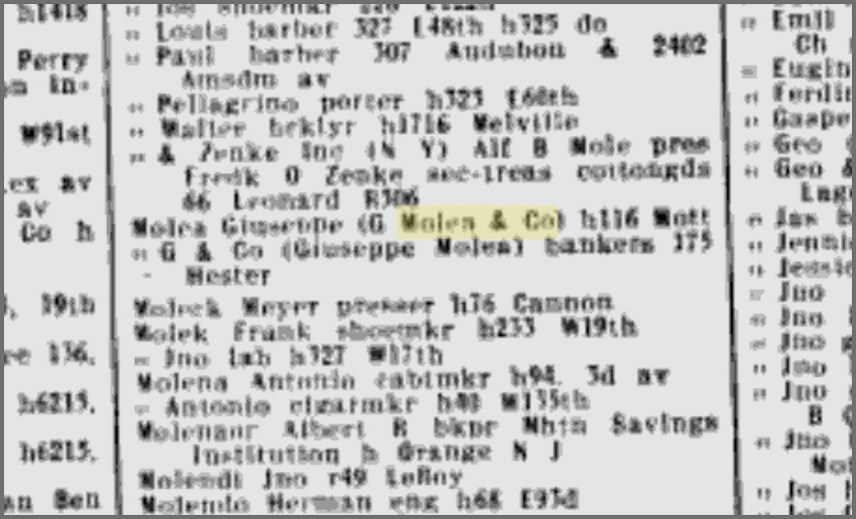
Unfortunately, the buildings and street layouts didn’t match what appeared in the movie. Naturally, one would expect some changes to the area over the decades, but even vintage photos seemed to indicate that 116 Mott was not what was in the Edison short.
After sharing my findings with Blakeslee, he was able to dig up a 1910 listing for G Molea at 122 Mulberry Street.
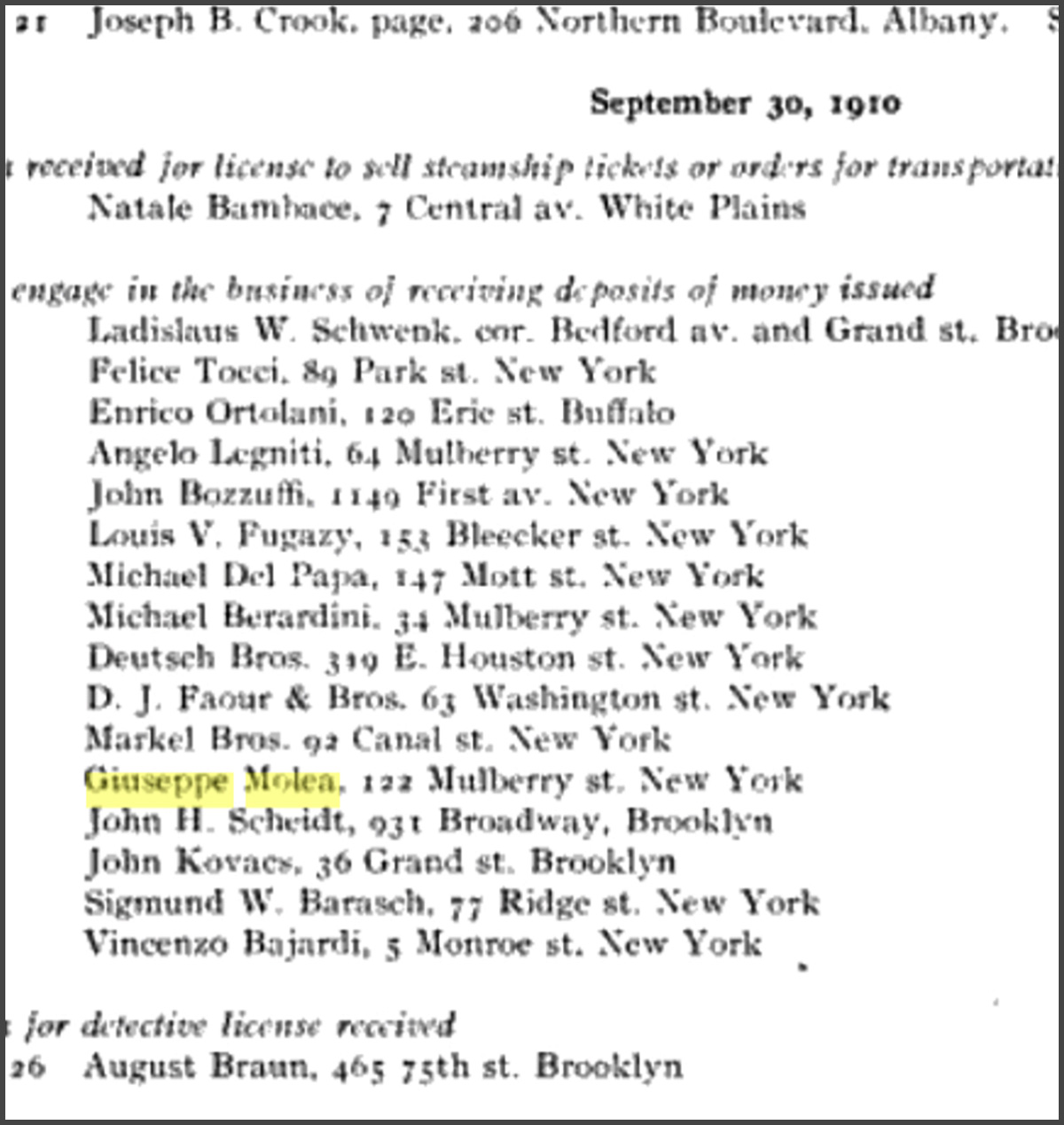
This area looked a bit more promising — even more so after Blakeslee found a circa 1900 photo of the block which appeared to have several matching details.
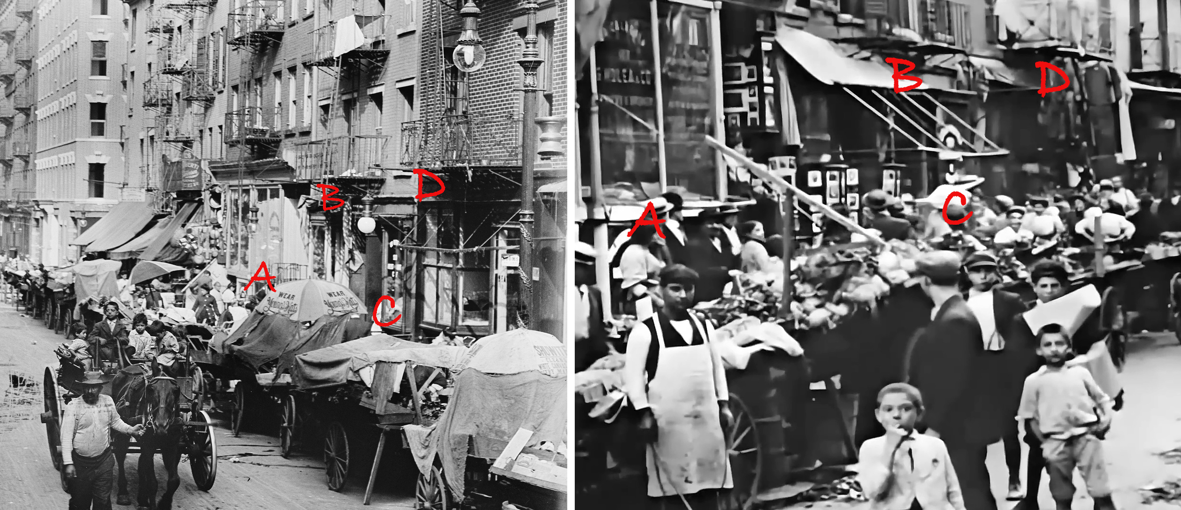
Basically, the c 1900 photo showed a pattern of windows and fire escapes that seemed to correspond with the 1910 short. Now granted, it’s not definitive proof, but it’s fairly persuasive evidence, especially considering 122 Mulberry is just a couple blocks from the Mott Street filming location. In the end, I’m giving this a respectable 75% certainty that we found the right place.
Back at the Plaza

Madison Square Park
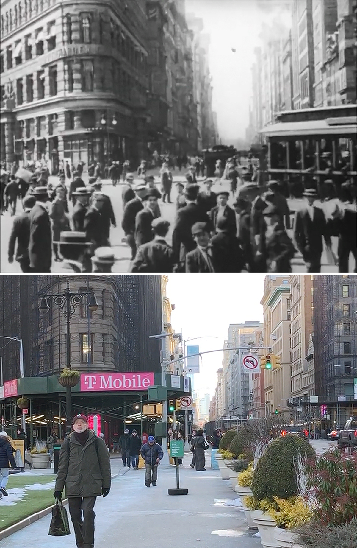
Once again, the movie goes back to the Plaza Hotel area before ending up at Madison Square Park. While the first shot on Madison Avenue wasn’t patently obvious, the T-intersection at 23rd Street was a decent clue to get me at the right spot. And of course, the flatiron Building a half a block over is an iconic NYC landmark that is hard to not recognize.
And with that, the brief sightseeing tour from over 100 years ago is concluded. Not a bad way to spend a Presidents Day Weekend.

Do you think there’s just a bunch of road dust in the 1910 shots, and it blurs out the backgrounds? Or more a matter of camera focus?
LikeLike
My guess it was most likely the result of camera inefficiencies and degraded film stock. The crew almost certainly used a Kinetograph motion picture camera, which was decent but was still being improved upon. Not to say there wasn’t a good amount of dirt and grime in the air, too.
LikeLike