
The early 1900s was a booming period for New York City: the population was rapidly approaching five million, towering skyscrapers were taking over the landscape, and the streets were filled with a mix of automobiles, trollies, horse-drawn carriages and zigzagging pedestrians. And all of this was captured by members of the Swedish company Svenska Biografteatern, who produced a nine-minute travelogue showing the city in all its early glory.
Photographed in 1911, this team of Scandinavian cameramen were able to document the essence of NYC as it was transitioning from the pastoral setting of the 19th century to the bustling metropolis of the 20th. Recently remastered and released by the Museum of Modern Art, the footage is remarkably crisp and clear, giving the viewer a wonderfully visceral experience of what life was like over 100 years ago (and making identifying the locations just a little bit easier).
While the film intercuts back and forth between different locations during its runtime, I organized this article by neighborhood, basically moving from south to north on Manhattan Island.
The Battery

Generally speaking, I focus most of my NYC locations efforts on fictional feature films, but I occasionally tackle vintage documentary shorts, mostly to keep my detective skills sharpened. Afterwards, I’d usually post my findings in the comments of whatever YouTube channel uploaded the video, but I decided to take a deeper dive into this 1911 short, partly inspired by a reader who requested that I do a thorough summery of the locations.
So… Challenge accepted!
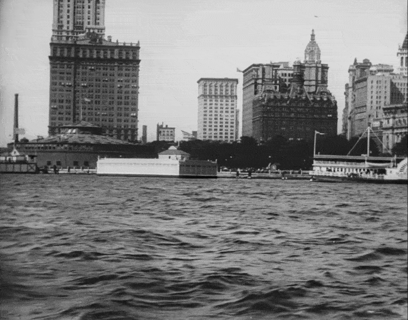
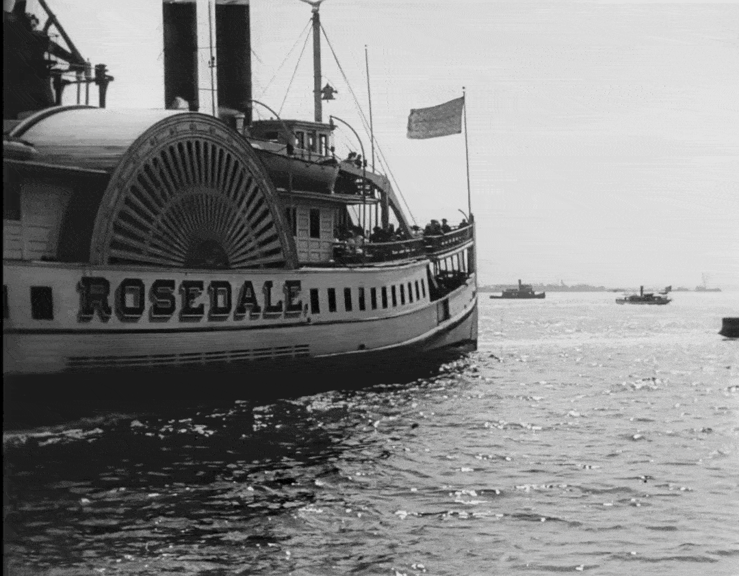
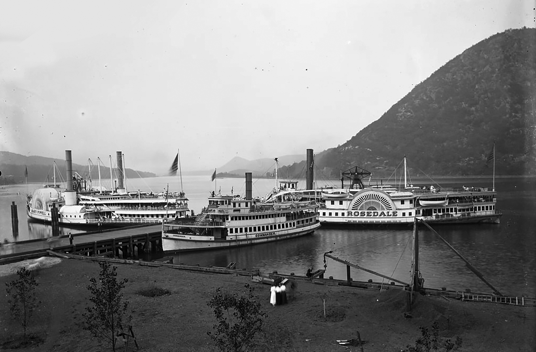
Naturally, these opening shots weren’t too difficult to identify, especially with Lady liberty prominently featured in a few of them. But there were a couple items I wanted to look at a little more closely. The first was the passenger steamboat “Rosedale,” seen traveling south in the harbor.
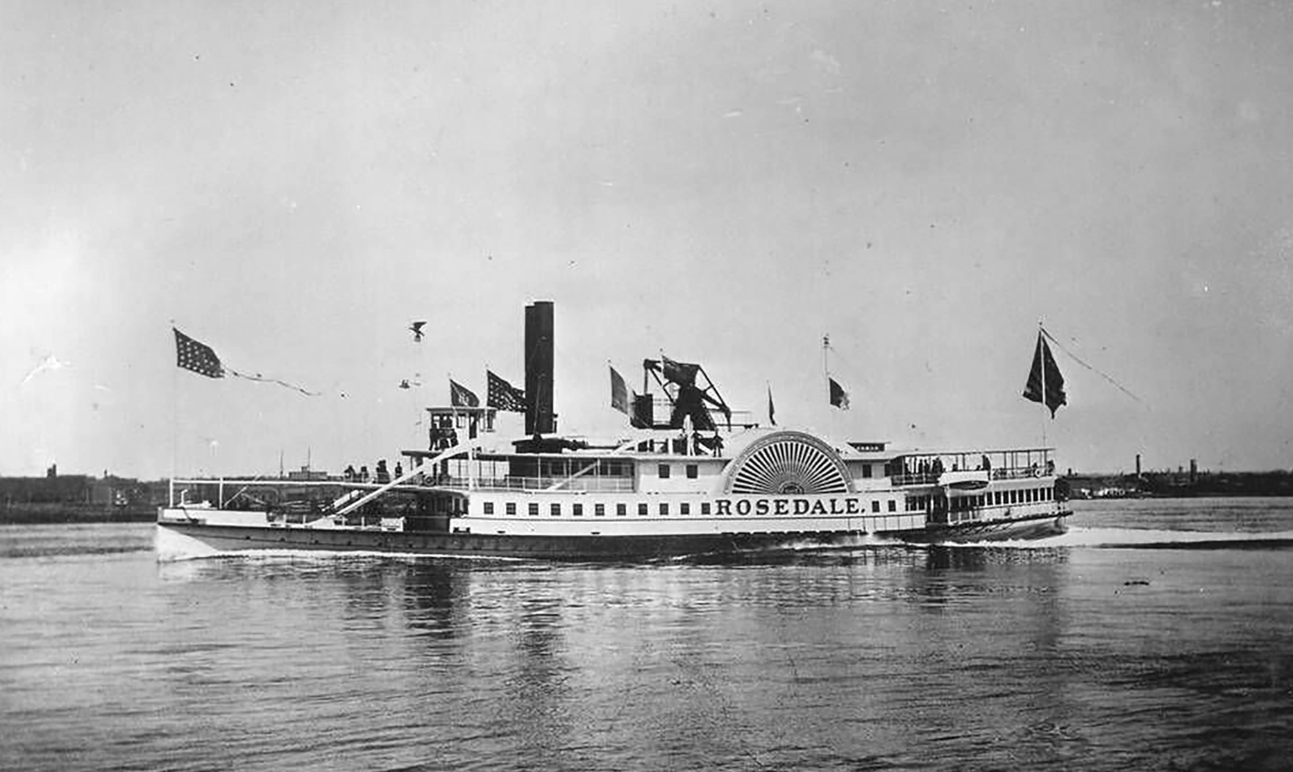
In its day, the Rosedale was deemed one of the most handsome steamboats in NYC, looking more like a vessel you’d see in the old south. Traveling the waters of the Hudson River and Lower Bay from 1877 to 1922, the wooden steamer took on several local routes, including daytrips to Peekskill, NY. However, by the time this film was made, it was primarily traveling between Lower Manhattan and Rockaway Beach in Queens.
One year after it was photographed in this documentary, the Rosedale was almost taken out of commission after it was struck by the steamboat Nassau inside Rockaway Channel, creating a huge gash in its hull. After being repaired in Hoboken, the steamer was back in business, doing some runs in Philadelphia and Norfolk, VA.
The Rosedale’s career finally came to an end in 1922 when a fire ravaged the vessel while laid-up at Norfolk — ironically, the same port where she was constructed some 45 years prior.
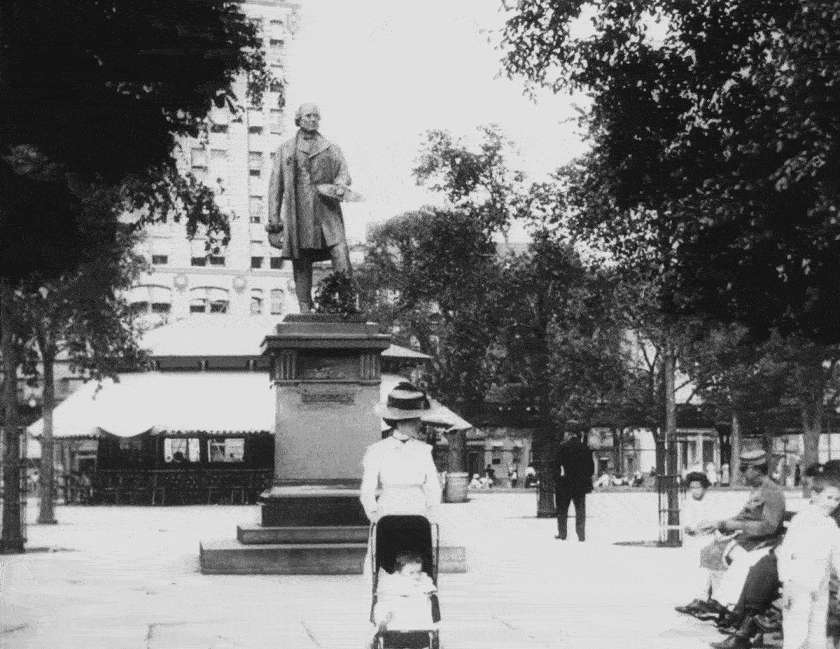
The other item from these opening shots that piqued my interest was the bronze statue of John Ericsson, an esteemed Swedish-American engineer and inventor, whose Scandinavian heritage was probably the biggest factor for the Swedish crew to include his statue in the film.
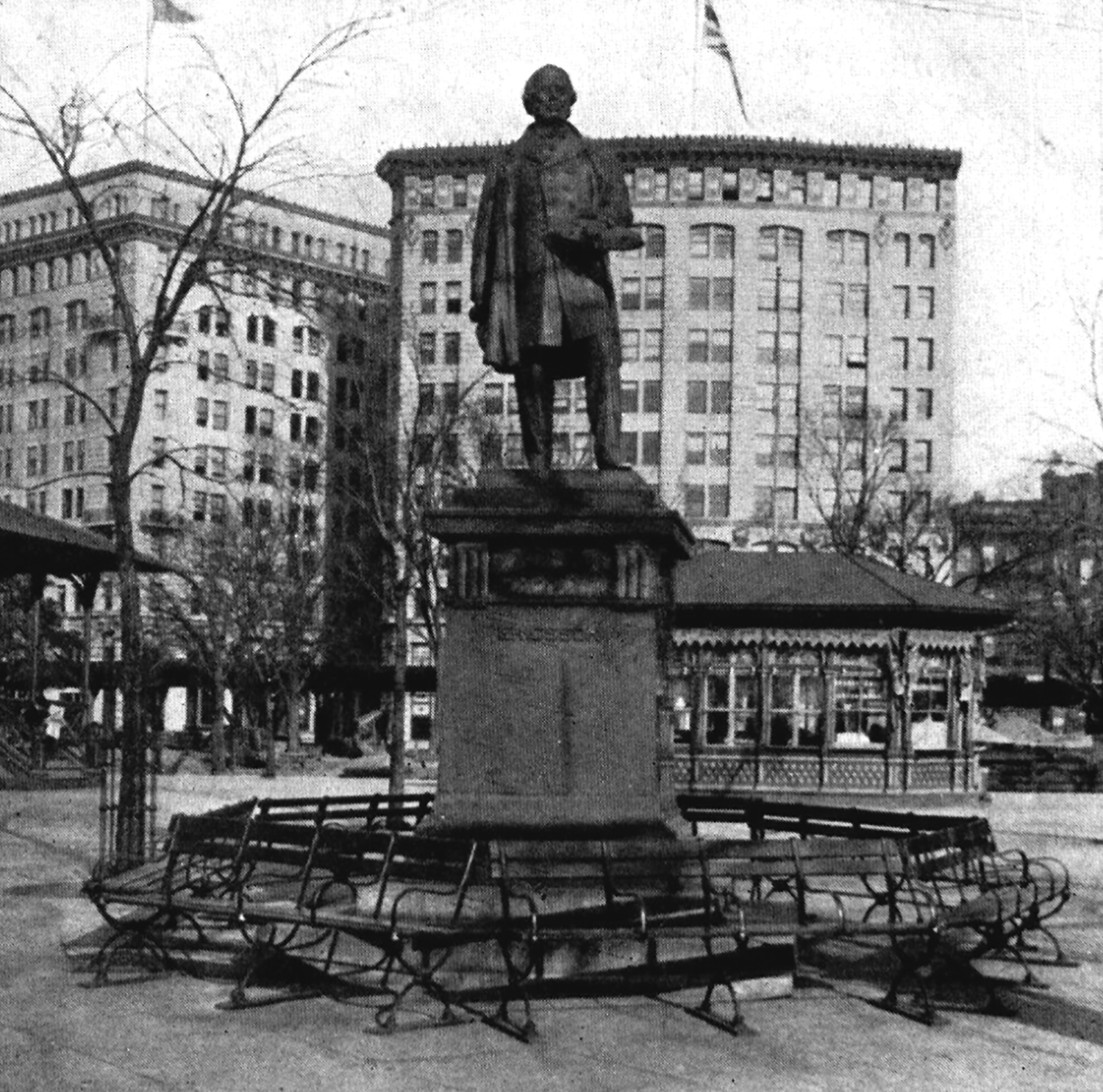
Dedicated April 26, 1893 in Battery Park, the bronze monument has been moved around several times during its lifespan, which created a bit of a puzzle as to the exact spot featured in the film. The main clue I worked off of was a piece of a building that appeared behind the sculpture in the film.
But things got a bit stalled when I couldn’t manage to identify it,. Even after I found wider pics of the statue showing more buildings in the background, I was still at a loss. And to add to the confusion, some of those photographs were mislabeled “Madison Square Park,” making me temporarily think that it was located in that northern park back in 1911.
After rejecting the notion that the bronze figure was ever situated outside the Battery, I went searching for old aerial photos of the area, hoping I could spot a matching building.
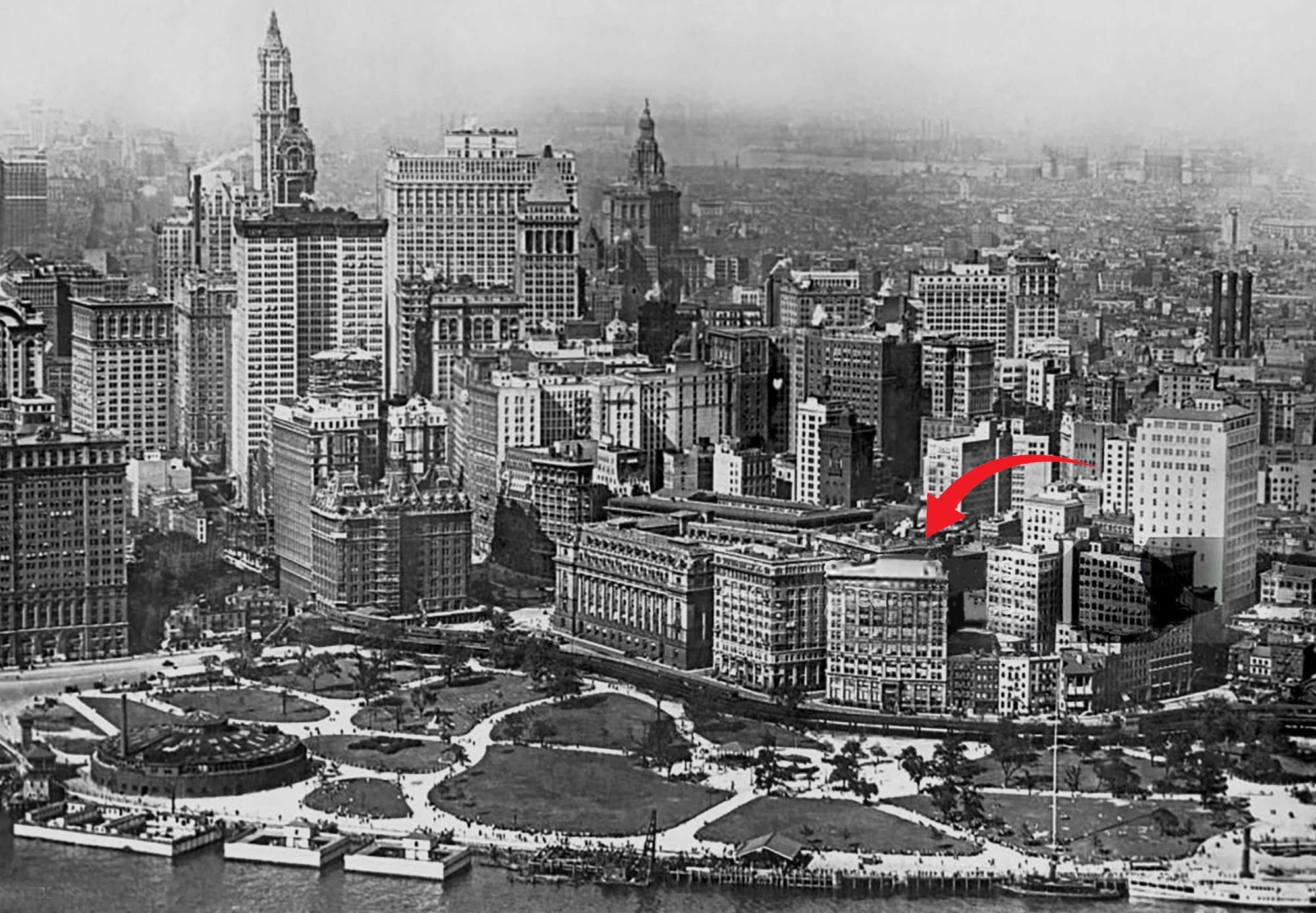
This turned out to be a fruitful strategy, because I soon found a pic that showed the position of the (since-demolished) buildings that appeared behind the statue, as well as the old layout of the park,. From that, I was able to get a good idea of where the Ericsson monument used to be.

Apparently, this statue-relocation is a continuing process. As of this writing, the John Ericsson Statue is located on the perimeter of Battery Park on State Street, across from Bridge Street, but it’s slated to be moved to a more prominent site a some point. This will probably happen sometime after the park’s current renovations are completed.
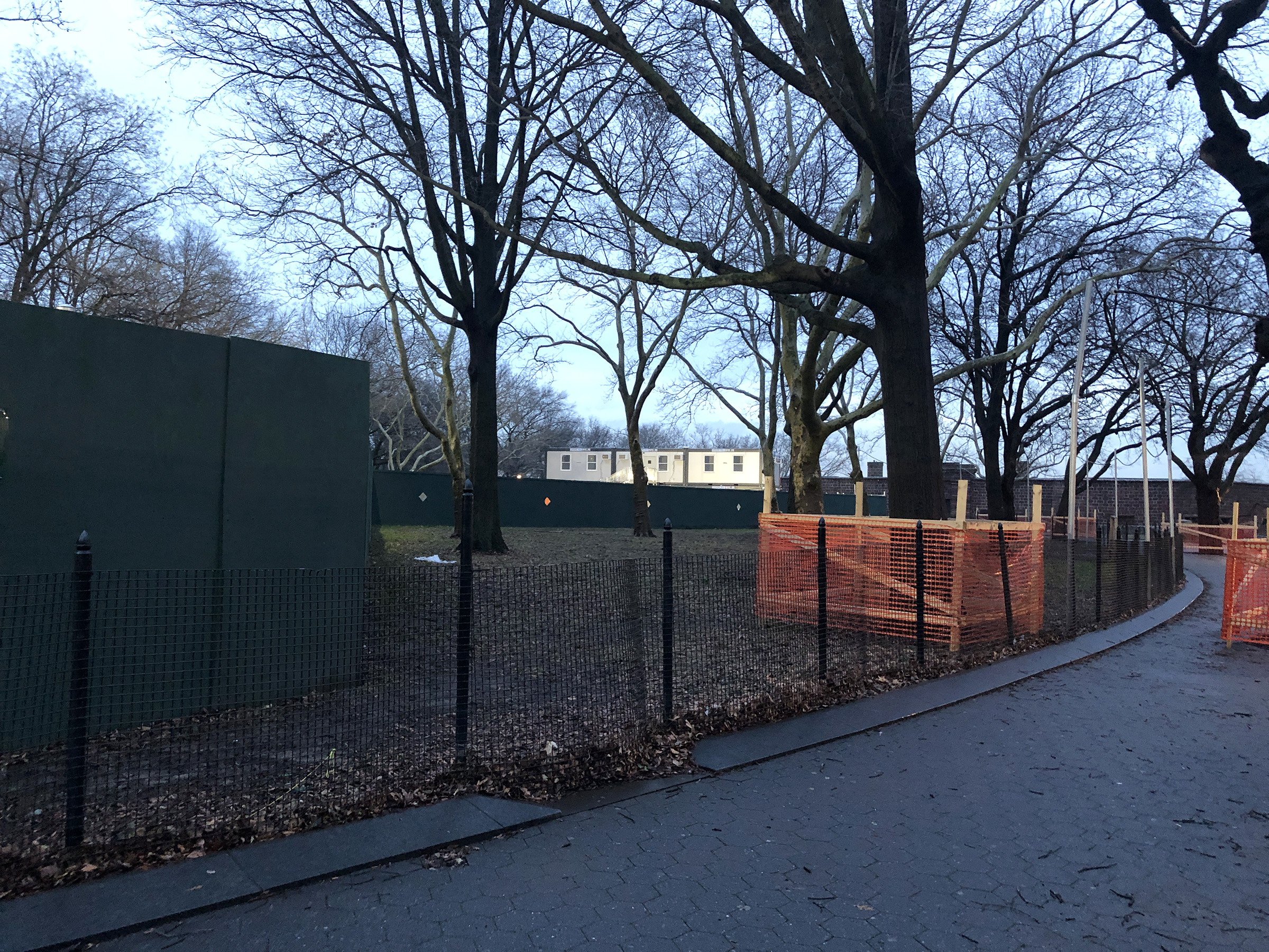
Right now, the park is completely overrun with construction boards and orange netting, making a less-than-picturesque setting and a bit of a challenge of getting from A to B. My tour guide friend told me the main purpose of the renovations is to rebuild and elevate the wharf promenade above the projected rise in sea level. (It’s been estimated that the sea level off New York’s coast will rise 2 feet by 2100, after already rising 9 inches since 1950.)
Brooklyn Bridge / City Hall
After MoMa re-released this short film in 2017, a couple articles popped up listing some of the NYC locations, but they were hardly exhaustive, and tended to focus on the more obvious city spots. Pretty much everything they listed were locations I already was able to identify without doing any research.
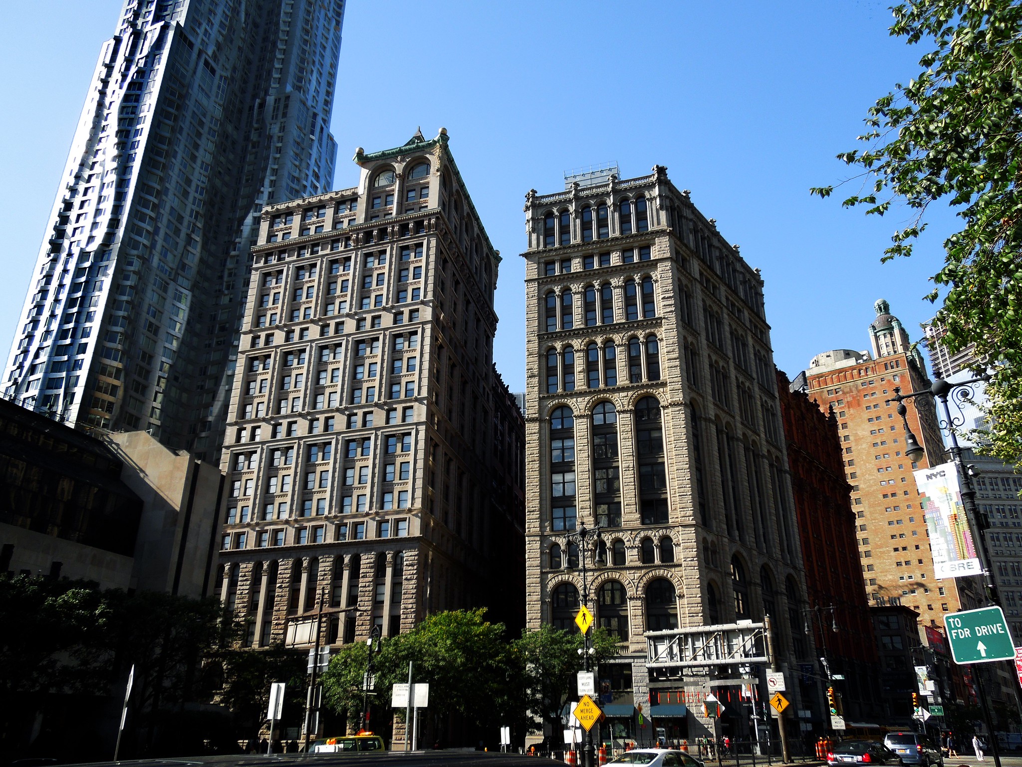
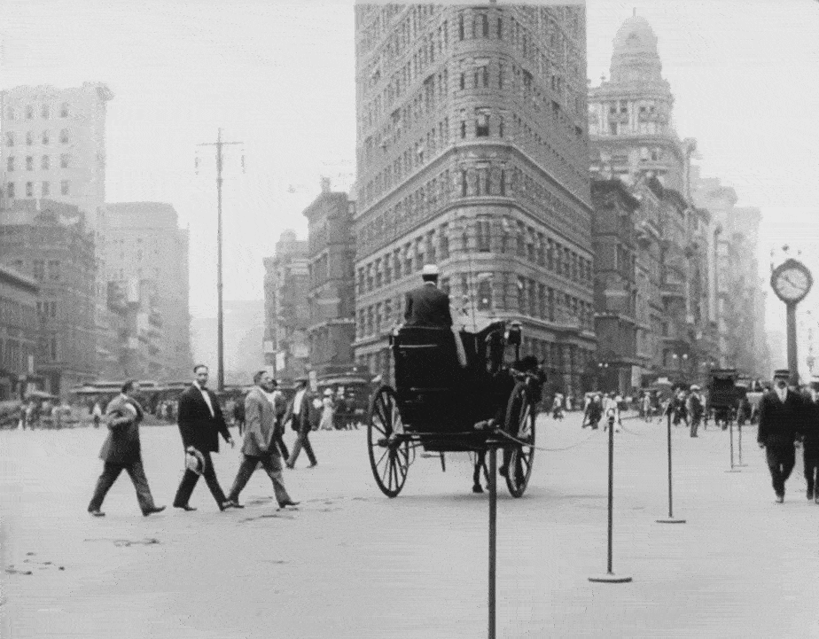
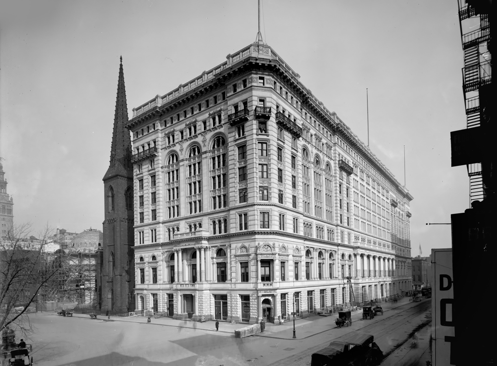
My first location “challenge” came with the first shot from this sequence, although to be honest, I ended up figuring it out relatively fast. With what looked like an open square and a trapezoid-looking building in the background, I knew there were only so many places in Manhattan that would fit the bill. I basically looked for any open space that had a street cutting through it at a diagonal angle, and before long, I found my way to Park Row along City Hall.

Fortunately, it was easy to confirm the location since that trapezoid building at 41 Park Row is still standing today.
The building turned out to be more significant than I expected, being one of the first headquarters of The New York Times and the oldest surviving structure from what used to be known as “Newspaper Row.” Erected in 1888-1889, 41 Park Row was the home of the Times until 1903, when the newspaper company moved uptown to One Times Square.
After being expanded from 12 to 16 stories, the building began housing a high number of tenants in the paper industry. This continued for the next few decades until the property was purchased by Pace University in 1951. The building is now part of a larger complex known as Pace Plaza and continues to be used by the university for classrooms and offices.
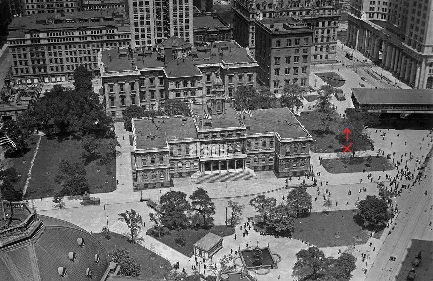
I assumed the next shot, featuring folks sitting below what looked like an El train station, was going to be nearly impossible to find. There weren’t many details available other than steps leading to a station and some very faint windows in the background. However, knowing that there was a station at City Hall, I took a guess that perhaps the film crew just swung the camera around to grab two different shots at the same location.
Hoping I was right, I darkening the background image in Photoshop, allowing me to make out a few more details on the building. After doing that, I quickly lined it up with the Surrogate Court at 31 Chambers Street, located across the street from City Hall. If you look closely, you can see the same series of windows broken up by a pair of columns.
That would mean the stairs were leading up to the City Hall Station for the IRT Second Avenue Line. And with that, I had all the pieces I needed to put together the approximate location of the camera, which was on the east edge of (what was then a more open) City Hall Park.
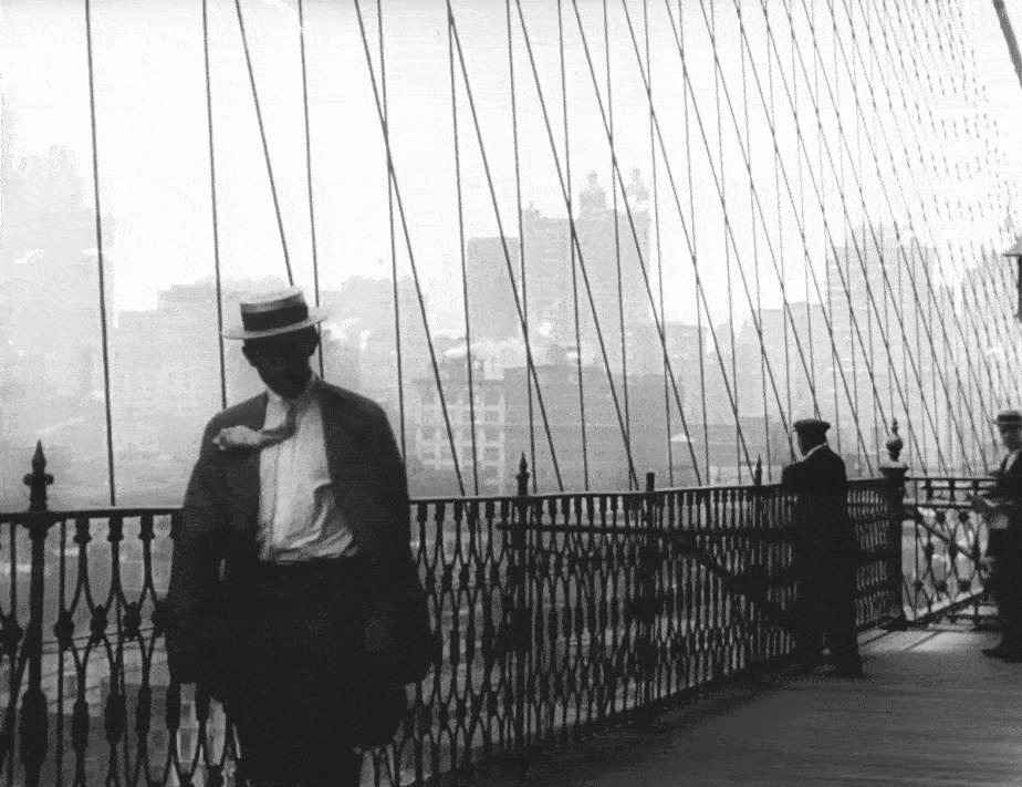
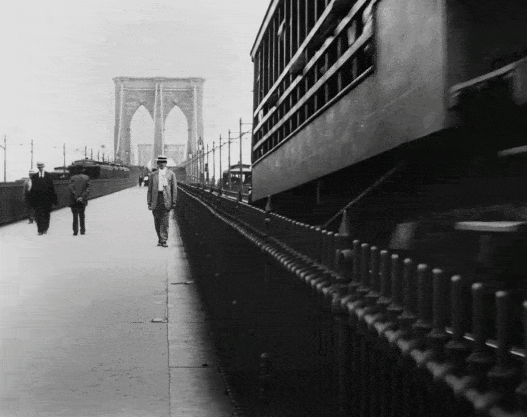
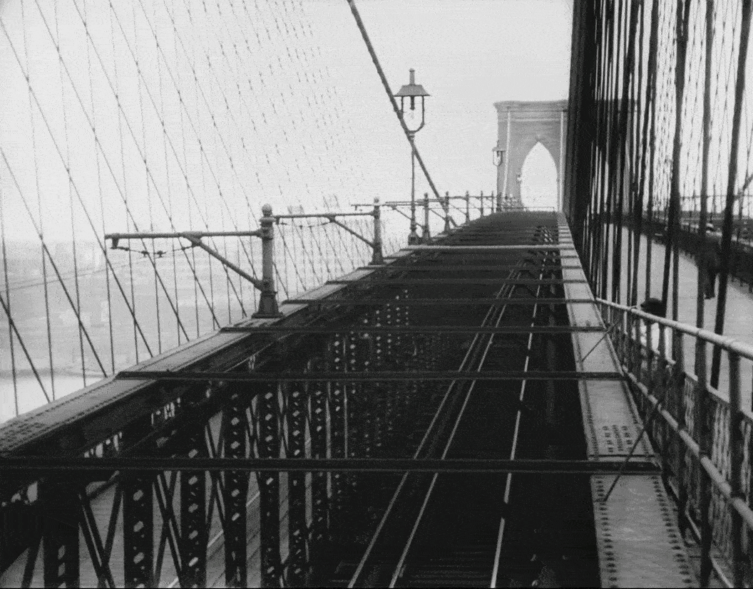
The rest of this sequence was clearly filmed on the Brooklyn Bridge whose Manhattan-side entrance is next to City Hall Park.
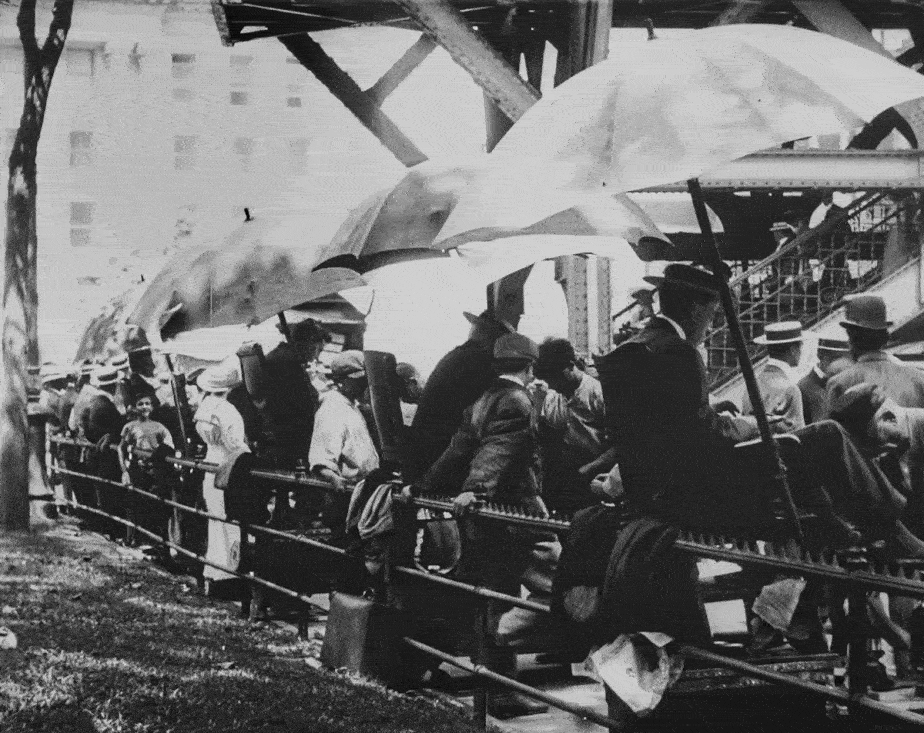
East River
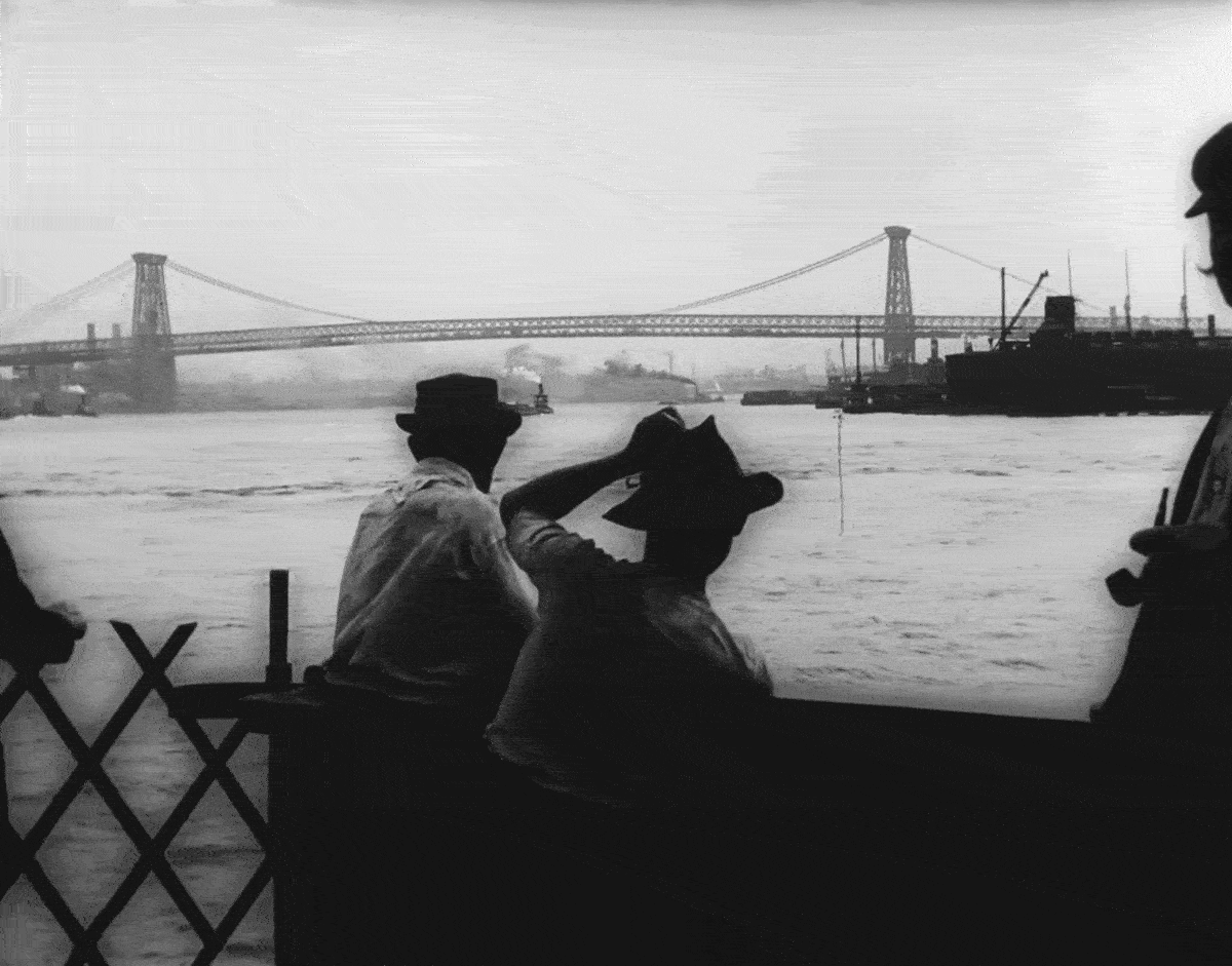
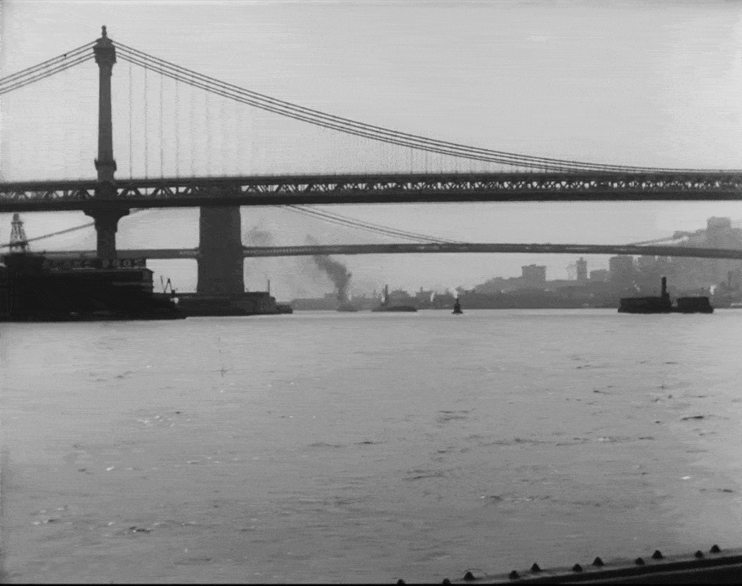
These river shots were rather straightforward to identify with all the landmark bridges in plain view. And getting the modern pictures on the river has become a simple task, ever since the city launched the NYC Ferry service in 2017 which runs up and down the East River. It’s rather cheap as well, costing only $2.75 per ride (when you buy the ten-pack), which can take you as far north as Sound View in the Bronx, or as far south as Rockaway Beach in Queens.
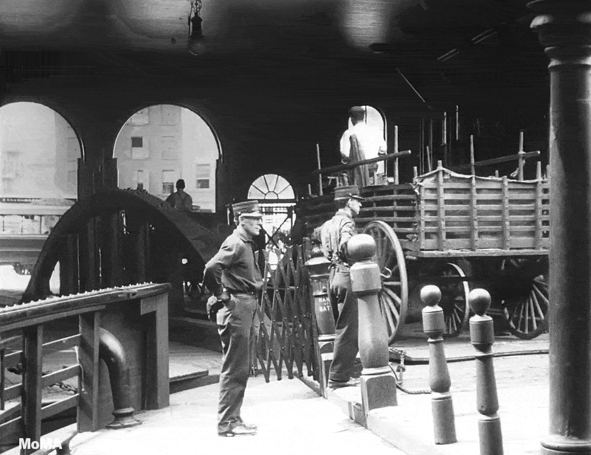
The only mystery in these water shots was the pier were the boat docked. I figured it was somewhere along South Street, not too far from the Battery, but couldn’t find the exact spot.
That’s when my research partner, Blakeslee, lended a helping hand. First thing he did was track down a ferry map from around 1909 to see which lines traveled in between the Brooklyn and Williamsburg Bridges, offering the same views seen in the film. Then he looked through the 1911 World Almanac and found a listing of ferries to and from Manhattan and where they docked.
And from that, he was able to narrow it down to either the pier at Roosevelt Street or the one at Catherine Street. However, he wasn’t able to find any definitive proof.

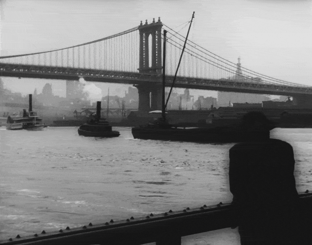
Armed with this new info, I decided to do some looking around myself and see if I could find some vintage images of either of those streets. Unfortunately, a lot has changed since 1911 and there weren’t many images from that period to look at. I did eventually find a 1939 photograph on NYPL showing the north west corner of Roosevelt and South Streets. Upon inspection, I thought the buildings in that photo looked a lot like the ones seen through the boathouse doors in the film.
Even though the window patterns looked about the same and the shutters at 176 South Street seemed like a match, I knew a lot of buildings along the waterfront were very similar looking, so I needed to do some more searching. In particular, I was hoping to find an image of the pier at Roosevelt Street, looking in from the East River — mainly because that was the perspective we had in the documentary short.
I searched and searched, but really couldn’t find anything. Growing discouraged, I was just about ready to give up when I stumbled upon a promising photo from the early 20th century looking under the Brooklyn Bridge from the Brooklyn side. Even though it was kind of small, it did show several piers along South Street, including the one at Roosevelt.
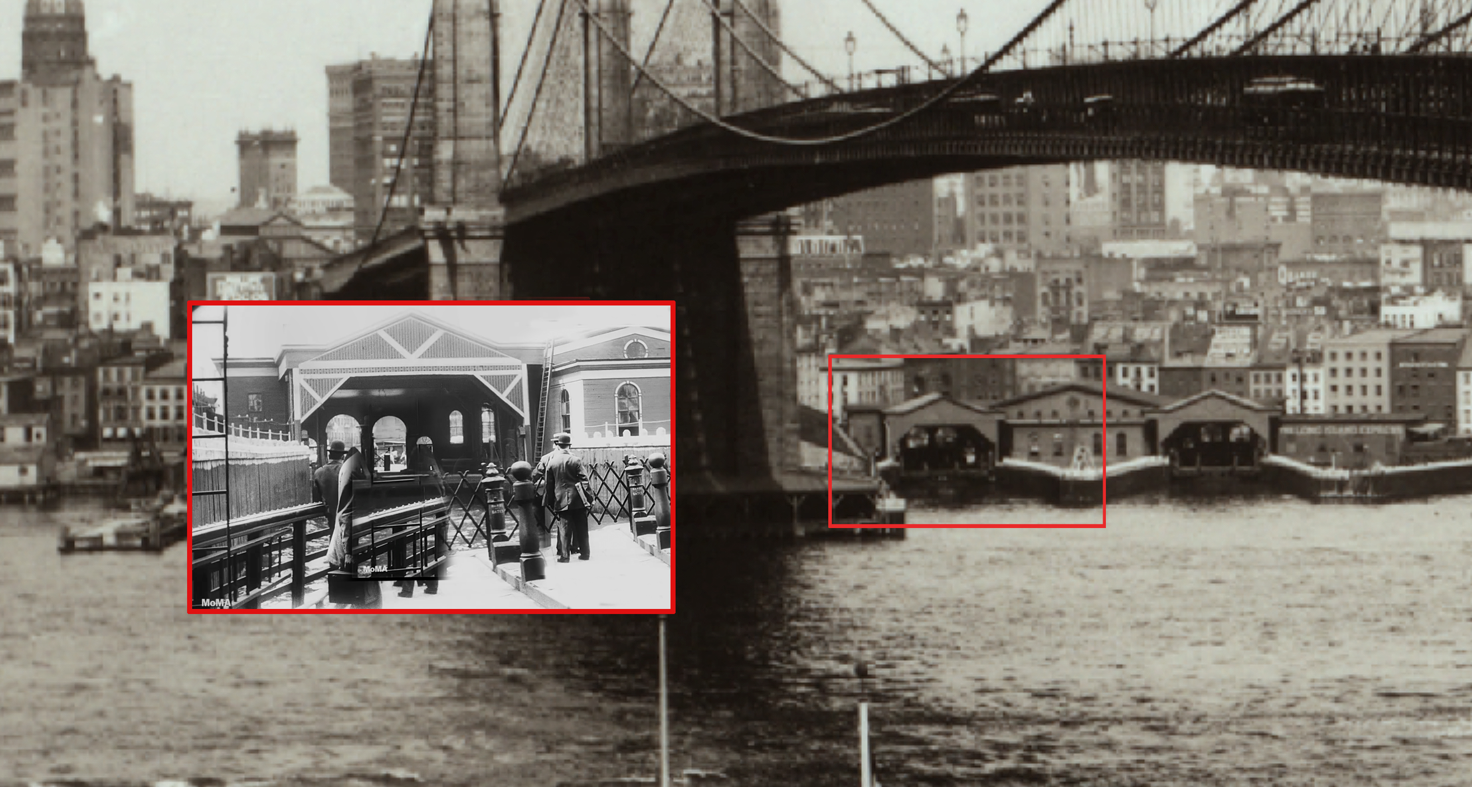
As I zoomed in, I could see that pretty much everything seemed to line up — the boathouse at Roosevelt Street had the same triangular shape as the one in the film, and the building to the right had the same thin arched windows and a circular window on its pitched roof. You could even see large arched doors inside the main boathouse which looked similar to the ones in the film.
The only thing that didn’t match was the painted trim, but I figured it was reasonable to assume that that had changed at some point over the years. But then, after I shared my findings with Blakeslee, he found a website that had a better image of the pier showing the same diagonal patterns on the top of the boathouse that are seen in the film
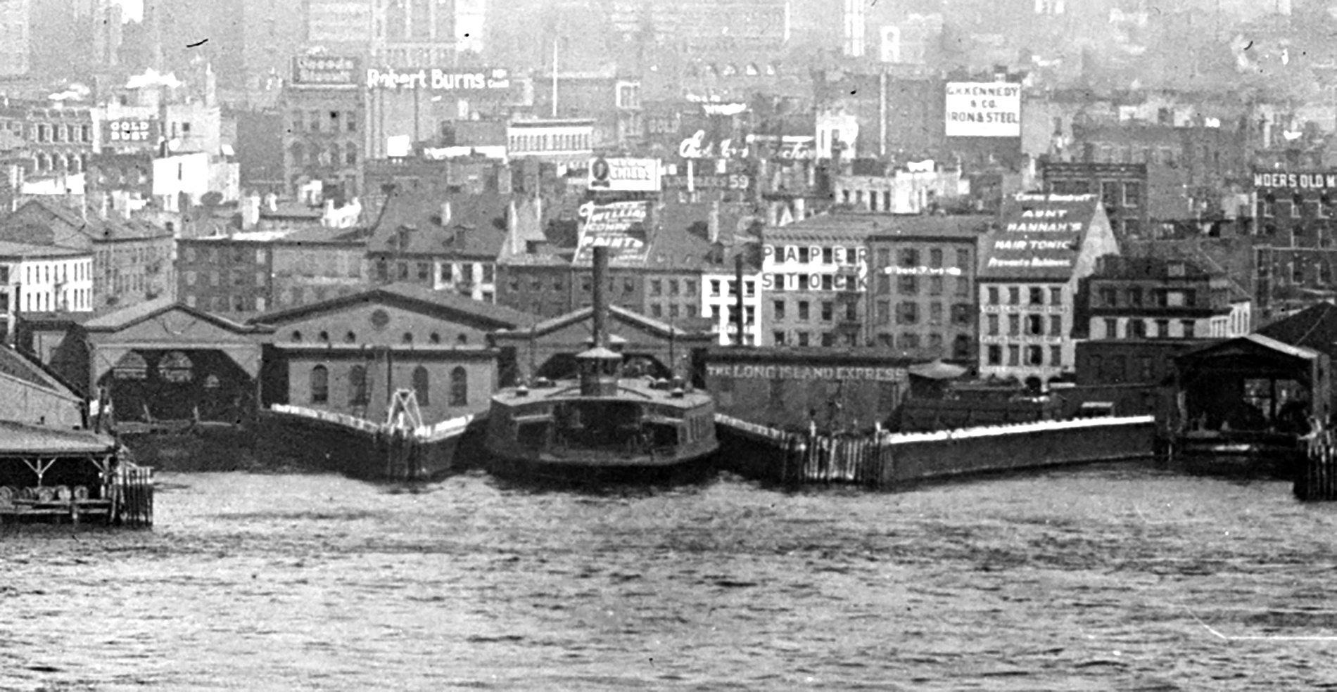
After he unearthed that last image, I went from 90 to 99 percent certain that we got the right place.
Chinatown / Lower East Side
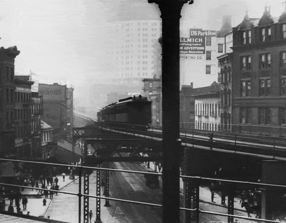
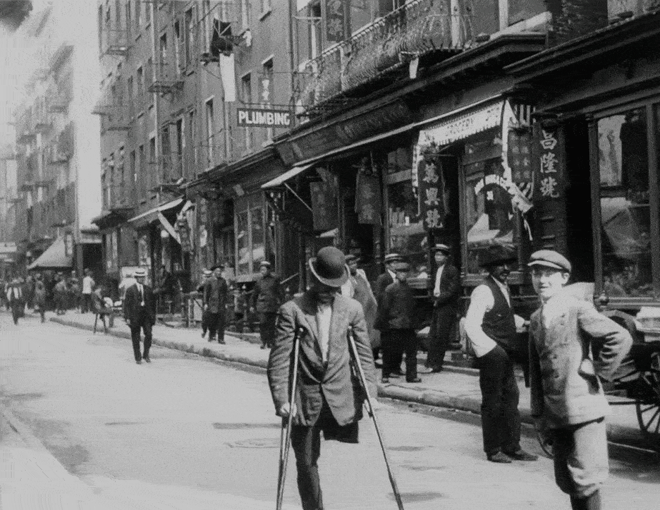
The first shot from this sequence was easily identified, thanks to a large wall sign with the address 176 Park Row written in big bold letters. This indicated to me that we were most likely looking from the Chatham Square Station platform near the intersection of Worth, Bowery and Park Row. Then, after I darkened one of the movie frames, I could make out a faint image of the Municipal Building in the background —still under construction!— further confirming the direction we were facing.
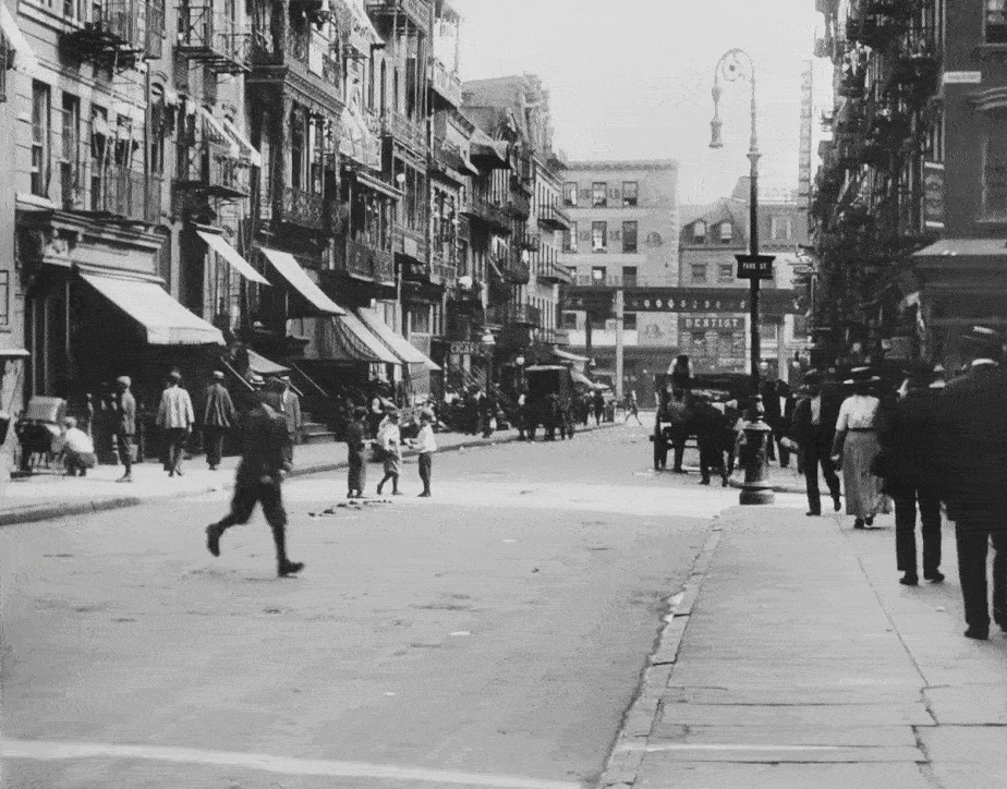
While there weren’t many obvious landmarks in the other “Chinatown” shots, I had a feeling they were taking place on or around Mott Street, which was (and still is) a condensed hub of ethnic foods, wares and services. Plus, since it was clear the filmmakers tended to grab multiple shots in the same general area, Mott seemed like an obvious choice for them since it’s just a stone’s throw away from Chatham Square.
Fortunately, I was able to zero in on the location of the first scene when I spotted a street sign on the right side of the frame that said “Park St.”
The sign wasn’t super obvious to spot at first since it was in the old “boxy” style — something I’ve only seen on the Lower East Side during the turn of the century. The first time I saw one of these unusual signs was while I was researching a scene from the 1950 noir film, Side Street, which took place on the now-gone Oak Street.
After spotting the sign, the next thing to do was find out where Park Street used to be, because I was almost certain it no longer existed in Manhattan. I first assumed it was one of many streets on the Lower East side that got destroyed post-WWII when housing projects started being built throughout the neighborhood. But it turns out, only part of the street got removed, and the part that survived was renamed Mosco Street. And thankfully, the part that survived is the part that appeared in this scene, making it easier for me to find its location. I basically just searched old maps for anyplace where Park formed a T-intersection, and quickly landed on Mott.
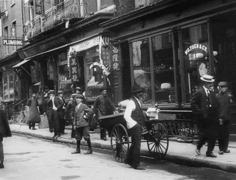
After confirming the Mott Street location by matching up several of the extant buildings, I turned my attention to the other Chinatown location. I assumed it wasn’t too far from Mott, but instead of cruising around the neighborhood in Google Street View, I focused on a store sign that appeared at the end of the shot that read, Wo Yuen & Company. A few clicks later, I found a listing for the business in a 1901 directory, placing it at 35 Pell Street.
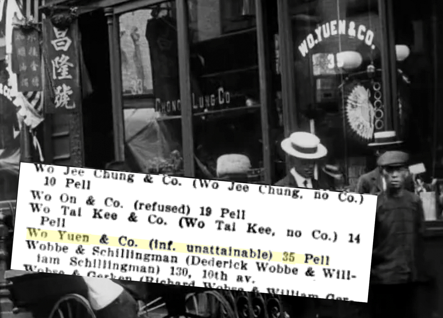
As I suspected, 35 Pell Street is right around the corner from the Mott Street location. And just like in the previous shot, most of the buildings in this shot are still around today and essentially unchanged (minus some of the more extravagant Chinese flair).
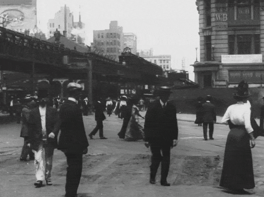
Broadway
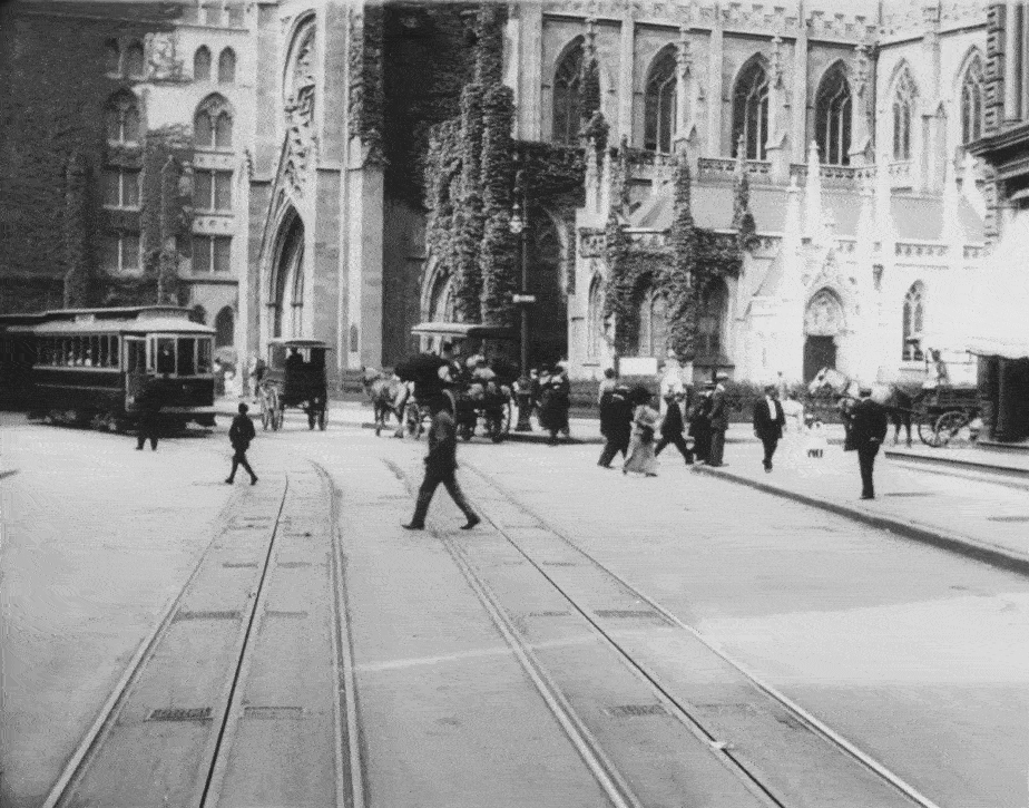
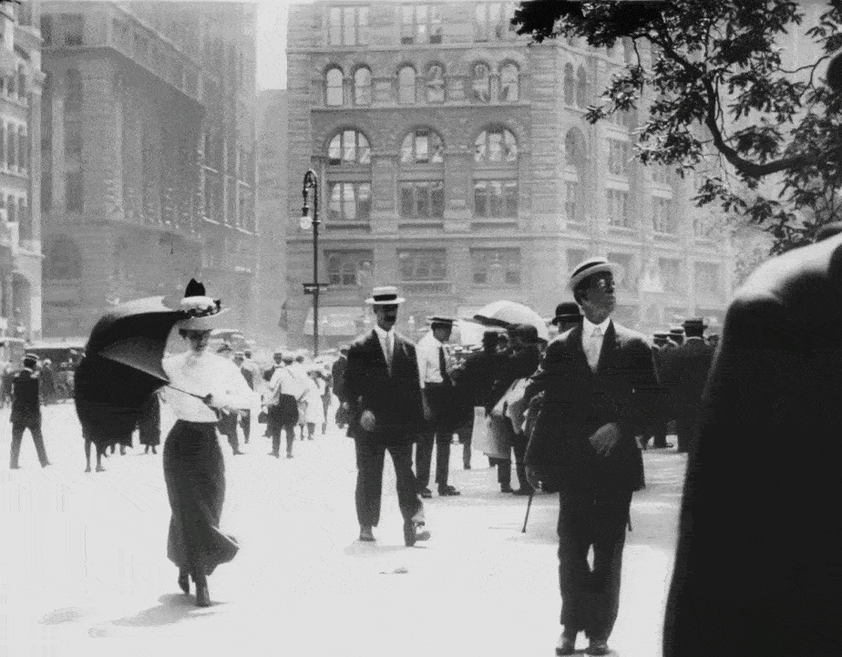
I instantly identified Grace Church in the first shot from this sequence without blinking an eye. Situated on Broadway where there’s a major crook the road, it’s one of the more recognizable churches in all of New York (not to mention, one of the city’s greatest architectural treasures).
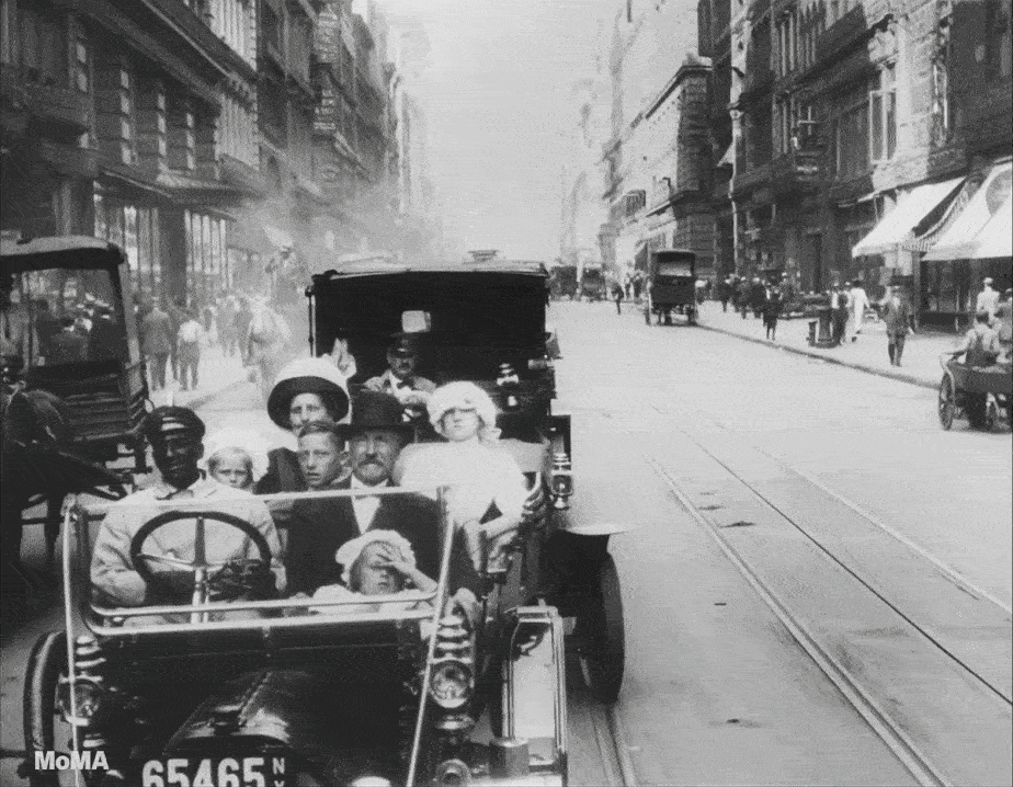
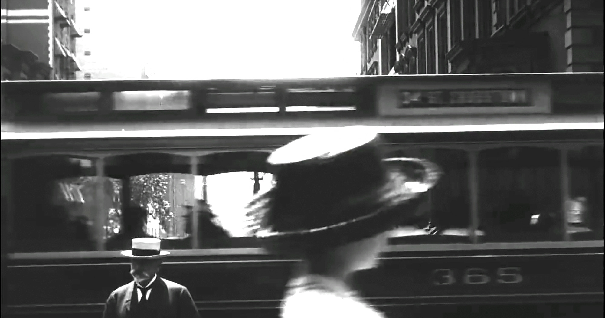
The second shot, featuring a family slowly traveling in an automobile, was not as evident, but judging by the street width and the streetcar tracks, I gathered it also took place on Broadway. I also thought the buildings on either side looked like the Cast Iron architecture common in SoHo, so I looked in that area in Google Street View until I found some matching buildings on Broadway between Prince and Spring.
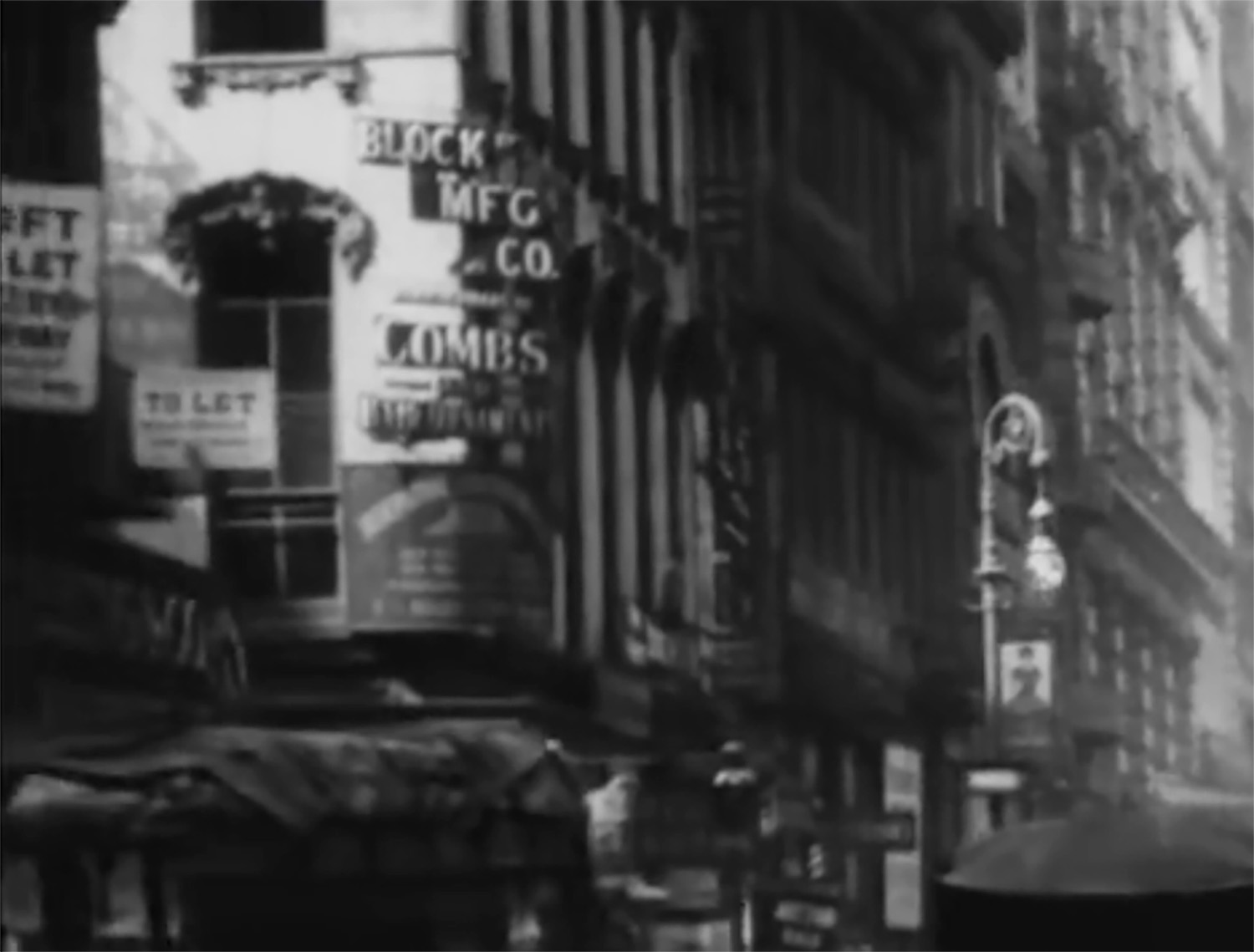
To further confirm the location, I was able to track down the address of Block Manufacturing Co., whose sign is seen at the end of the shot. I found the address in the 1911 edition of The Jobbers’ Handbook, affirming that it was on the northwest corner of Spring and Broadway (right where I thought it should be).
Even though the sign mentions “combs,” I was surprised to see that Block was classified as a “novelties” business, until I realized they were using the broader definition of the word, meaning small manufactured adornments, opposed to gag items. The company was described in a 1910 trade magazine as having “a splendid reputation for novelties in combs, hair ornaments…hat pins, buckles, brooches, hair pins, etc.”
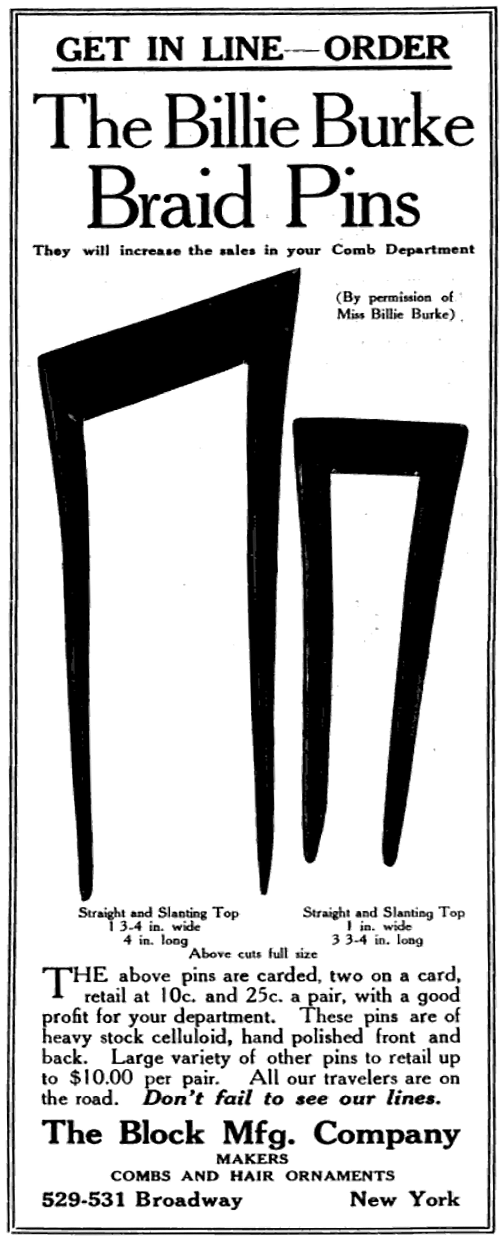
But what seemed to be their most fanciful item was something called the Billie Burke Braided Hair Pins. I can only assume the pins were designed to help replicate some notable hair style worn by the bubbly actress at the time.
Flatiron District

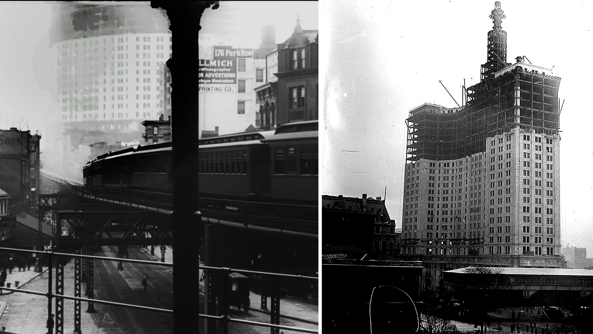
This was another fairly easy set of locations to identify since all of them were at the iconic Flatiron Building on 23rd Street. I immediately knew the first and third aerial shots were taken from the building’s rooftop, but I had to doublecheck to verify the second shot was also taken there.
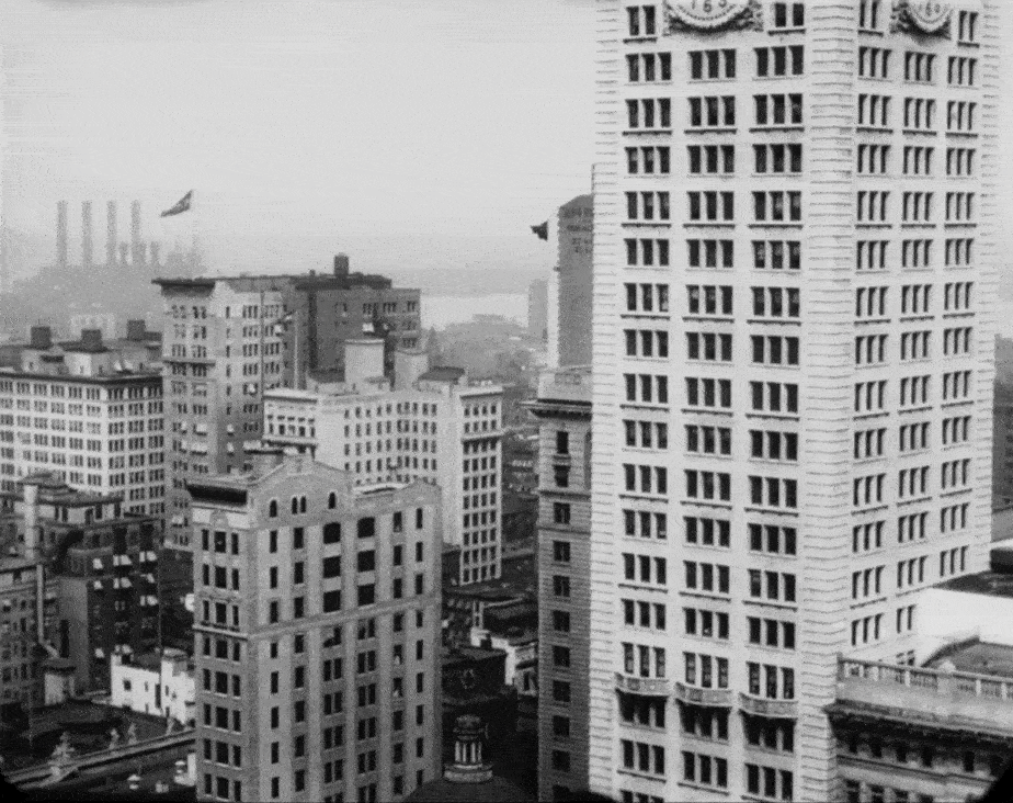
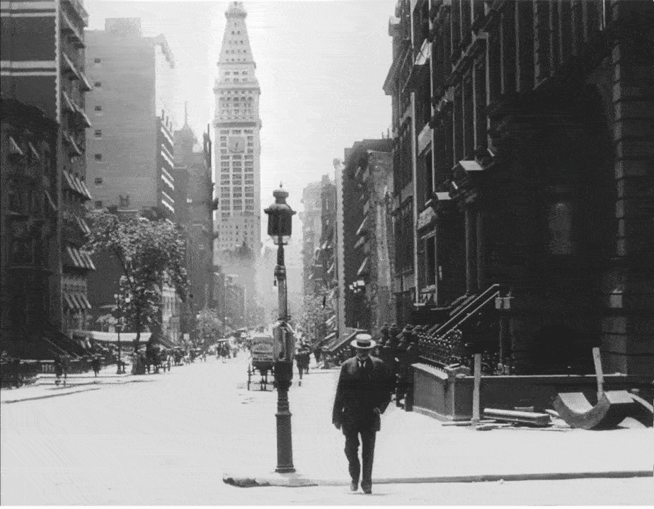
While not the tallest, the Flatiron was probably one the most famous structures in NYC at the time (and of course still is), but what was especially noteworthy about the first rooftop shot is that they captured a fleeting image of the Metropolitan Life Insurance Company Tower over at Madison Square Park which was actually the tallest building in the world at the time.

Located on the corner of 23rd and Madison Avenue, the Metropolitan Life Insurance Building was first completed in 1893, topping off at only 11 stories. But it was still considered an impressive edifice.
Then in 1901, as the citywide rise of skyscrapers gained steam, Metropolitan Life decided to add a 50-floor tower to the base, making it the tallest building in the world. But it would only hold that title for a total of four years, after which the Woolworth Building would take those honors from 1913 to 1930.
Herald Square Area
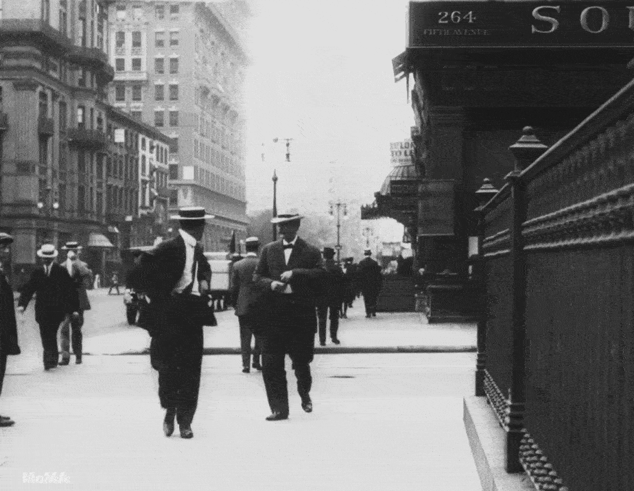
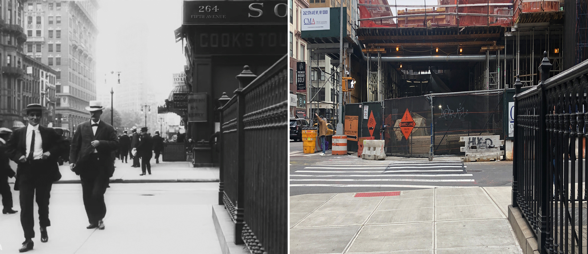
This sequence basically moves north from the Flatiron at 23rd to Herald Square at 34th with the first shot taking place on Fifth at 29th. This, of course, was an effortless site to identify due to an address being displayed above the corner building’s entrance.
Unfortunately, there is currently a major construction project going on at 264 Fifth Avenue which is essentially blocking the one surviving building from this scene — the red-bricked Brunswick Building at 225 Fifth Avenue (est. 1907). Snubbed by architectural critics in its day, this block-long, Renaissance Revival building is now considered a welcome sight along Fifth Avenue, and one of the few structures in the area that dates back to the 19th century.
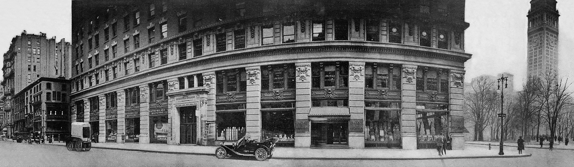
In order for me to include the Brunswick Building in my “before/after” image above, I had to cheat my angle to the left a bit to get around all the construction apparatus at 264 Fifth Avenue. But in doing so, I wasn’t able to include the iron fence belonging to the extant Marble Collegiate Church, which appeared in the foreground in the film.
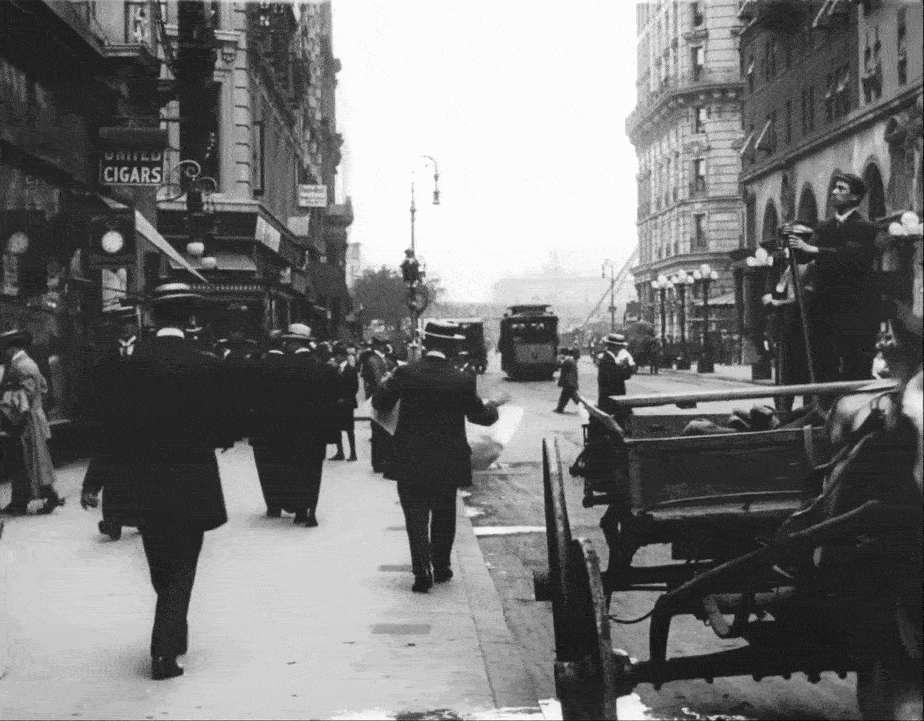
The next shot was found by Blakeslee who was able to do a Google “reverse image search” of one of the buildings. Surprisingly, two of the buildings seen in the shot survive today, although the Martinique New York at 53 West 32nd Street is currently shrouded in construction netting. Operating as a hotel since its conception in 1897, the building is currently part of Hilton’s Curio Collection, and since it’s landmarked, it should be safe from being razed anytime soon. (While I’ve never been inside the building, when it was a Radisson in the early 2000s, it was the hotel of choice for my cousin and his mom when they visited from Upstate.)
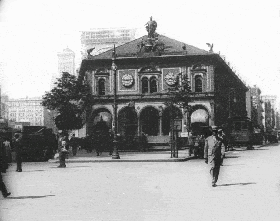
The next two shots are looking north in Herald Square, with the first one offering up a nice clear view of the old Herald Building.

The squat, triangular building was completed in 1895, serving as the headquarters for the New York Herald, which at the time, was the most popular and profitable daily newspaper in the United States. The Herald Building was officially designed by famed architect Stanford White, but the owner of the newspaper, James Gordon Bennett Jr., was said to have had signifiant influence on its style and decoration.
At this point in his life, the flamboyant publisher was obsessed with hoot owls, and personally had 26 four-foot bronze owls installed along the roofline, some of which were given green glass eyes that glowed on and off as Herald’s clock rang out.
Unlike the Brunswick Building to the south, the Herald Building was an instant success with both critics and laymen. A great feature was the expansive arcade along its sides, offering passersby the opportunity to watch the giant newspaper presses in action. In addition to the owls, the structure was filled with many carefully-crafted details, like the bronze smiths that would strike out the hours on a big bell, and a large clock and wind dial affixed to the southern facade.
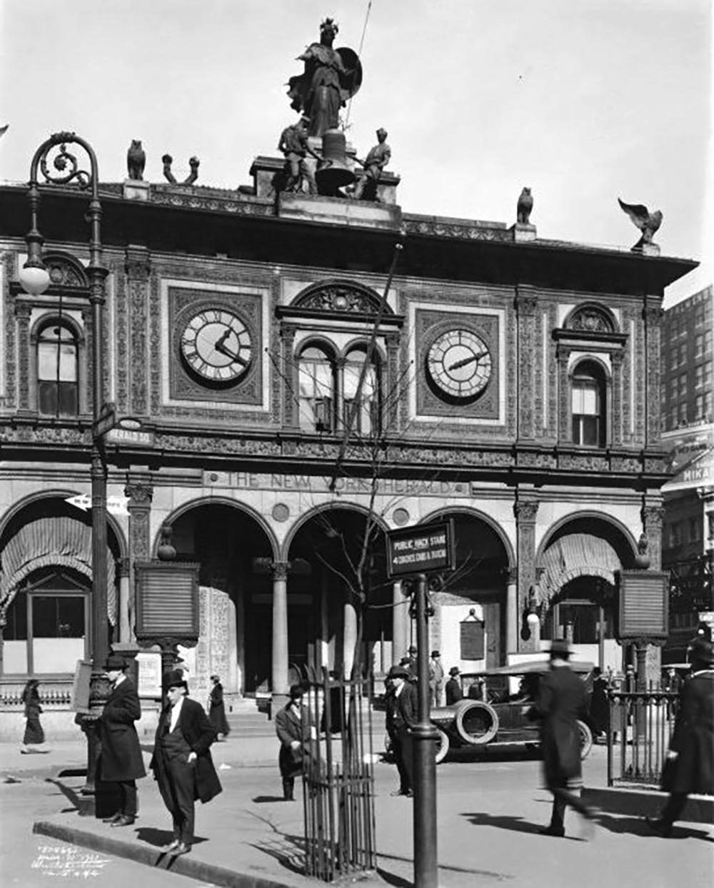
But this gem of Herald Square didn’t last long. In 1921, the New York Tribune vacated the property to move further north. By 1940, plans were being laid to replace the newspaper building with the rather unimpressive granite and limestone building that’s there today.
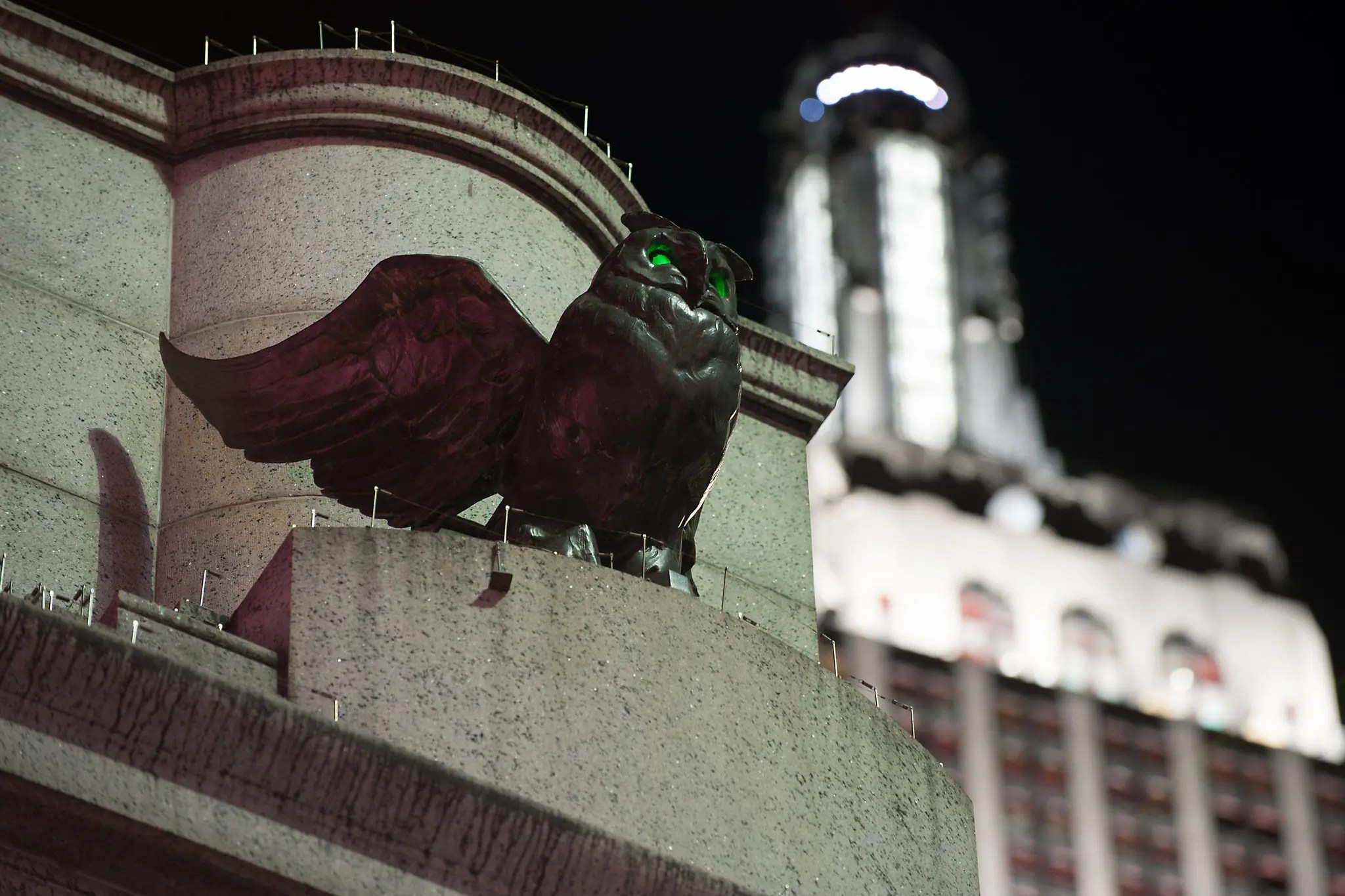
Even though White’s magnificent Italian Renaissance Herald Building is long gone, the small memorial park at 34th Street does feature several of the old bronze owls that used perch on the rooftop. But the real standouts are the owls atop the tall granite monument at the north end of the park that still flash their eerie green eyes at night, undoubtedly overlooked by oblivious passersby busy staring down at their phones.
Madison Avenue
While this wasn’t the last shot from the film, it was the northern-most location used (and quite possibly the last place visited by the traveling camera crew). This was also the very last location I verified.
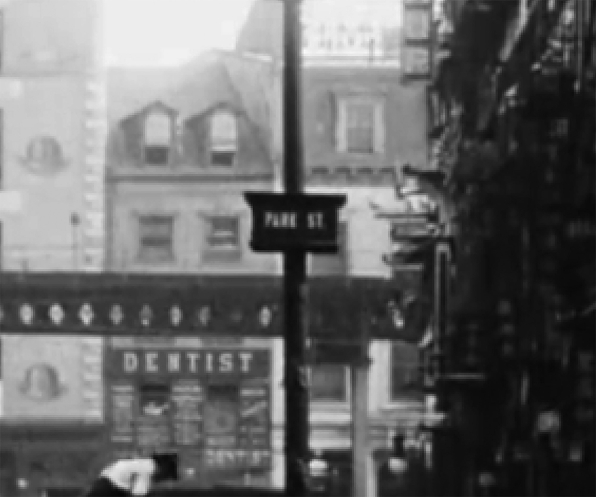
This should have been a quick find since I saw all the clues right away. I could tell we were looking south on Madison, due to the Metropolitan Life Insurance Company Tower appearing in the background. I was also pretty sure we were on 34th Street since the streetcar that passed through the scene had signage on it indicating that it was the “34th Street Crosstown.”
But for the life of me, I couldn’t find any matching buildings to confirm this location. I knew that Madison, in particular, saw a lot of changes in the early 20th century, replacing most of the single-family mansions with larger skyscrapers. So, I knew even the 1940s tax photos would likely not have anything from this film.
I searched through practically every old photo of Madison Avenue between 23rd and 42nd Street on the NYPL digital archives, but couldn’t spot one match. It got to a point when I started doubting my assessment, briefly thinking that maybe we were on 23rd Street looking east towards the Metropolitan Life Tower.
In the end, it was when I looked at Madison Avenue on a modern Google Street View that I spotted some extant buildings from the film. Aside from the tower at Madison Square Park, I spotted three surviving buildings, the most noticeable one at 161 Madison.
Originally operating as the low-end Warrington Hotel, the modest 11-story building’s big claim to infamy came in 1972 when the hotel’s 33-year-old maid was found murdered in one of the guest’s room, shoved into a laundry basket and covered in sheets.

Currently, 161 Madison is the only building that isn’t completely obscured by modern structures, but the way things are constantly being razed and replaced in NYC, who knows how long that will last.
That being said, after identifying all the locations from this short documentary, I found it quite remarkable that almost every shot has at least one extant structure in it. Pretty amazing considering the movie dates back to over 110 years ago. Who knows what will still be around 110 years in the future?

Splendid, spectacular, brilliant work and research! Thank you so much Mark for this amazing accomplishment and bringing this visual history to life.
LikeLike
Great research, Mark. I always enjoy your trips through time and the way you line up the old & new shots.
LikeLike
Thanks for taking up my challenge! Really cool to see what has changed and what remains the same. Do you know anyone at MoMA you could share this with?
LikeLiked by 1 person
As usual, a comprehensive and exhaustive treatment. Thanks, Mark!
LikeLike
Oh! I I meant to mention that I ran across a YouTuber, Jarrett Ross, who did a detailed genealogical search of the family in the car: https://youtu.be/B38qoCKEn249Lfl
LikeLiked by 1 person
Yes, I saw that video a few days ago… Fascinating research done there. It kind of inspired me to make that family my cover image for this post.
LikeLiked by 1 person
Just ran across what appears to be a 68mm film from 1896! Posted by EYE Filmmuseum in HD, 2023. Can you identify this exact spot? https://youtu.be/oOq3gQvcYfQ
LikeLike