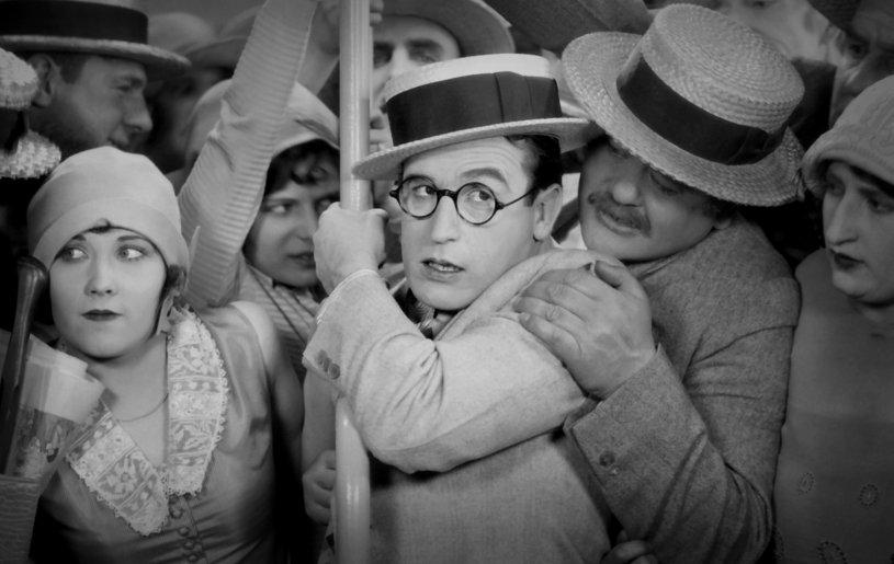
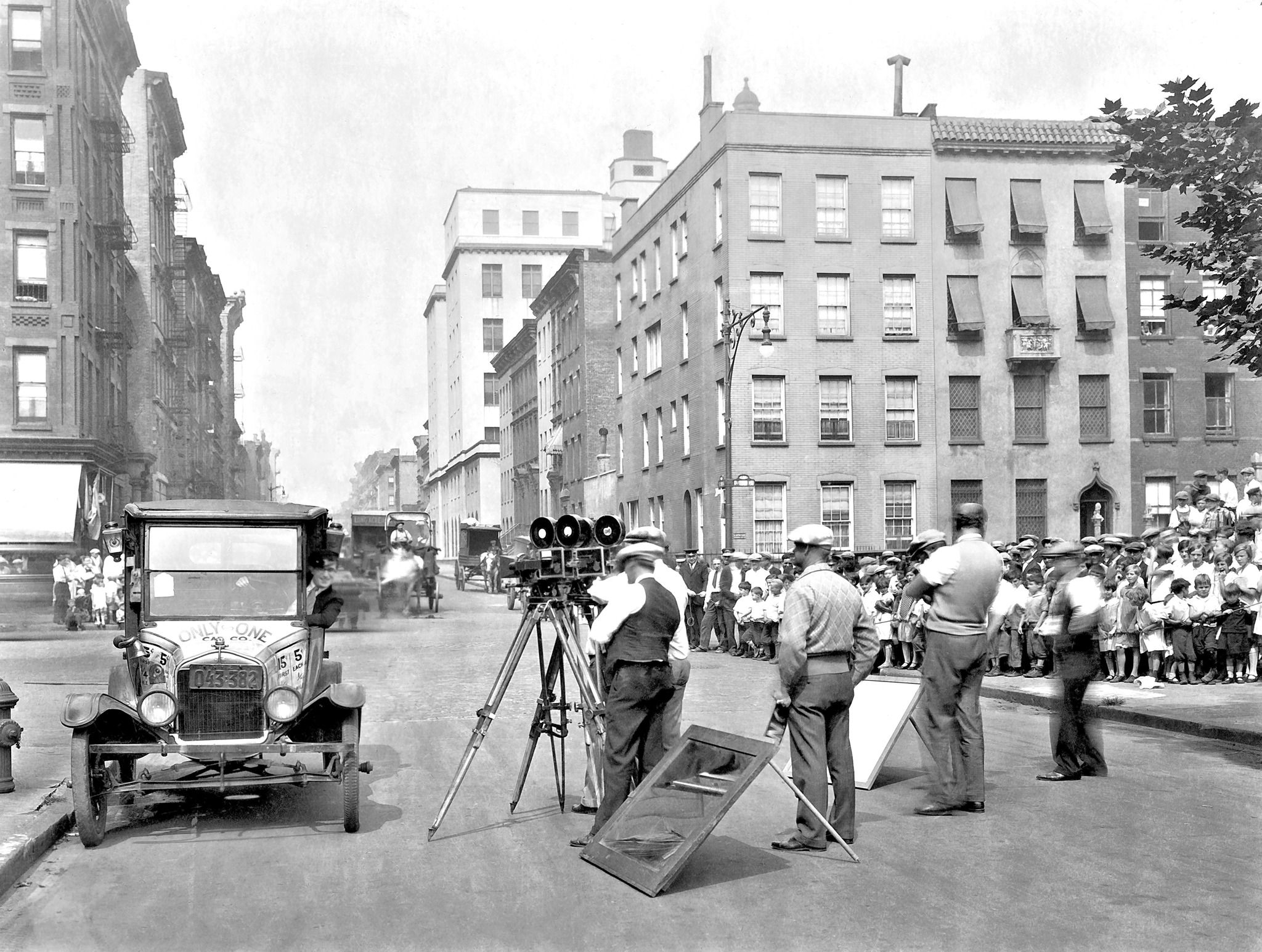
Harold Lloyd’s final silent comedy, Speedy, was his only feature to be shot on location in New York, and is regarded by many to be one of his greatest achievements. Filmed during the summer of 1927, Speedy is a goldmine of vintage NYC locations, giving us vistas of Manhattan, Brooklyn and the Bronx during the Roaring Twenties (along with a few Los Angeles streets doubling for the Big Apple).
With such an extensive shot list, taking on this movie always seemed like a daunting task, but I felt this was the time to finally take the plunge. The main inspiration was to use this as a dedication to the amazing film historian, John Bengtson, who sadly passed away earlier this year from ALS. His books, which painstakingly explored the precise filming locations of silent comedy legends Chaplin, Keaton and Lloyd, helped motivate me to start this NYC in Film project. John’s erudition and steadfast contribution to silent film history is priceless, and he will surely be missed.
Here’s hoping this entry will do him proud.
Introduction
I would say about eighty percent of these Speedy locations were discovered by John Bengtson, who catalogued his findings in his book, “Silent Visions,” and his website, silentlocations. And what’s impressive is, he did most of this research in the early 2000’s, before a lot of the online tools which are used by current location-sleuths were readily available. (It becomes even more impressive when you consider that he was a native Californian and wasn’t particularly conversant with NYC.)
Aside from working off street or retail signs appearing in a scene, it seems that old aerial photographs and historic city maps were two of his most valuable aids in finding a location. This was especially true for locations in Los Angeles; a city that has gone through many dramatic changes since the early 20th century, including the elimination of entire streets and avenues.
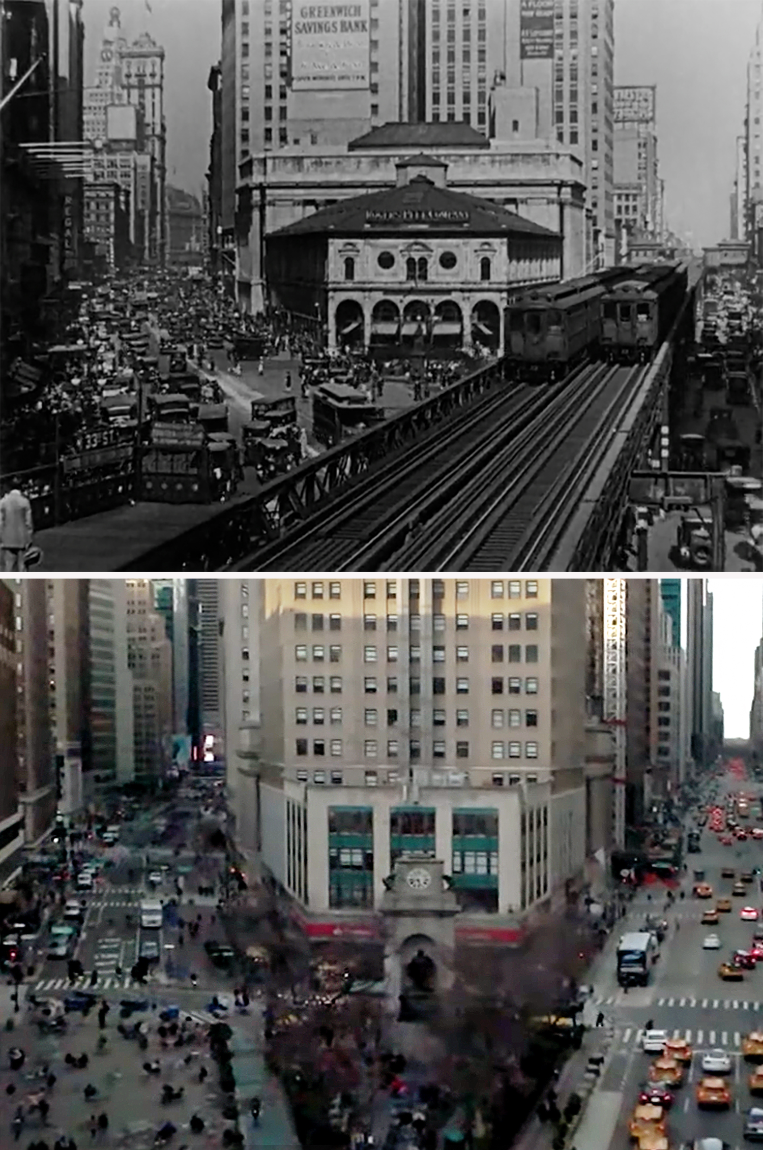
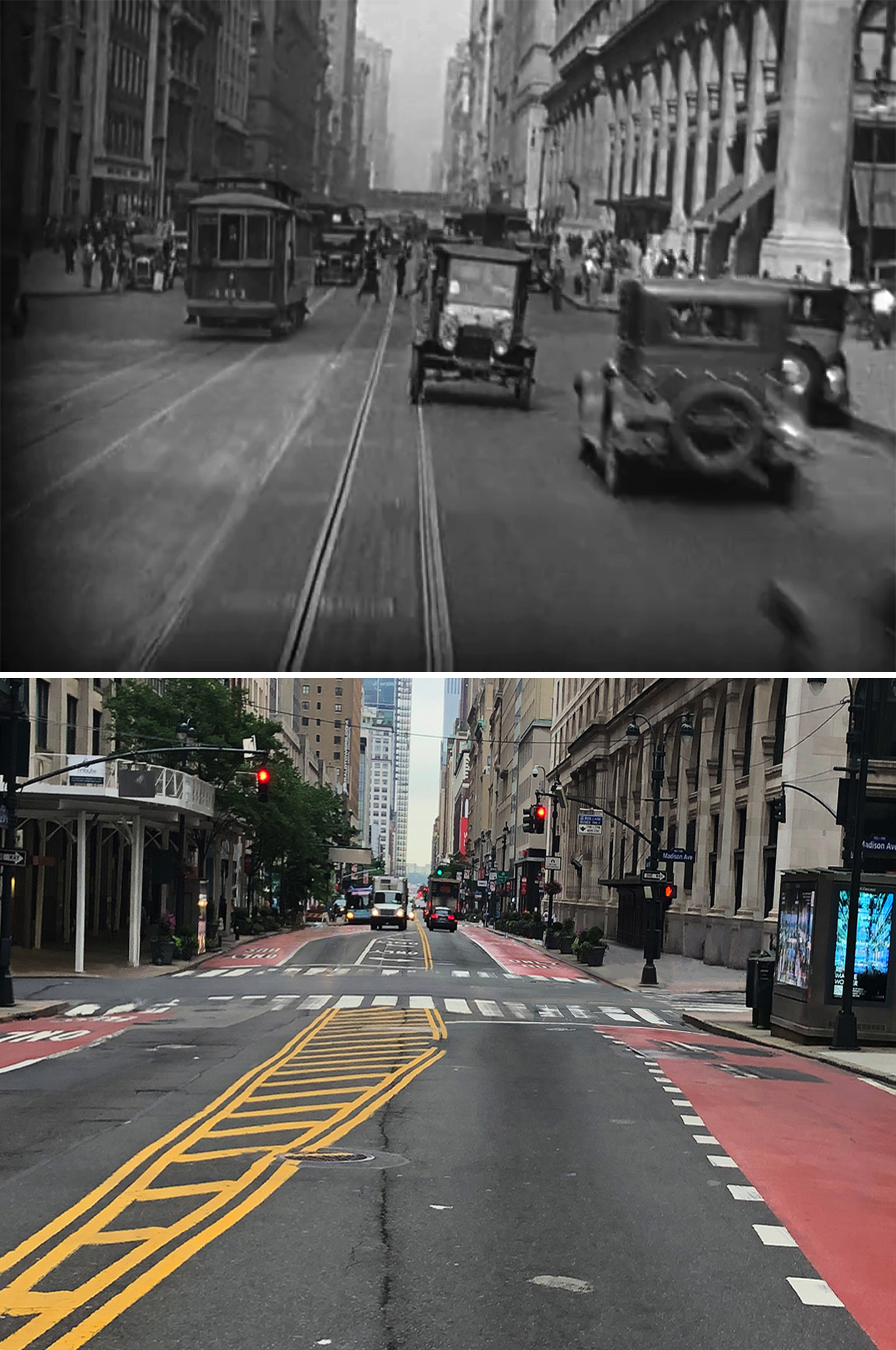
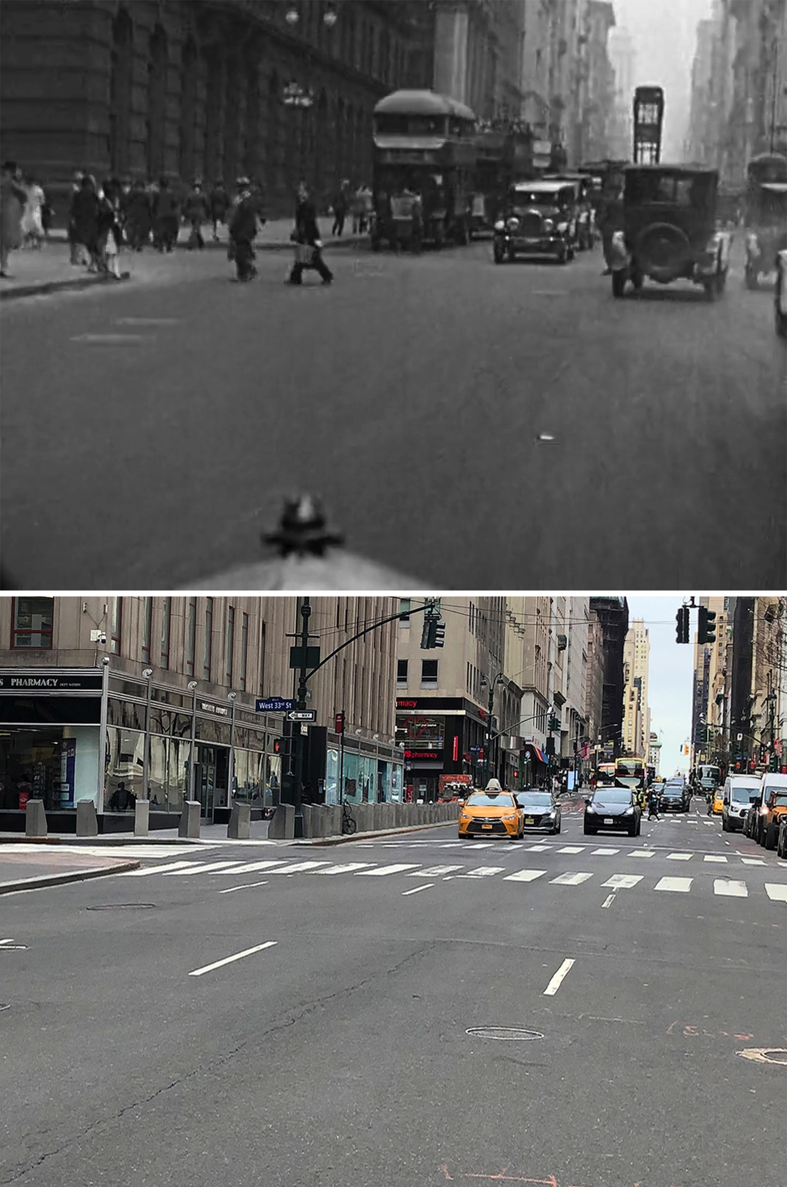
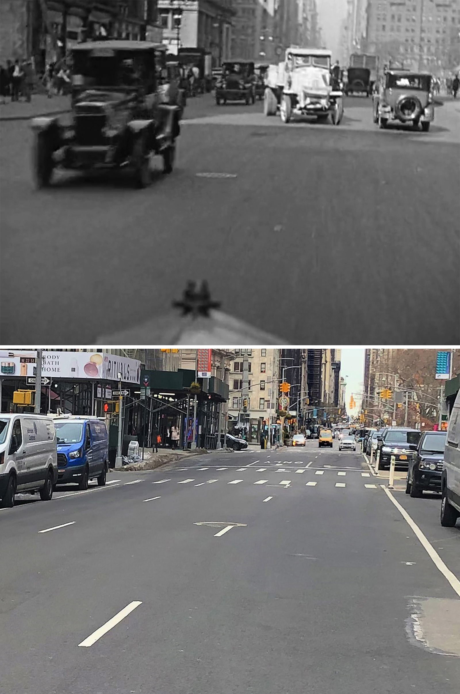
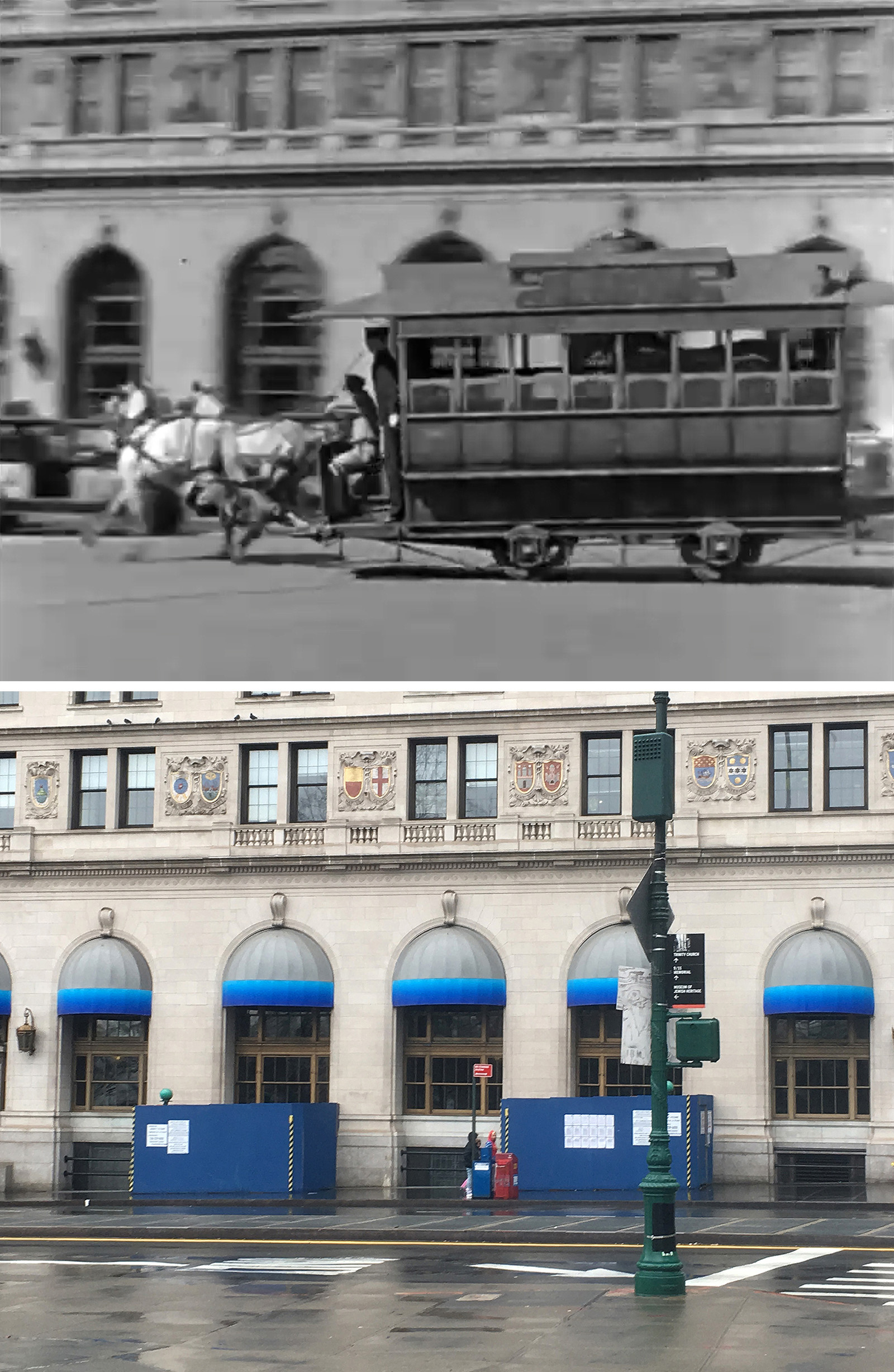
Despite not being an expert on New York, these shots from the opening introduction to the city were probably easy for him to identify, thanks to prominent landmarks appearing in most of them. The only shots that aren’t super obvious are the last two, but at least they were taken in fairly popular Midtown hotspots, so there were a decent number of vintage photos out there with similar views.
Running an Errand
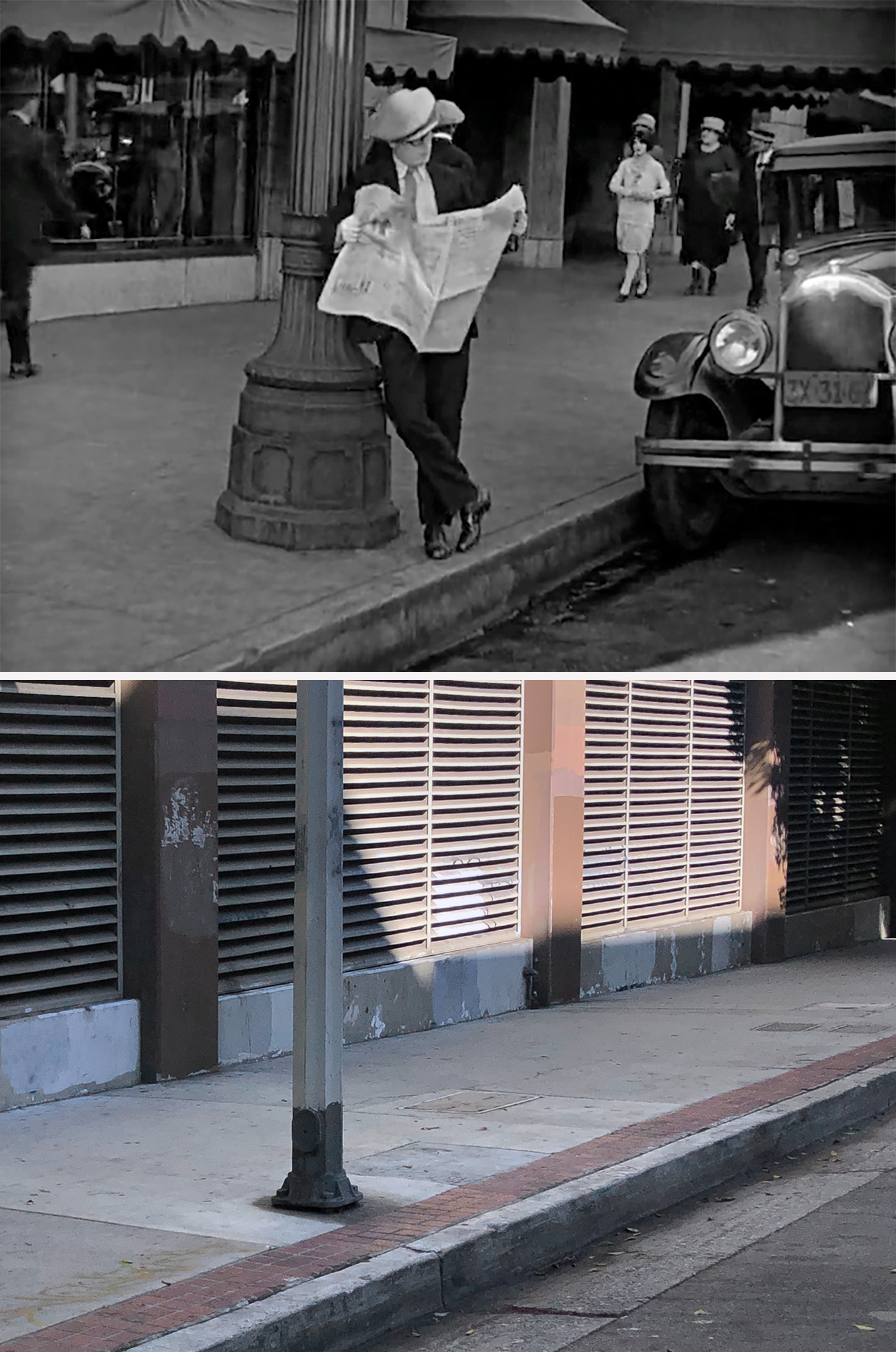
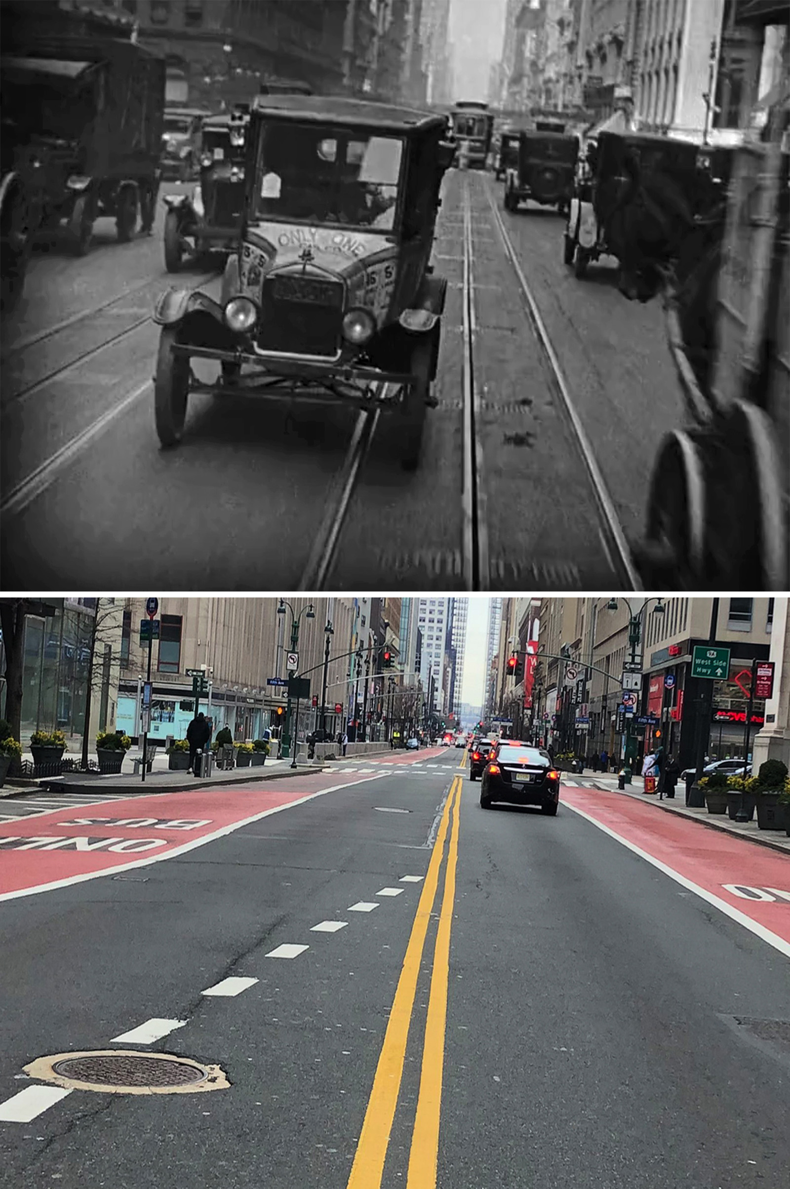
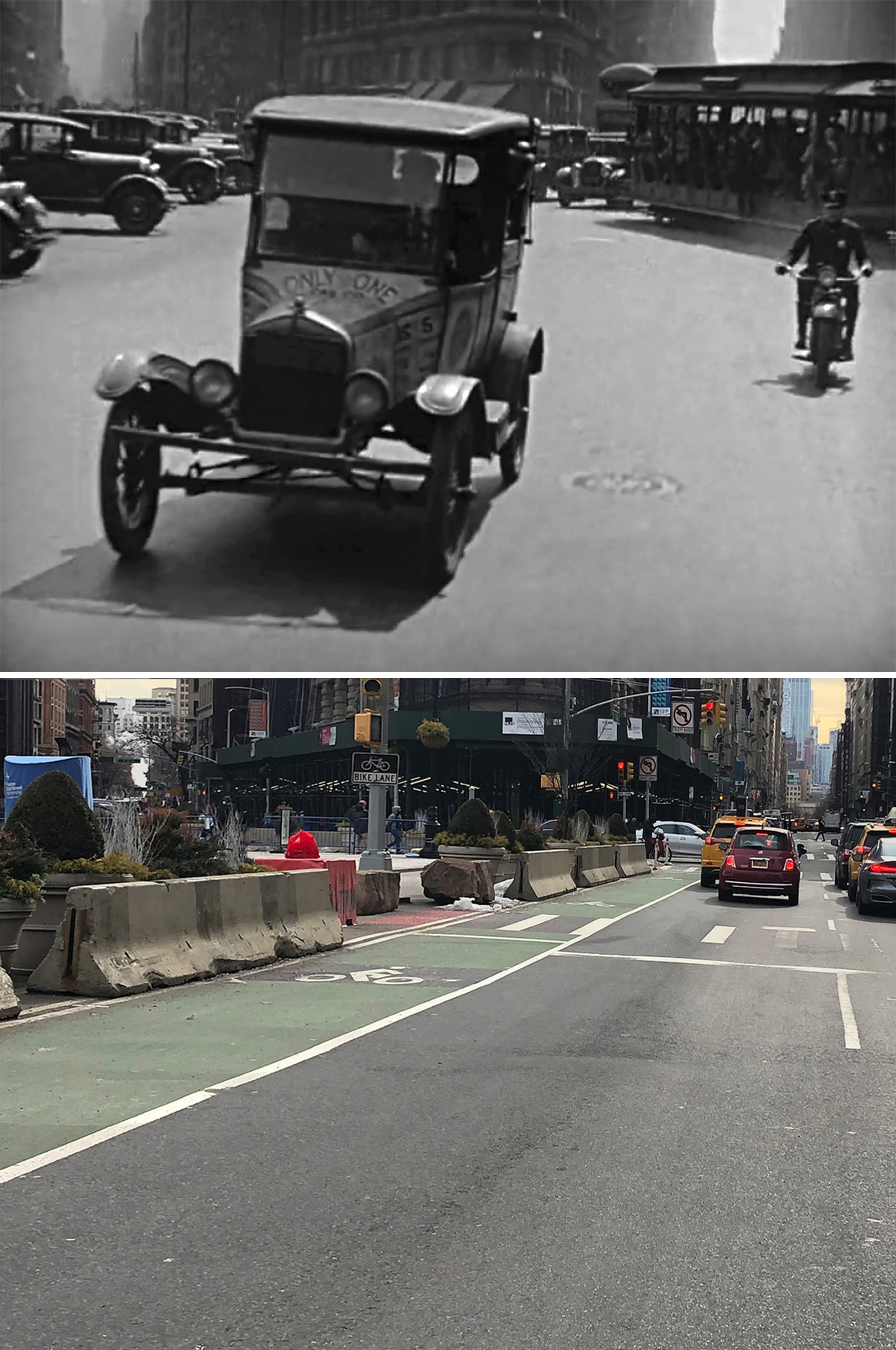
The majority of this sequence was filmed in Los Angeles, and thankfully, John did all the legwork to find the exact spots used. If he hadn’t, I can almost certainly predict that most of them would still be a mystery today.
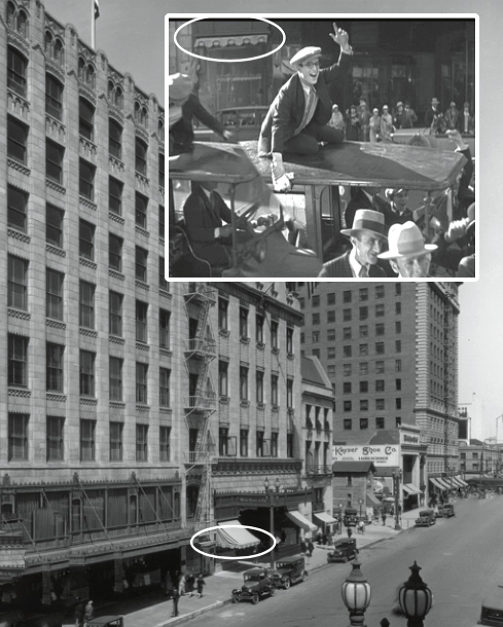
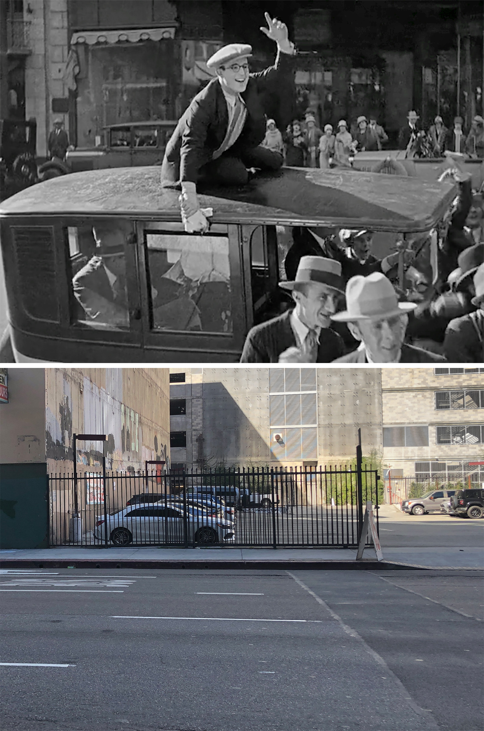
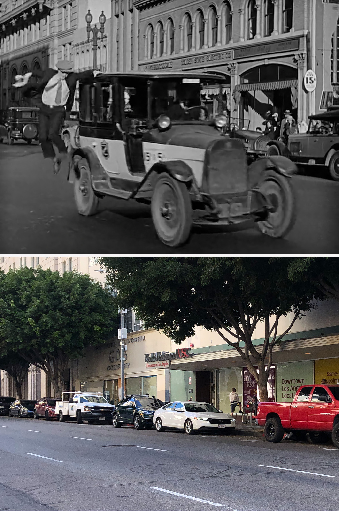
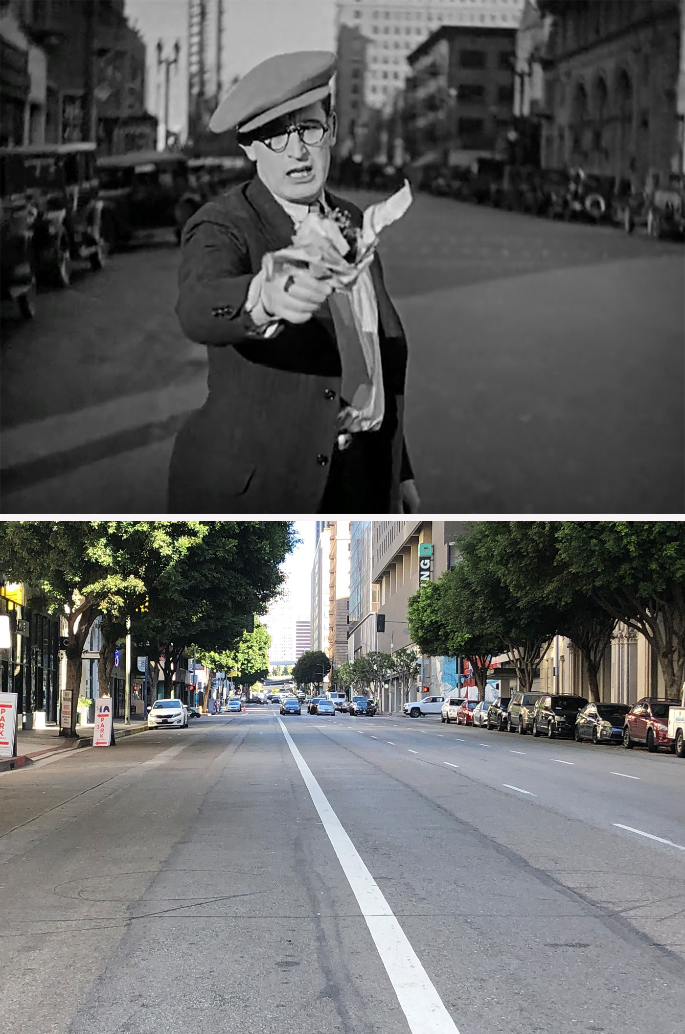
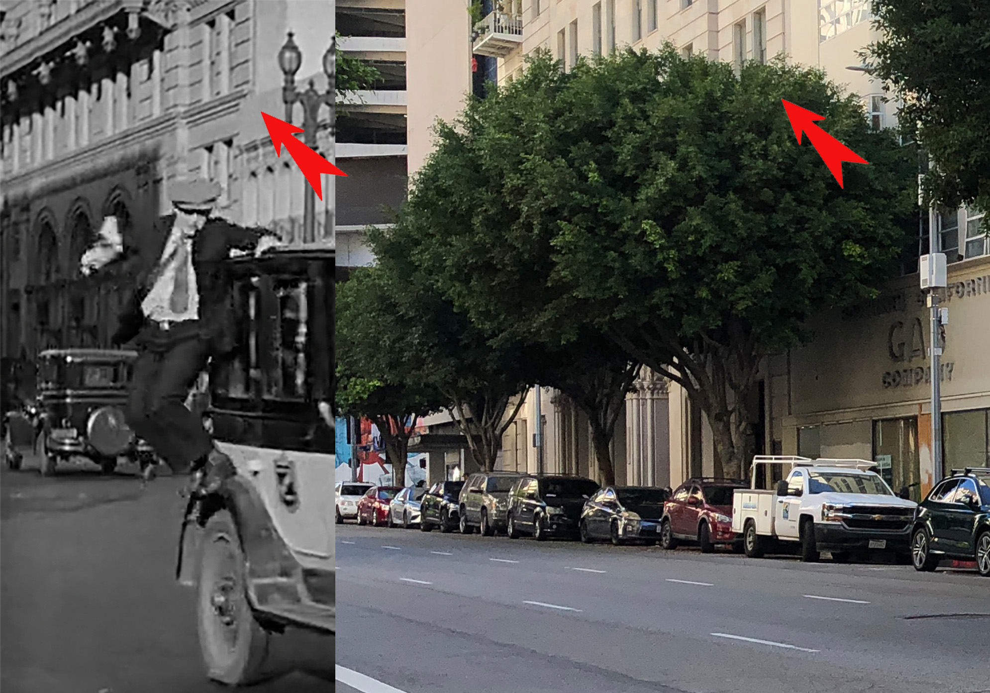
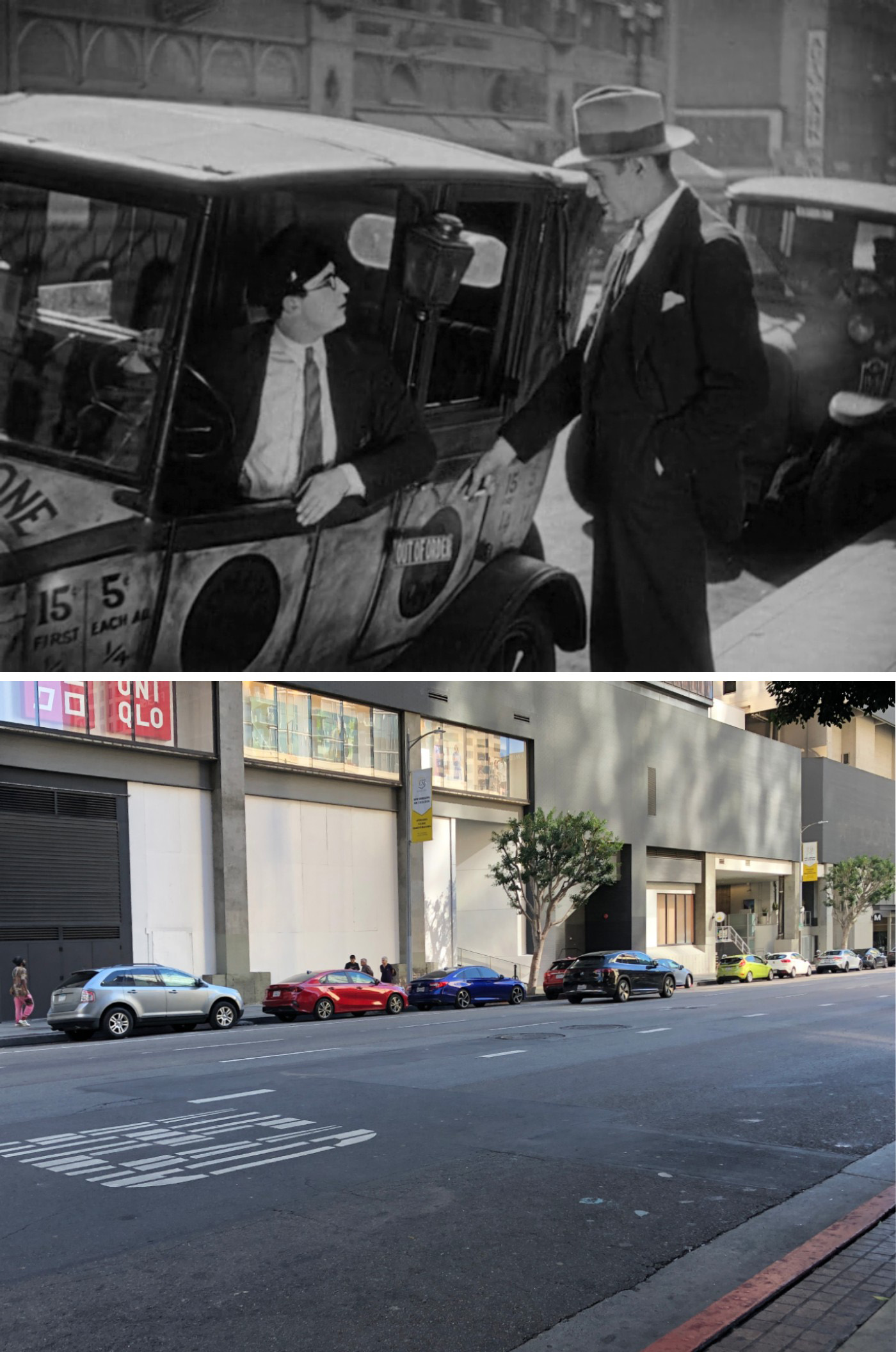
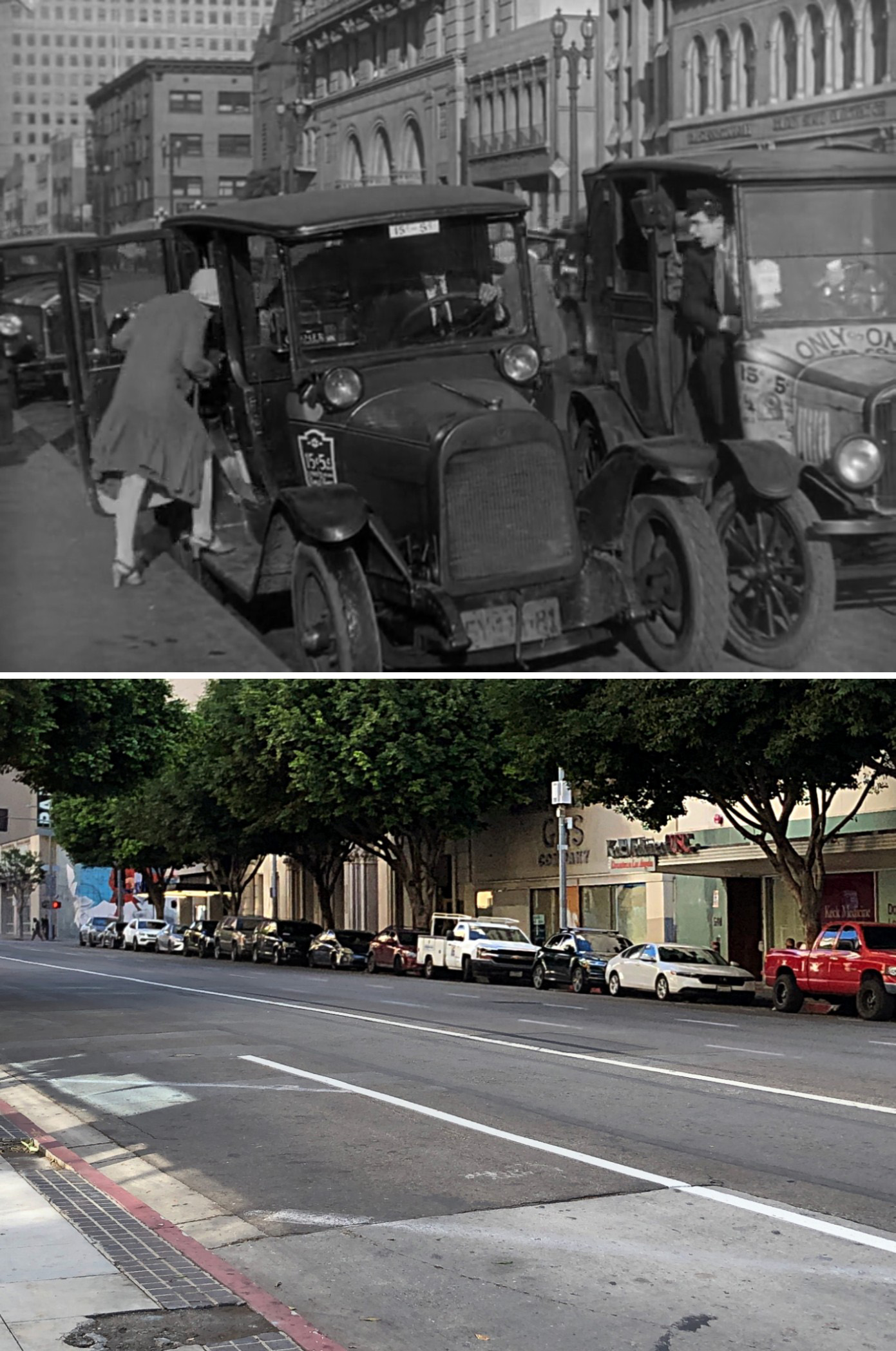
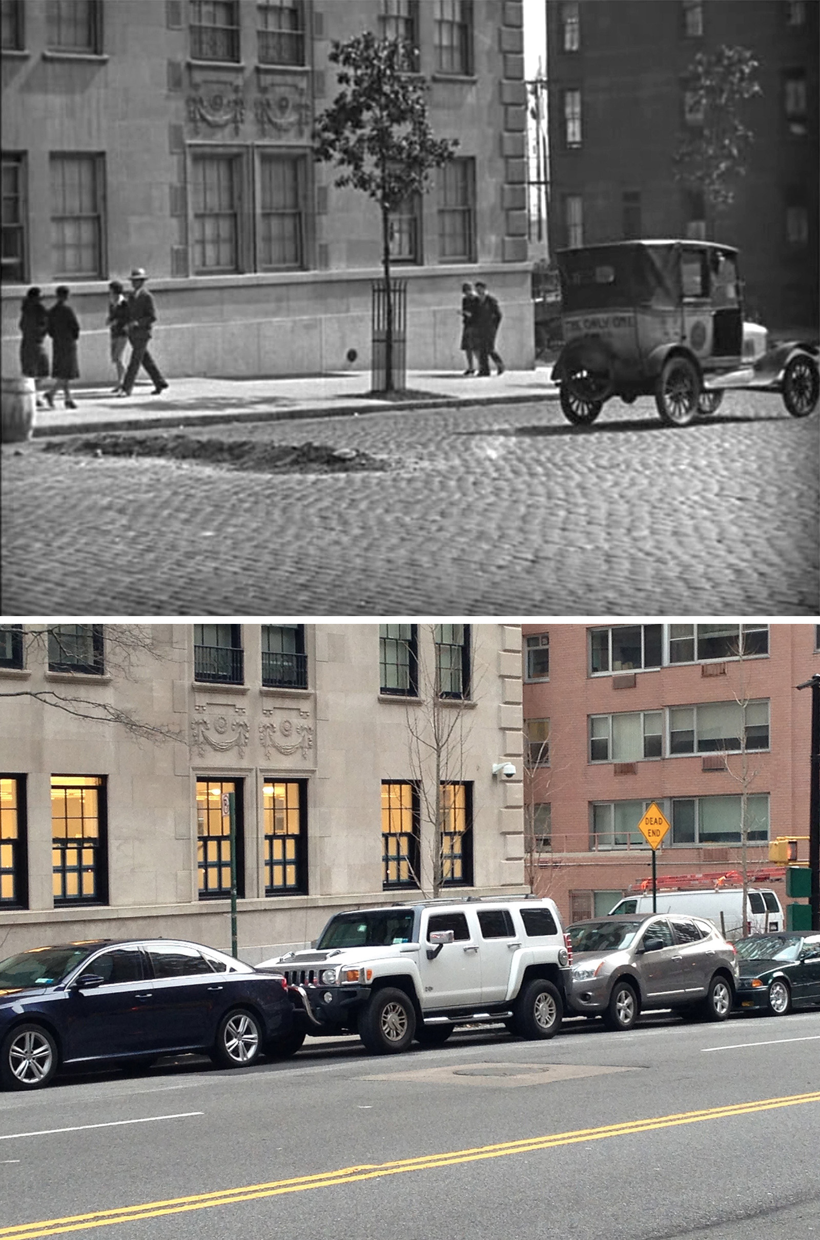
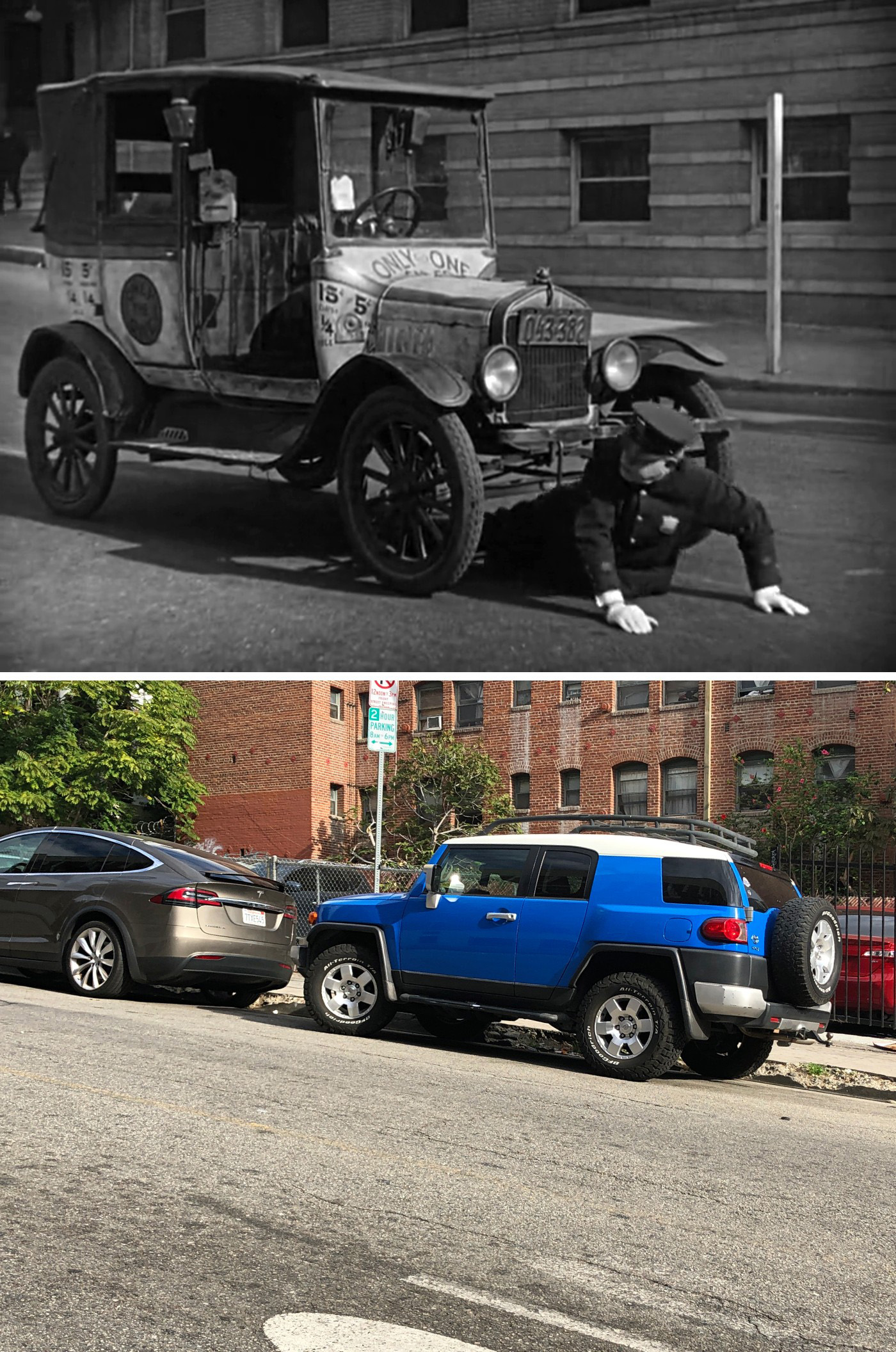
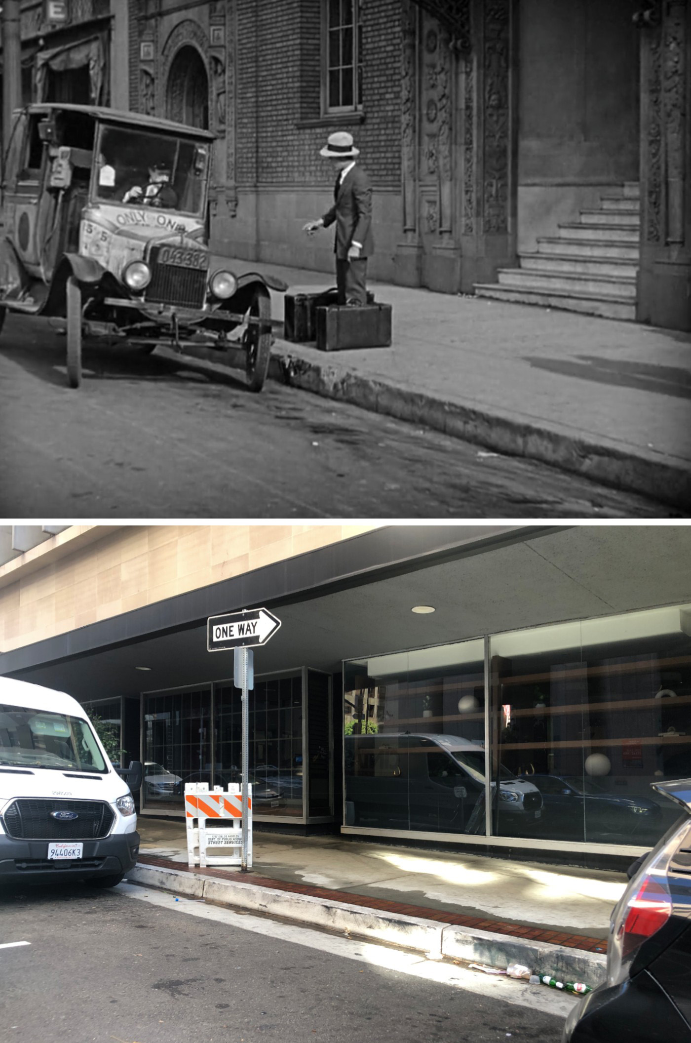
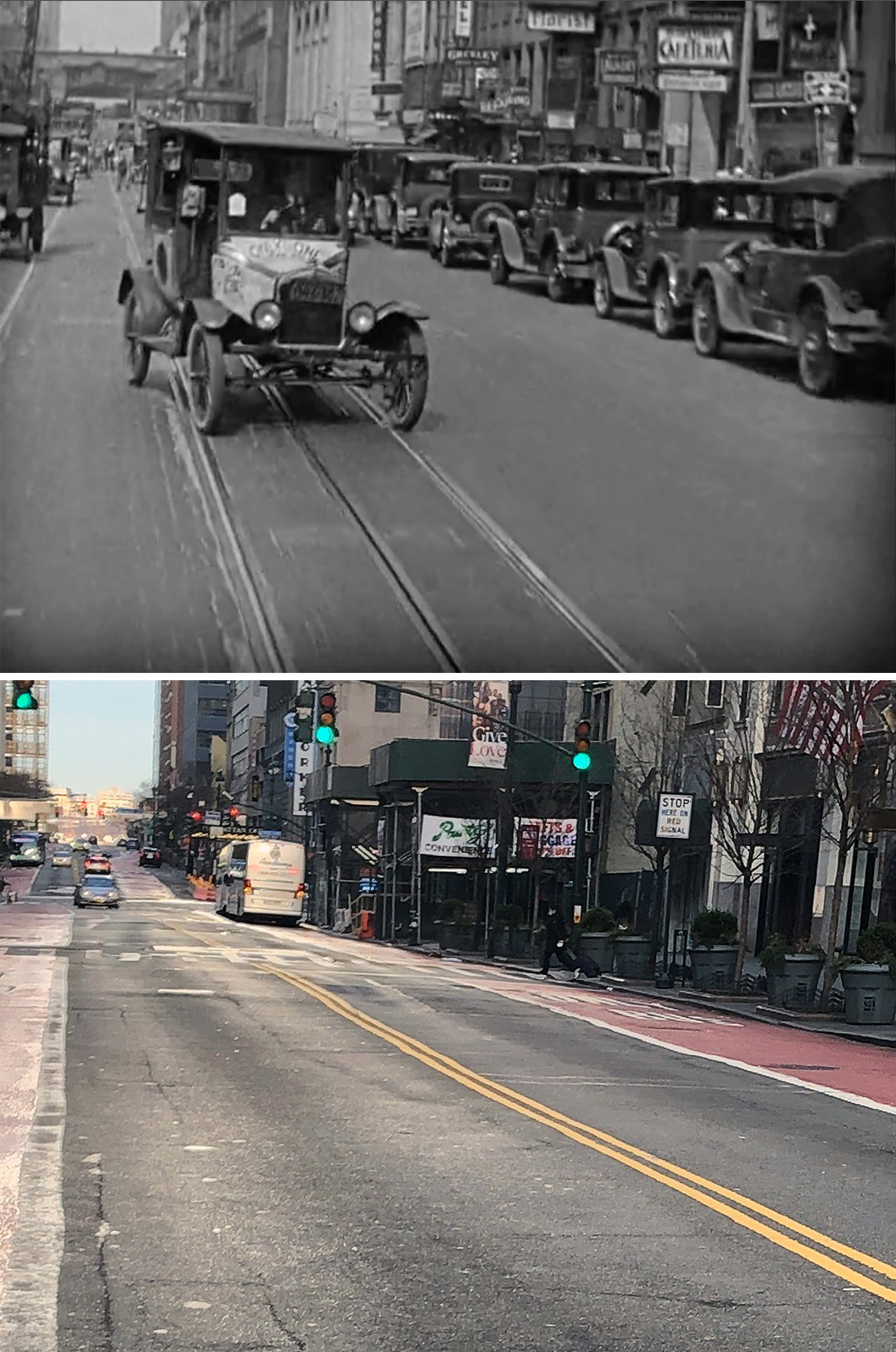
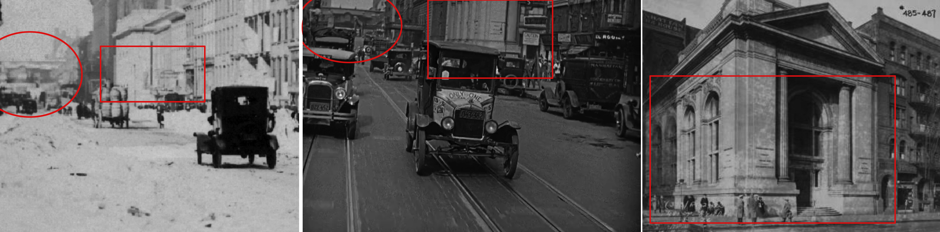
For some reason, a good chunk of the Los Angeles footage was taken on South Flower Street, which will appear in several taxicab scenes later in the film. I assume Lloyd had an affinity for Flower Street because its architecture was pretty similar to New York at the time. Of course, you wouldn’t know it by the way things look today.
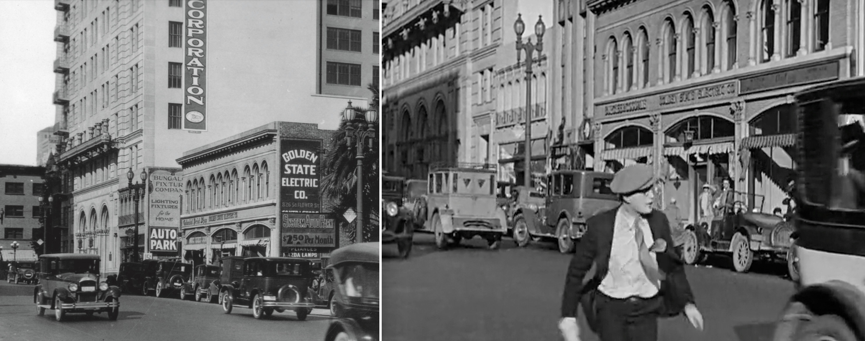
Almost everything has since been razed. The only building from this scene that is still standing is the Los Angeles Gas and Electric Corporation Building near the corner of 8th Street. Established in 1925, most of its lower floors are now obscured by trees, but you can see a couple matching windows from the movie just above the tree line, helping confirm the correct angles.
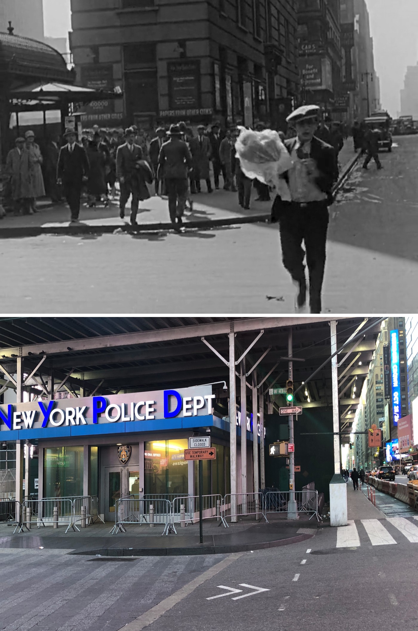
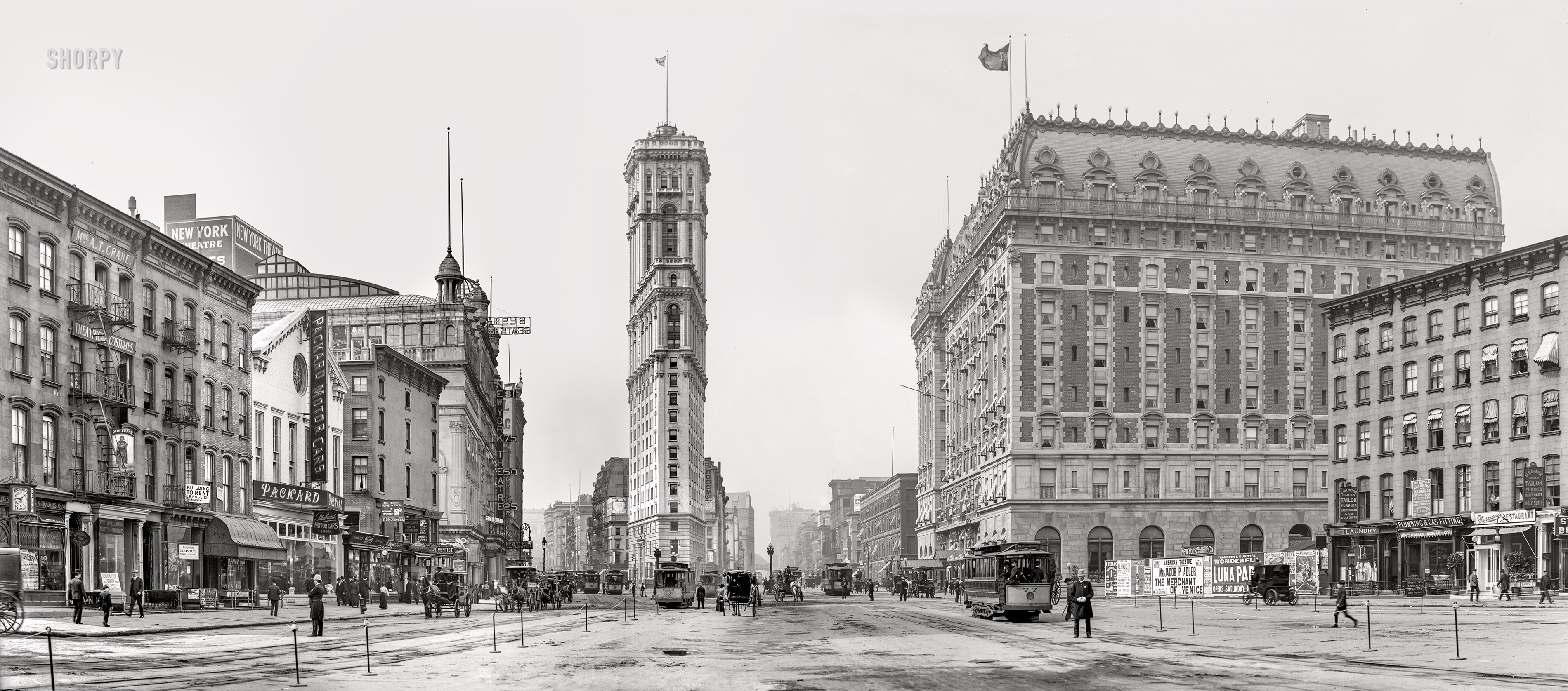
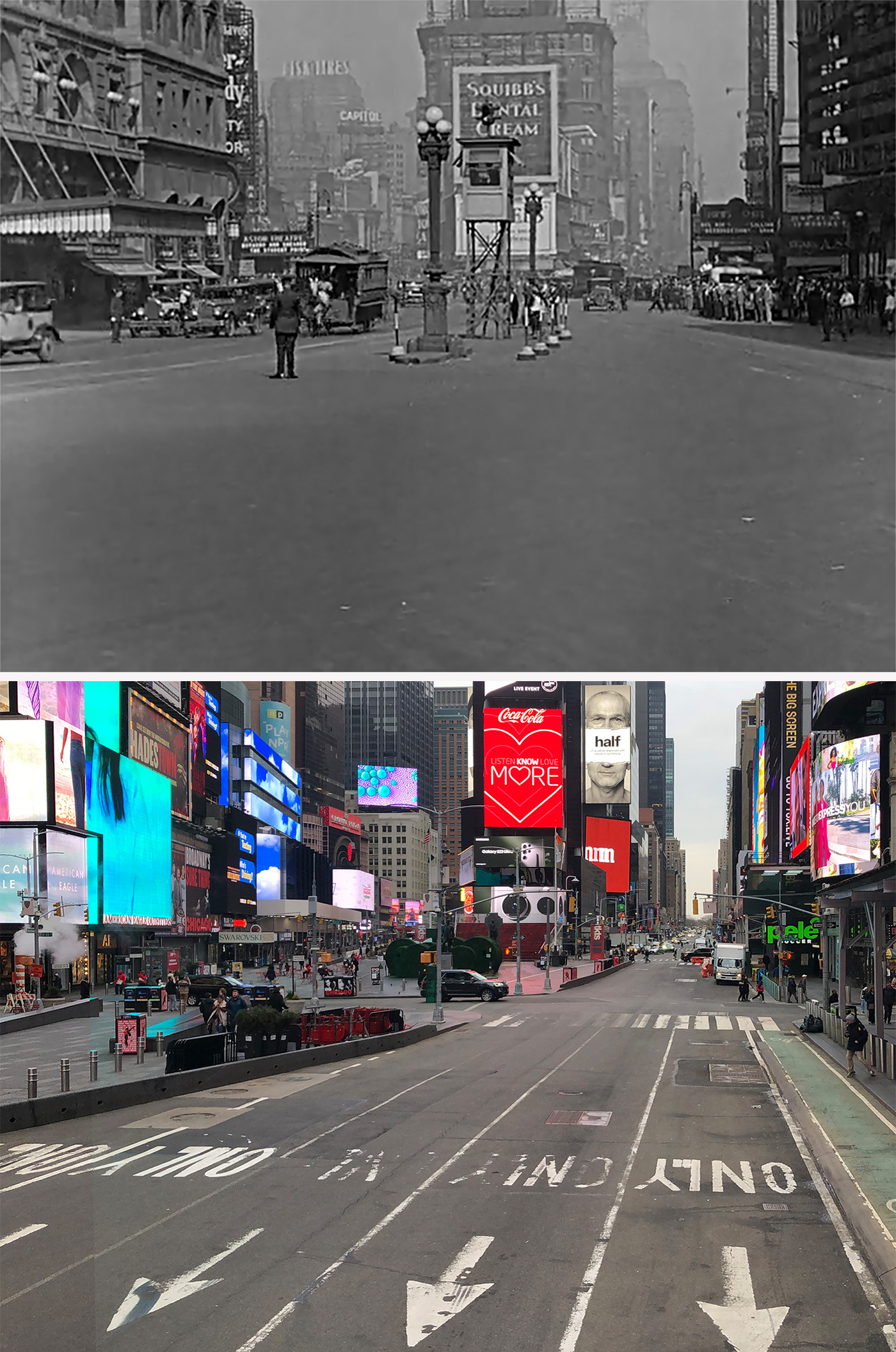
Naturally, the quick shot of Lloyd running through New York’s Times Square was easily identifiable, especially with the presence of One Times Square in the background.
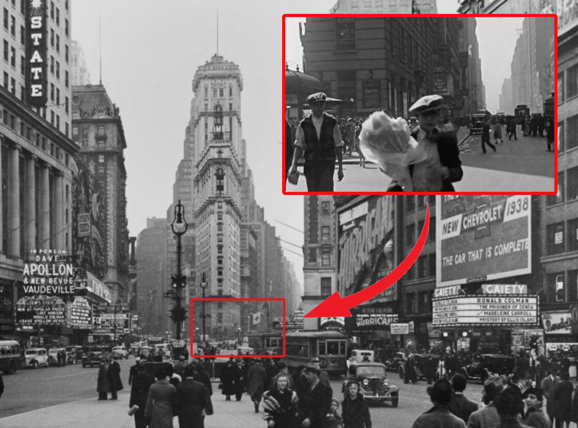
This iconic 25-story skyscraper on W 42nd Street was built in 1903-1904 as the new headquarters of The New York Times newspaper. The illustrious tower soon became the centerpiece of the area and is the reason why Longacre Square was renamed Times Square. Unfortunately, its original neo-Gothic facade has been completely stripped away, and these days, it looks like an entirely different building.
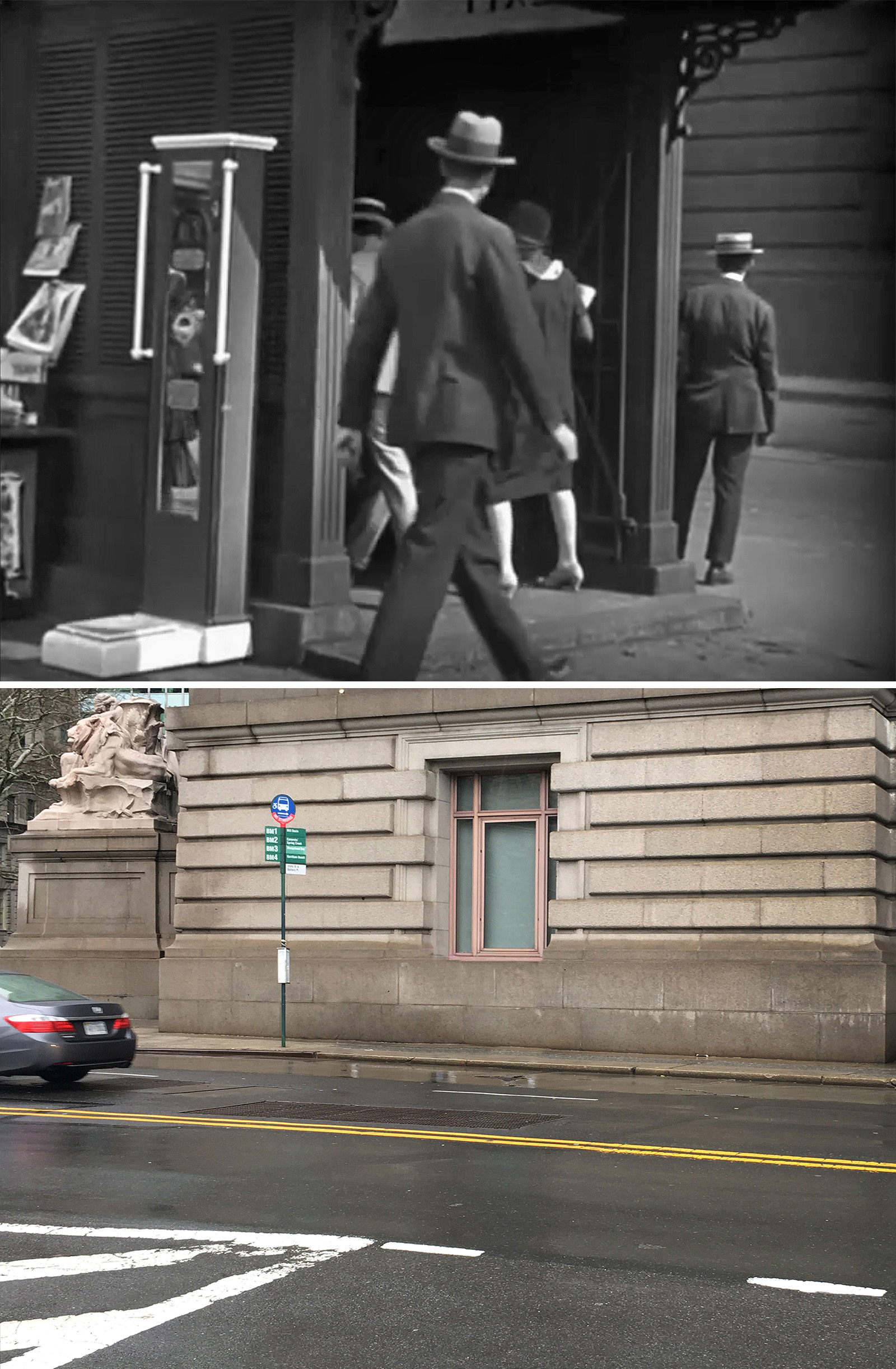
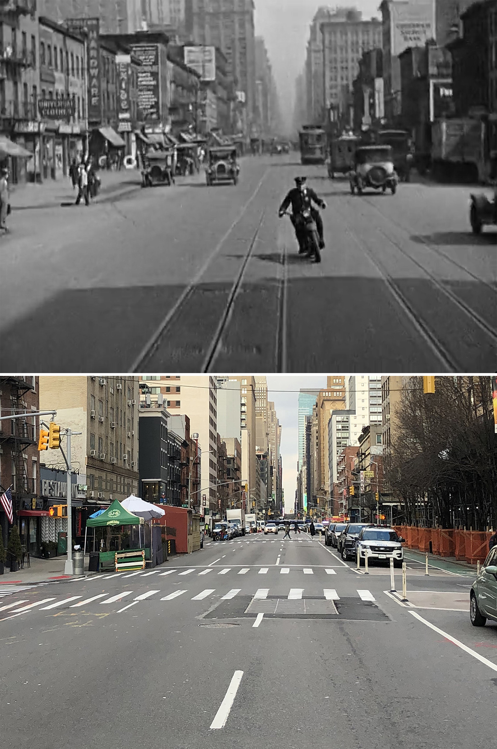
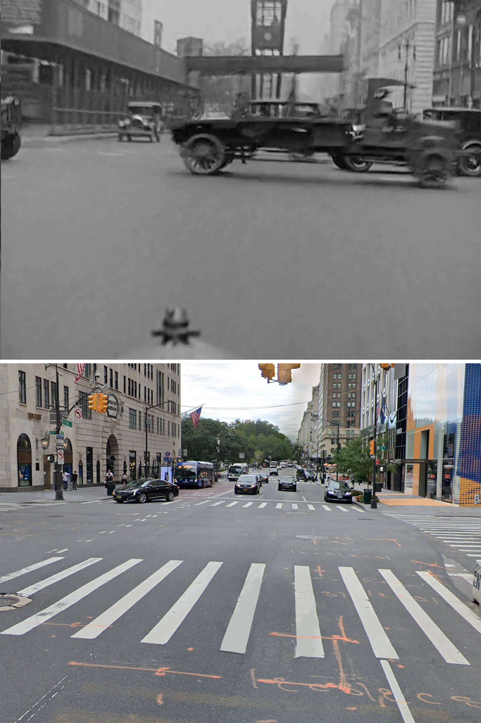
The shot that immediately follows the one at One Times Square is a bit of a puzzler.
If you look closely, you can see portions of a subway kiosk (indicated with red ovals above) — something that was unique to New York’s first subway line that opened in 1904.
However, I have a sneaky suspicion that the kiosk in the movie was just a prop, and the scene was actually filmed back in California on a backlot. But it’s hard to know for sure.

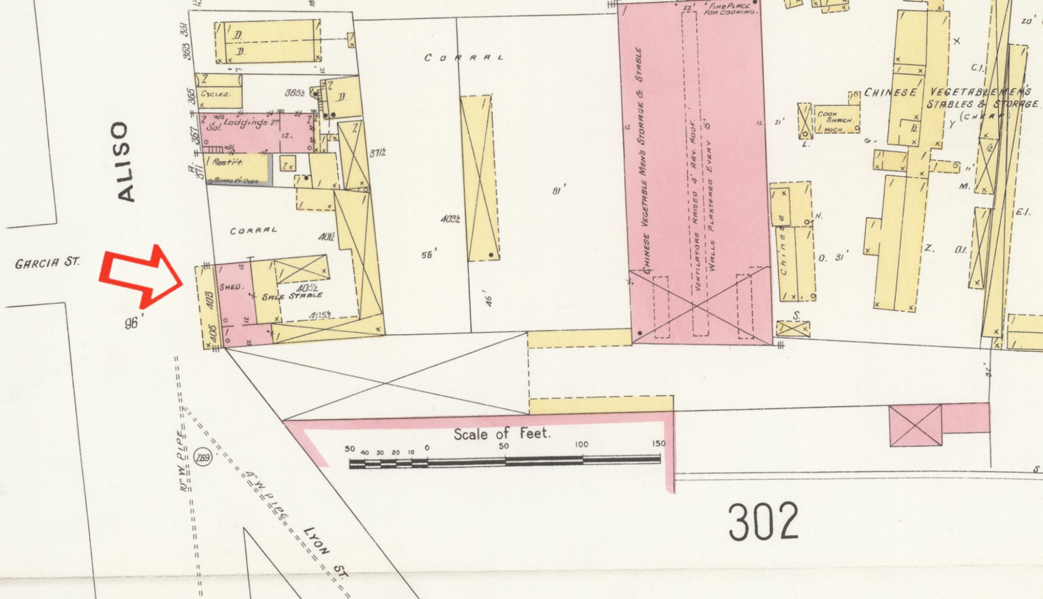
 are Nos. 59 to 69 Bleecker Street, at, adjoining and w of NW corner of Lafayette. 1929")

I did try to track down as many photos of those subway kiosks as possible, but I couldn’t find anything that looked like the movie. Of course, it wasn’t an exhaustive search, so it’s still possible there’s a photo out there proving that it was filmed in NYC, but my gut feeling says it was filmed in LA.
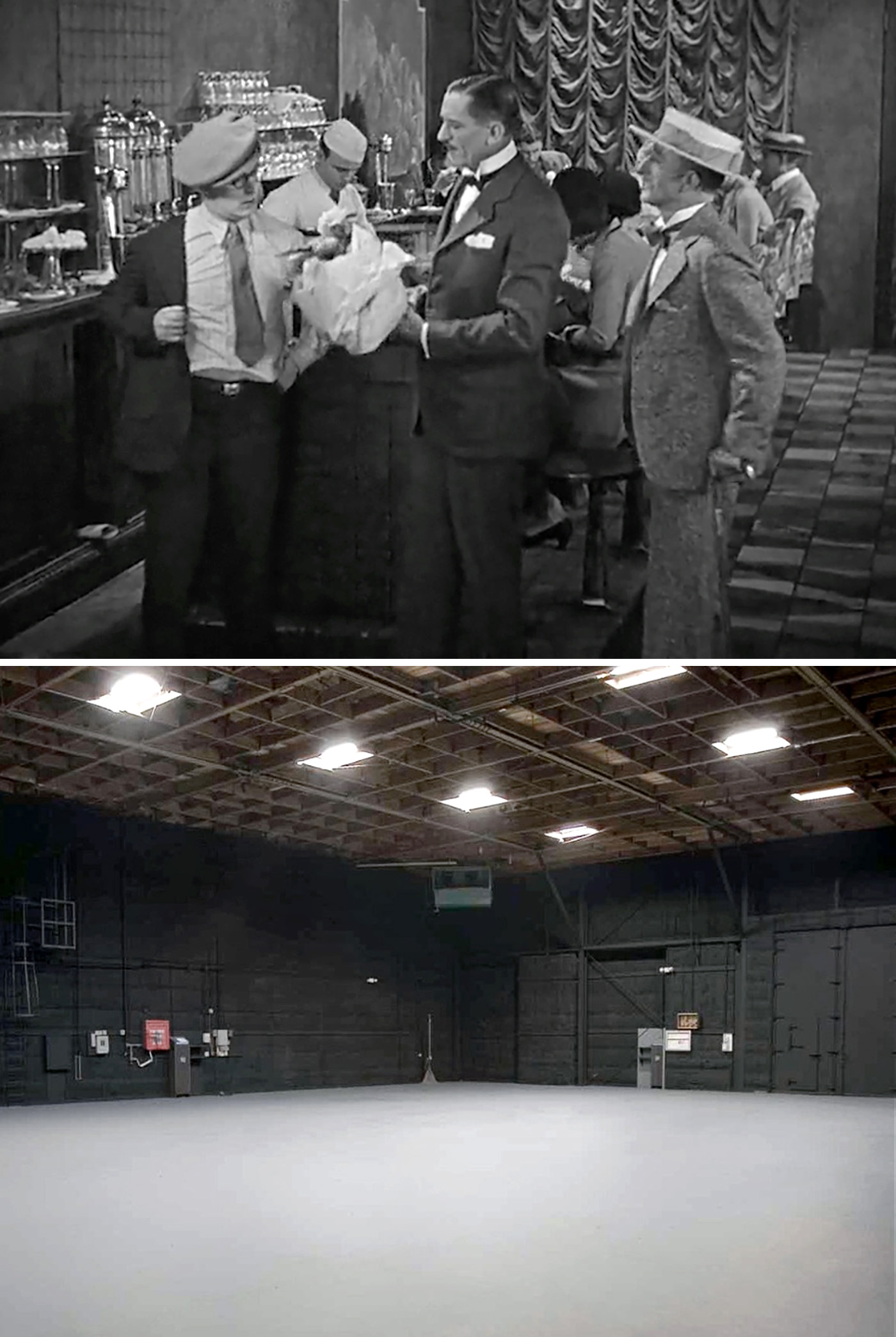
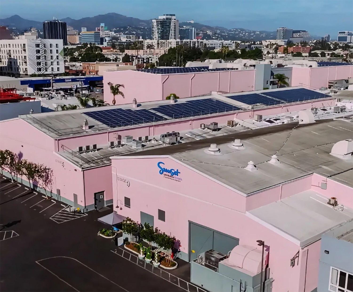
One thing that was definitely filmed back in LA was the pharmacy interior where Harold worked as a soda jerk.
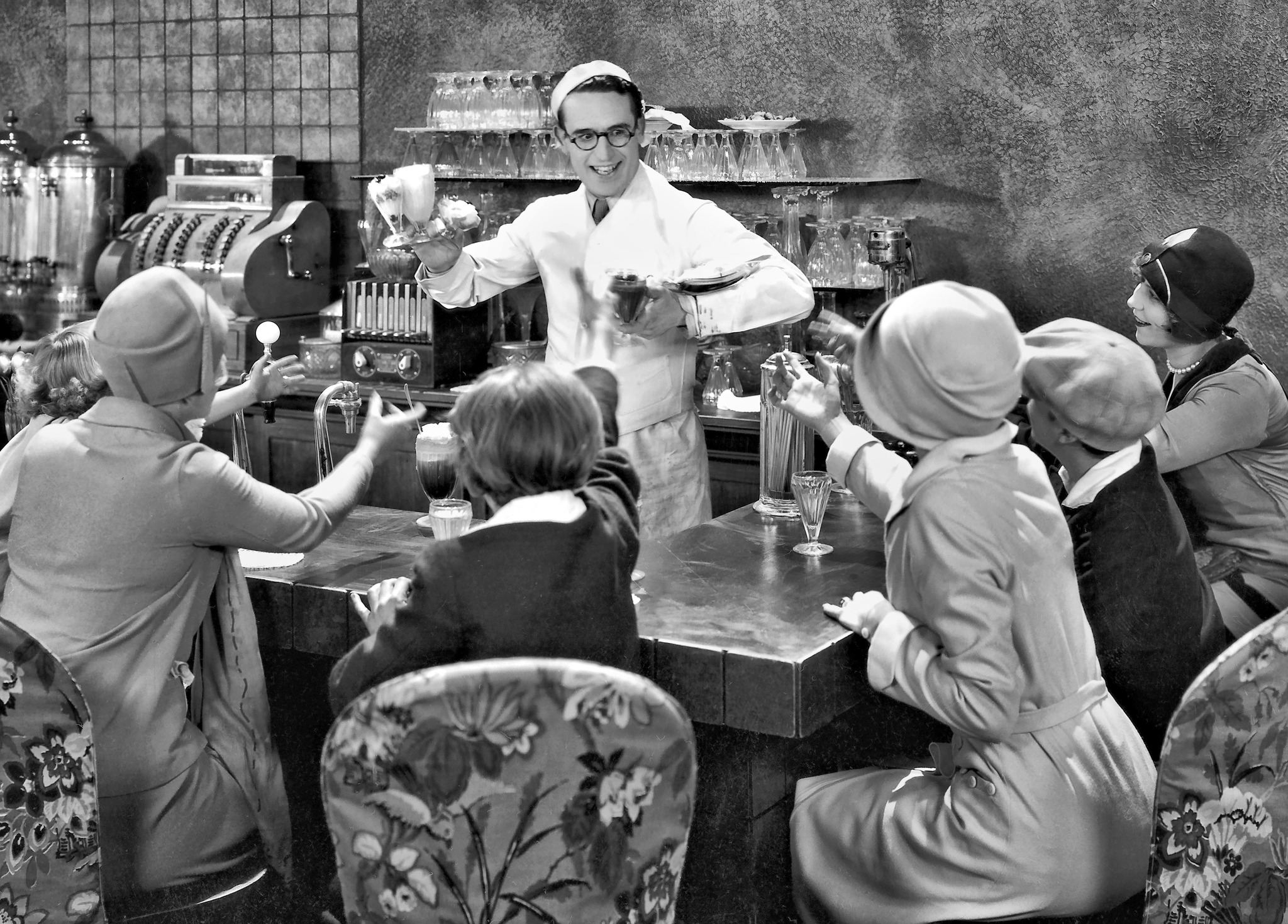
I’m fairly certain all the interiors from Speedy were sets built on soundstages at Hollywood Center Studios, located at 1040 North Las Palmas Avenue. The production lot is still in business under the name, Sunset Las Palmas Studios, and has been around since 1919.
I know Lloyd used the studio after leaving the Hal Roach team i 1926, producing his independent films there. However, I haven’t found any official documentation specifically confirming he shot Speedy there. But I’m assuming he did, especially since I couldn’t find anything to contradict that.
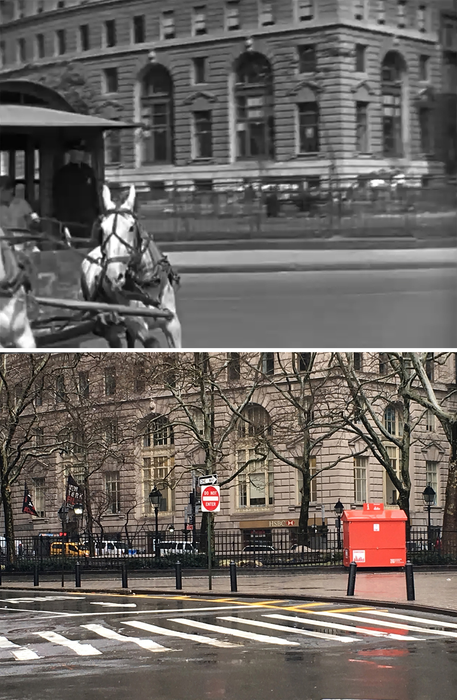
Subway
There were a decent number of clues indicating where they filmed this scene, like the Custom House and the curved Standard Oil Building, both of which are still standing today.
While the subway entrance was real, the platform below was an elaborate set built in Hollywood, complete with moving subway cars.
It was a pretty impressive set-up, but you can pretty quickly tell it’s fake by the brightness of the station and basic layout.
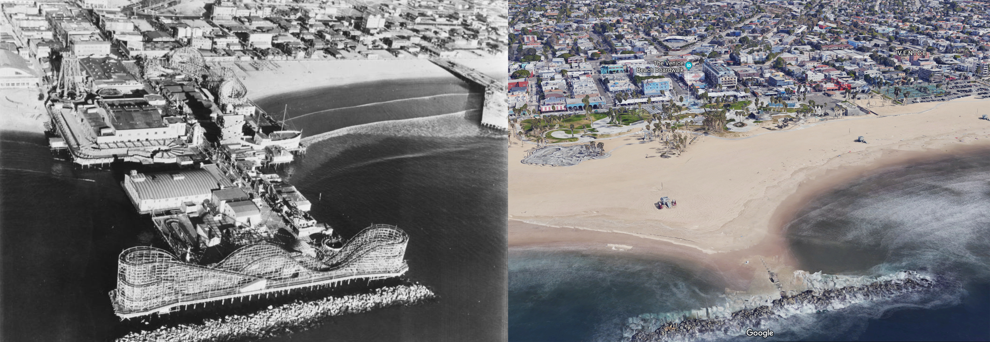
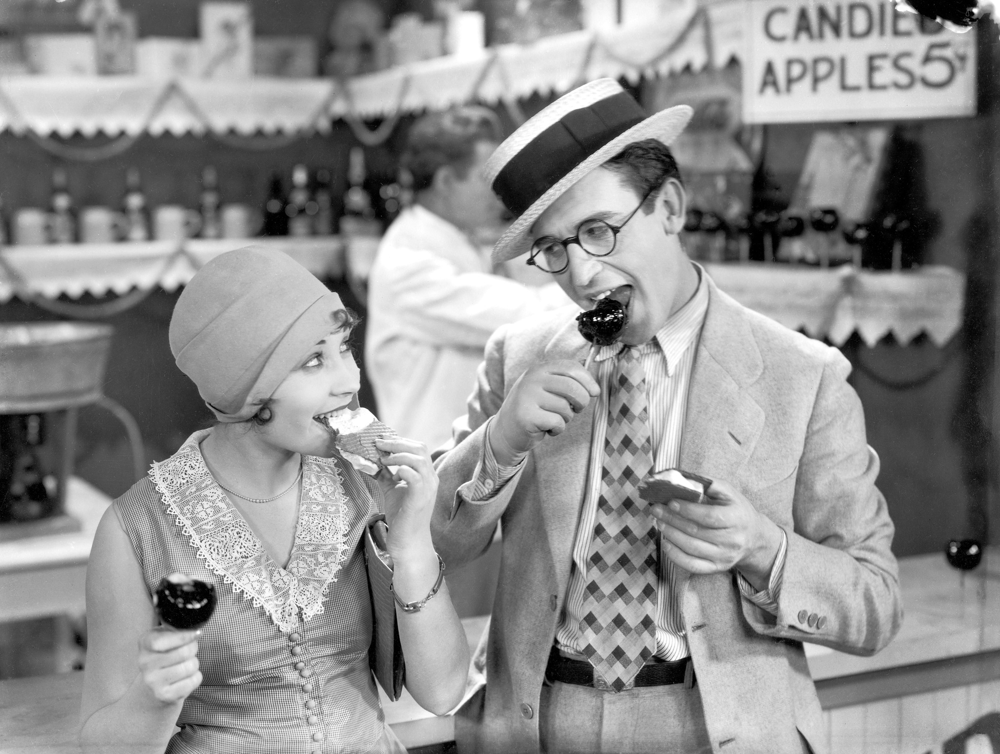
Coney Island
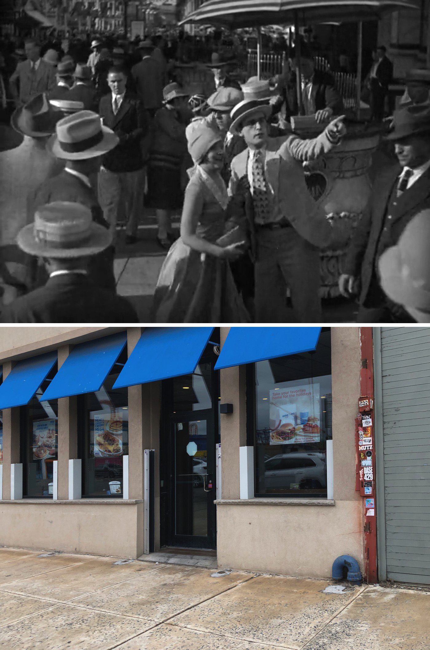

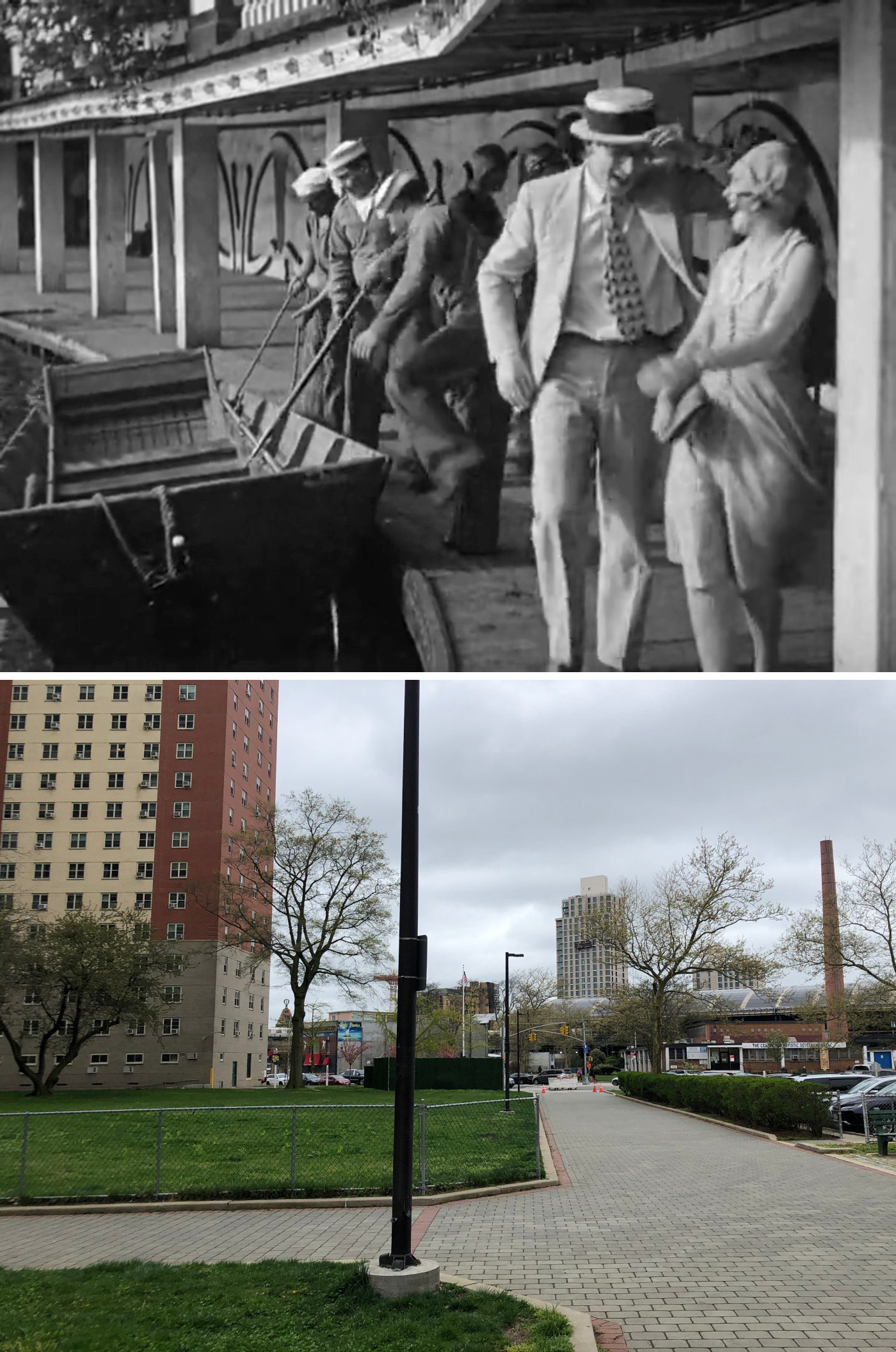
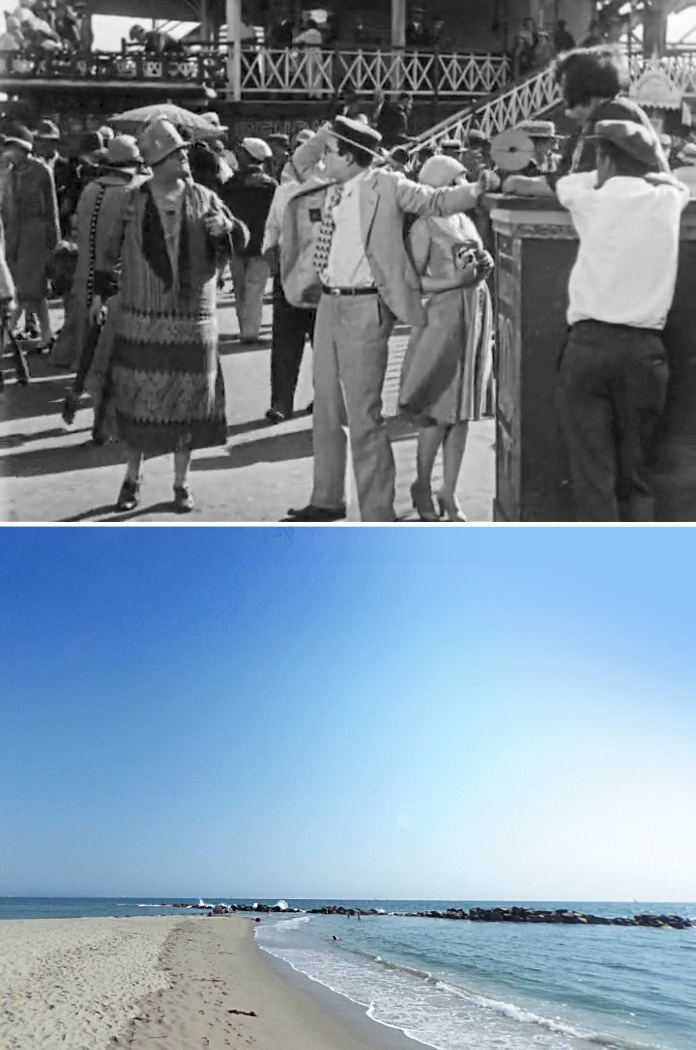
I was completely awestruck by the amount of work it must’ve taken John to find all of these “Coney Island” locations, especially since Lloyd mixed footage from both the Atlantic snd Pacific, and virtually nothing that appears in the movie remains today.
Basically, most of the shots of Lloyd and his co-star, Ann Christy, riding the rides were filmed in Brooklyn’s Coney Island, and everything else was filmed on the West Coast. For a deeper dive into these ancient Californian amusement parks and how John found them, I highly recommend you snag his book, Silent Visions.
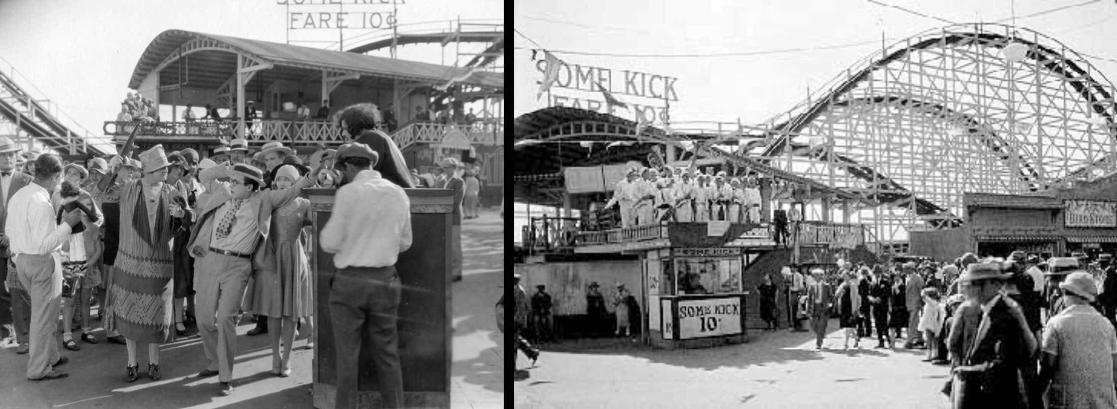
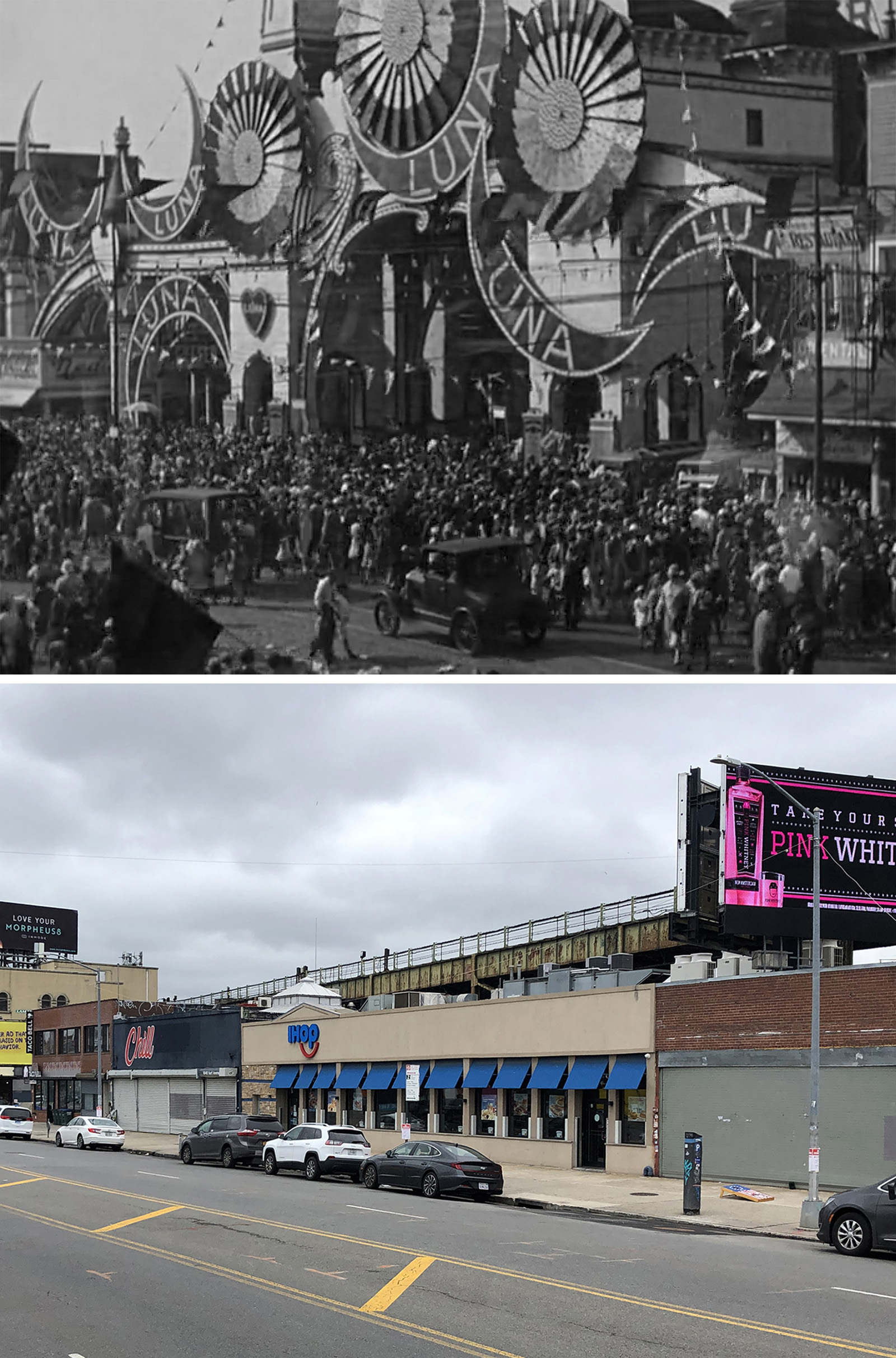
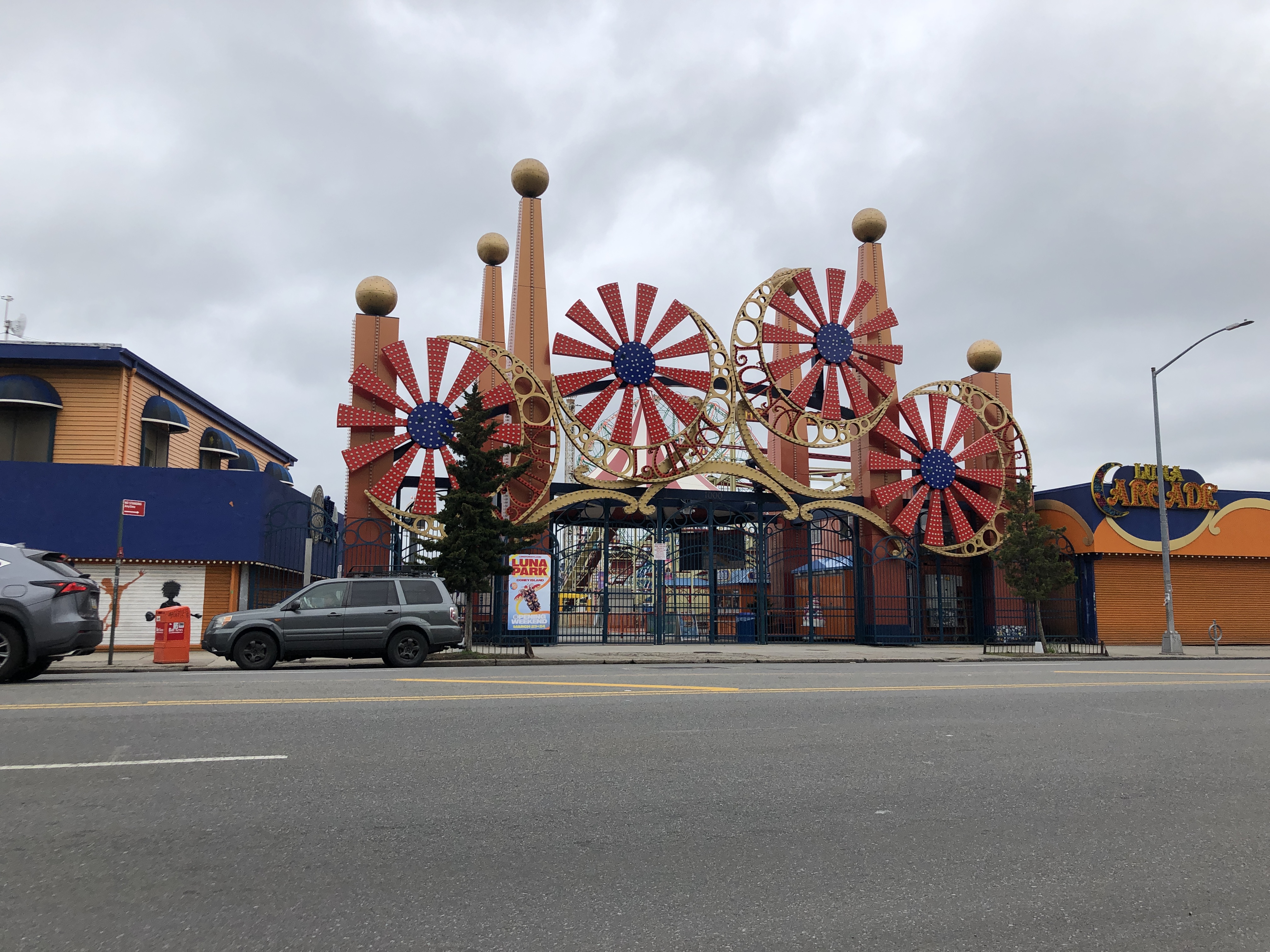
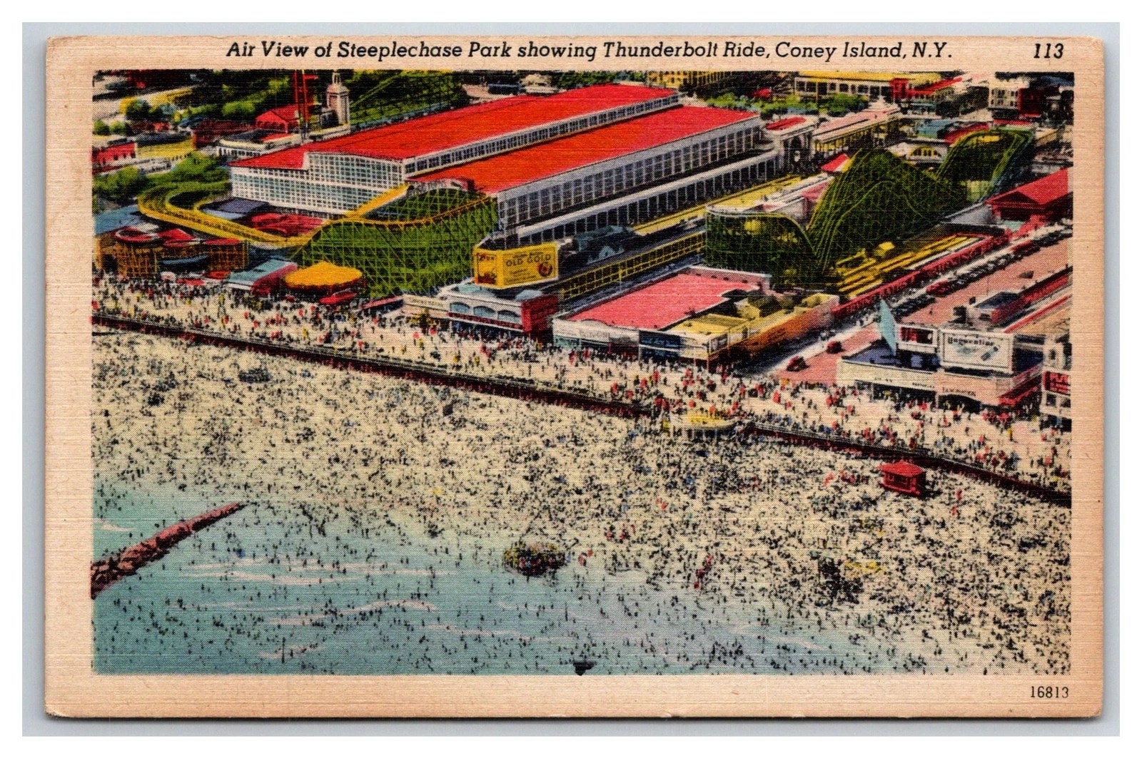
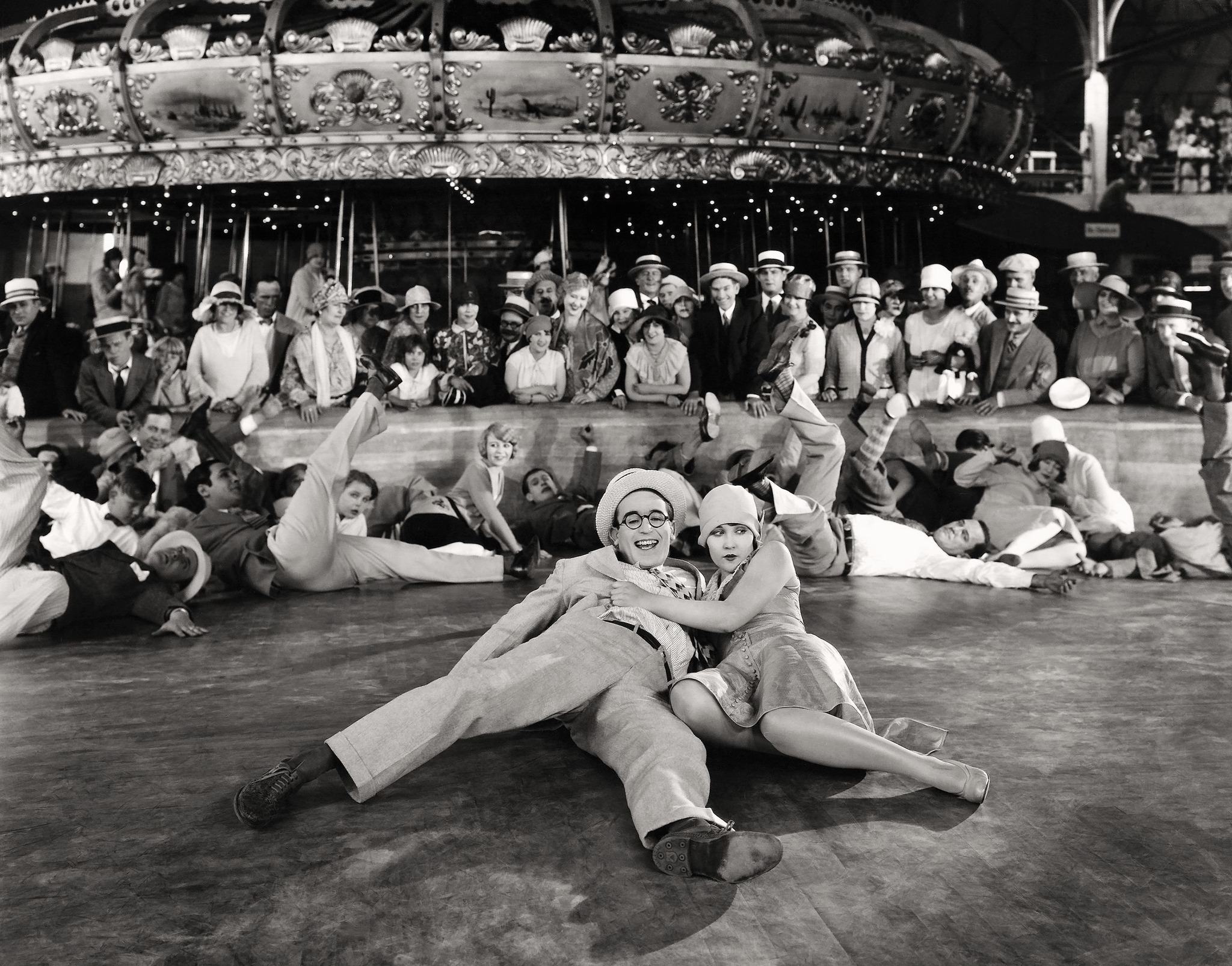
When it came to the stuff actually shot in Coney Island, Lloyd essentially made use of two amusement centers — Luna Park and Steeplechase Park.
I’ve covered Luna Park in previous posts, so I’m going to focus most of my attention on the lesser–known Steeplechase Park.
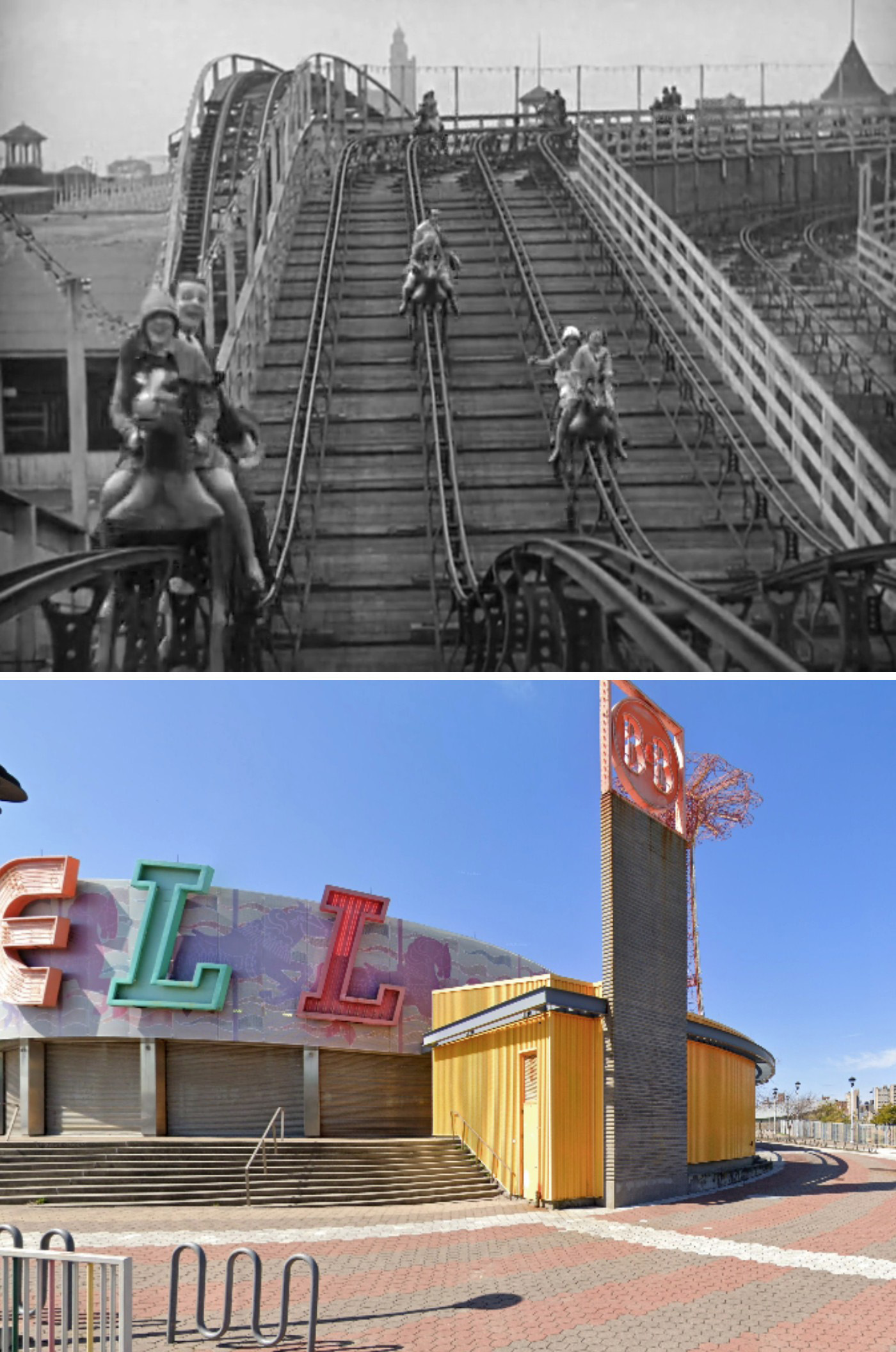
Operating in Coney Island from 1897 to 1964, Steeplechase Park was actually the longest-lived of the three major amusement parks on the shore. The secret to its success was its simplicity. Its founder, George C. Tilyou, purposely avoided overly extravagant attractions and instead focused on amassing simple group rides that didn’t need to be revamped every season, thus minimizing its maintenance costs.
But to make it all work, Tilyou knew he needed one spectacular flagship ride that would be universally associated with the park
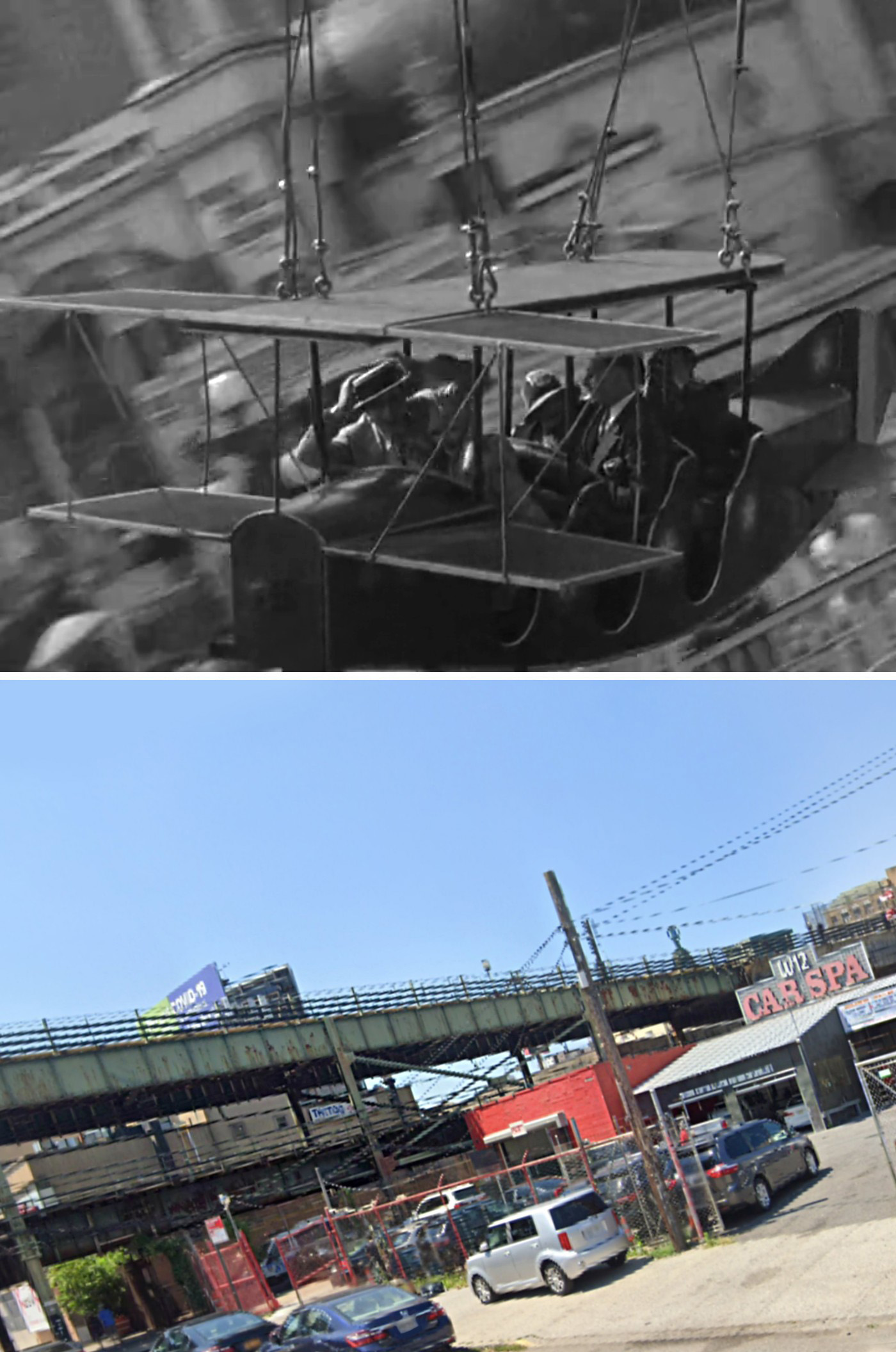
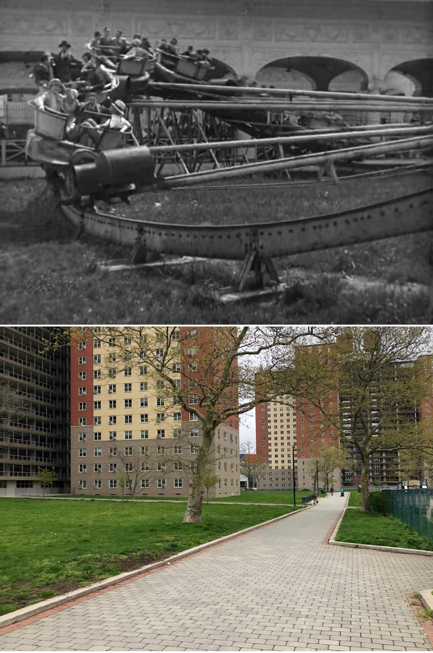
And that ride would be the one featured in this movie — The Steeplechase Horses. Manufactured by J.W. Cawdry, the family-friendly ride featured gravity-pulled mechanical horses racing along a series of metal tracks, giving people the novel opportunity to race fellow patrons.
The ride was a big hit and Steeplechase Park did well for the next several seasons. The number of visitors it attracted increased as overall crowds grew in the area, particularly after Luna Park and Dreamland opened in 1903 and 1904.
Despite a devastating fire in 1907 that burned down much of Steeplechase, Tilyou persevered, rebuilding the park by the start of the 1908 season and calling it, ‘New Steeplechase.’ The rebuilding also gave him the opportunity to improve the park in many small ways, including adding two more tracks to the Steeplechase horse ride.
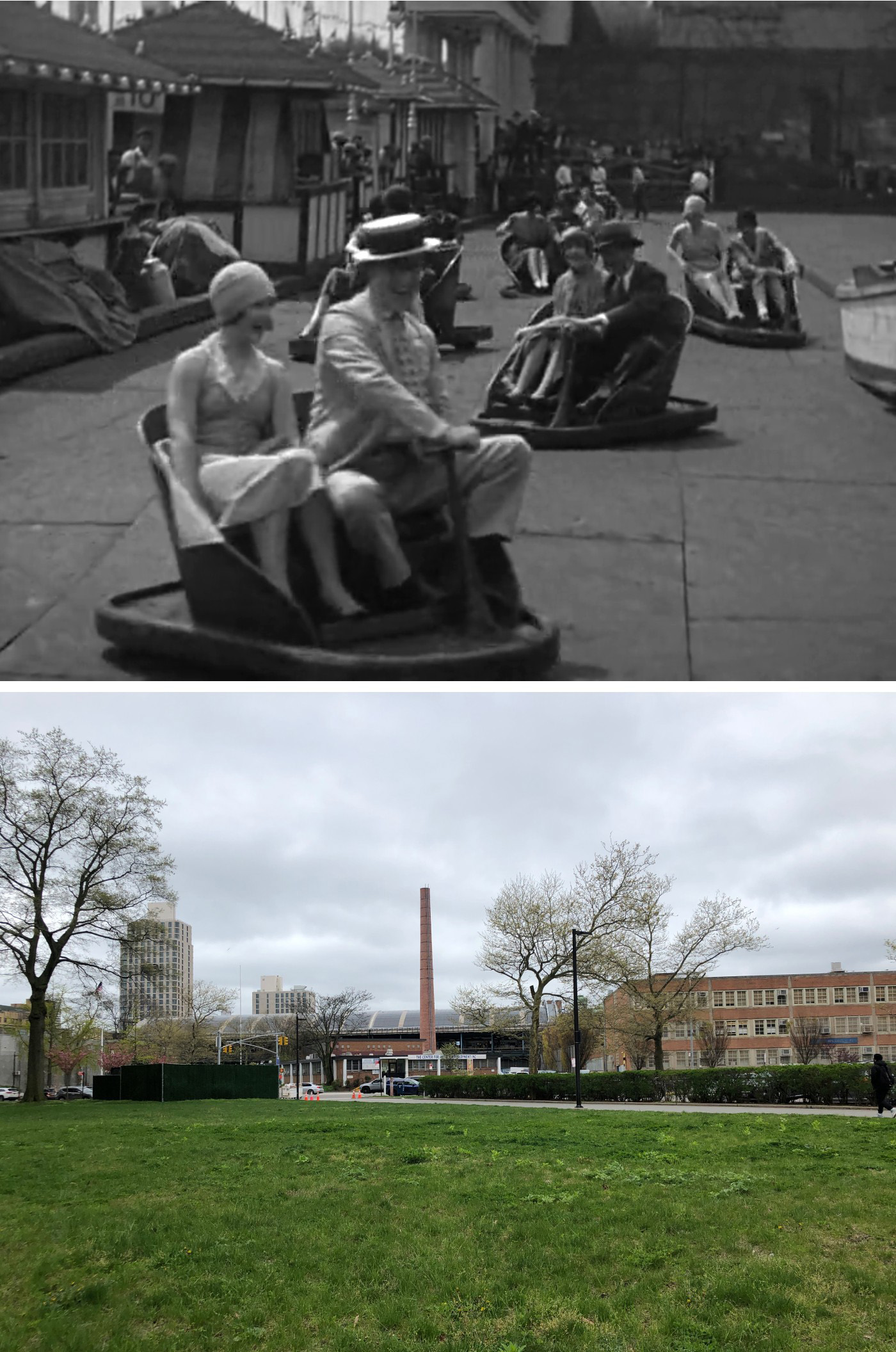
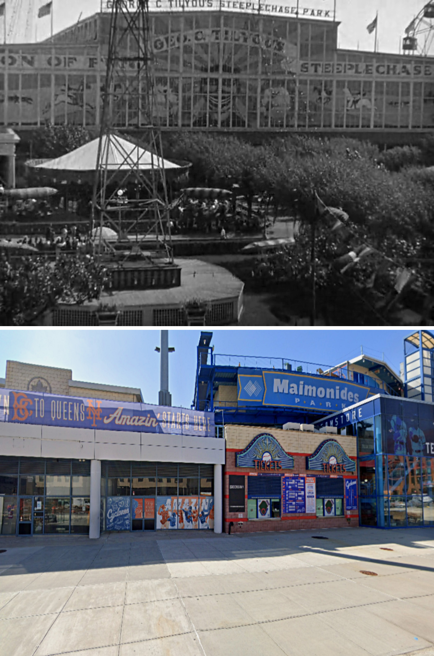
However, the most significant improvement was the creation of a new centerpiece for the park — a massive enclosure called the Pavilion of Fun, which housed an indoor amusement park.
The Pavilion of Fun played a significant role in helping make Steeplechase Park the longest surviving amusement park in Coney Island. That’s because it allowed patrons to enjoy the rides and attractions year-round, even in inclement weather.
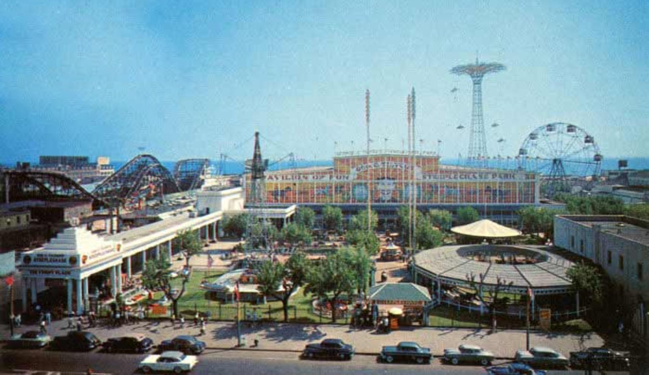
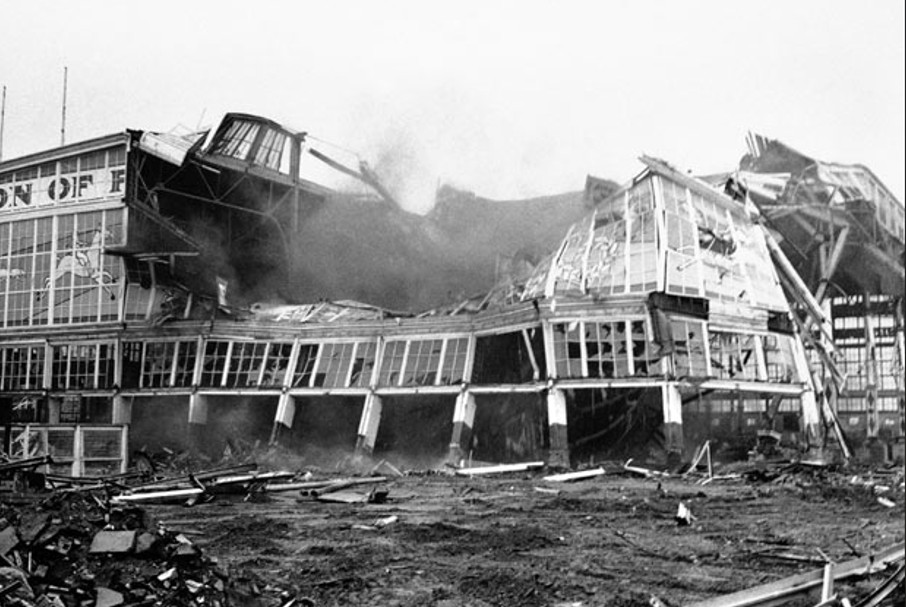
Even as the park started to whittle down its attractions, the pavilion remained a solid institution in Coney Island, surviving up to the day Steeplechase closed in 1964. Afterwards, real estate developer Fred Trump purchased the site and tore down Steeplechase in what ended up being an unsuccessful attempt to build condominiums there.
Today, Maimonides Park, home to the Brooklyn Cyclones baseball team, sits on the site of Steeplechase’s Pavilion of Fun. The only reminder of this forgone amusement park is the landmarked Parachute Jump which sits along the boardwalk.
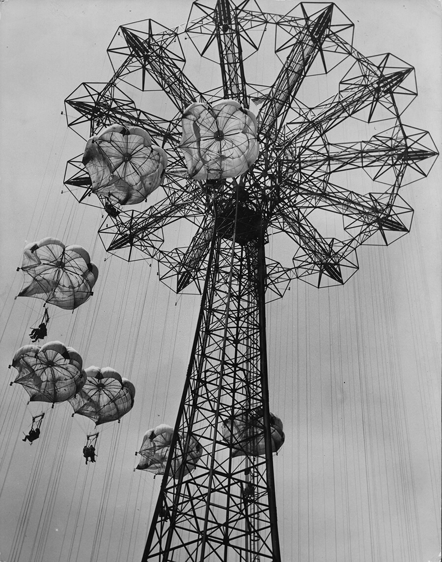
Acquired by Frank Tilyou and George Tilyou Jr. from the World’s Fair in 1941 for $150,000 (equivalent to $3.5 million in 2026), the 250-foot-tall steel tower has astonishingly remained intact on the same spot ever since.
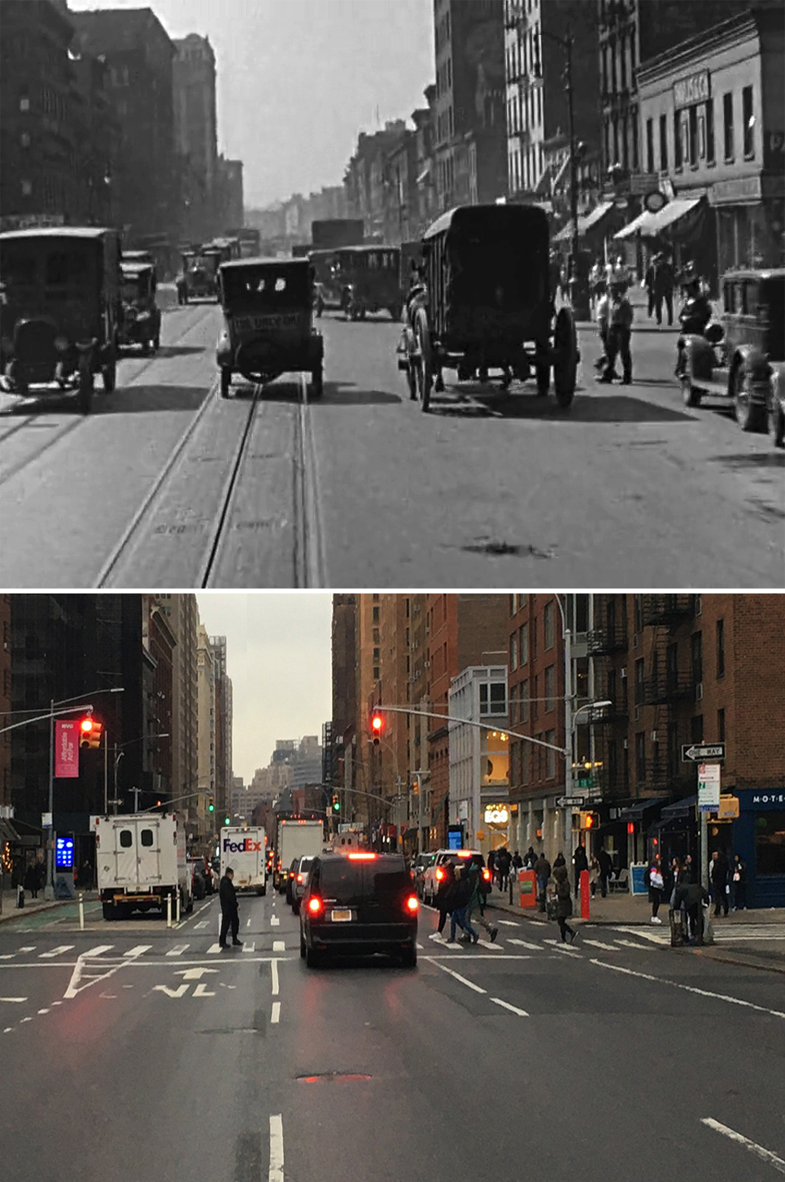
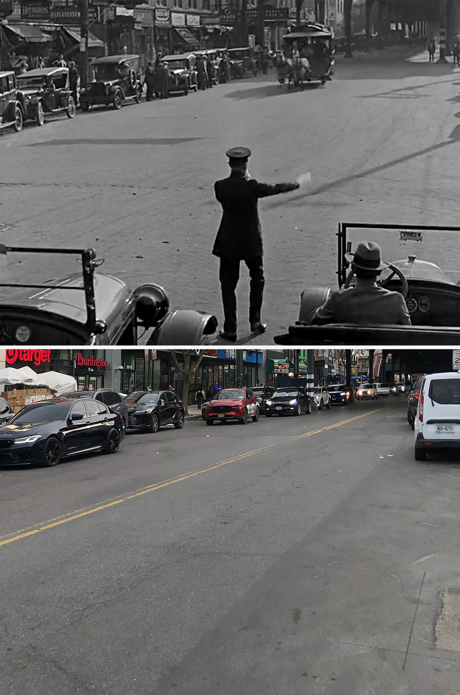
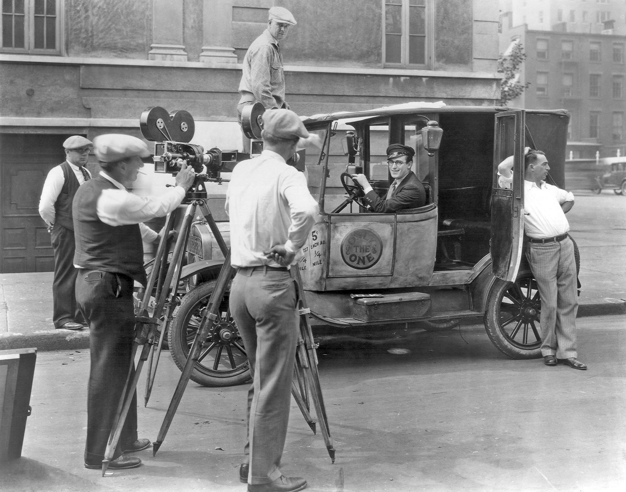
Taxi Woes
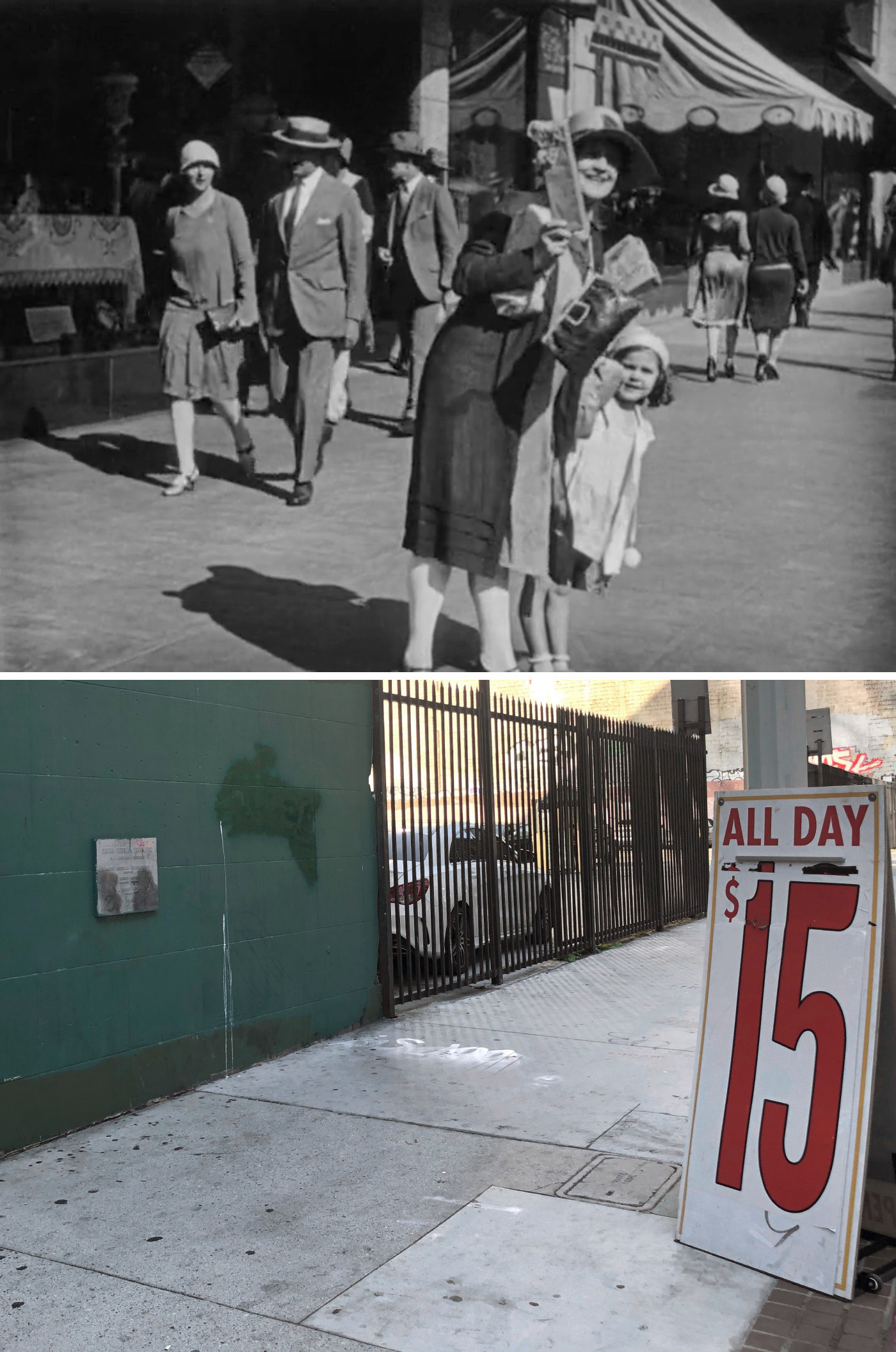
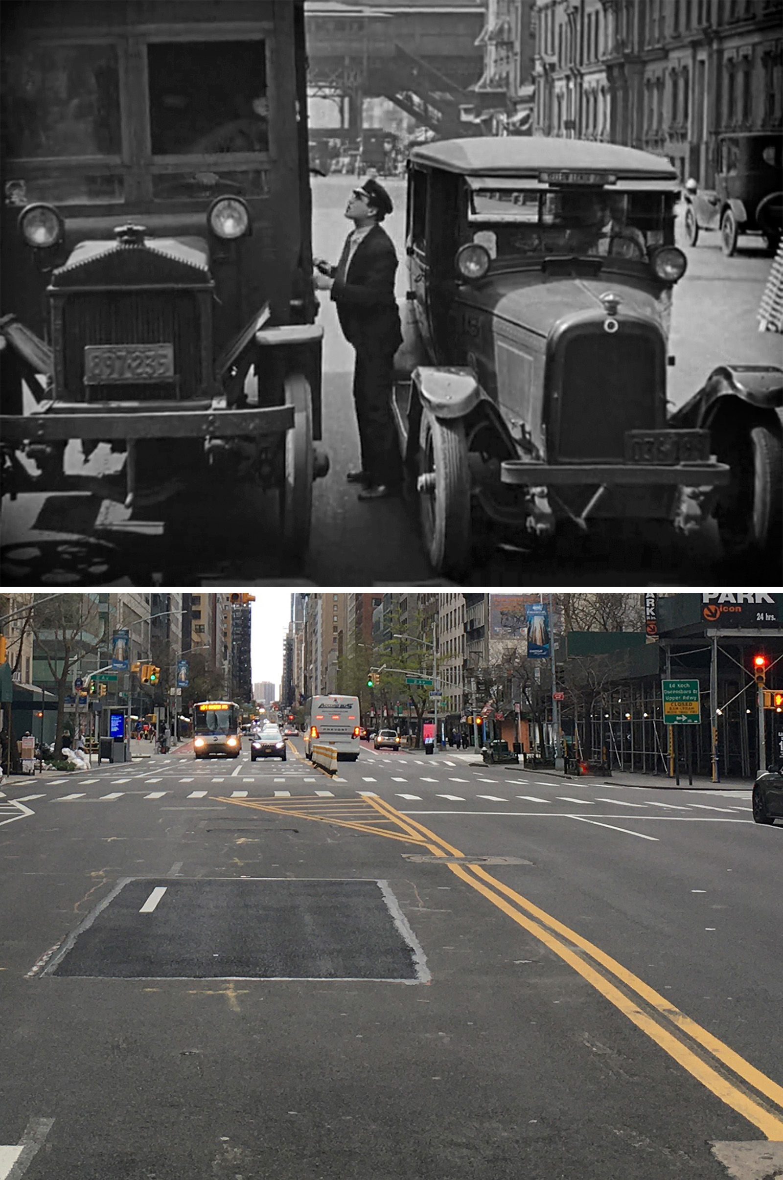
This sequence of Harold’s trials and tribulations in his new taxicab job is another example of Lloyd mixing up East and West Coast footage. Considering how often the geography jumps around, it’s surprising on how well things match up.
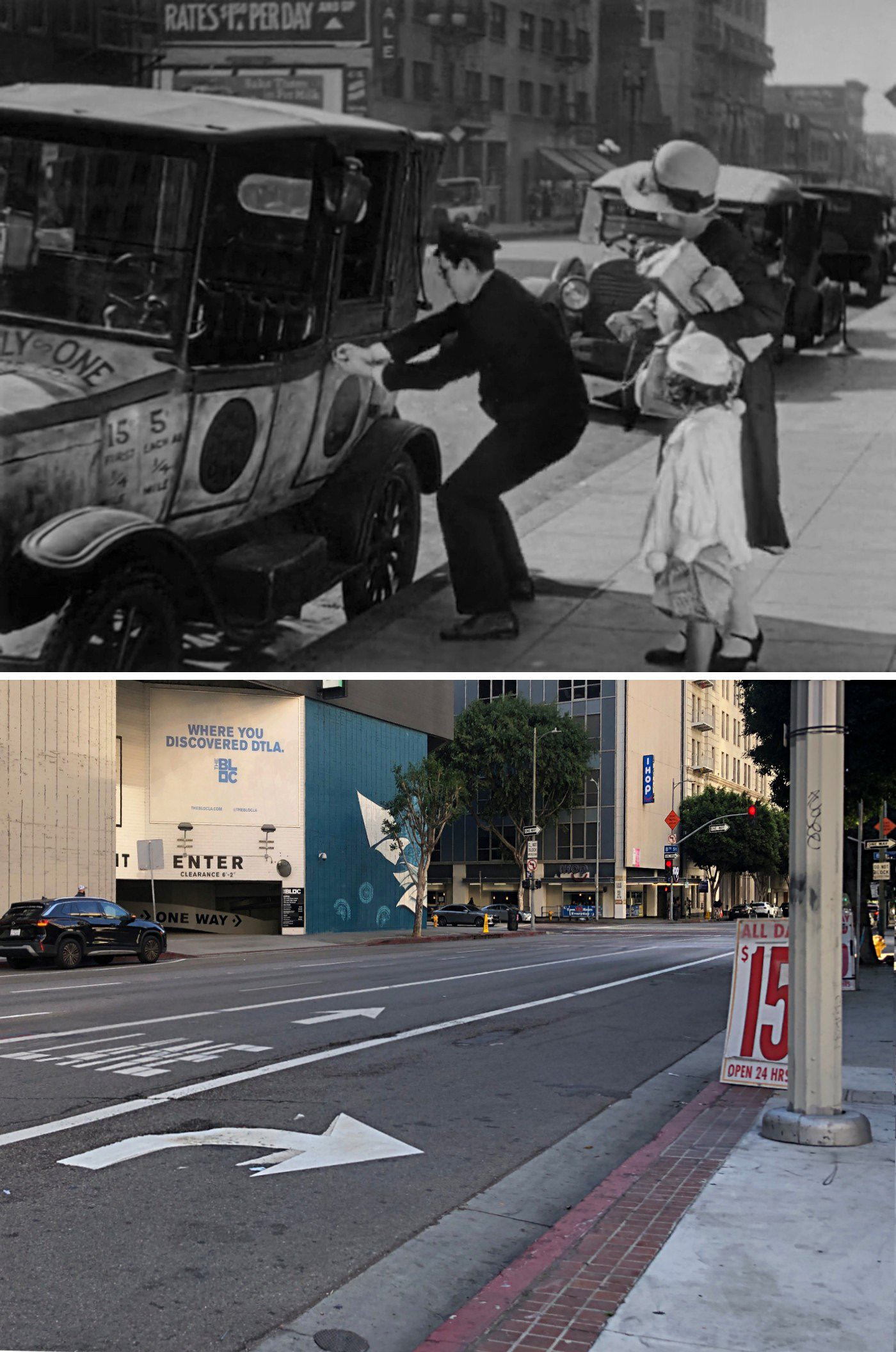
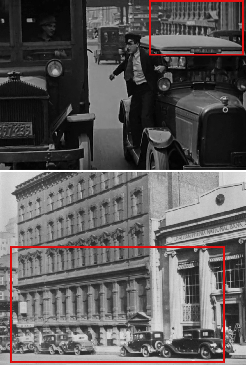
Before I ever thought about tackling this movie, John Bengtson had already figured out the majority of the locations from this extended sequence. Of the Los Angeles stuff, most of it was filmed on South Flower Street over the span of a few blocks. In a couple shots, you can see pieces of the extant Gas and Electric Building, which was also featured in the earlier scene where Harold is delivering the flowers.
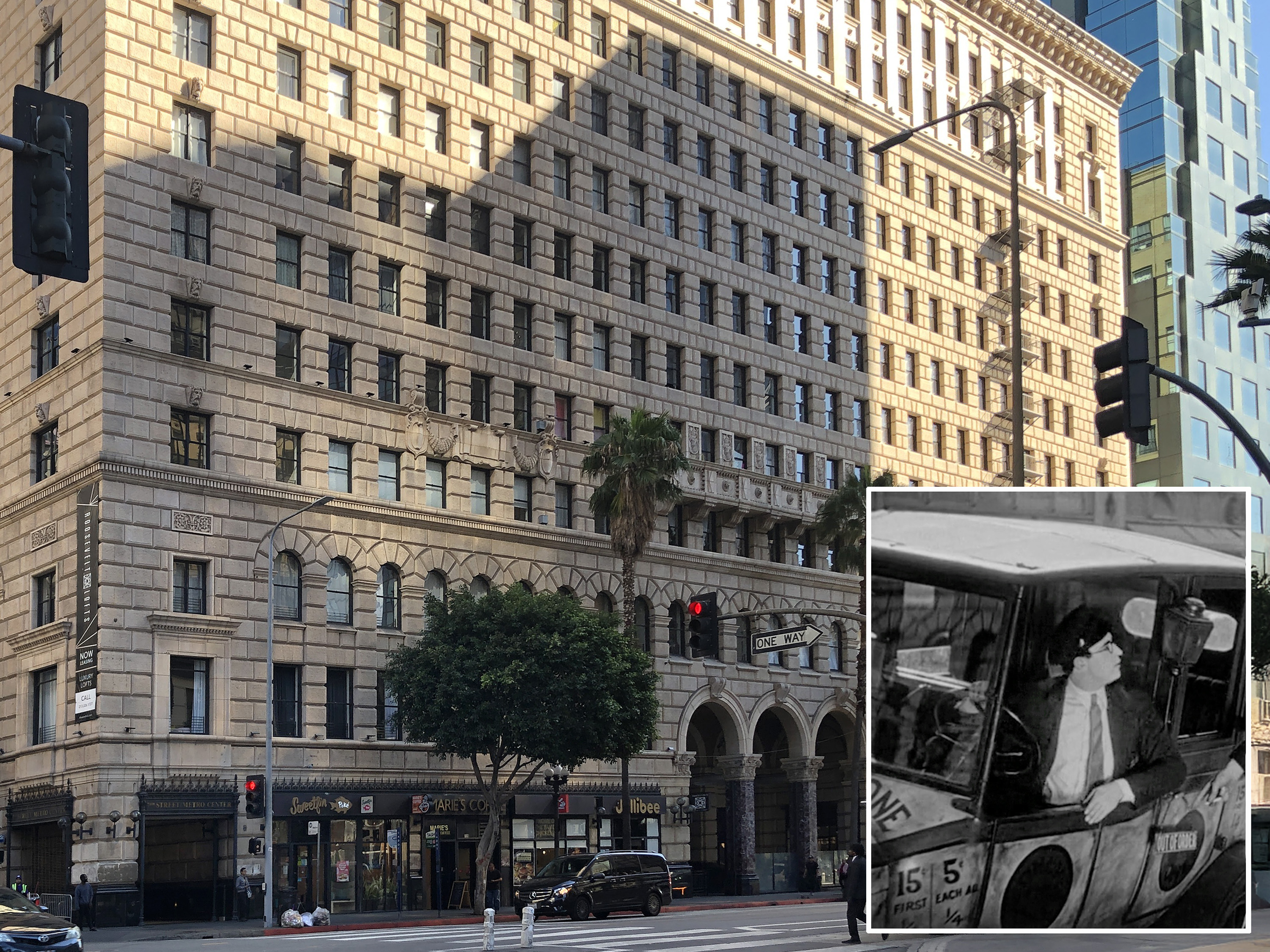
One other extant Flower Street building that appears in this sequence is the Roosevelt Building (EST 1922) on the northeast corner of 7th Street. However, it’s only visible as a reflection in the taxicab’s windshield.
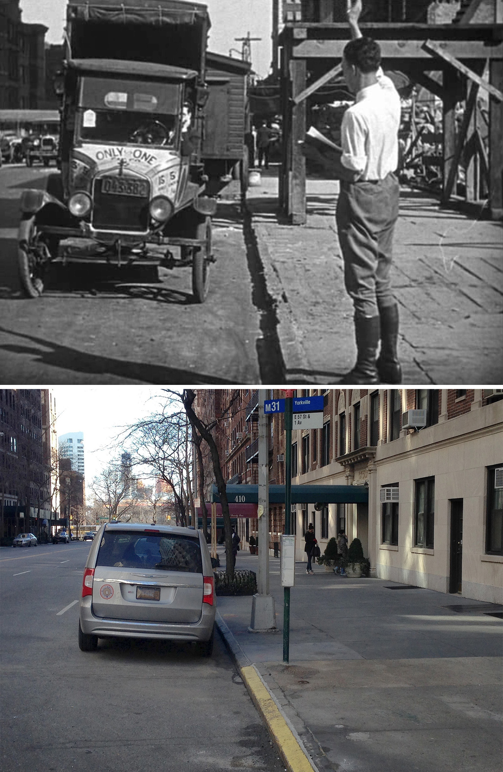
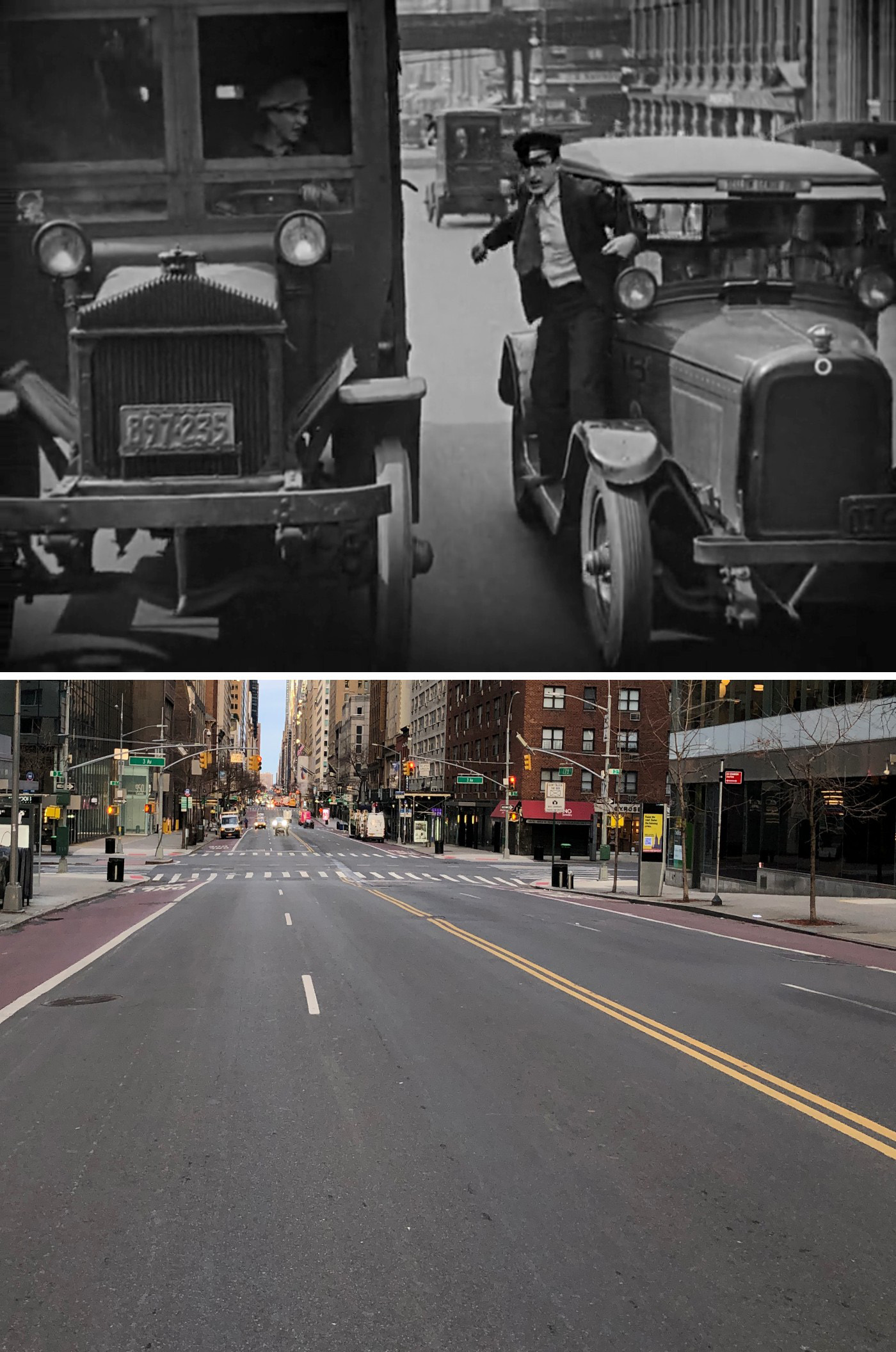
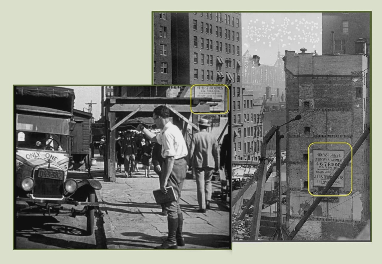
Lloyd mixed LA and NYC locations throughout this sequence, but the most audacious use of it happens about a third of the way through. Harold is in his cab on S Flower Street and responds to a man hailing him from “across the street.” But in reality, the man was hailing him from across the country, standing on E 57th Street in New York.
John found that location in 2014 after he was granted access to the Harold Lloyd film storage vault. Even though he only had a small window of time with the materials, by pure chance, he pulled a 4×5 glass negative taken at that very filming location. Fortunately, the image revealed more of the environs, including a sign bearing the address, 410 E. 57th Street.
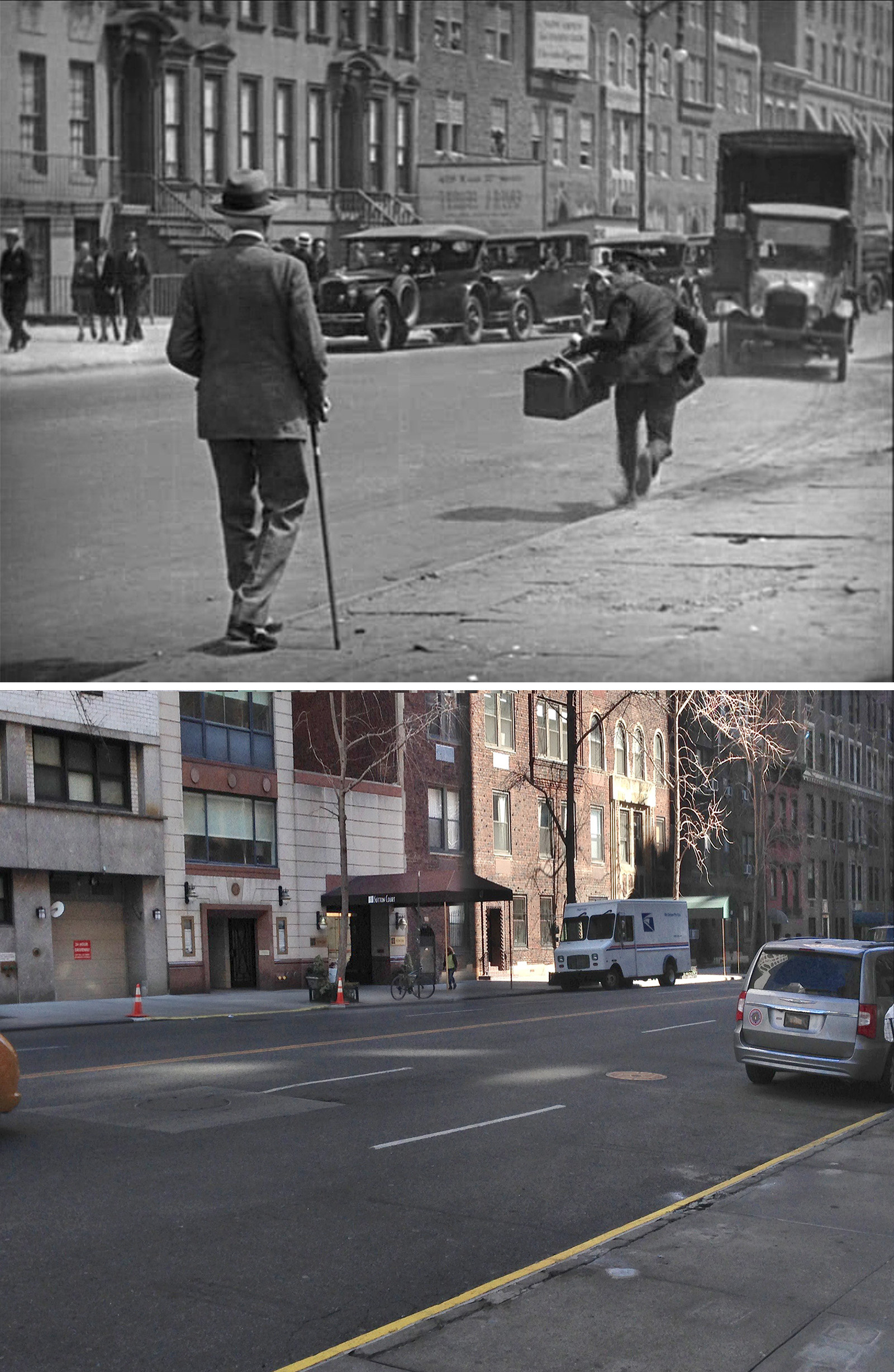
Years after John figured out the construction site on E 57th Street, I figured out where Harold chased down the truck. Seeing that they were on a major cross street, I took a guess that they were also on E 57th. And with el tracks in the background, I also took a guess that we were looking at either the one on Second Avenue or Third.
Next, I searched NYPL’s digital archives for any images of E 57th Street near the Second or Third Avenue El and pretty quickly figured out we were looking at both of them.
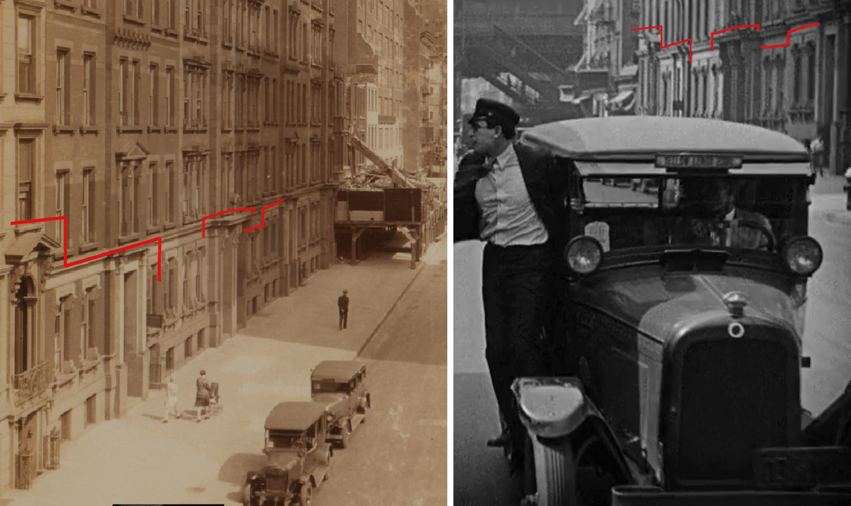
Unfortunately, nothing from these two shots on 57th remains today, but the archival photos definitely helped confirm that I found the right spots.
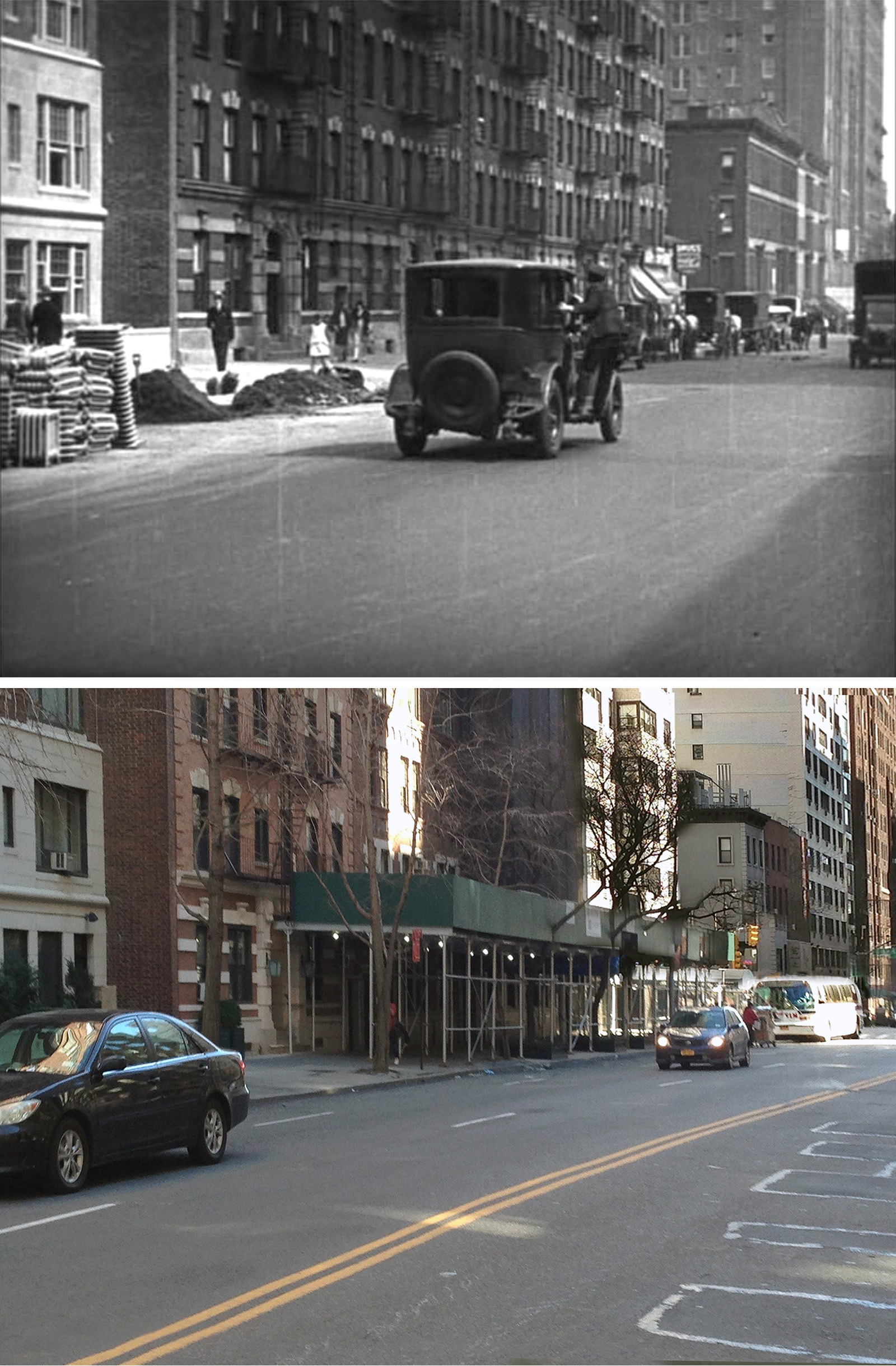
After one more quick shot in New York, the sequence finishes off in Los Angeles, starting with a gag involving the cab rolling down a hill and knocking over a cop. This was filmed on Witmer Street, and despite having a steep slope that is more typical with LA than NYC, it still matched pretty well with the previous shot taken on Sutton Place.
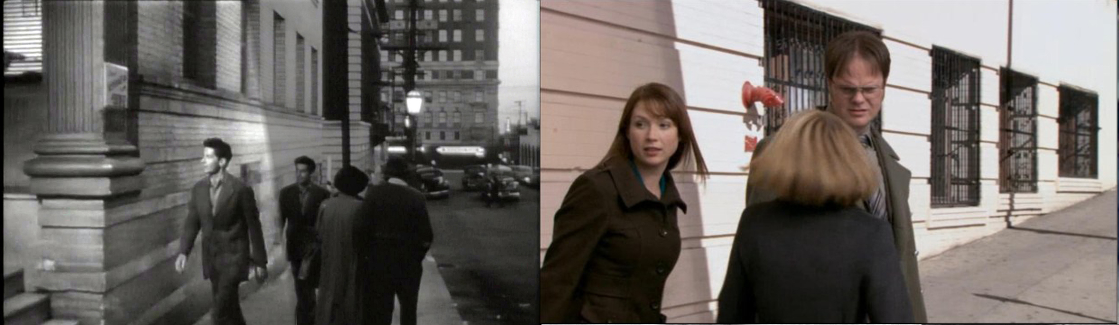
This unassuming downhill street with its T-intersection has been featured in a few other productions, such as the 1950 film noir, Edge of Doom. and season 7 of the TV show, The Office.
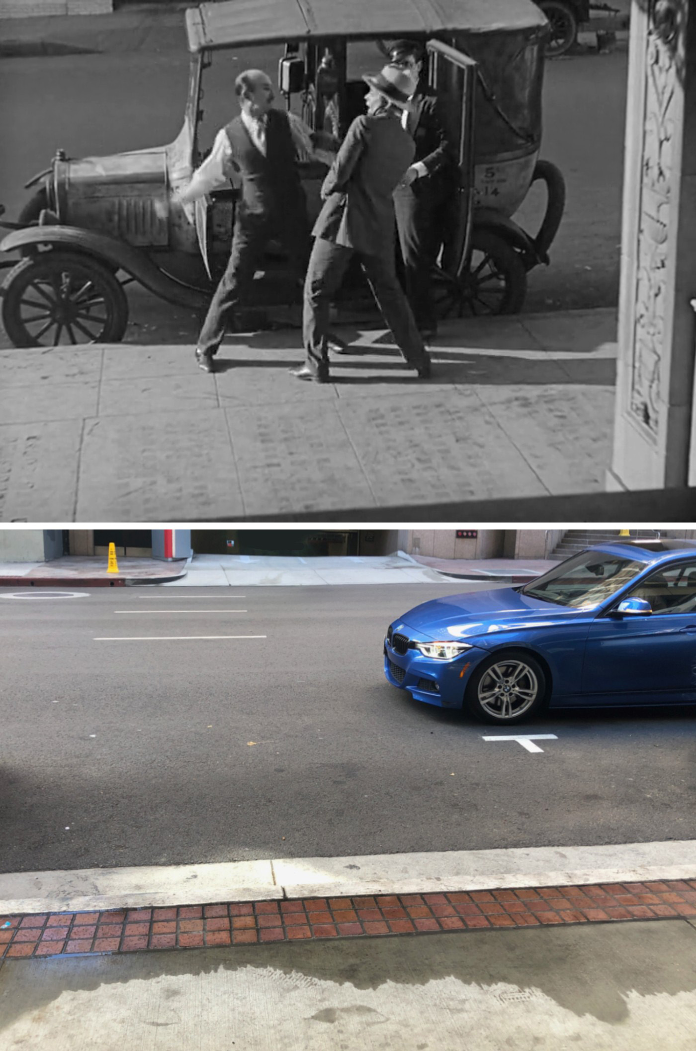
The last gag from this sequence with the two men fighting was filmed outside the former Knights of Columbus Building at 612 S Flower. All of the buildings seen in the scene are long gone, but if you go a half a block north, you can visit the still-standing Arco Plaza, which doubled for NYC in the 1976 thriller, Marathon Man.
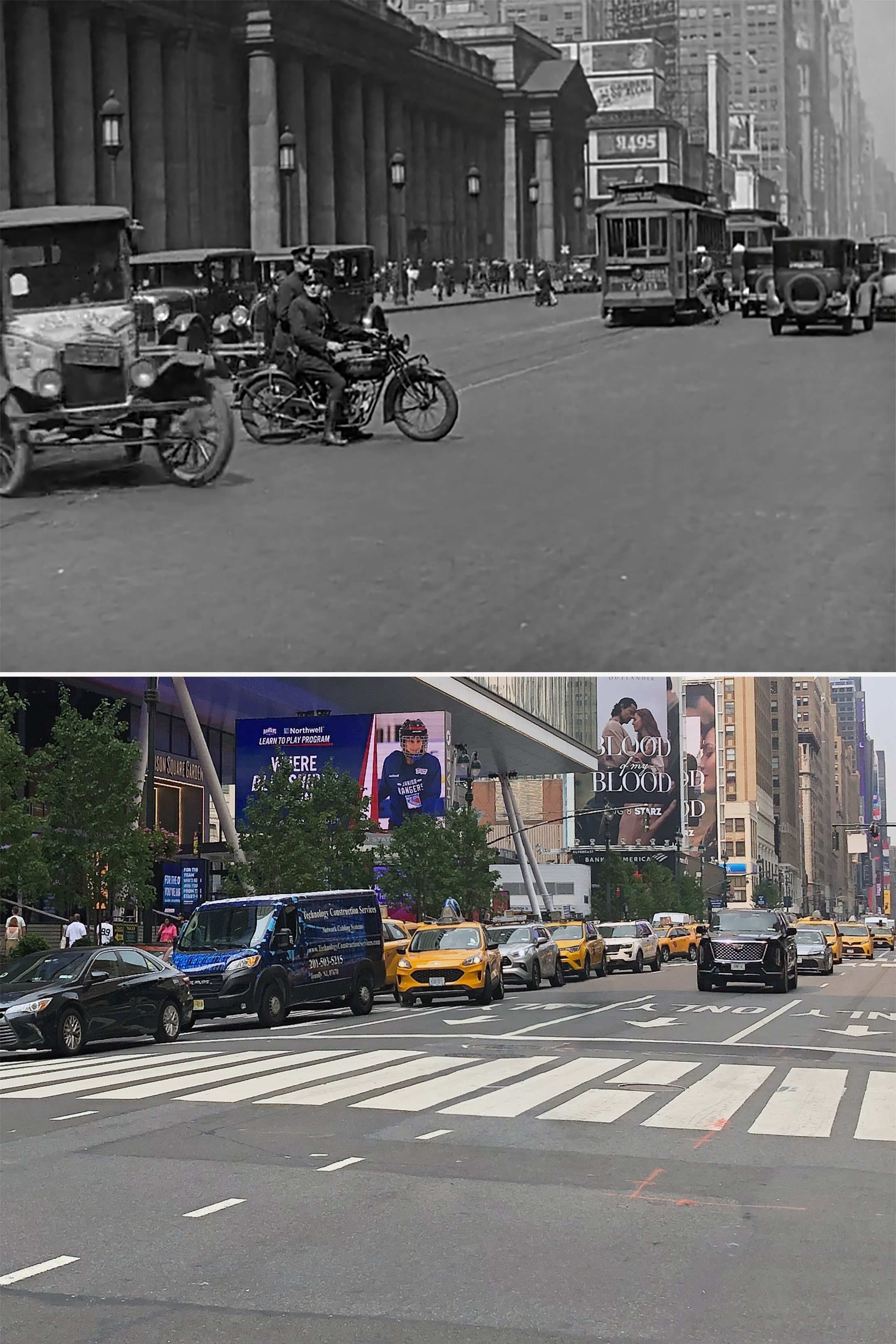
Off to Penn Station
With the exception of Pennsylvania Station, all of these locations were found by me and my research partner Blakeslee.
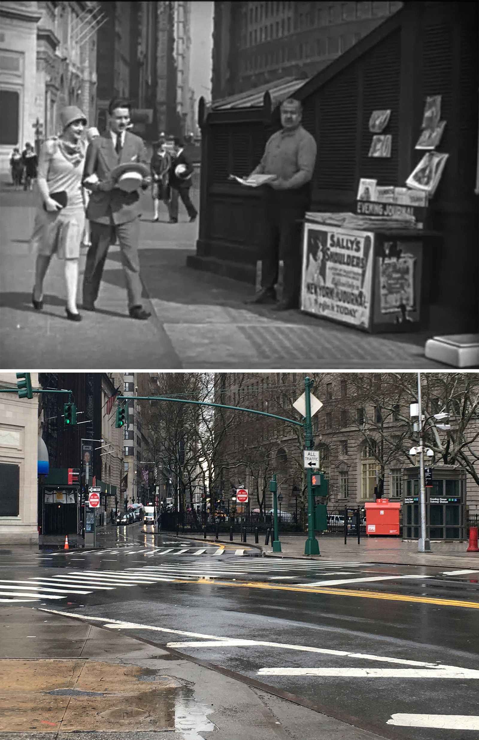
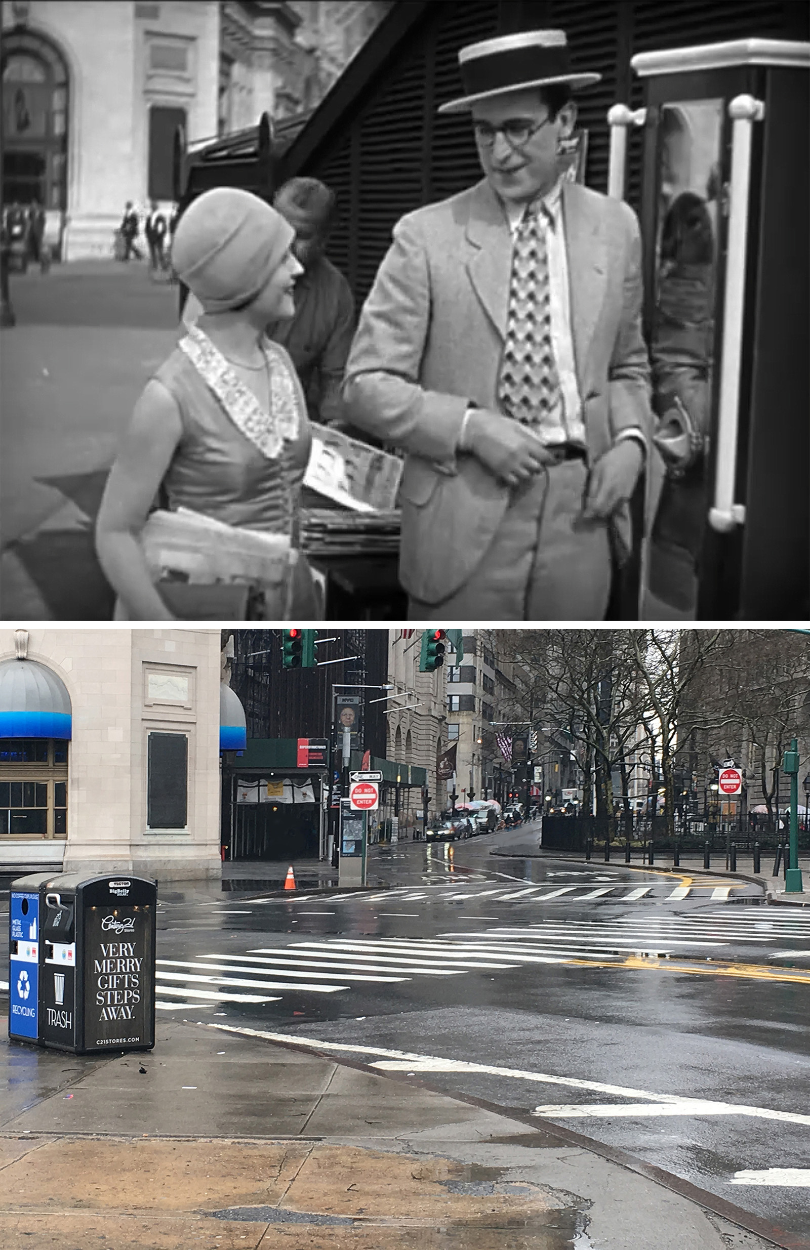
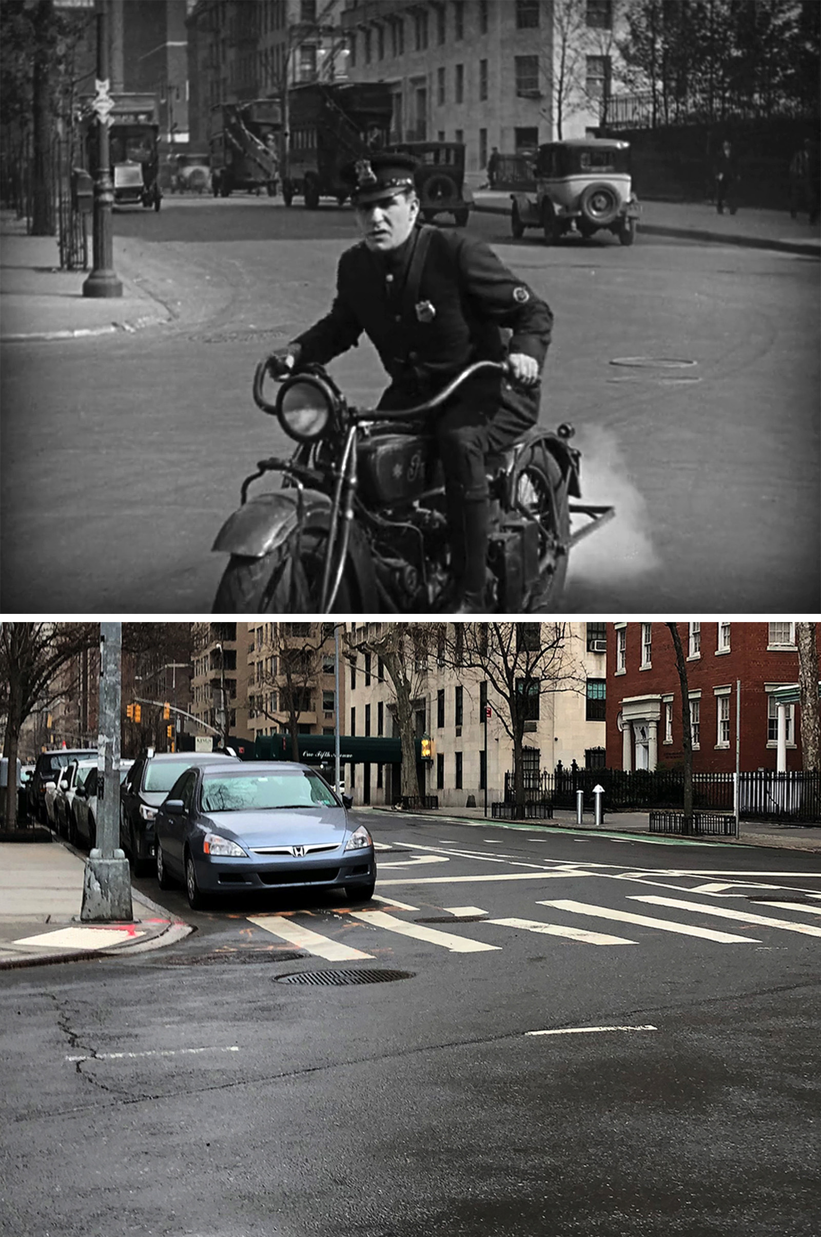
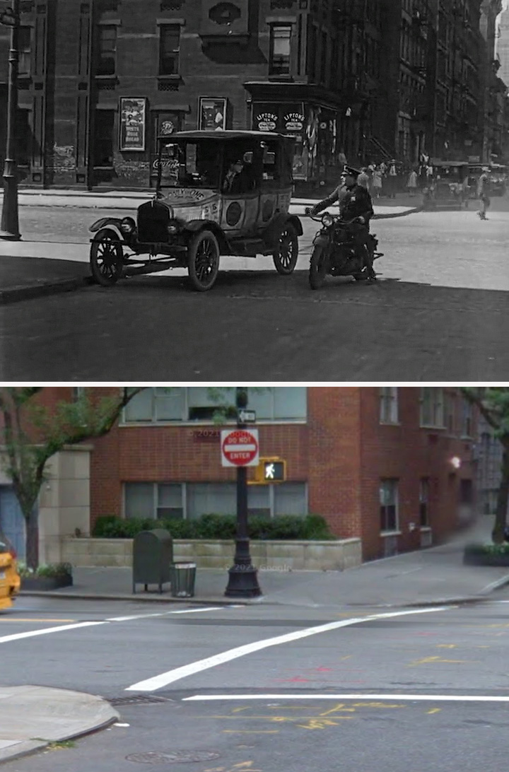
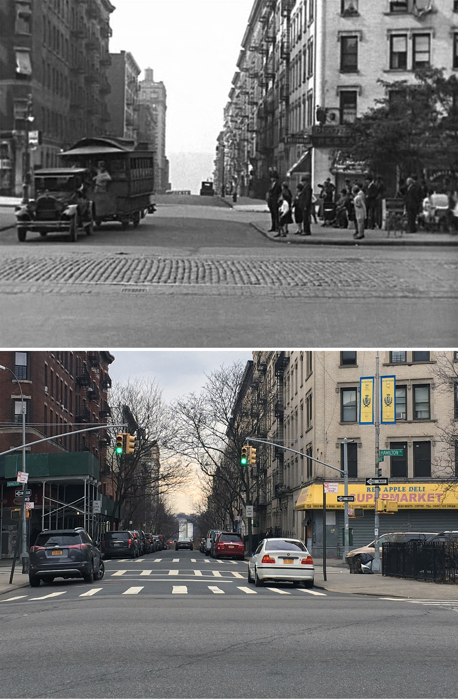
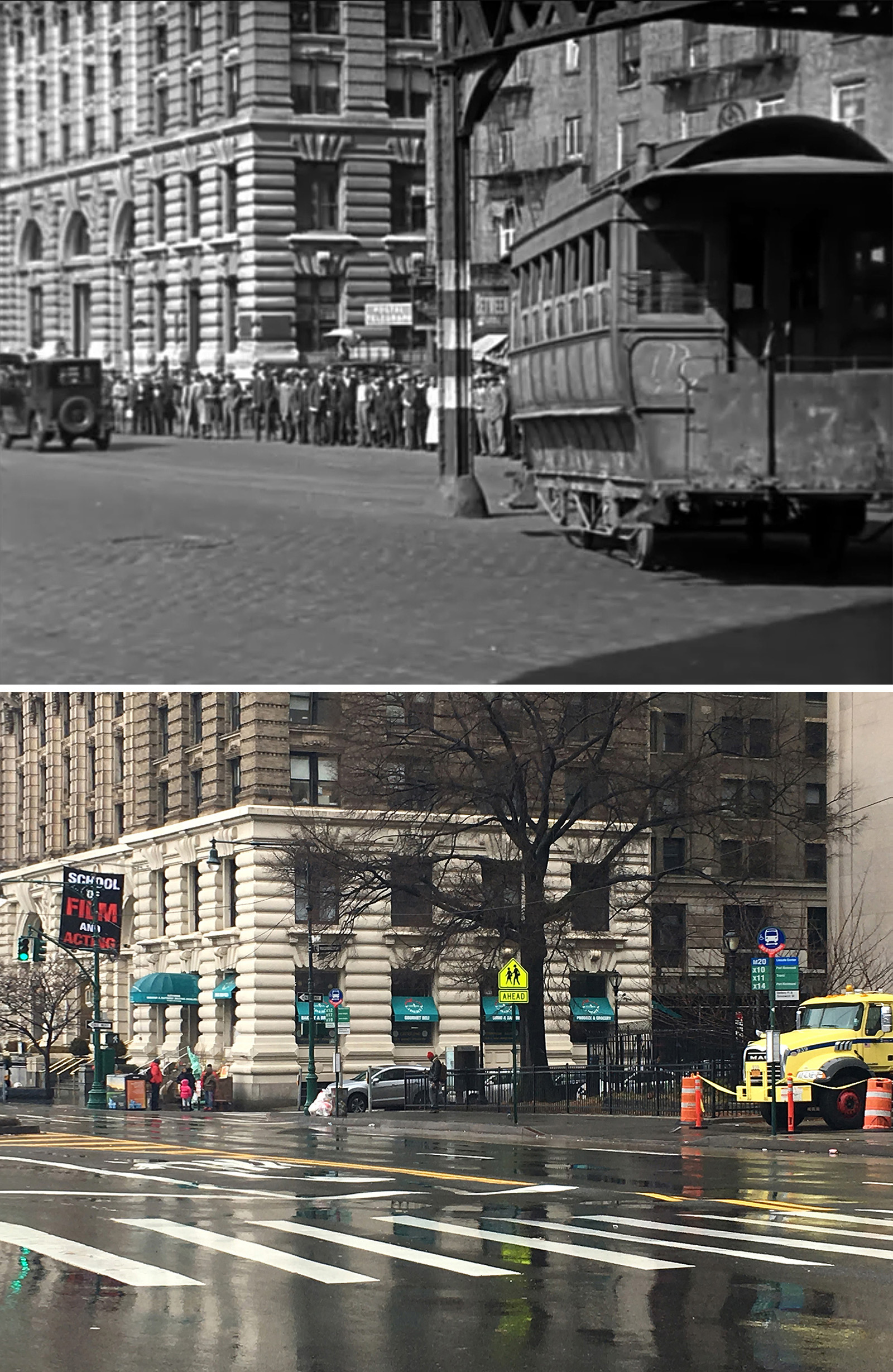
For the first shot of the motorcycle cop stationed at a street corner, the most prominent feature was a large building with a “flattened” corner across from what appeared to be a stone wall. With not much else to go on, the first thing I did was check the surrounding areas of already-established filming locations. While a good idea in theory, it didn’t get me anywhere (except briefly mistaking Hamilton Place for the correct location).
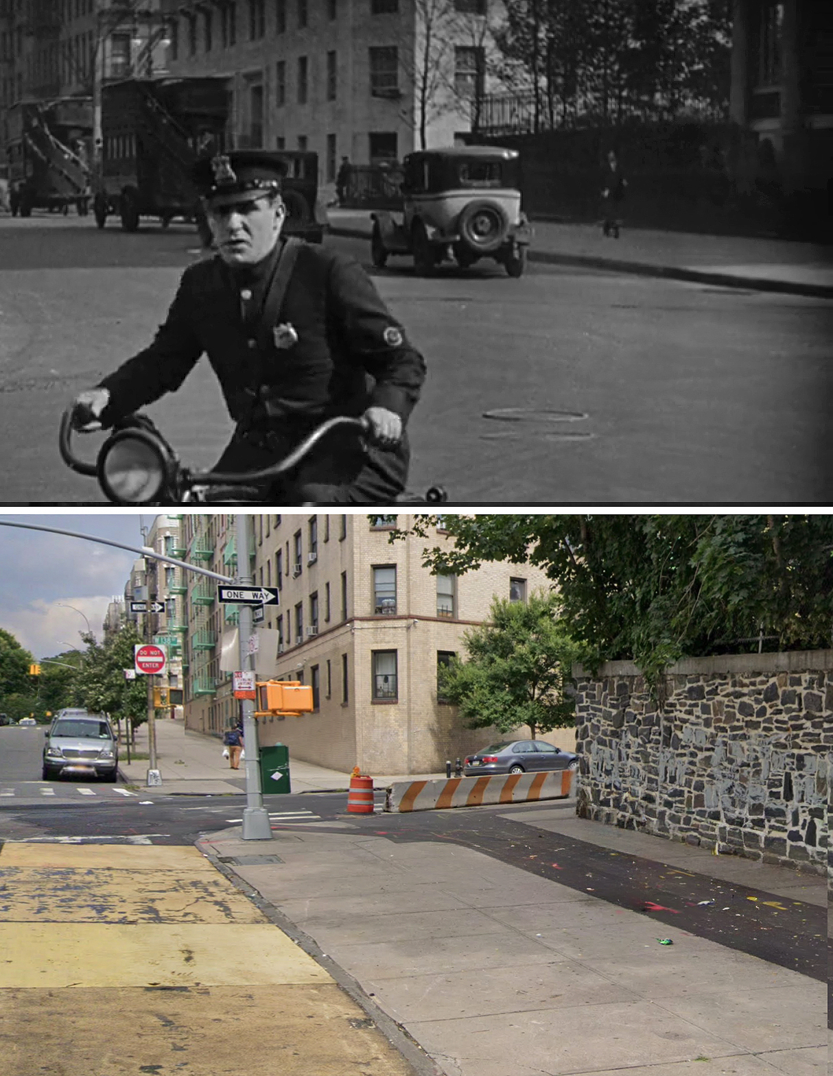
Finally, a big breakthrough came when Blakeslee spotted a lamppost with dual bulbs in the background. While he didn’t think it was a major find, I expeditiously recognized it as a valuable clue. That’s because I recently discovered that lampposts with that unique “double teardrop” style were pretty much exclusive to Fifth Avenue in the early 20th century.
So, I immediately started searching for any buildings on Fifth with a flattened corner and eventually stumbled upon the extant building at 1 Fifth Avenue near Washington Square Park. The stone wall is no longer there, but everything else looked correct.
Blakeslee helped verify this location by digging up a 1933 picture showing the stone wall still in place. Apparently, the wall was part of the Sailors’ Snug Harbor estate. It was removed in 1935 when a large mansion on the corner of Washington Mews was demolished and replaced with ten two-story houses masquerading as converted stables.
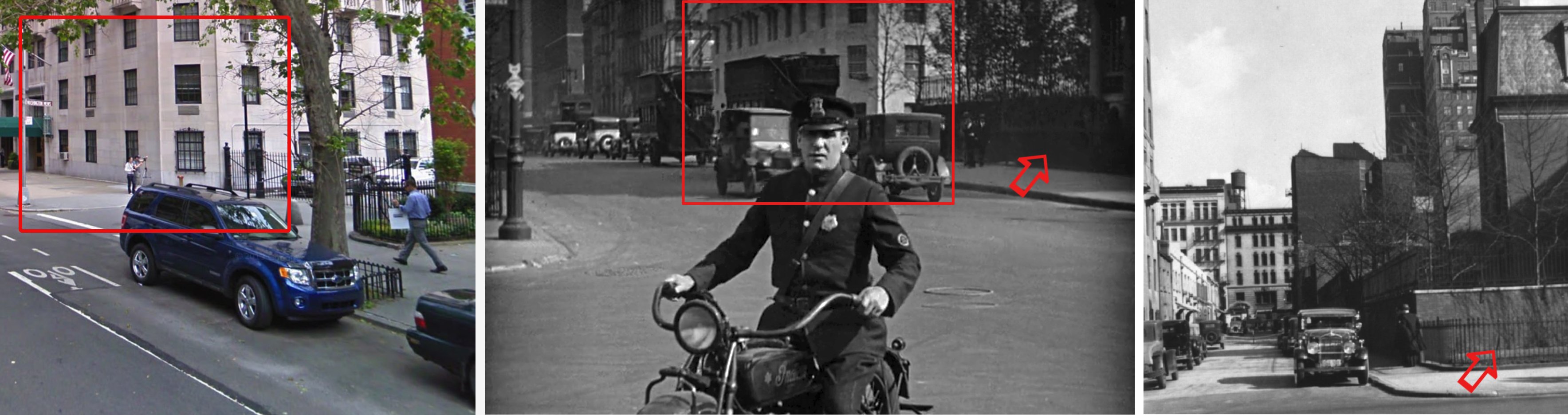
What’s intriguing is that they filmed this scene in front of the famous Washington Square Arch but chose not to show it in the frame. (The Arch does, however, make a brief appearance towards the end of the movie.)
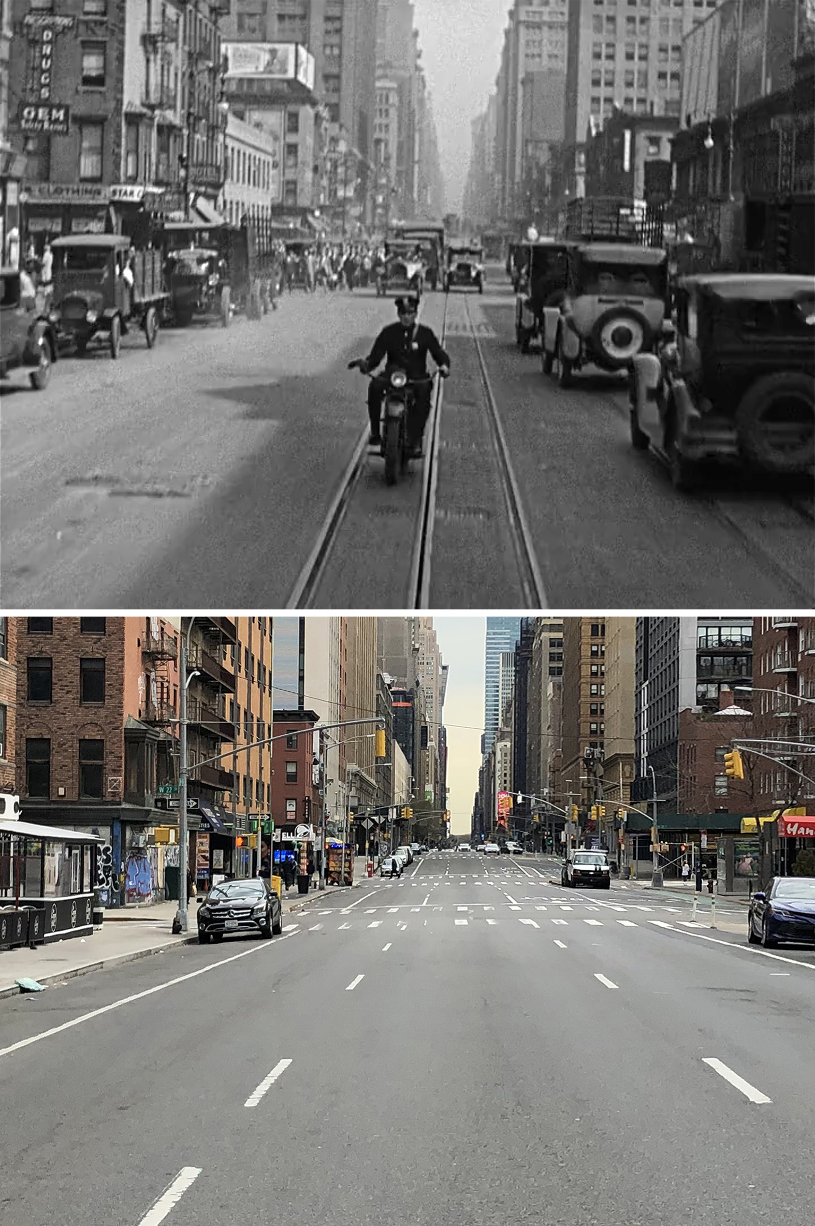
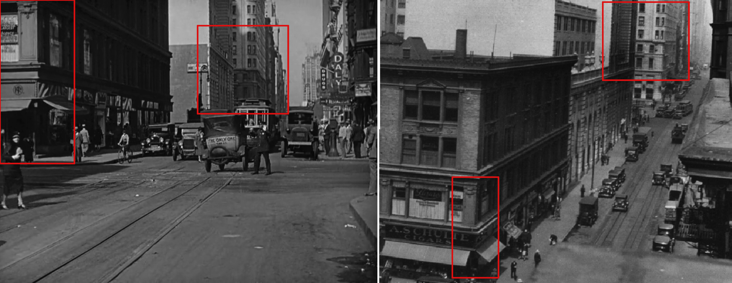
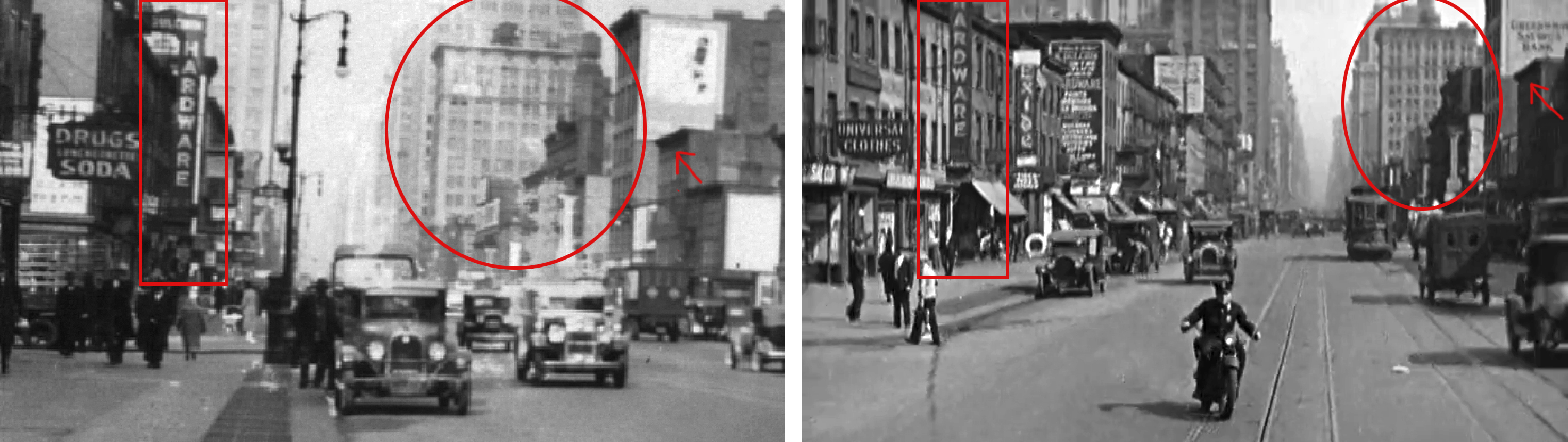
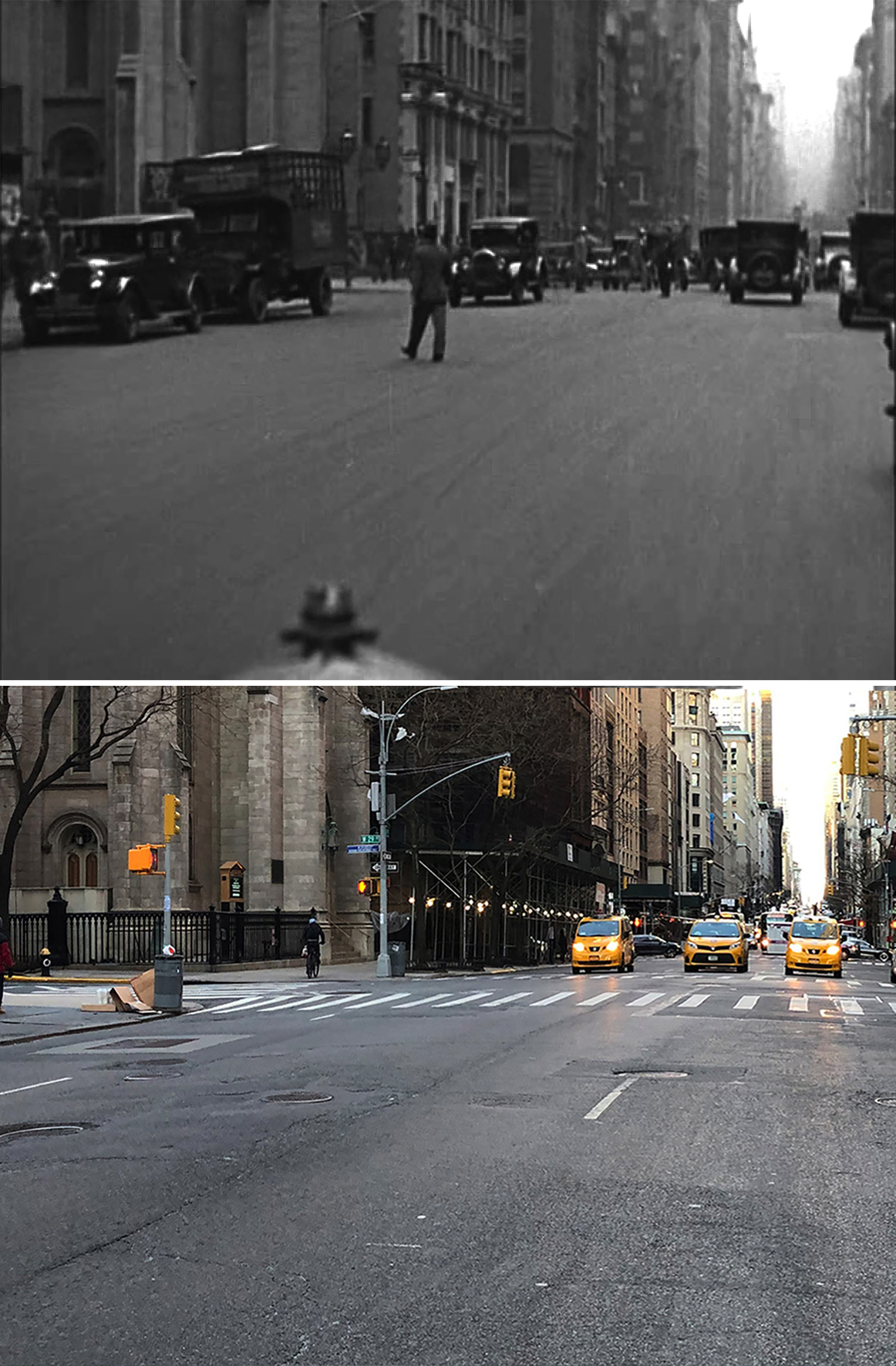
The next shot was on Seventh Avenue with the camera looking south towards W 18th Street. This was solved by Blakeslee, and if memory serves me correctly, the big clue that got him there was the crook in the avenue that can be seen in the far distance. (When Seventh Avenue was extended in 1911-1917, it had to turn slightly to the east in order to connect to Varick Street in Lower Manhattan.)
After Blakeslee found that initial southern-looking shot on Seventh Avenue, I took a guess that they filmed some other stuff in the same area (both in this sequence and the following one). Using the tall skyscrapers that appeared in the background as a guide, I was able to determine that the rest of the Seventh Avenue shots were pointing north. Then, it was just a matter of sifting through vintage images from the NYPL digital archives and the NYC tax archives in search of any matching buildings.
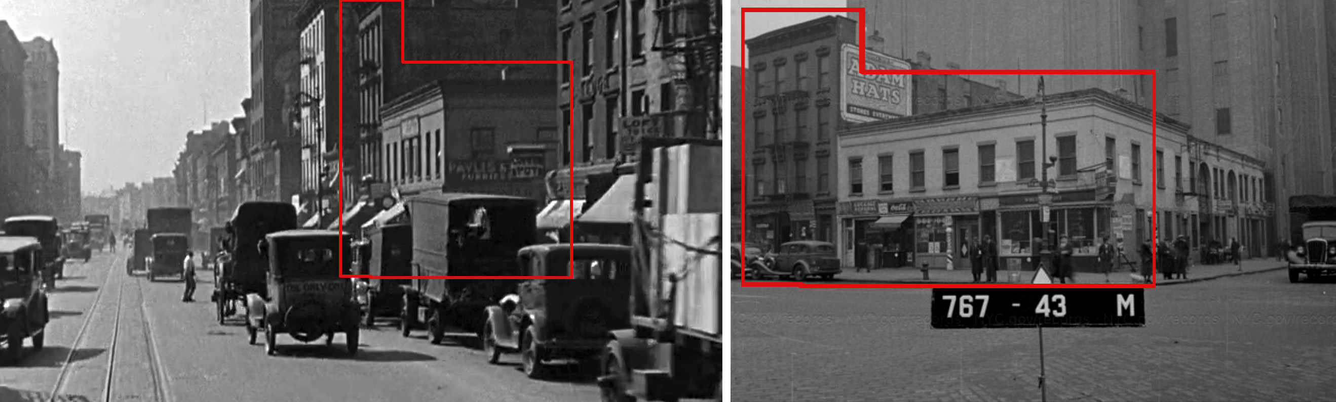
Incredibly, the shot of the cop at Seventh Ave and W 22nd has many buildings —both large and small— that are still around today.
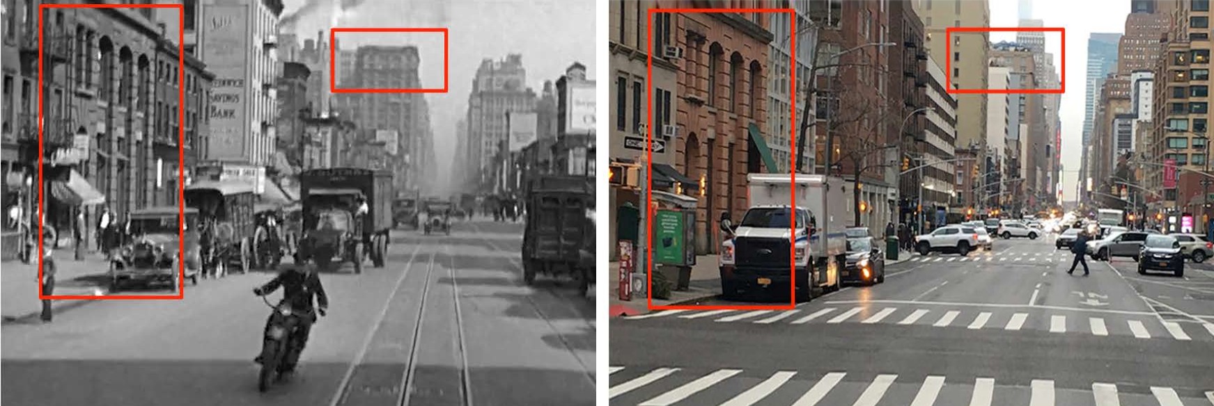
The big clue in solving the stuff filmed on the west end of 34th street was the Roman-style building on the corner — something I thought looked like a bank. I also noticed an el in the distance which I figured was most likely the Ninth Avenue line (based on a couple different characteristics).
Running off of those two clues, Blakeslee had the bright idea to use the 1920 Bromley Land Book as an aid. Searching for any banks on a corner of a two-way street near Ninth Avenue, he quickly zeroed in on the Metropolitan Trust Company on the corner of W 34th and Eighth Avenue.
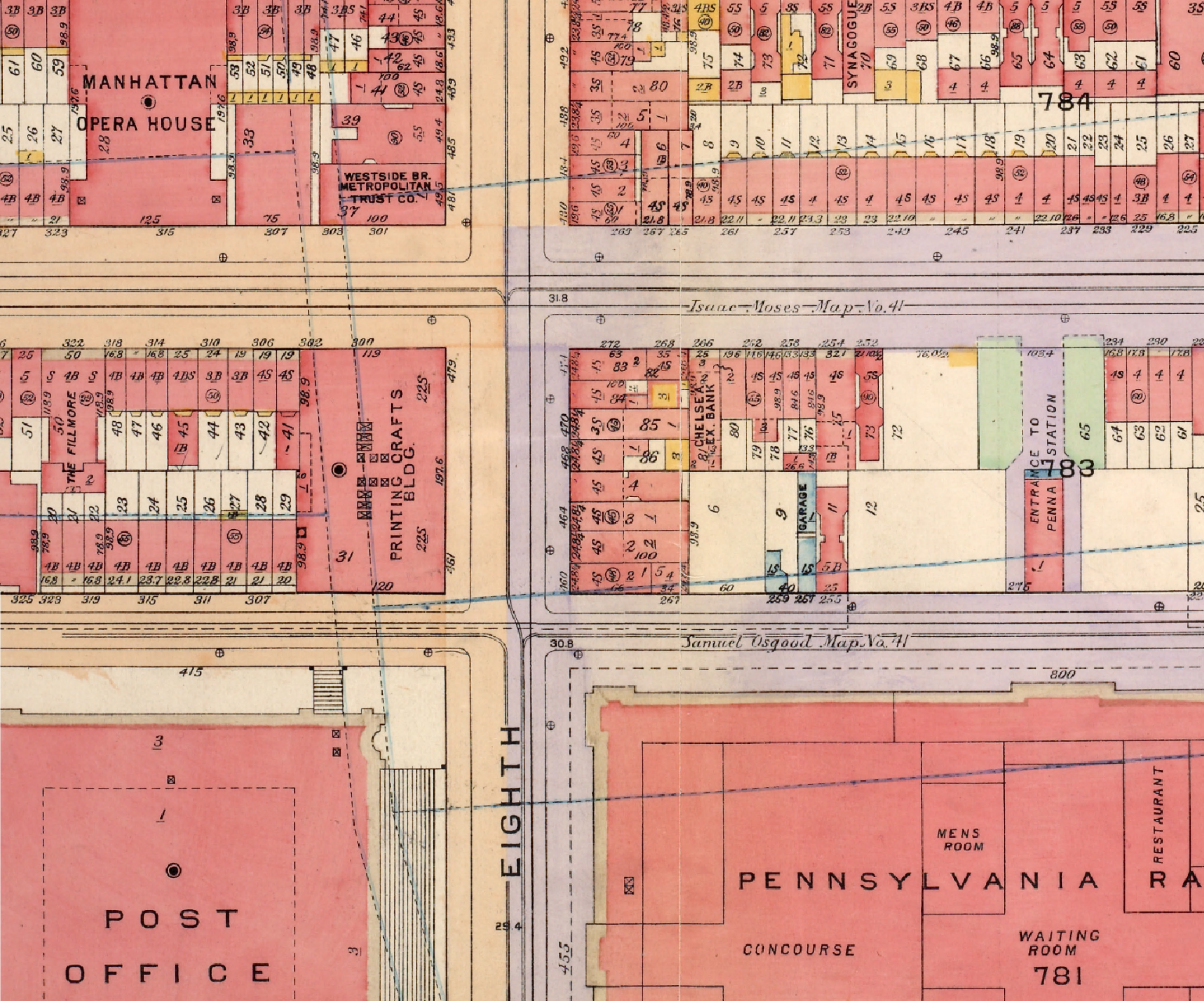
Once I found a few pics of the bank and the surrounding area, I was confident we got the right place.
Both the El and Westside Bank are now gone —with the latter being replaced by the Hotel New Yorker just a couple years after this movie was made— but there is an extant building on the same block that appears in the next sequence.
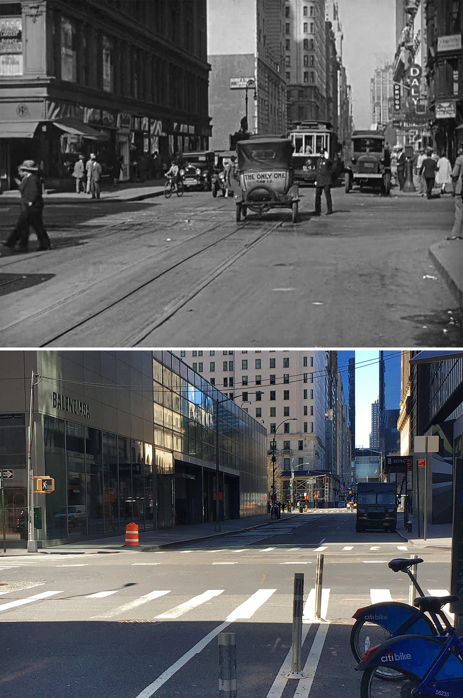
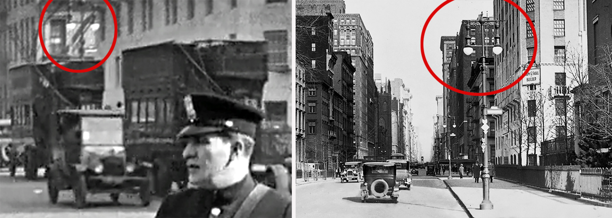
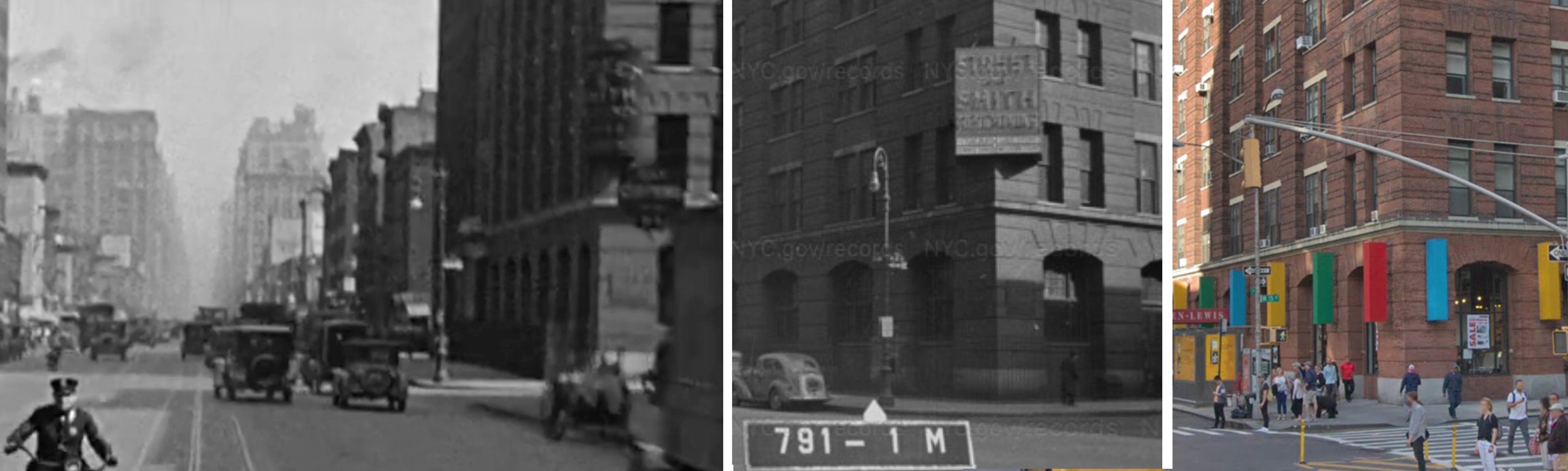
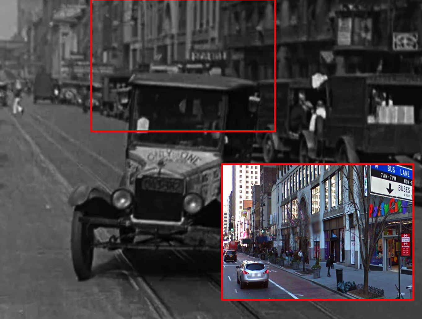
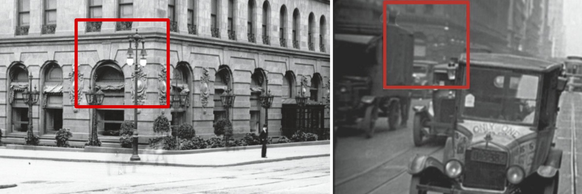
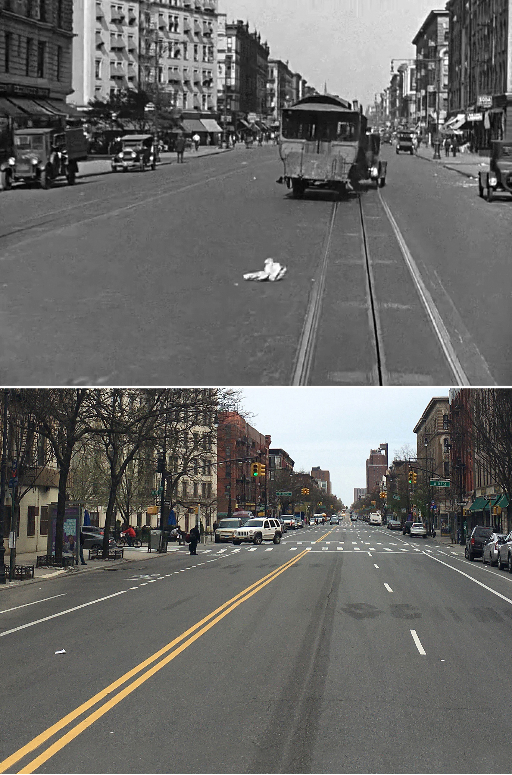
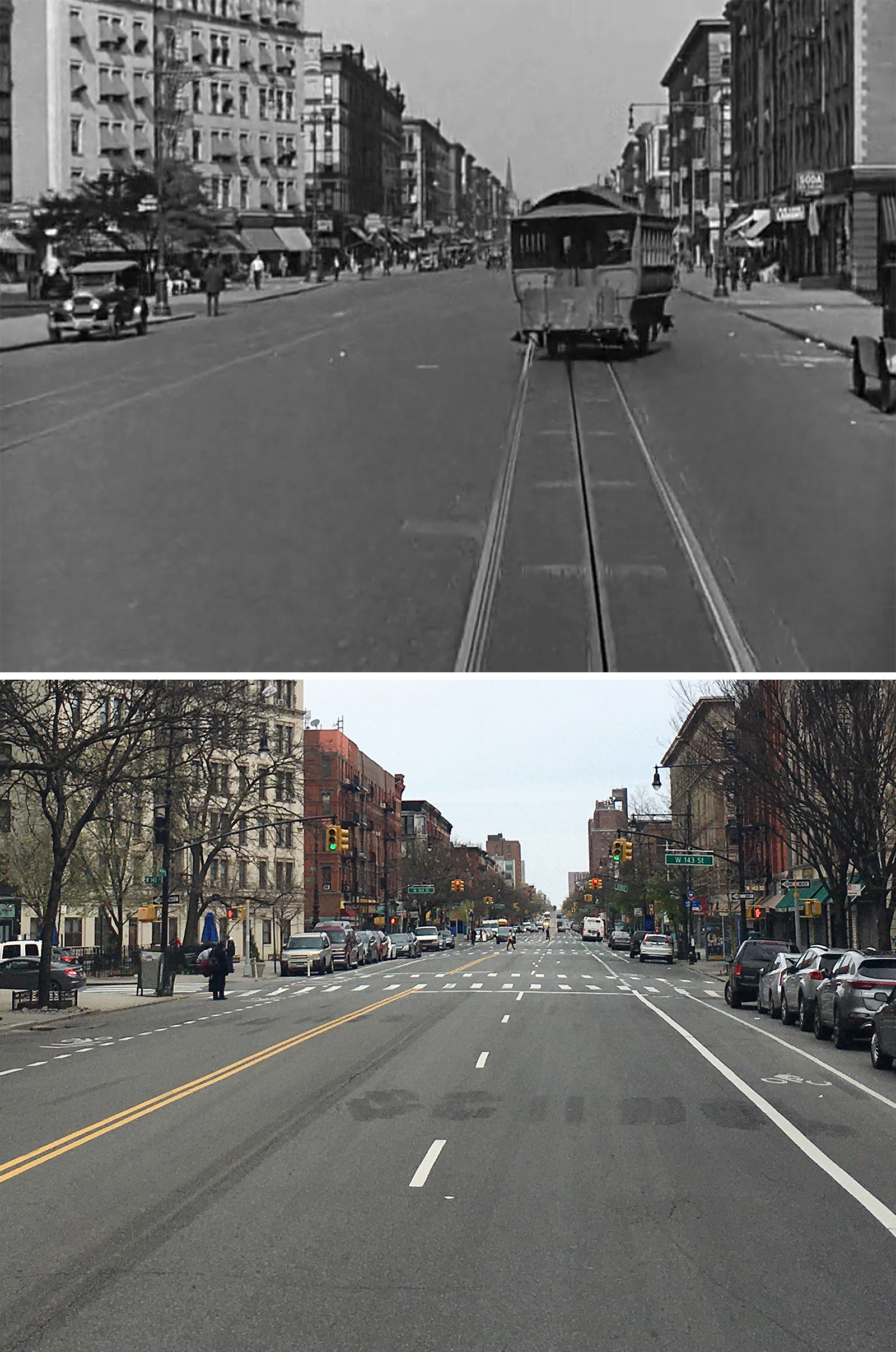
Right before they arrive at the train station, we get a quick shot of Harold’s cab maneuvering through the intersection of 59th and Madison. This location was figured out after I recognized the Plaza Hotel’s telltale corner windows in the background. And just to make sure I got the right spot, I looked up “Daly” (whose sign can be seen on the right) in a 1928 Manhattan phonebook, and saw that its address put it on 59th between Fifth and Madison Avenue.
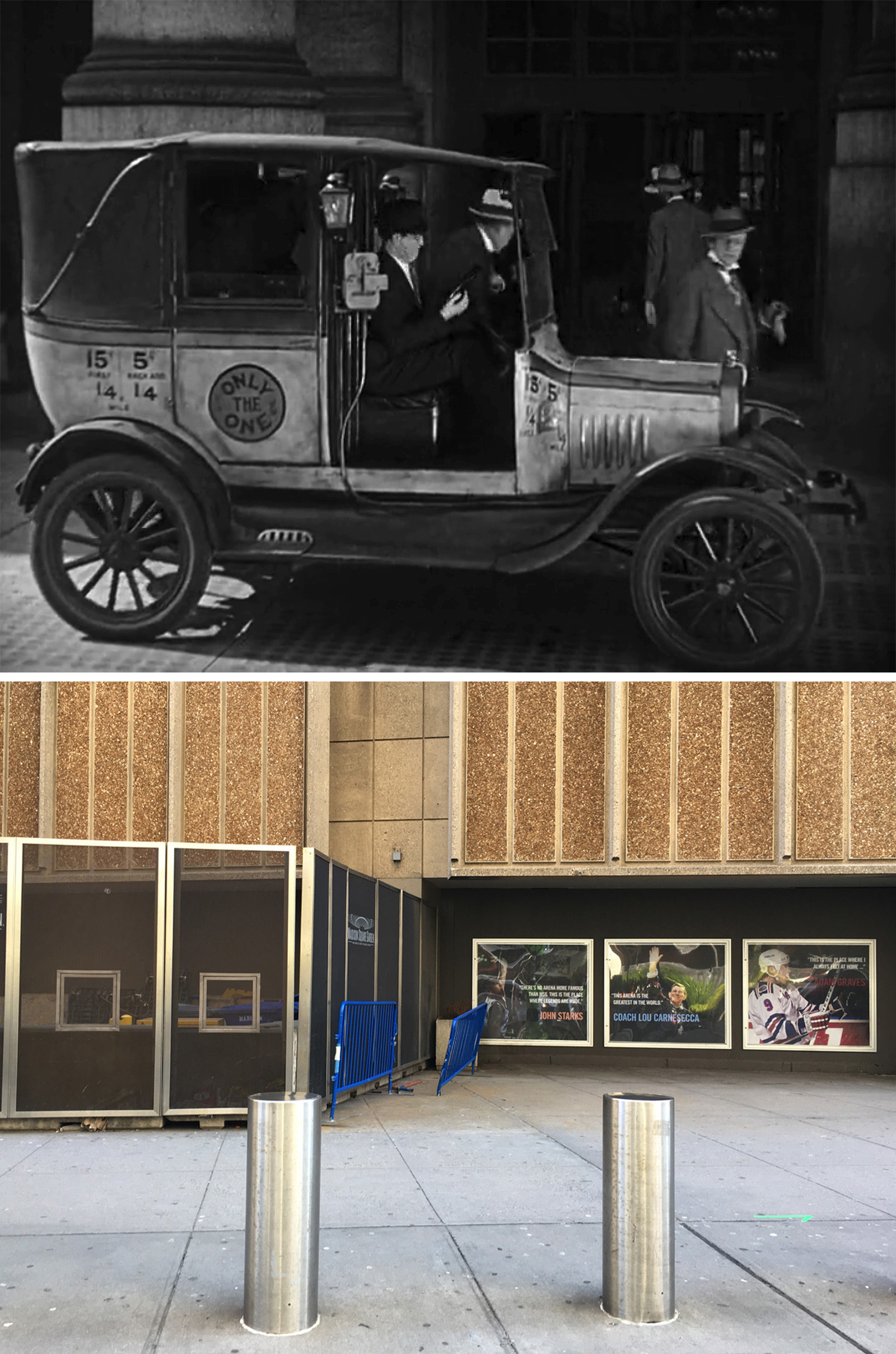
According to John’s book, the scene at Pennsylvania Station was pretty easy for him to identify, especially since the detectives in the movie tell Harold to go there. Finding the exact spot where they get dropped off wasn’t as easy, but fortunately, the corner of the Hotel Pennsylvania appeared in the background, letting John know they were on 33rd, looking towards Seventh Avenue.
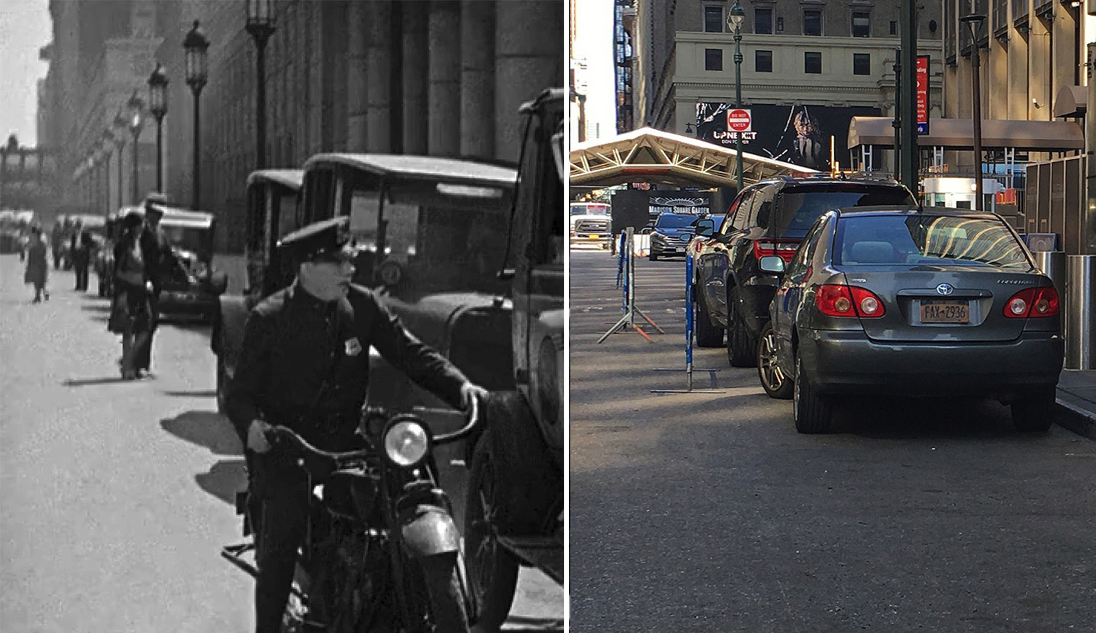
Sadly, as I’ve mentioned in recent posts, the hotel was unceremoniously demolished in 2023, removing the one last matching element from that scene.
Motorcycle Cop Chase
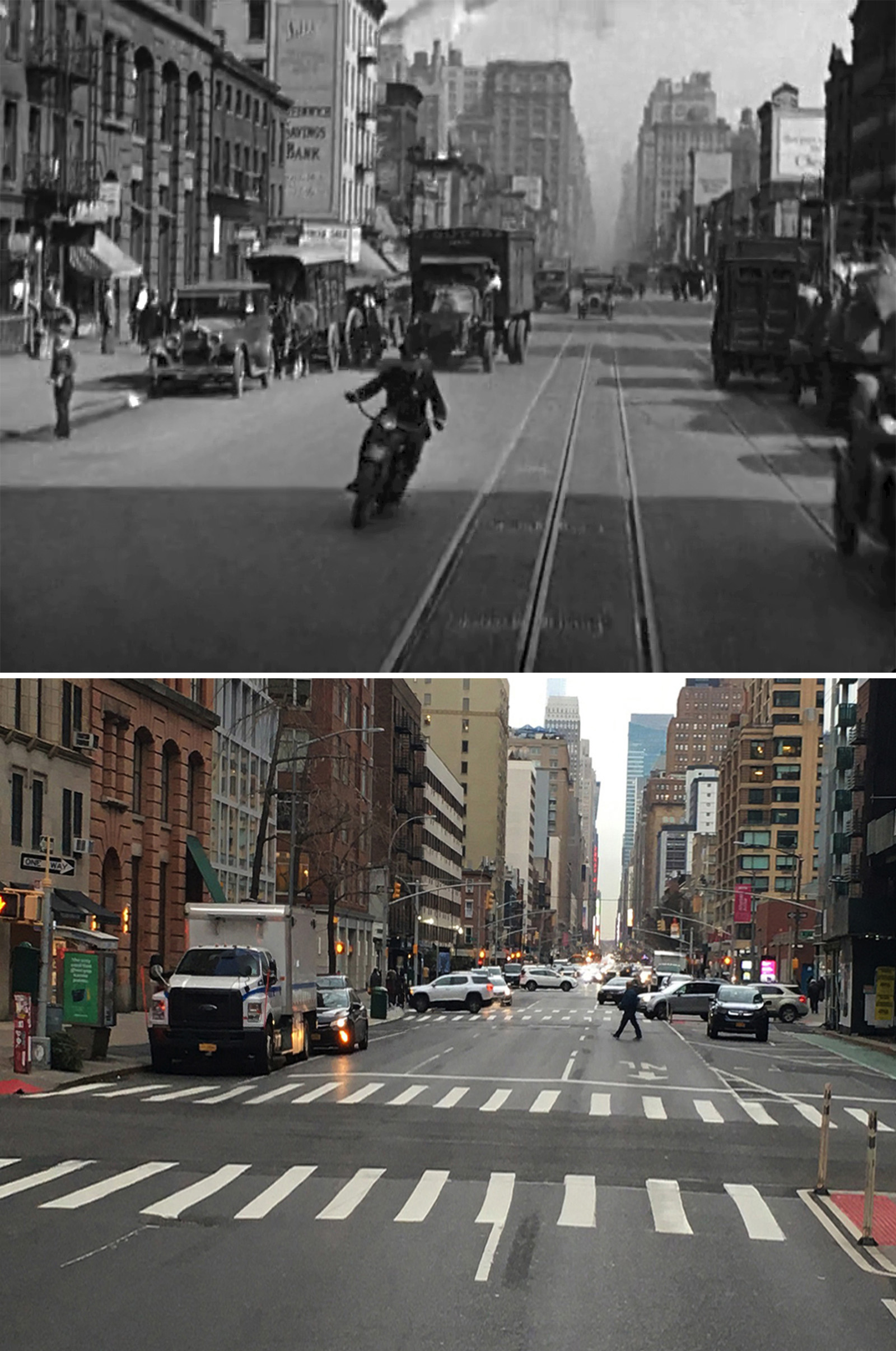
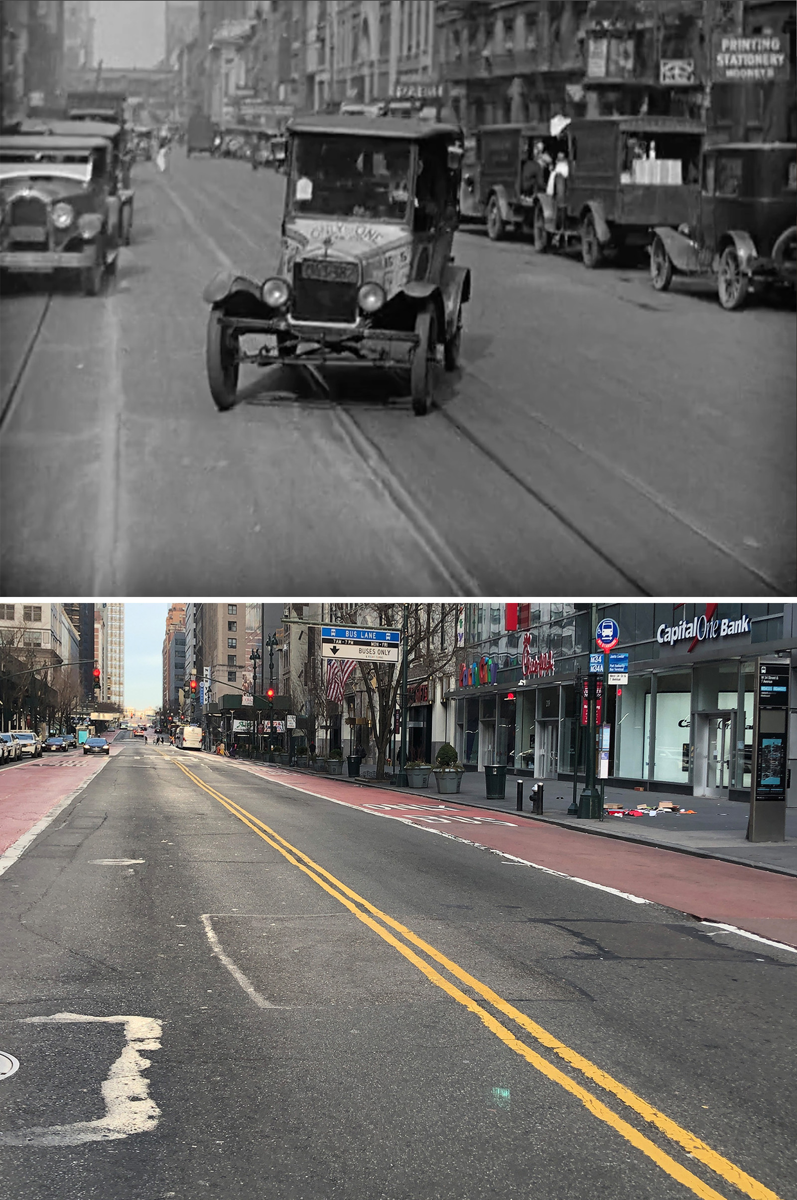

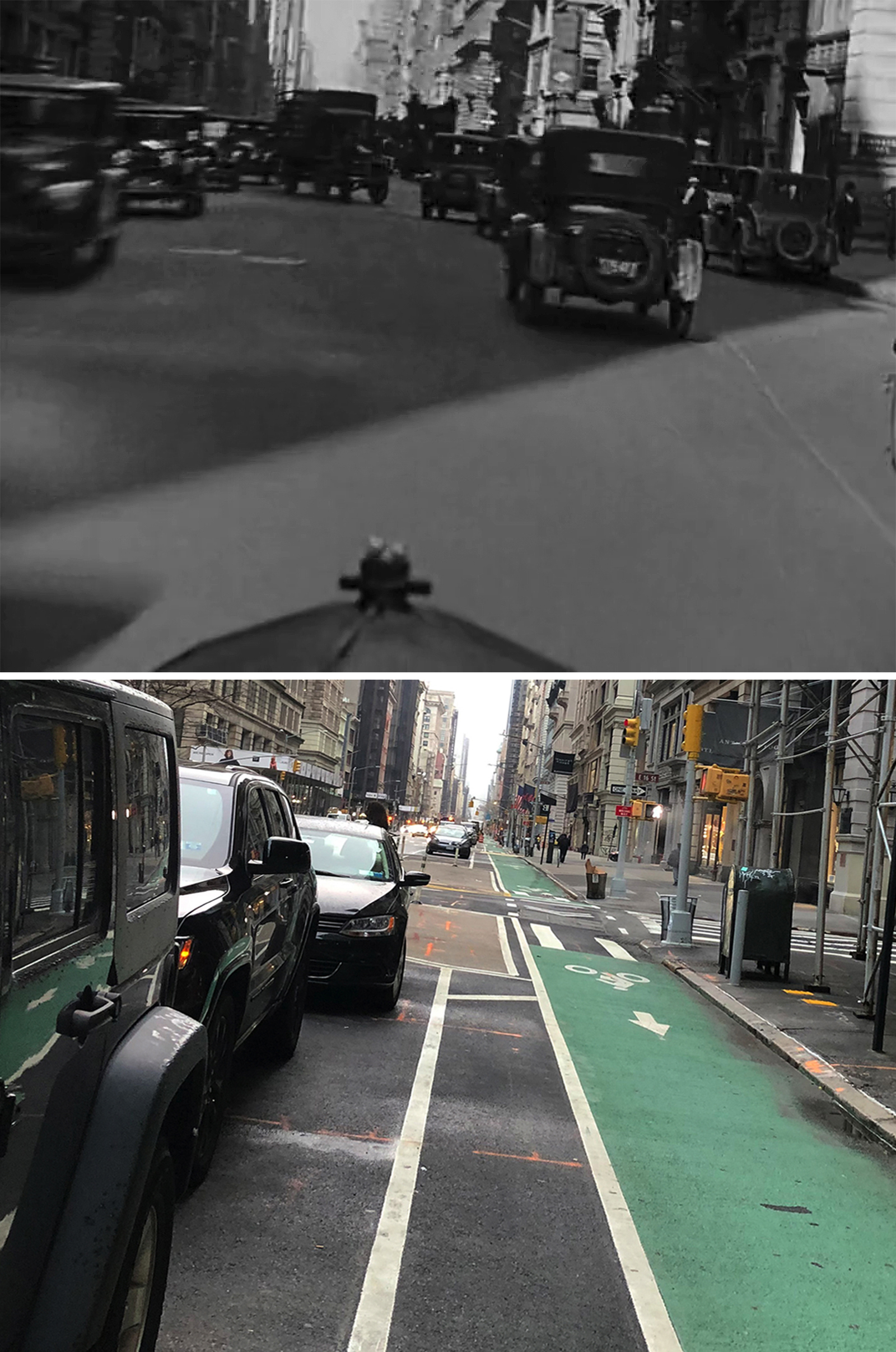
In this crazy zigzagging-of-geography chase sequence, John had previously identified the shot of the taxicab on 34th and Fifth, as well as the last shot near the Flatiron Building. The rest were found by Blakeslee and myself.
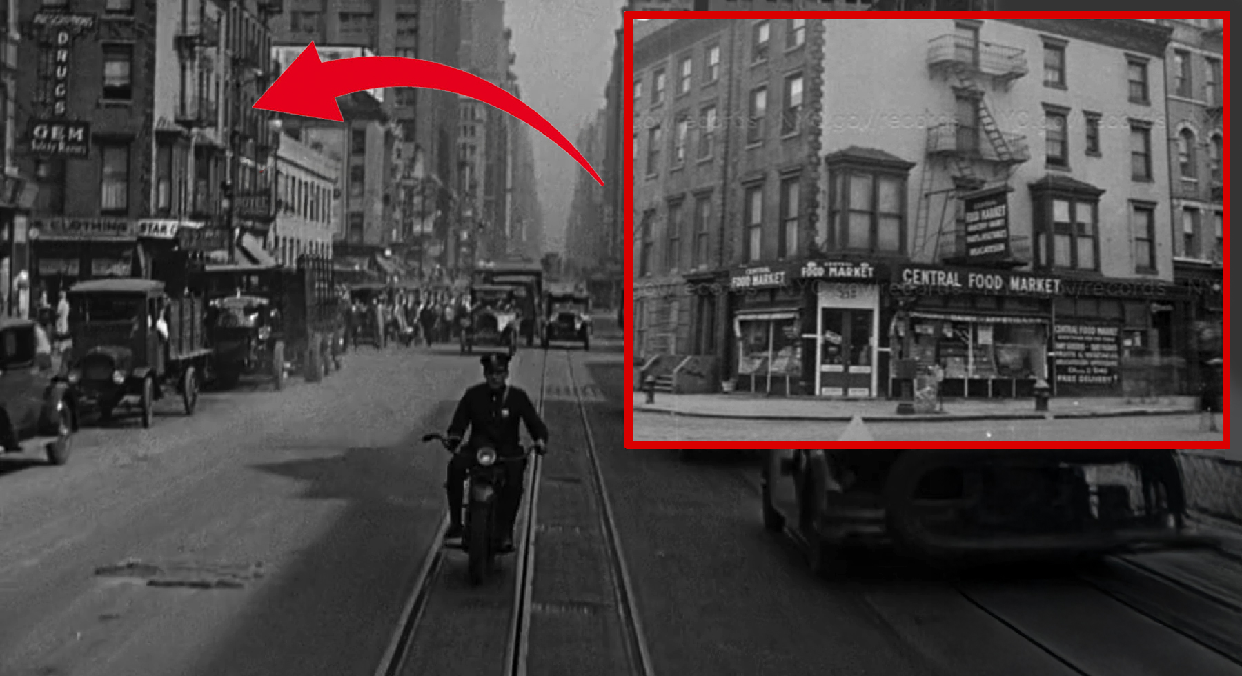
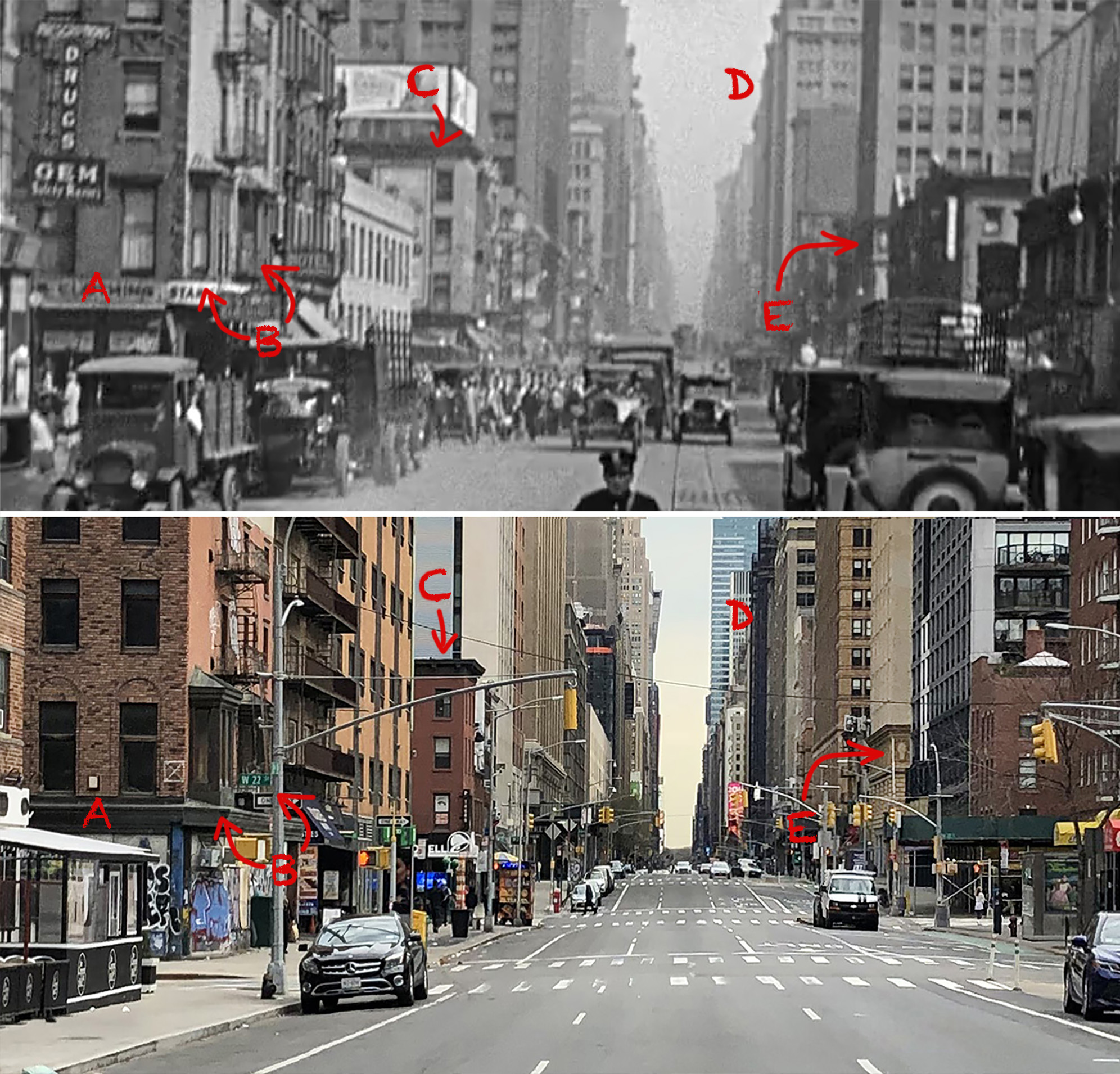
Lloyd kept intercutting shots of Seventh Avenue throughout this sequence. I was able to group them together based off the skyscrapers in the background and the placement of the trolley tracks in the road.
Fortunately, all of the locations were fairly close to each other (between 16th and 22nd streets) and in many cases, there were buildings in the shots that are still standing today. (As I was compiling these locations for John Bengtson in 2019, I remember being very excited whenever I’d discover a surviving building in Google Street View.)
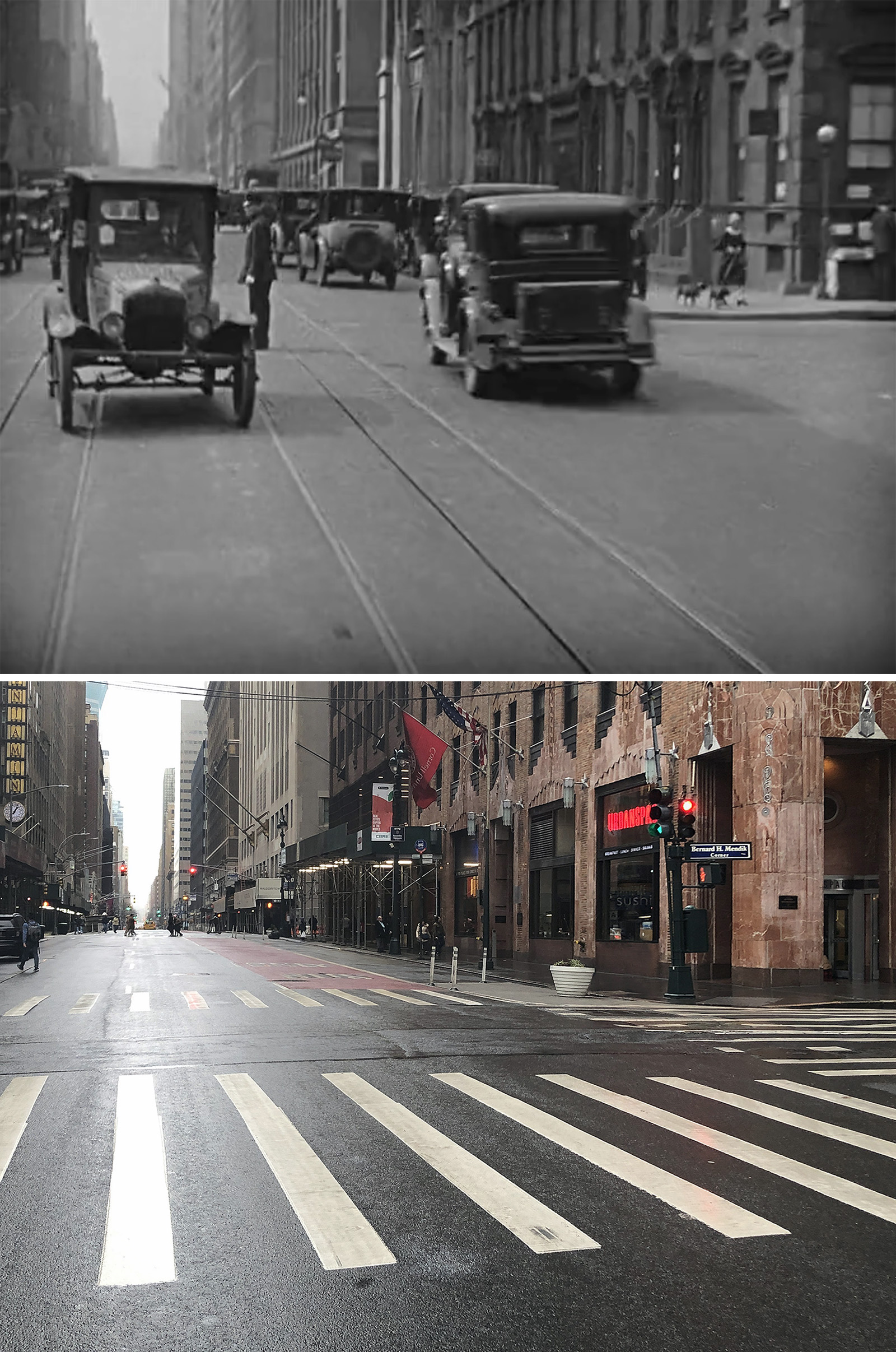
Halfway through this sequence, we get another shot of W 34th Street between Seventh and Eighth Avenue. It was most likely just a continuation of the footage used in the previous sequence. But one nice bonus from this part of the footage is that it captured an extant building on the north side of the street.
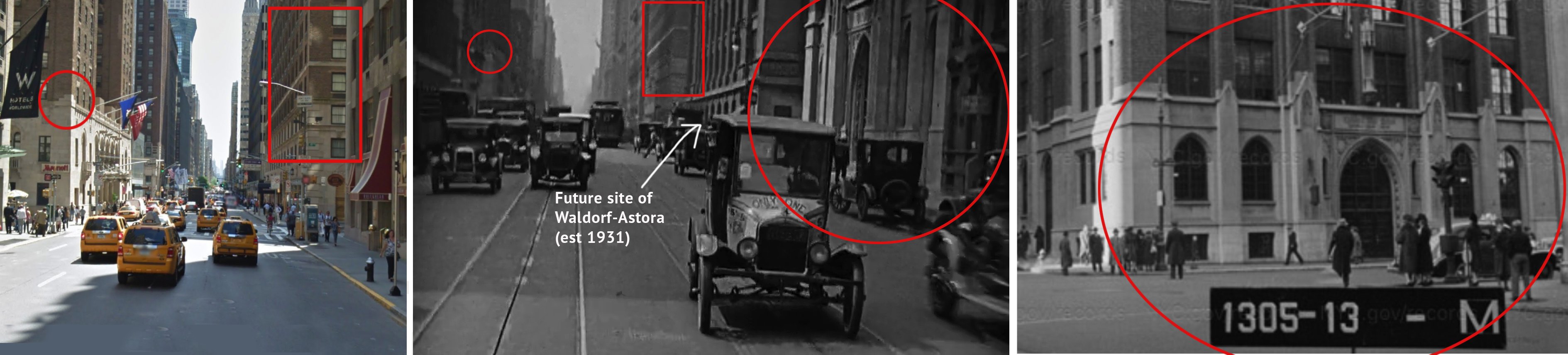
John had previously identified the stuff filmed on the east end of 34th Street for his book. The thing that seemed to help him figure it out was the original Waldorf-Astoria Hotel on the corner of Fifth, whose ground floor can be seen behind the cab.
The Waldorf would be torn down a year after this movie was released, making way for the Empire State Building (EST 1931).
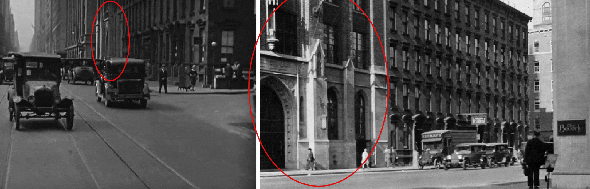
Figuring out the Lexington Ave location was the toughest of the bunch. The only helpful thing I could find in this moving shot was a structure that looked like a Catholic Church.
But after Blakeslee and I did countless searches, we couldn’t find a match. That’s when I discovered another clue that had eluded us before — at the very end of the shot on the right side of the frame, you can see a subway station entrance.
From there, it came down to my city instincts.
For whatever reason, the shot “felt” like it was in Midtown Manhattan on the East Side. If that was true, that would mean the subway entrance would’ve been for the 4/5/6 IRT. And if that was true, since the entrance didn’t have one of the Budapest-style kiosks, that meant we were somewhere north of 42nd Street. (The original 1904 IRT curved west at 42nd, using the tunnel that now serves the Times Square Shuttle, and continued north along the Broadway tunnel that now serves the 1/2/3. So, if there was no kiosk, then that indicated that it was part of the extension built in 1913-1918 along Lexington Avenue.)
Now, that was a lot of “if’s,” but thankfully, they were all true. After searching vintage photos of Lexington Ave subway stations, I finally found one showing that building Blakeslee and I thought was a church, but was in fact, a Catholic school for boys. The school is now gone, but it used to be on the northwest corner of E 50th Street.
Interestingly, one block south of the Cathedral school was the future site of the new Waldorf-Astoria Hotel, which opened in 1931 (the same year the ESB opened on the site of the original Waldorf).
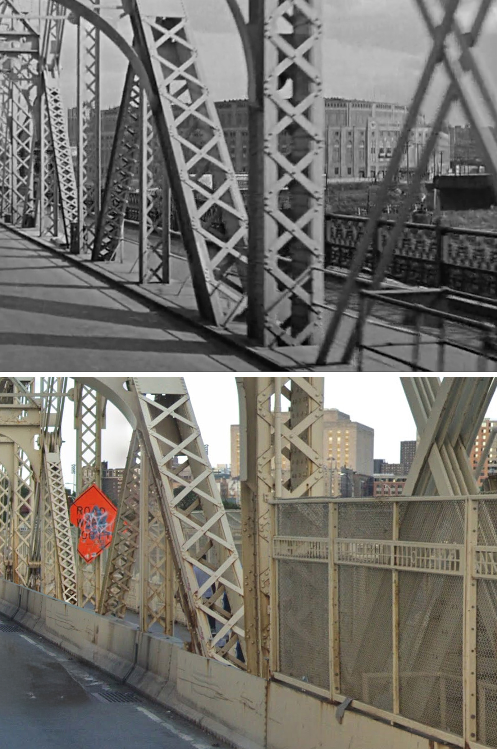
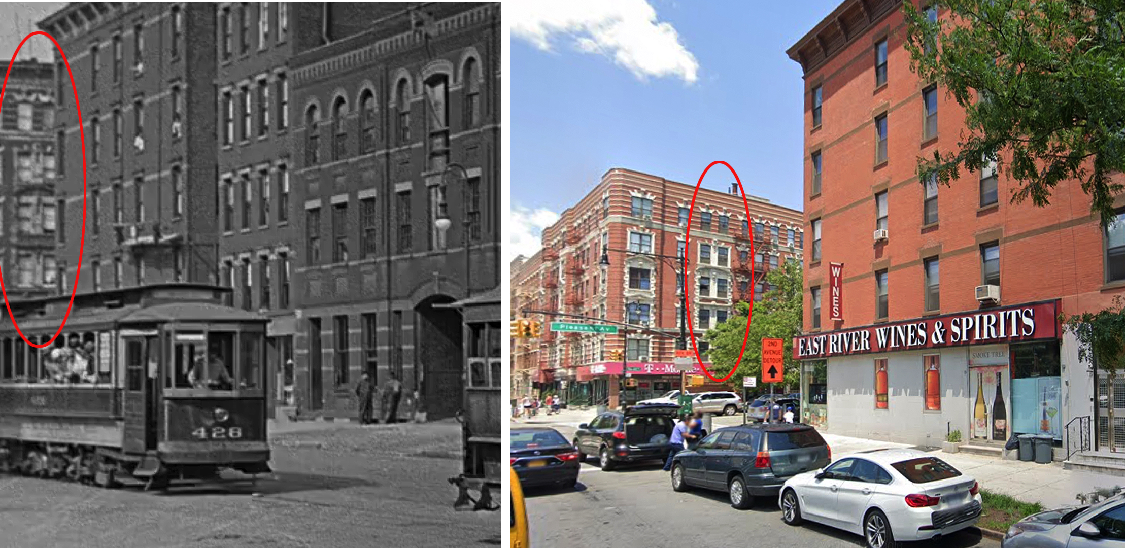
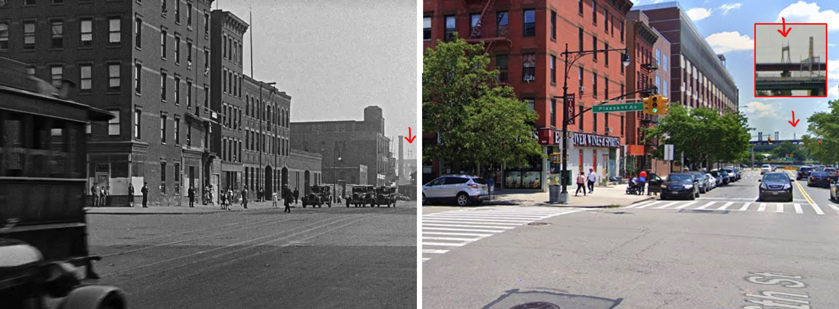
This chase sequence ends at Sutton Square on the Upper East Side with the camera pointing west on E 58th Street.
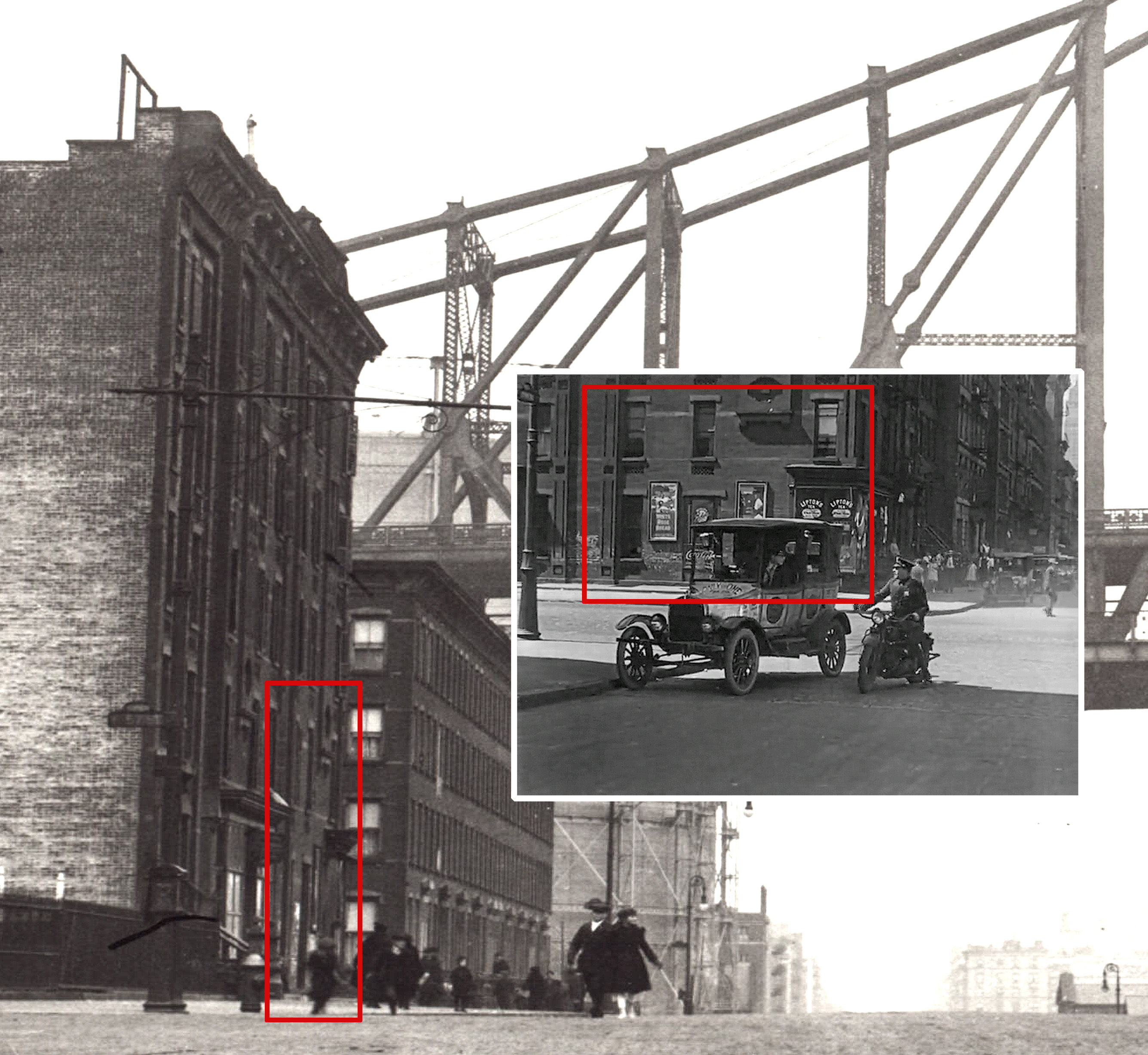
This tiny UES street has been a popular filming location throughout the history of NYC cinema, but usually, the camera is pointing east instead of west.
That’s because the eastern direction offers a spectacular vista of the 59th Street Bridge (probably best captured in Woody Allen’s, Manhattan).
Babe Ruth
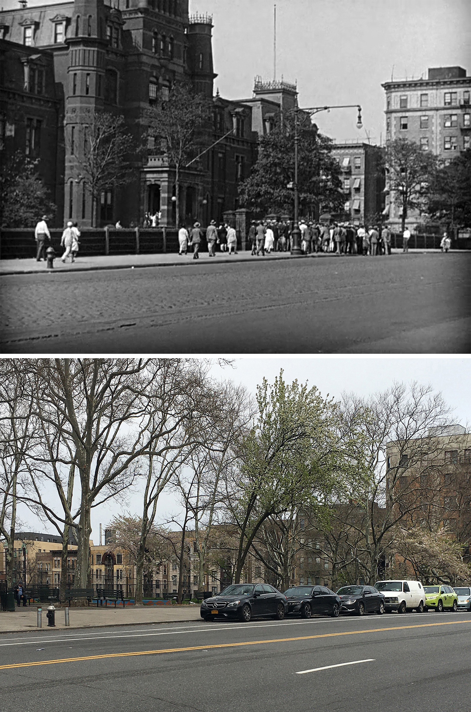
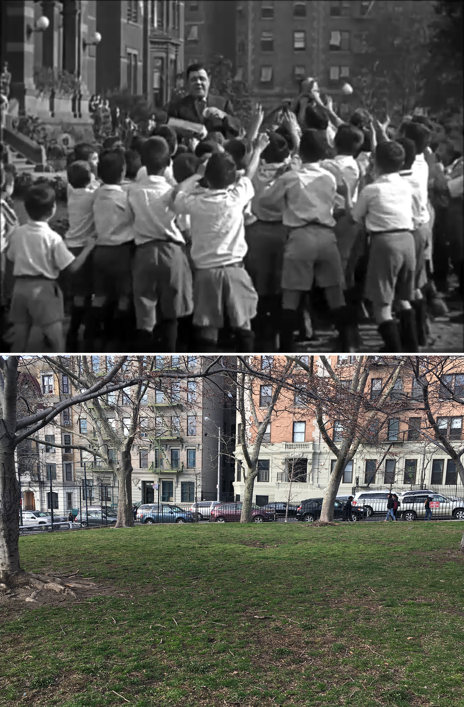
This Babe ride begins at the Hebrew Orphan Asylum (HOA) on Amsterdam Avenue and W 136th Street. It first opened in 1884, and was soon acknowledged as the nation’s premier orphanage, being able to house up to 1,750 children.
But by the time they filmed this scene with the Yankee superstar, HOA was considered outdated and was in the process of closing its Amsterdam building.
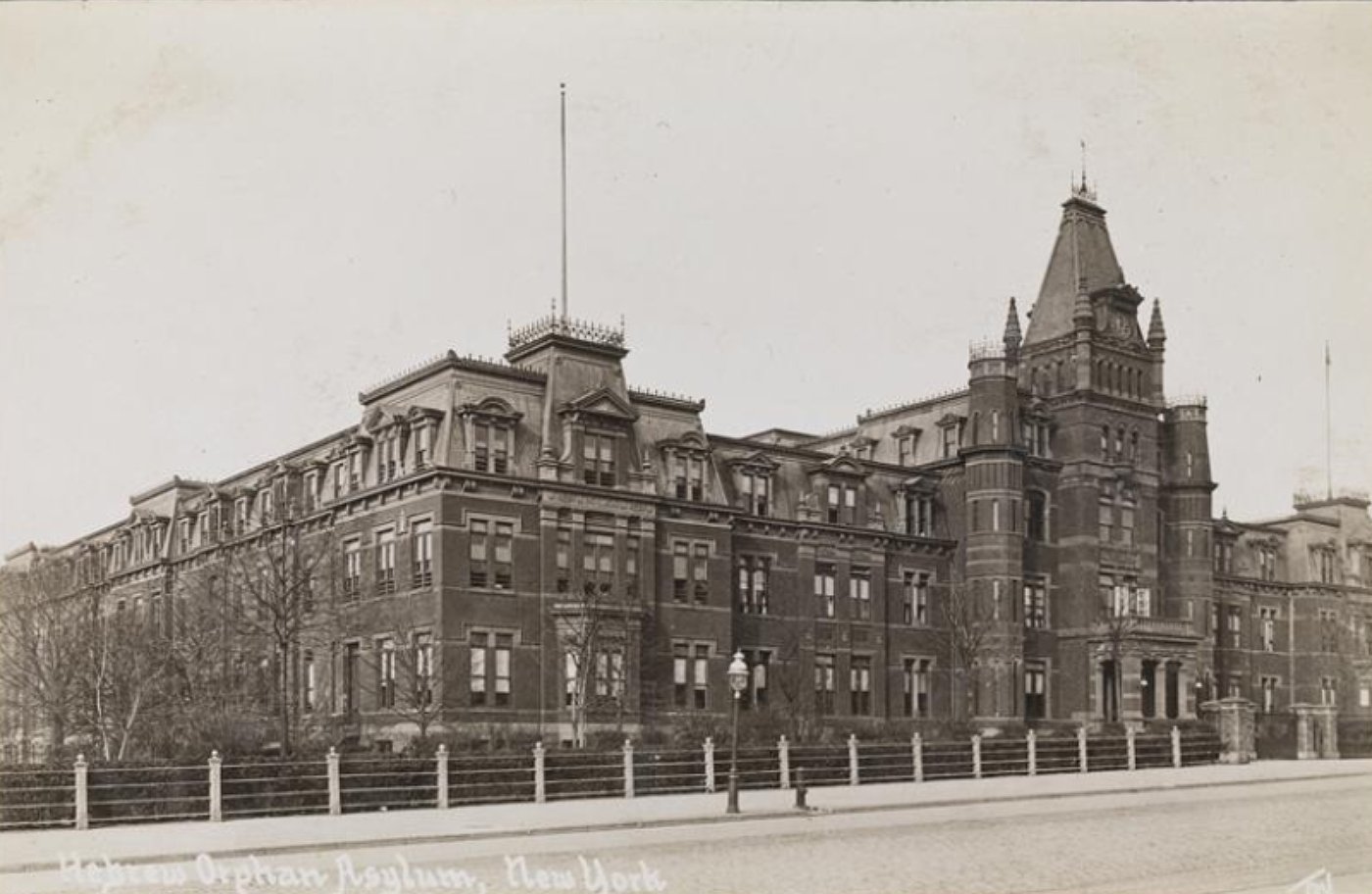
Coincidently, earlier on, there were tentative plans to have Yankee Stadium built on the HOA’s Amsterdam site. There were even numerous newspaper accounts confirming the deal, but in February 1921, the Yankees chose to instead build the stadium on a more suitable site in the Bronx.
The Hebrew Orphan Asylum closed the Amsterdam facility in 1941, and the building was thereafter used as housing for junior officers studying at City College across the street. In 1955, it was finally demolished by the City Parks Department to clear the site for the Jacob H. Schiff Park and Playground.
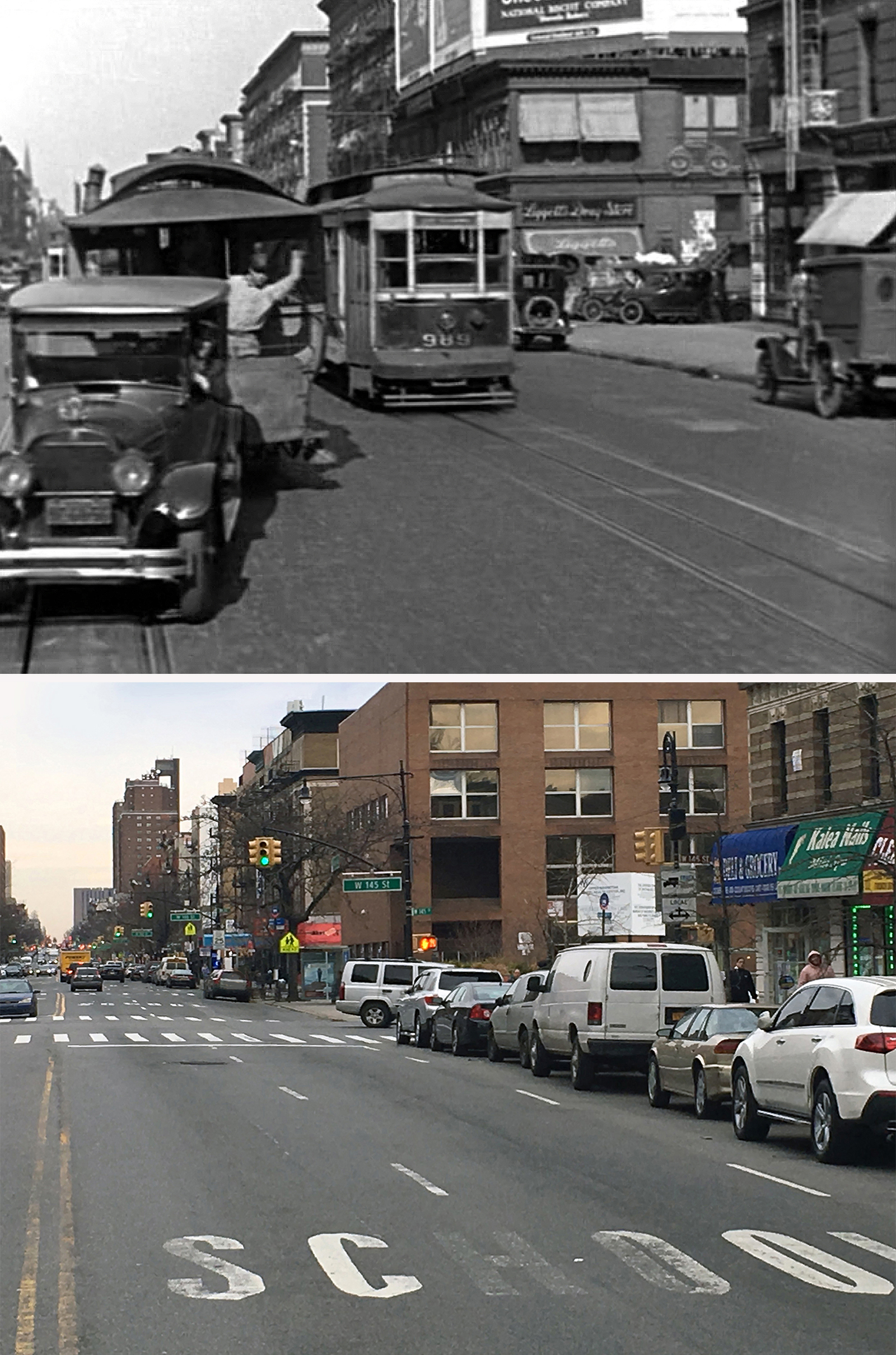
Funny enough, Babe’s taxi ride should’ve been a short one since the HOA was only about a mile away from Yankee Stadium. In fact, just like all the other taxicab sequences in this movie, there’s quite a bit of jumbled geography in this trip to Yankee Stadium. That being said, at least they stayed on Fifth Avenue for most of it. The fact Lloyd basically stuck to one continuous avenue probably helped John Bengtson find the spots more rapidly.
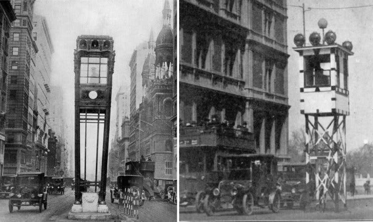
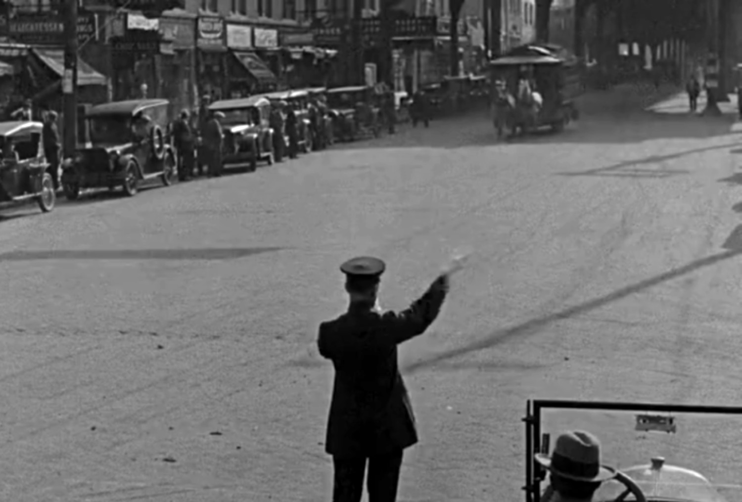
The things that helped confirm this trip was on Fifth Ave were those odd traffic signal towers positioned in the middle of several intersections. These experimental towers were installed along Fifth in 1920 in an effort to reduce gridlock. (Prior to that, NYC traffic was essentially controlled by street corner cops.) Using a block signal system originally developed by the railroads, the towers were situated at the intersections of 34th, 38th, 42nd, 50th, and 57th Streets, and were manually operated by a police officer seated inside.
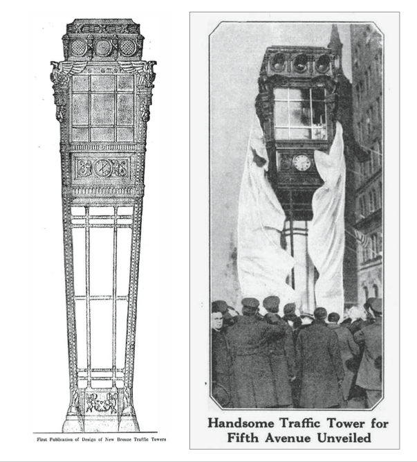
The initial response to the towers was positive —with reports indicating significant reductions in travel time— encouraging other major avenues to put in their own systems. As traffic signals became more ubiquitous in the city, their designs became more efficient and less obtrusive. By 1929, the city had determined that the sumptuous towers on Fifth were blocking the roadway too much.
 They were thereupon removed and replaced with smaller two-light traffic signals mounted on the corners.
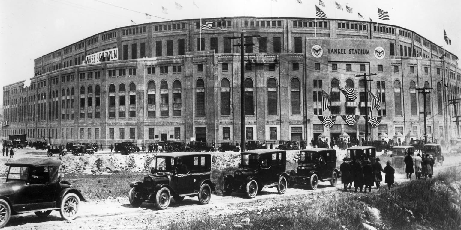
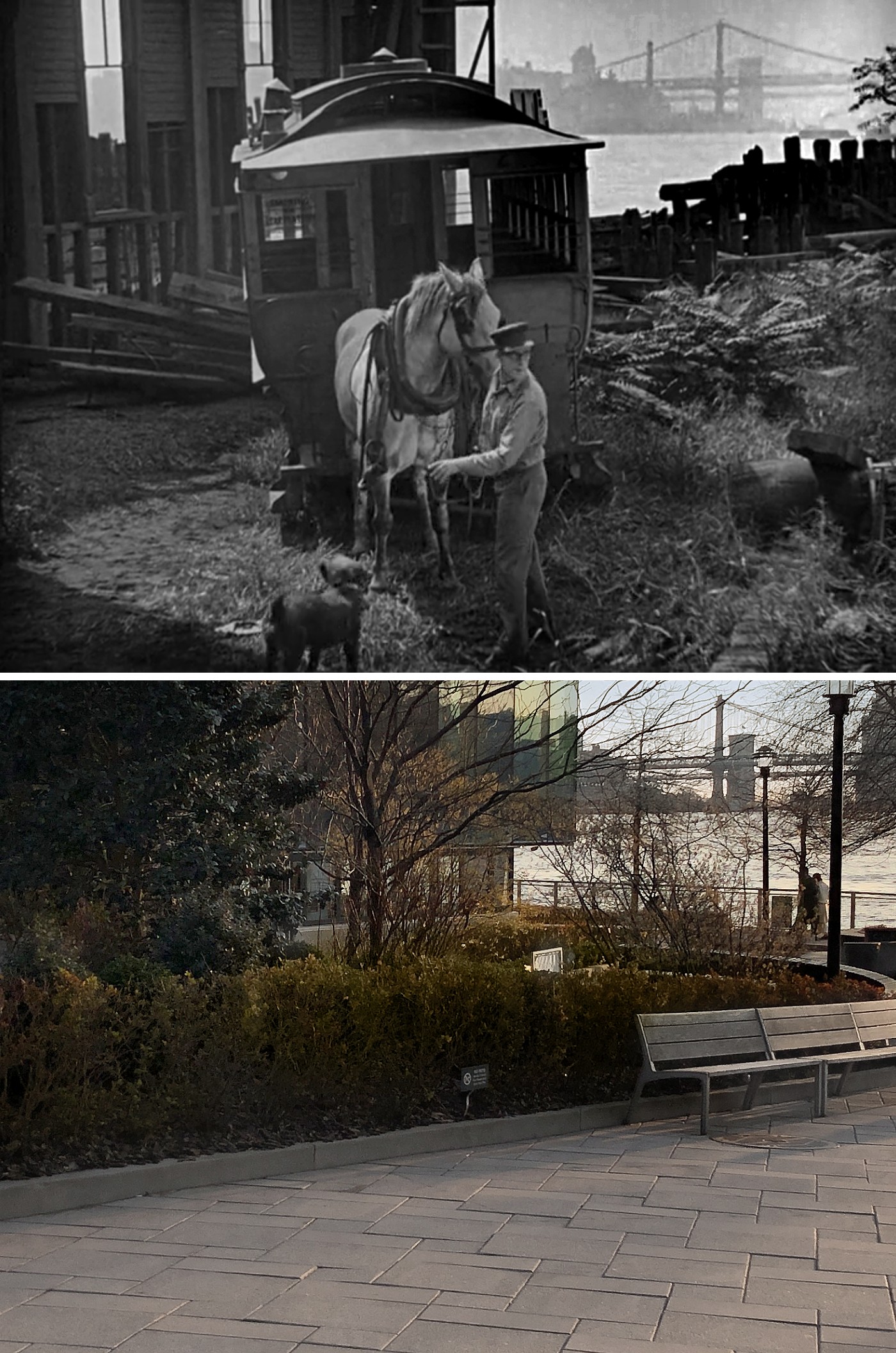
Yankee Stadium
As mentioned earlier, when the Yankees were looking for a permanent stadium, management nearly acquired the site of the Hebrew Orphan Asylum for their new home, Instead, they went with the Bronx and built a stadium that was nearly twice as big as any other at the time. Rightfully nicknamed, “The House That Ruth Built,” the grand stadium hosted games for 85 years. It was demolished in 2009-2010, following the team’s move to a new stadium just to the north. The site was repurposed into a public park and ballfield, giving visitors the opportunity to run the bases where many baseball greats once did.
Since the stadium is no longer there, there’s not much to match up, other than the Macomb’s Dam Bridge featured in one wide shot.
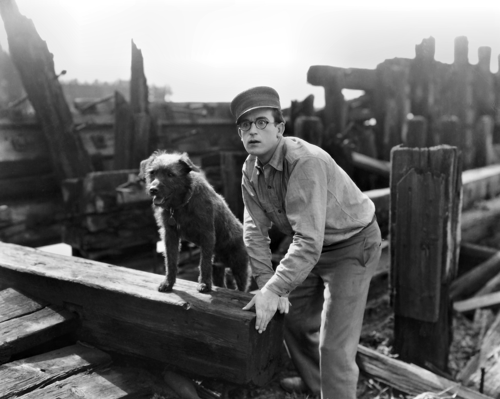
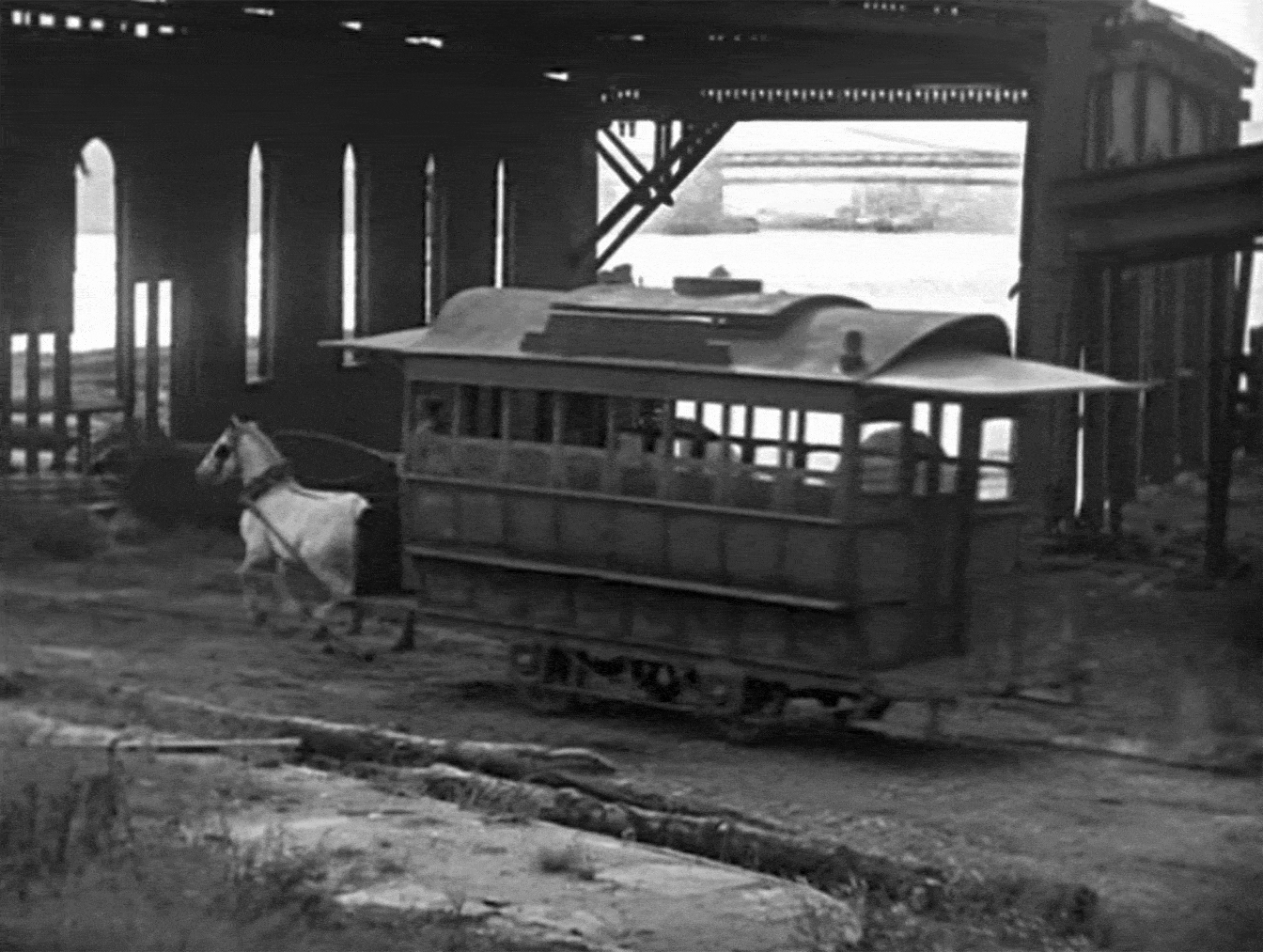
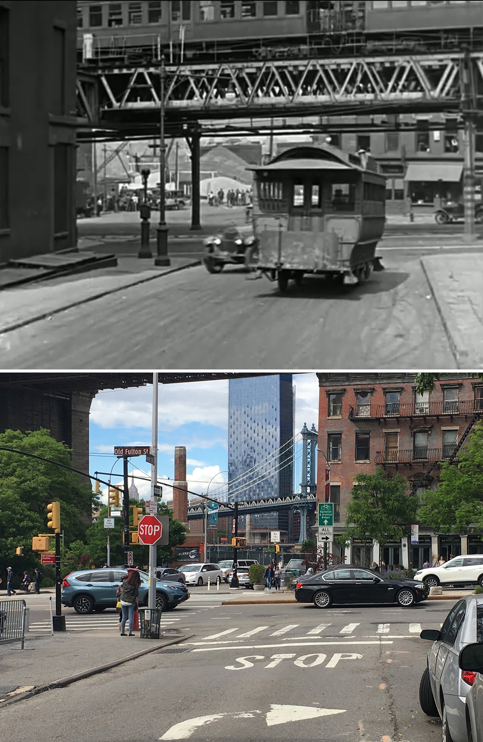
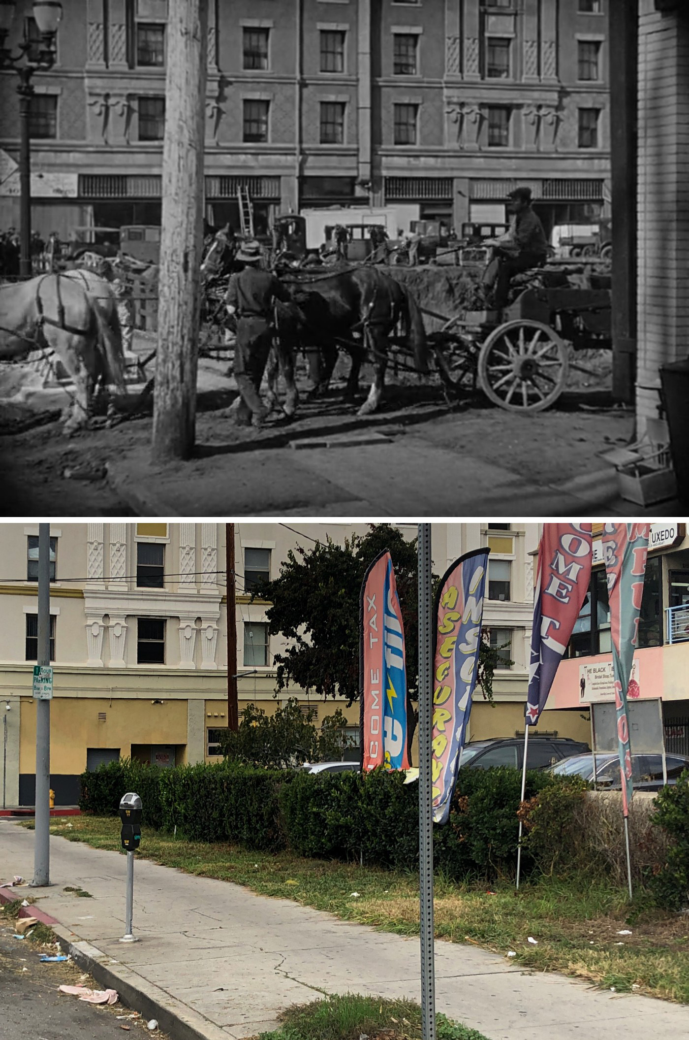
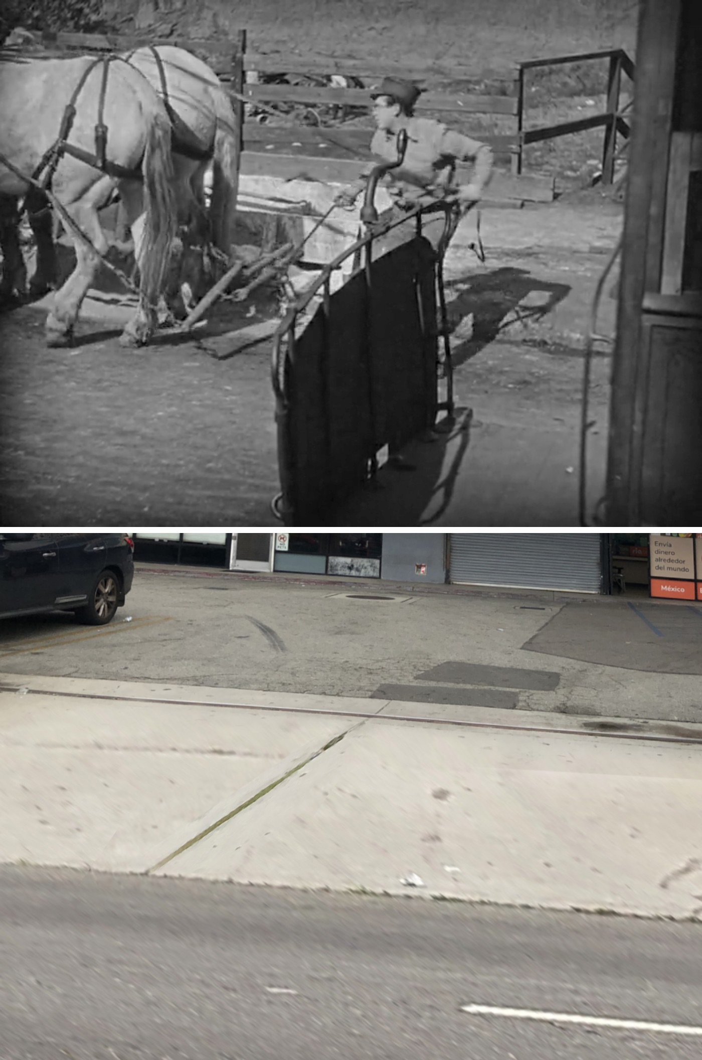
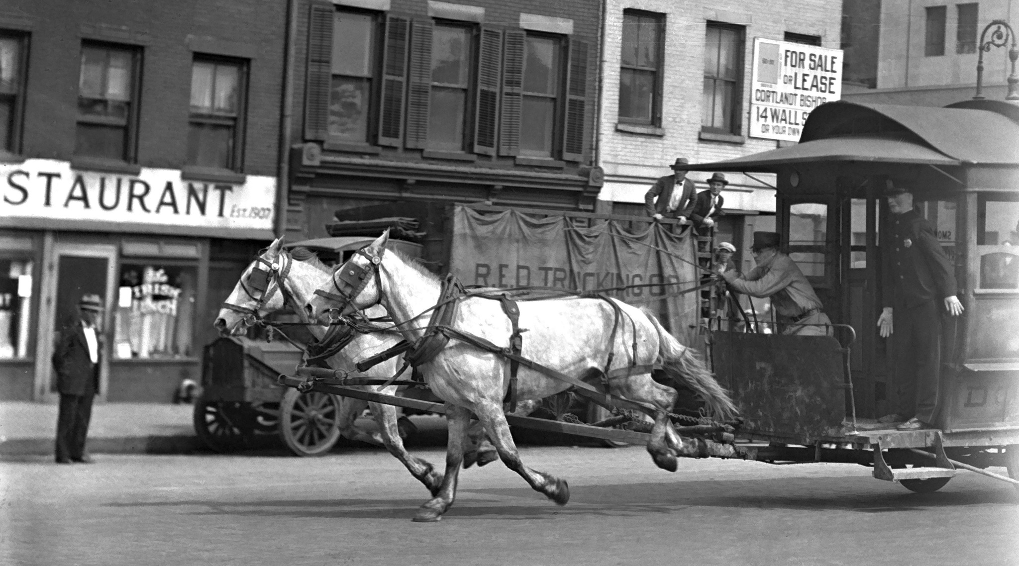
Stealing the Horsecar
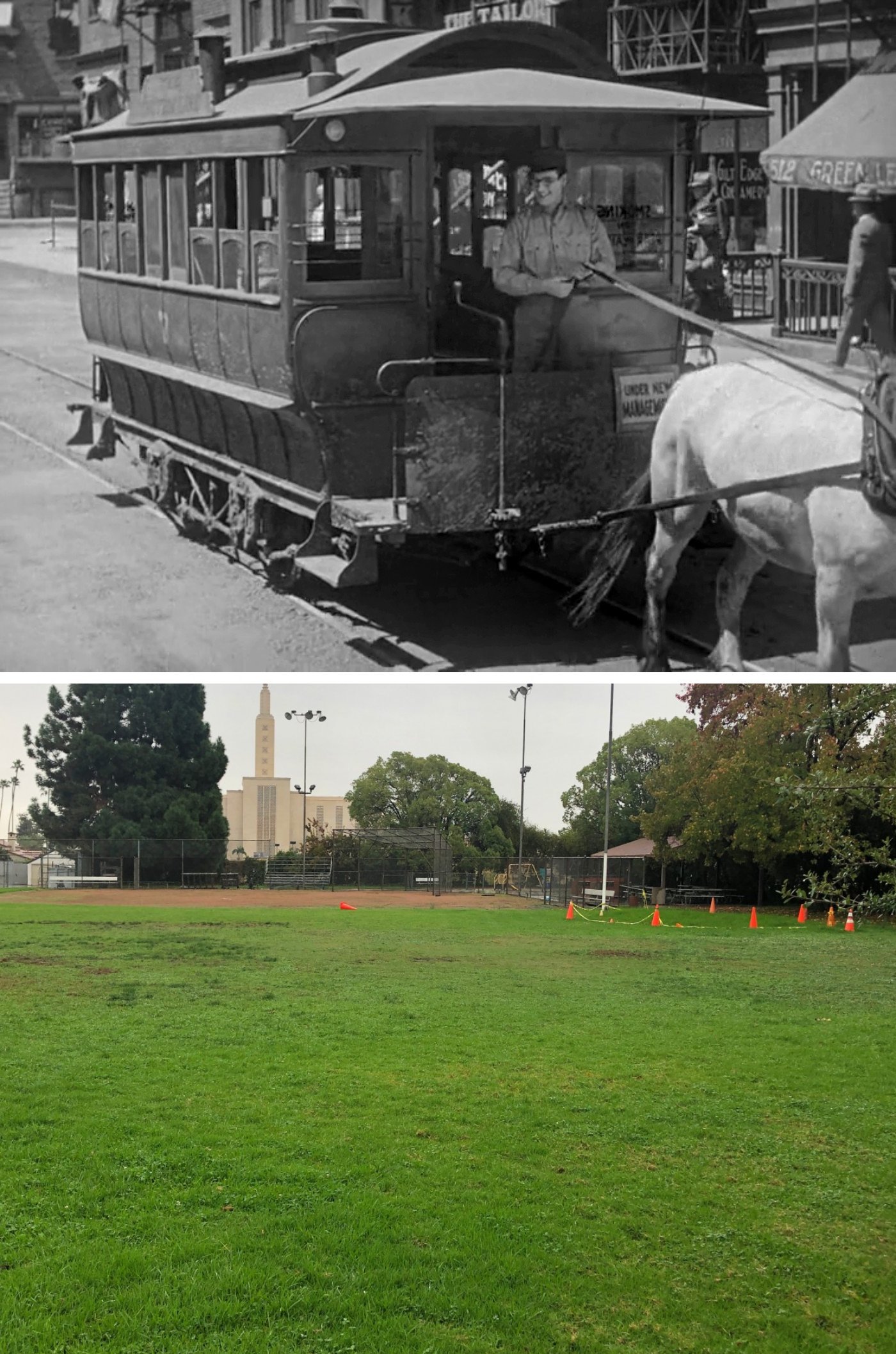
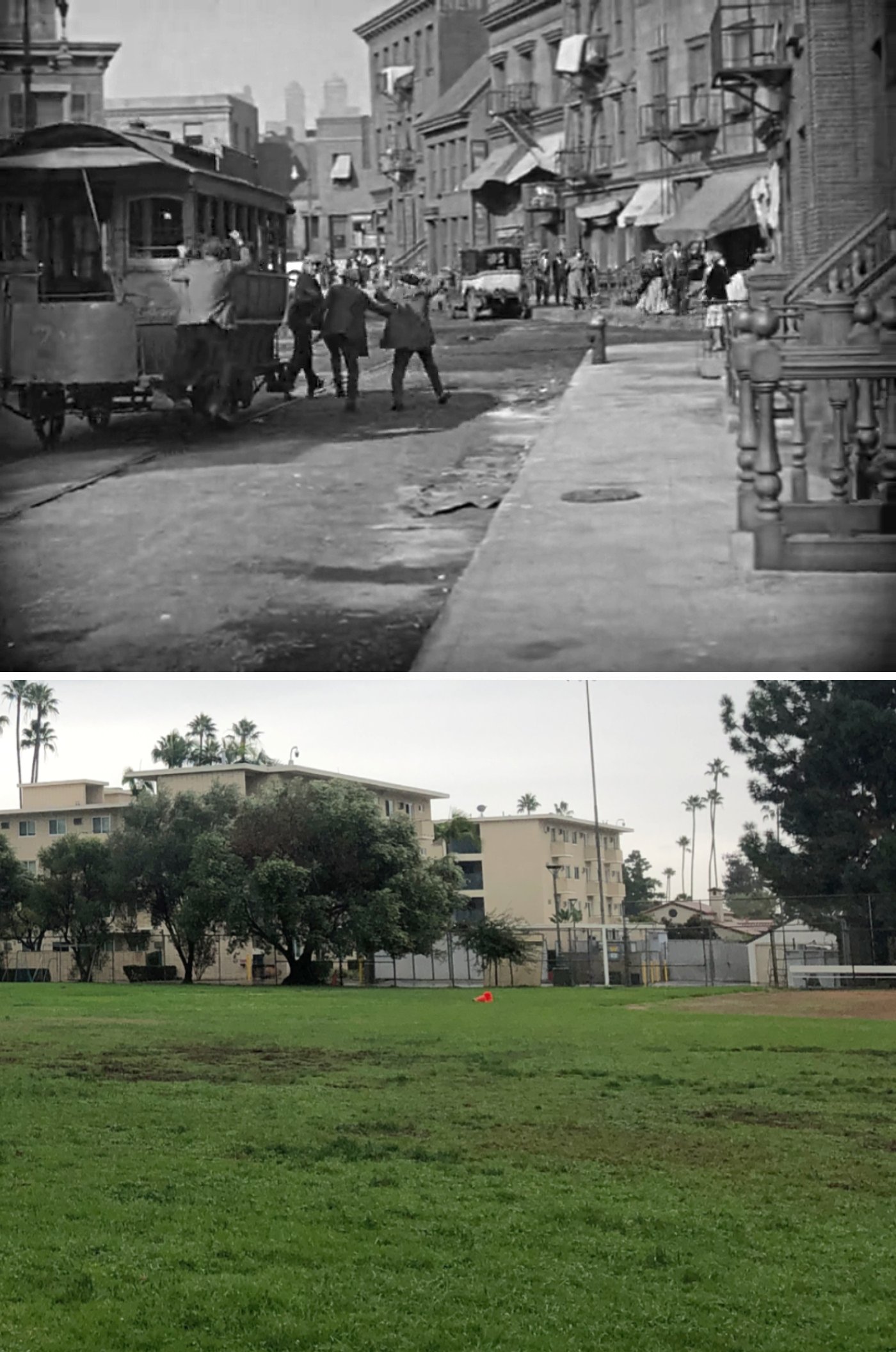
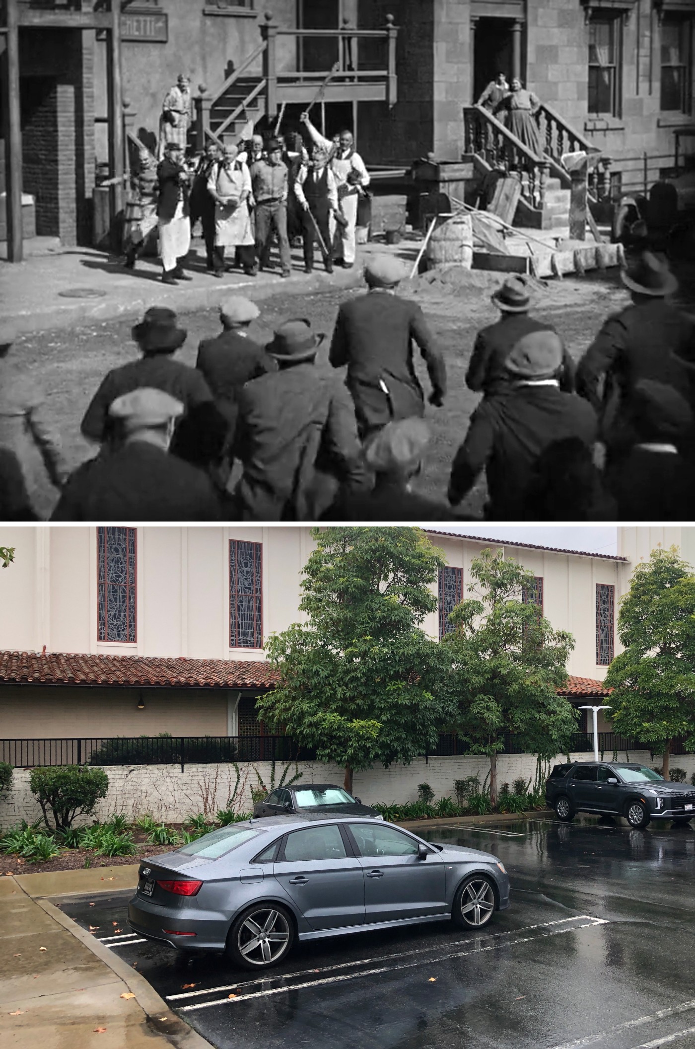
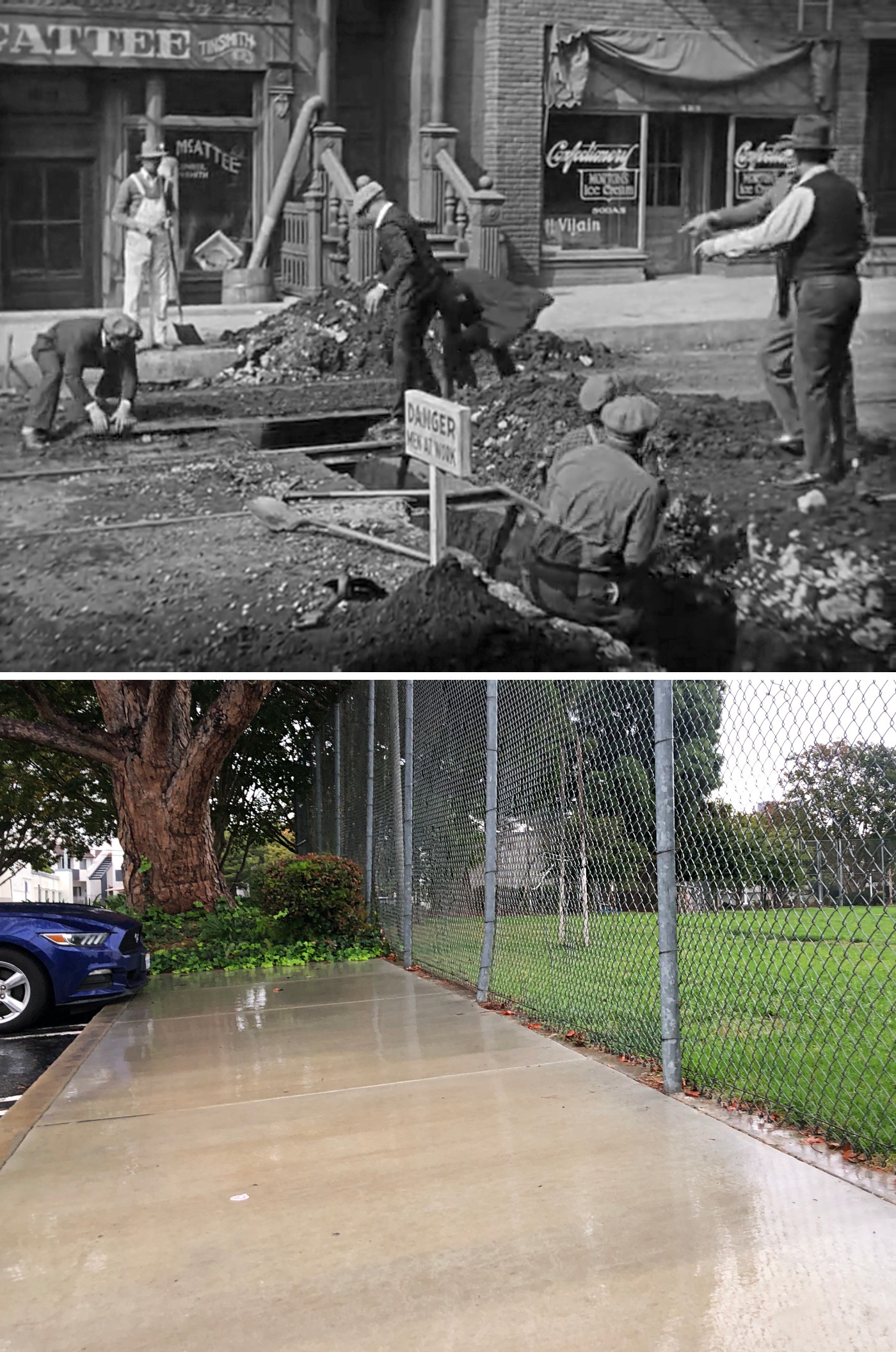
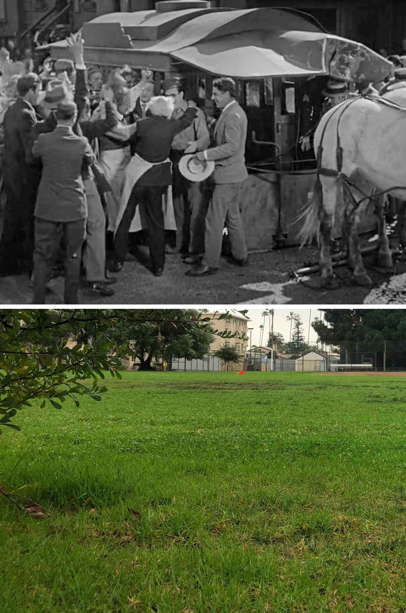
In 1923, the Harold Lloyd Corporation bought the Westwood Location Ranch, bounded by Ohio Avenue, Manning Avenue, Santa Monica Boulevard, and Selby Avenue as a possible studio site.
Lloyd decided to continue production at the Hollywood Studio instead, but kept the property, eventually building the sweeping New York exterior set for Speedy.
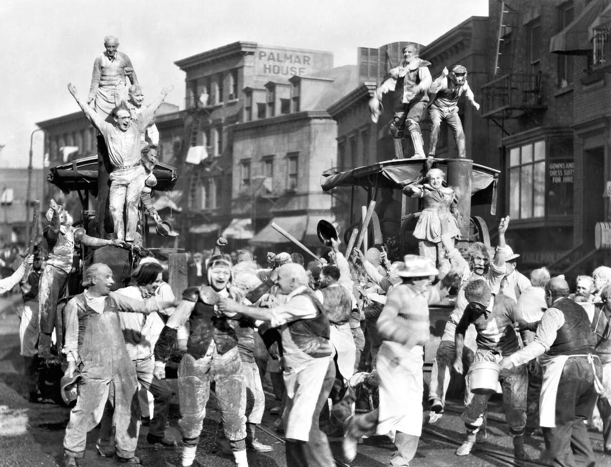
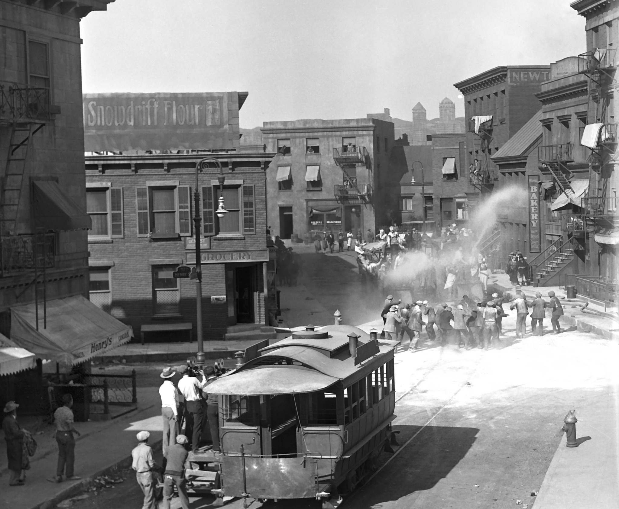
Inspired by the Sheridan Square area of New York, Lloyd used this set again for his 1934 production The Cat’s Paw, and would occasionally rent it to other studio productions, such as 1936’s Little Lord Fauntleroy.
Shortly thereafter, Lloyd sold off sections of the land to schools and churches, with the area that was used for the New York set going to the Mormon Church in 1937. And as you can tell from the then/now images above, the church’s softball field and parking lot are approximately where the elaborate set used to stand.
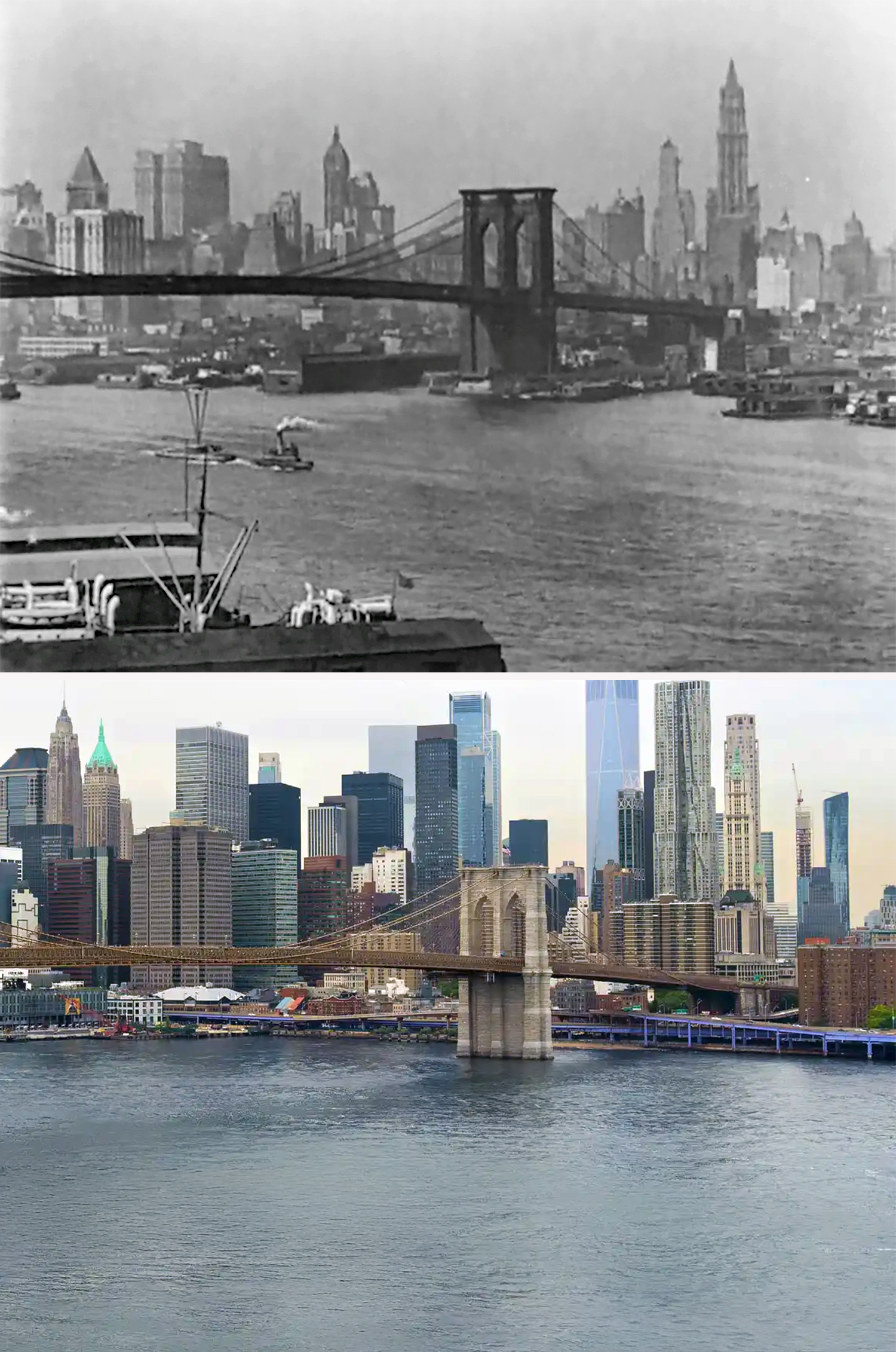
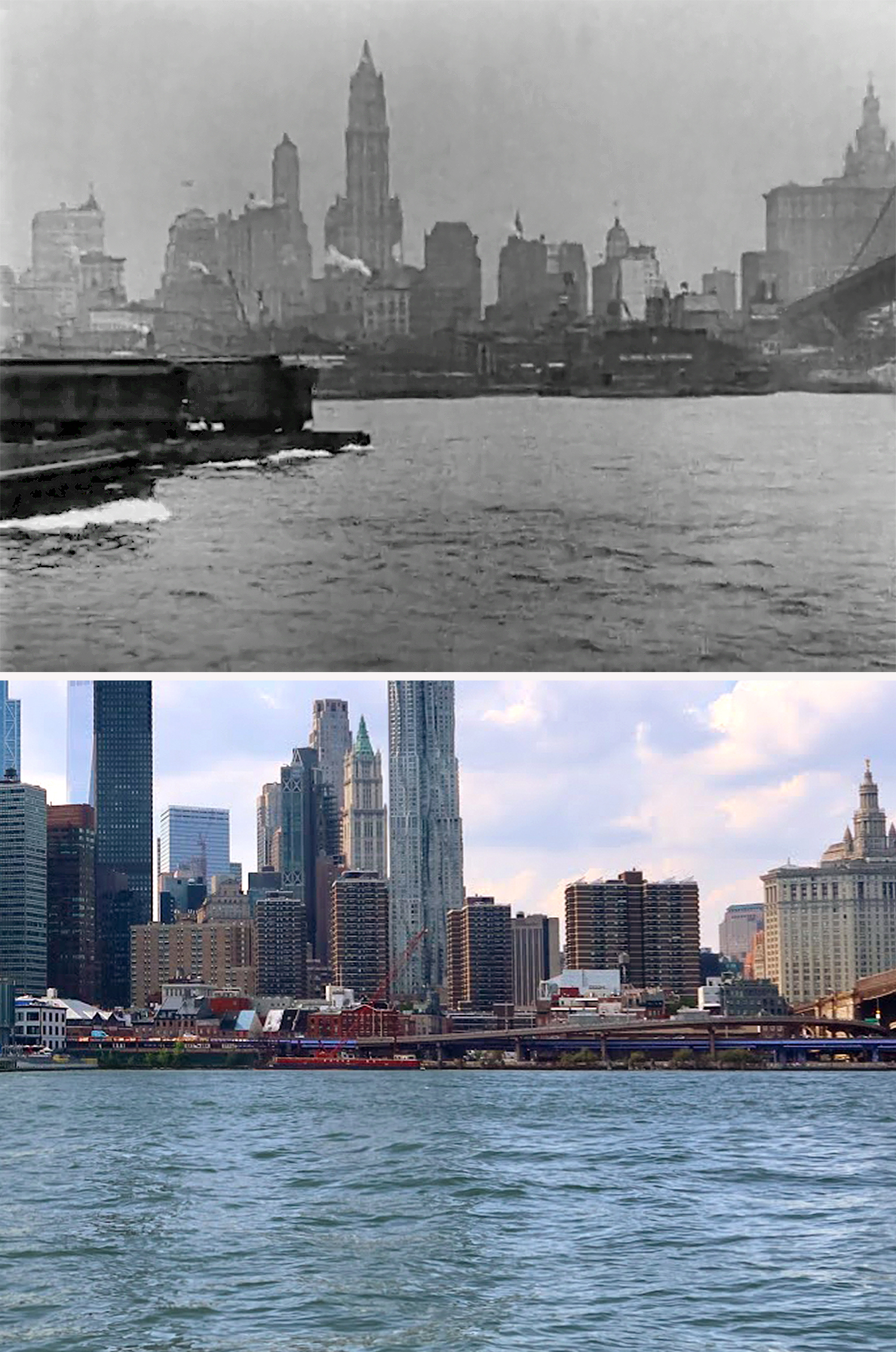
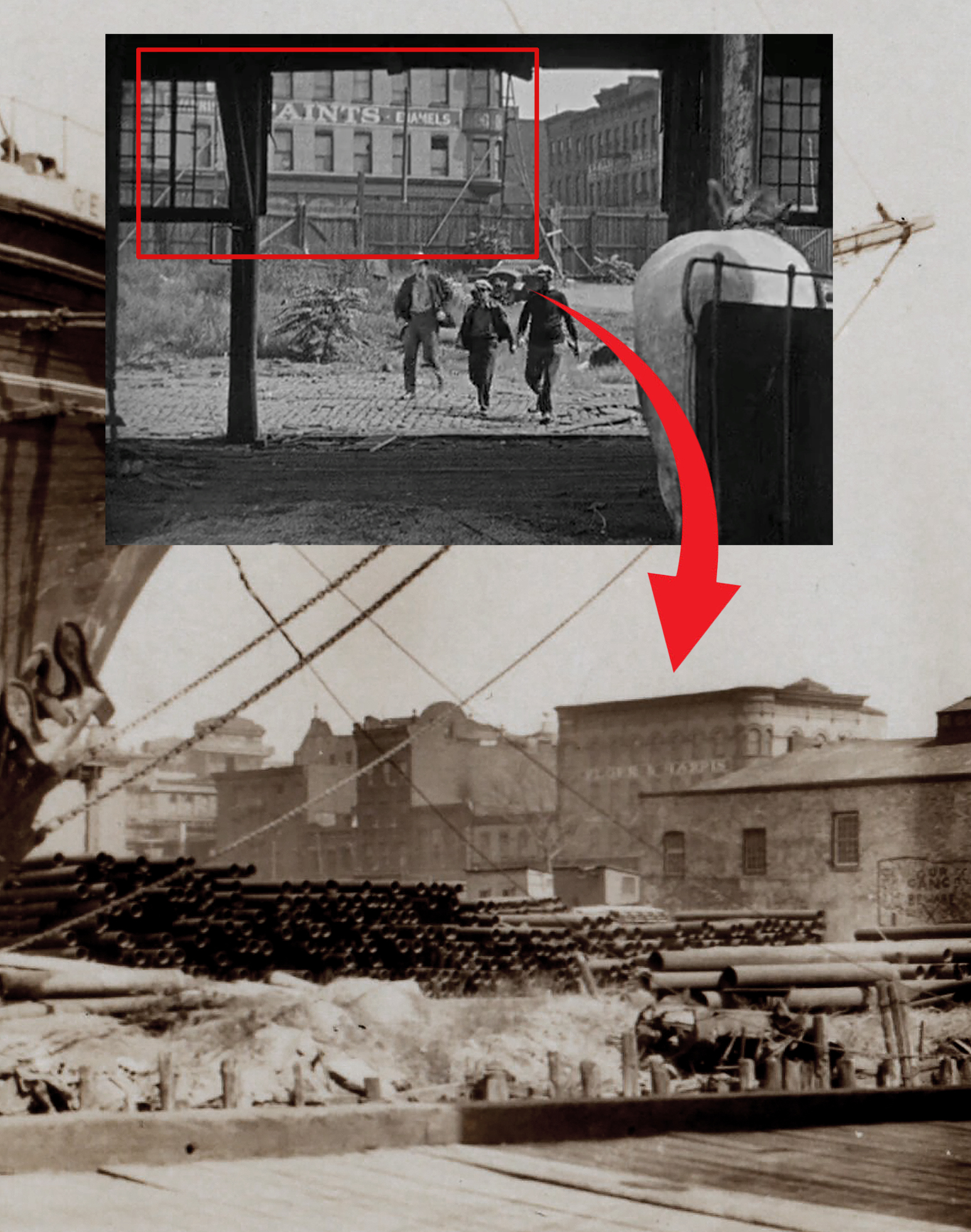
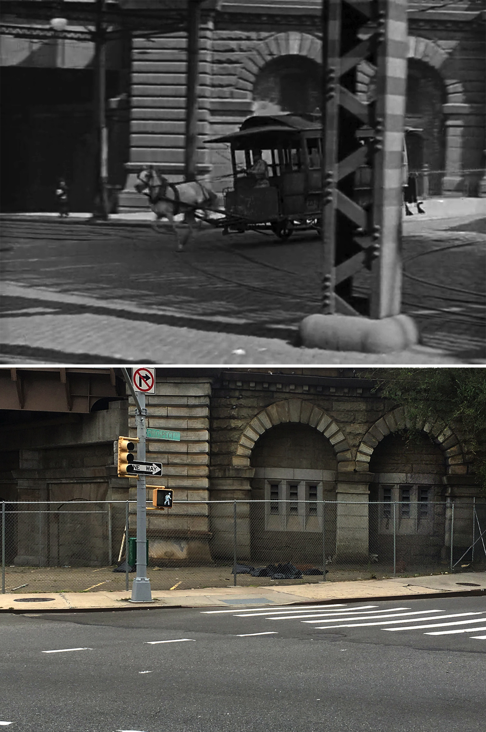
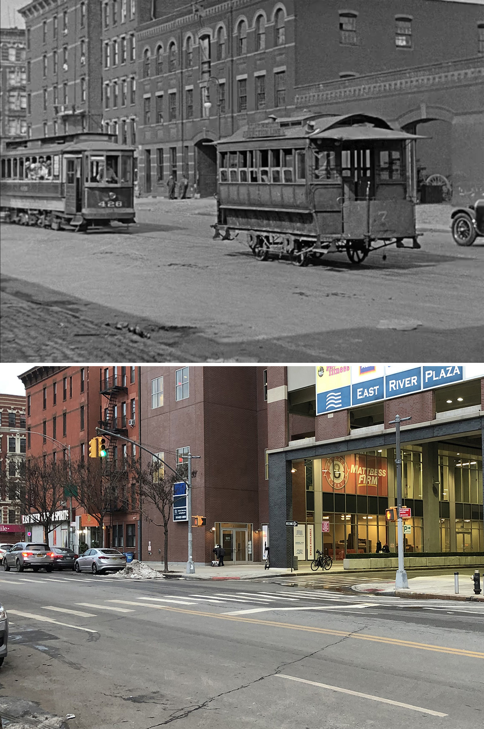
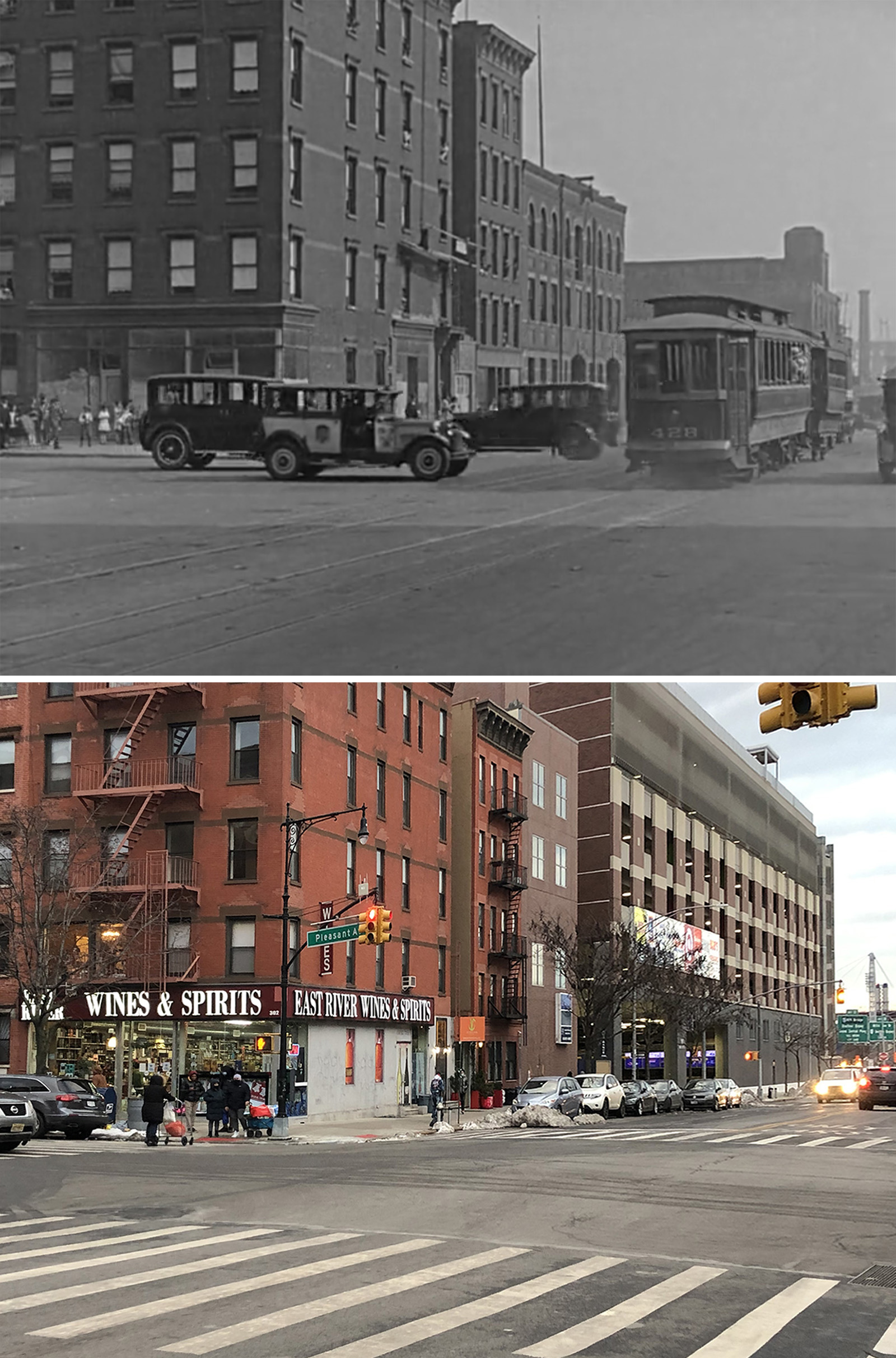
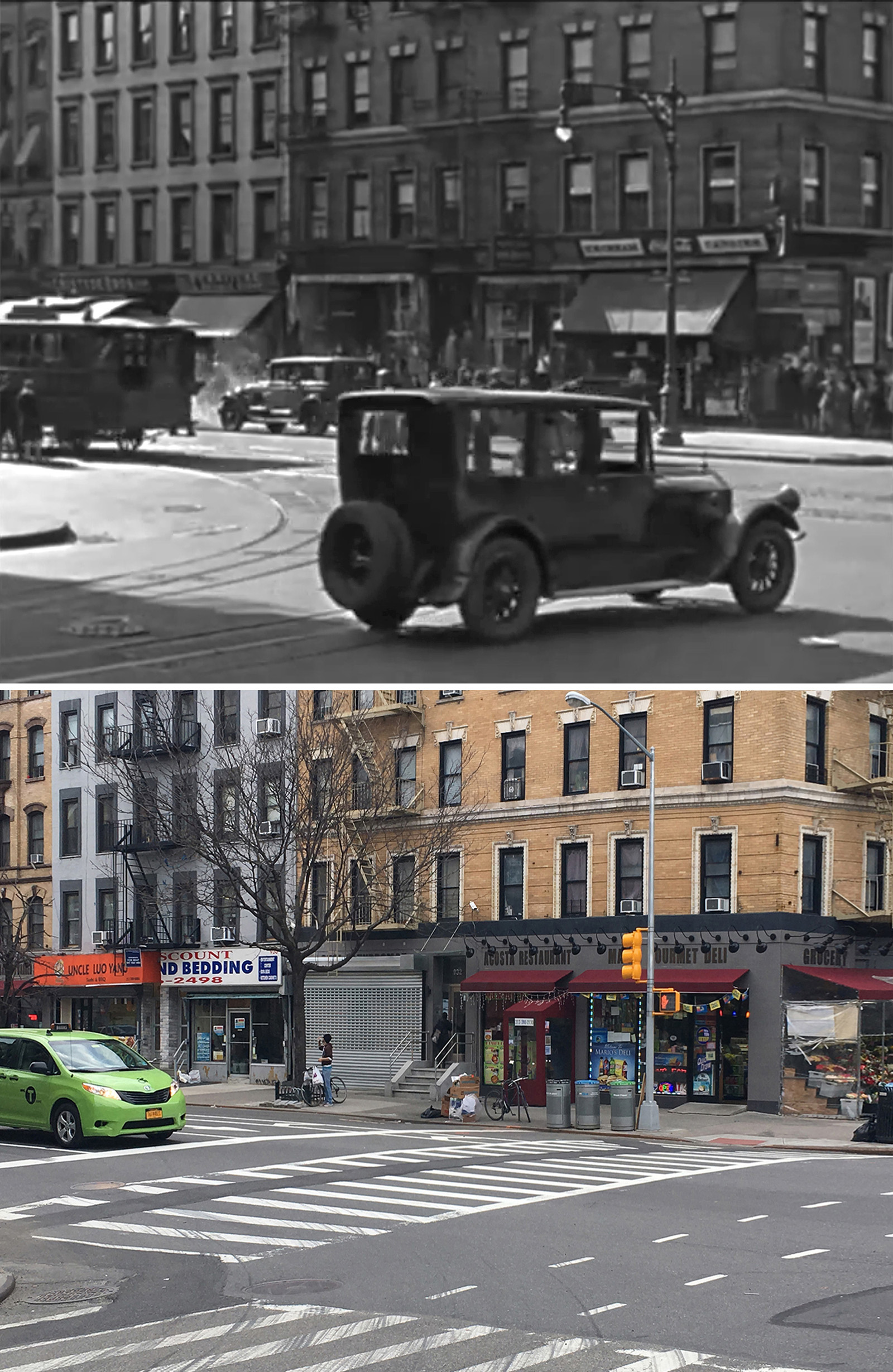
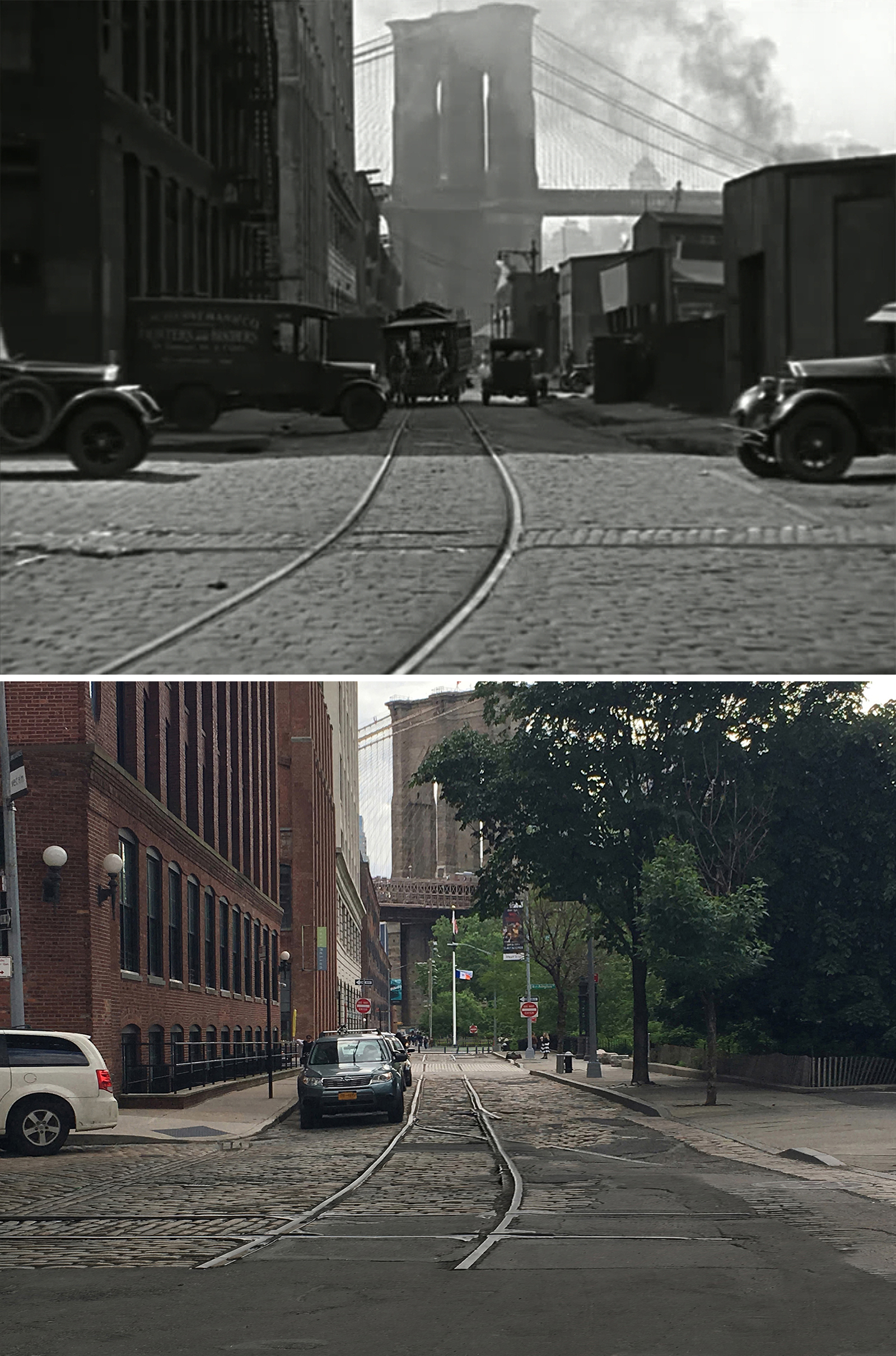
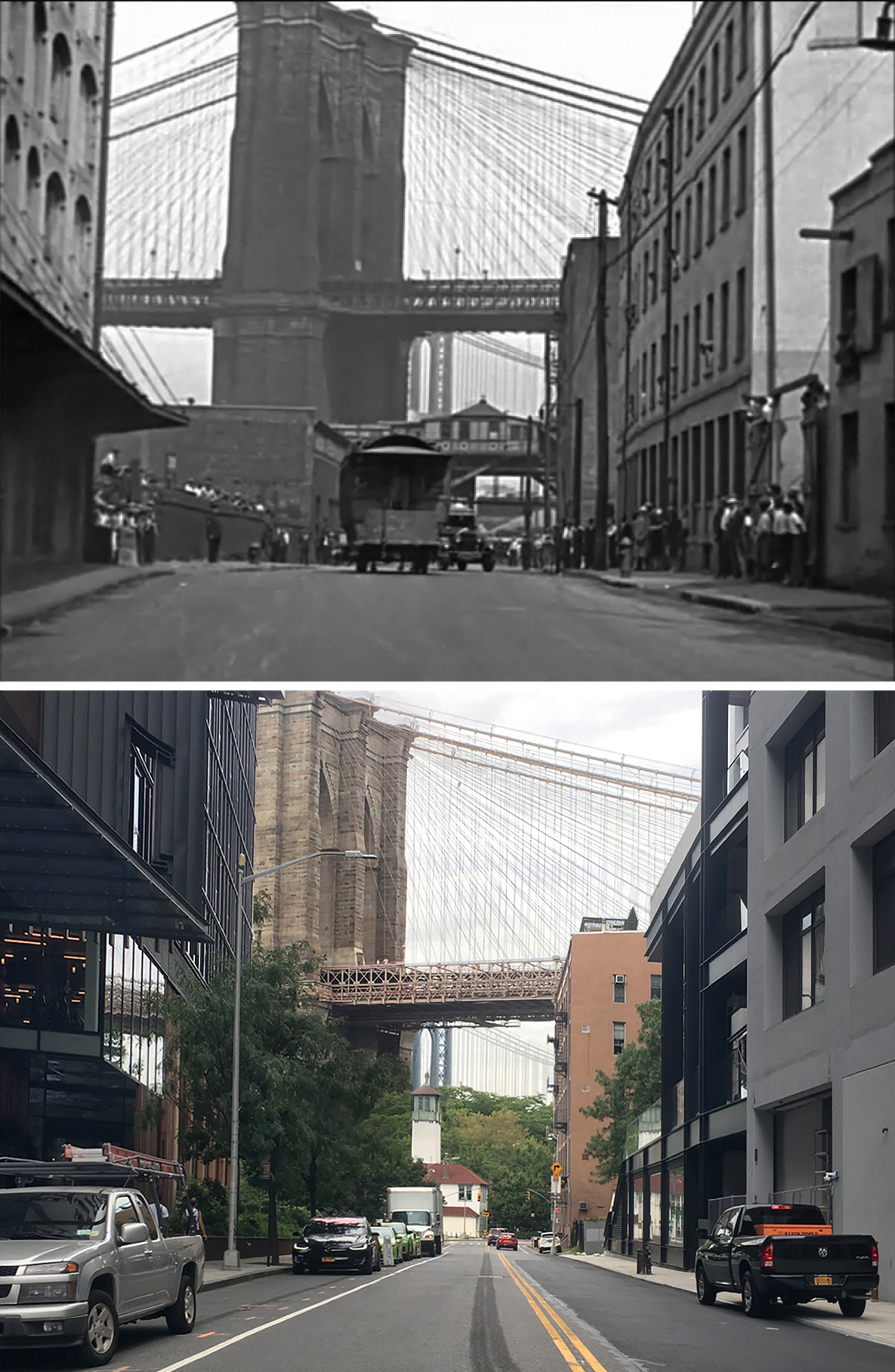
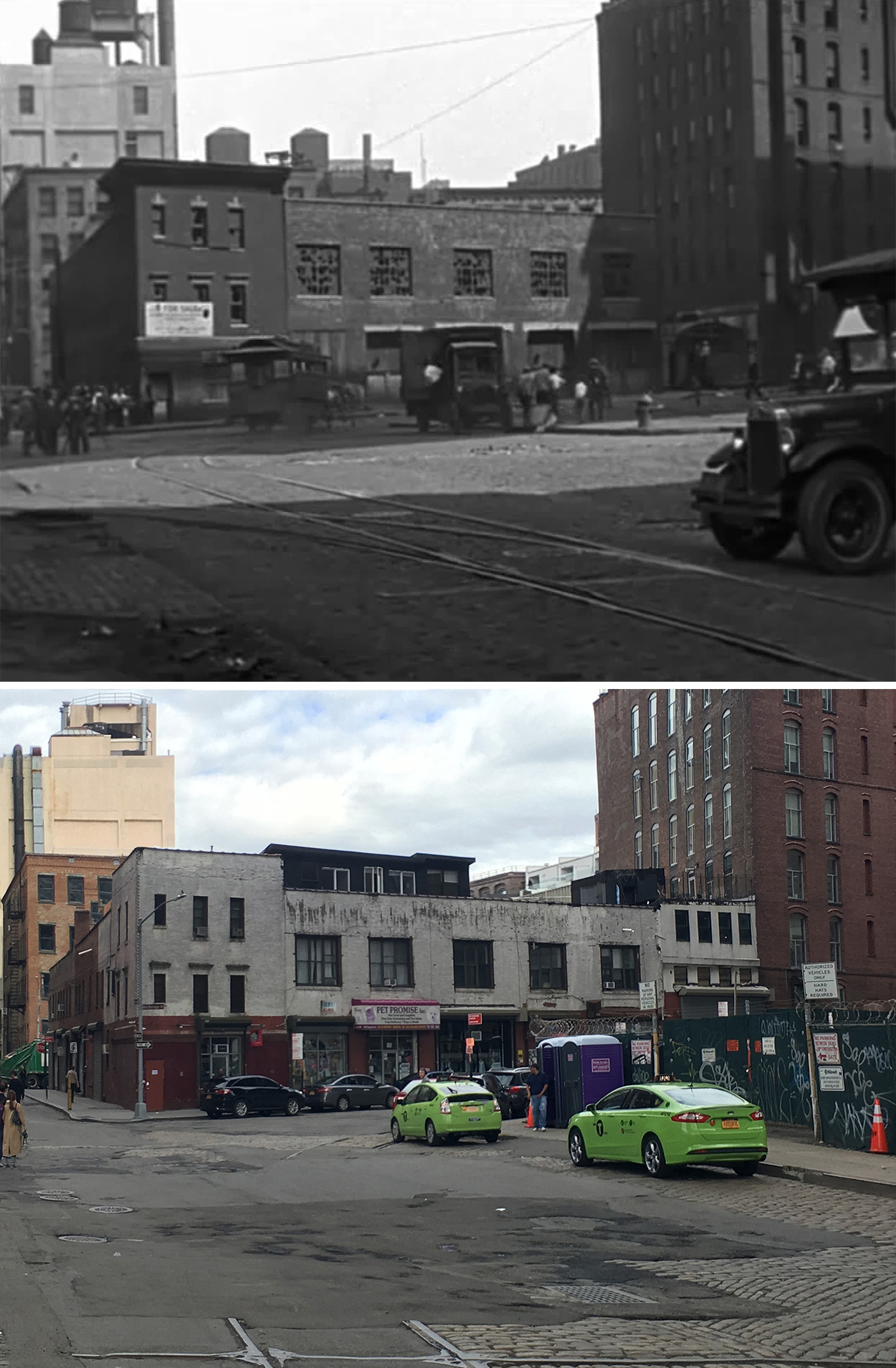
Finding the Horsecar
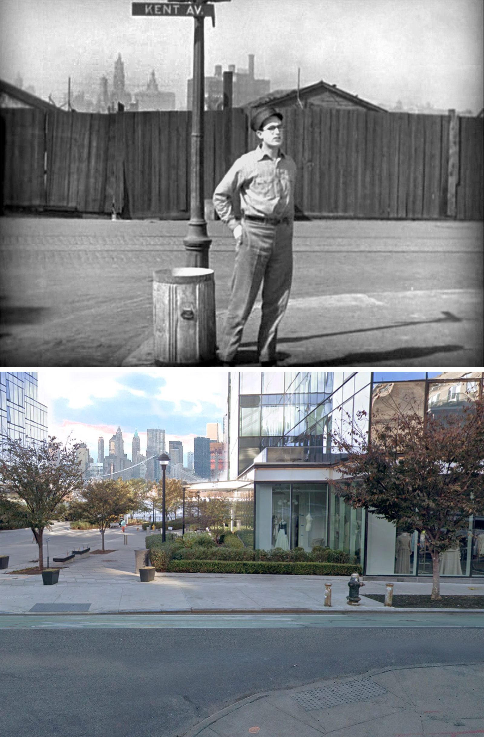
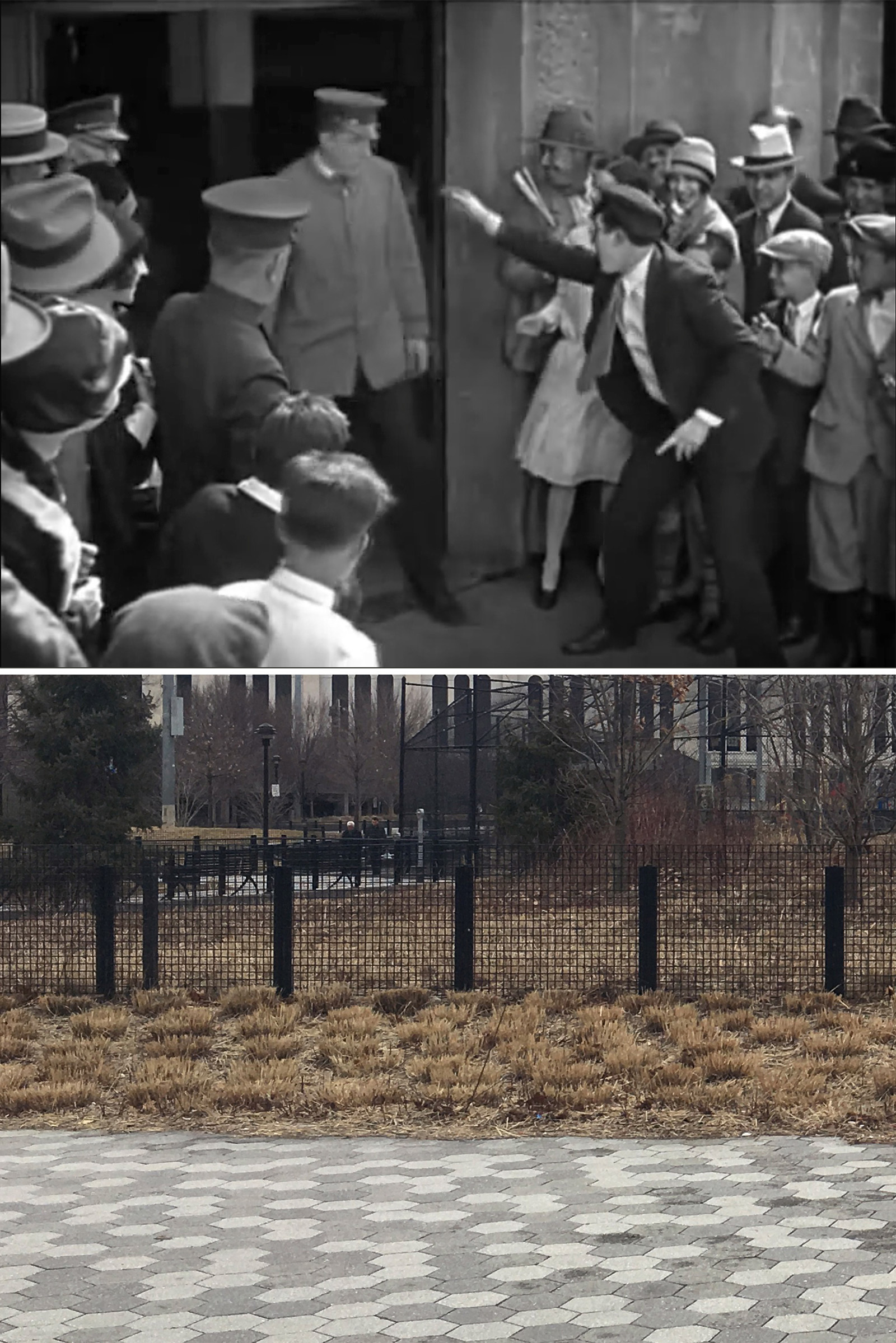
This was found by John back when he was working on his Silent Visions book. A street sign, the East River and distant views of the Manhattan and Brooklyn Bridges probably helped him pinpoint the location.
But just as an additional measure to verify this location, I dug up a 1931 photo of the storage yards of the Columbia Steel Tube Company, showing a matching building on Kent.
As you can see, the area that used to be storage yards for a piping company is now home to a pair of expensive high-rise apartment buildings.
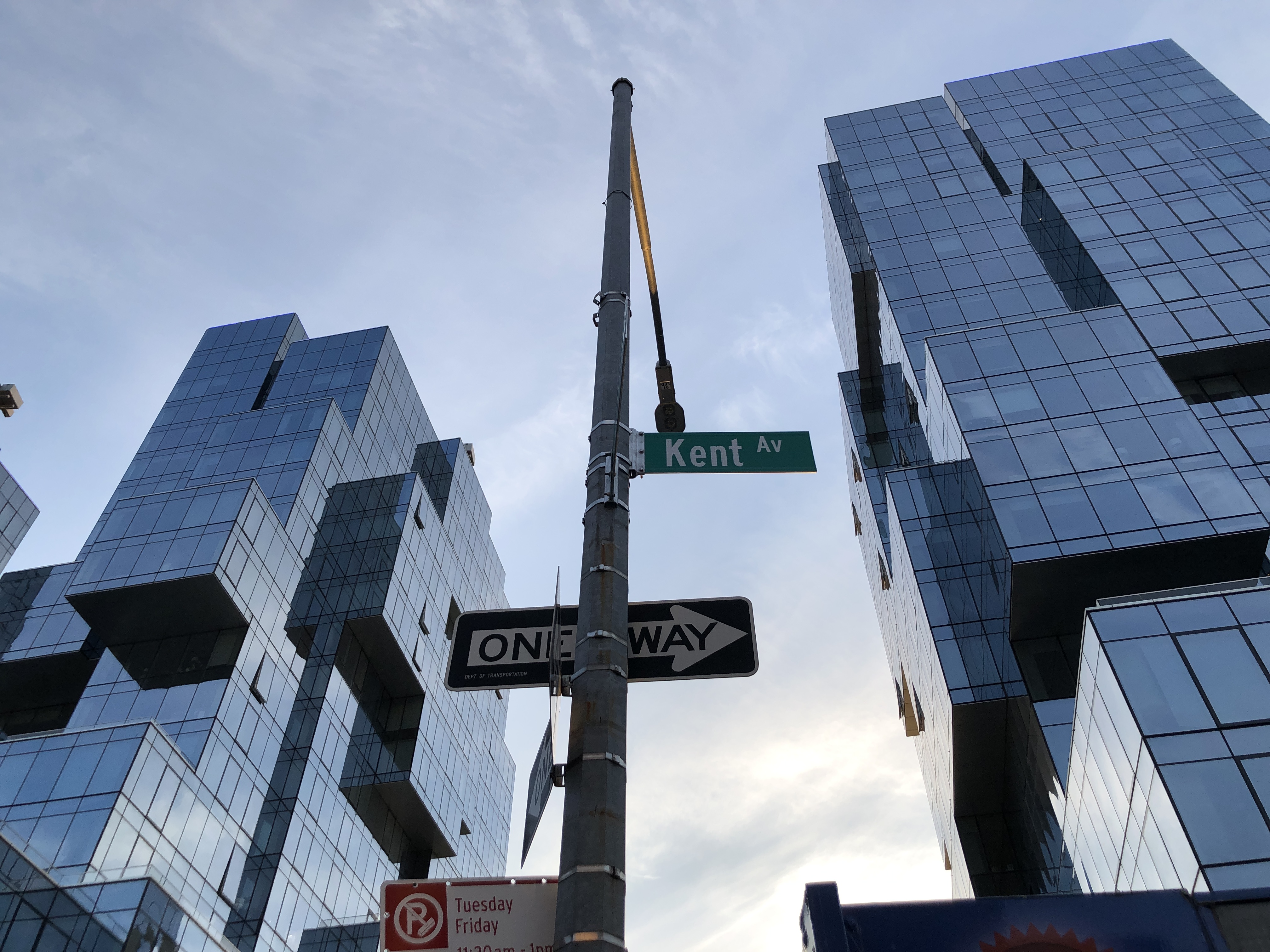
When I first visited the location in 2017, the area was mostly an open lot, with some construction equipment and the beginnings of one of the new towers.
Fortunately, there’s a decent open plaza and esplanade on the site, offering the public views of the river and allowing me to get pretty close to where this scene took place.
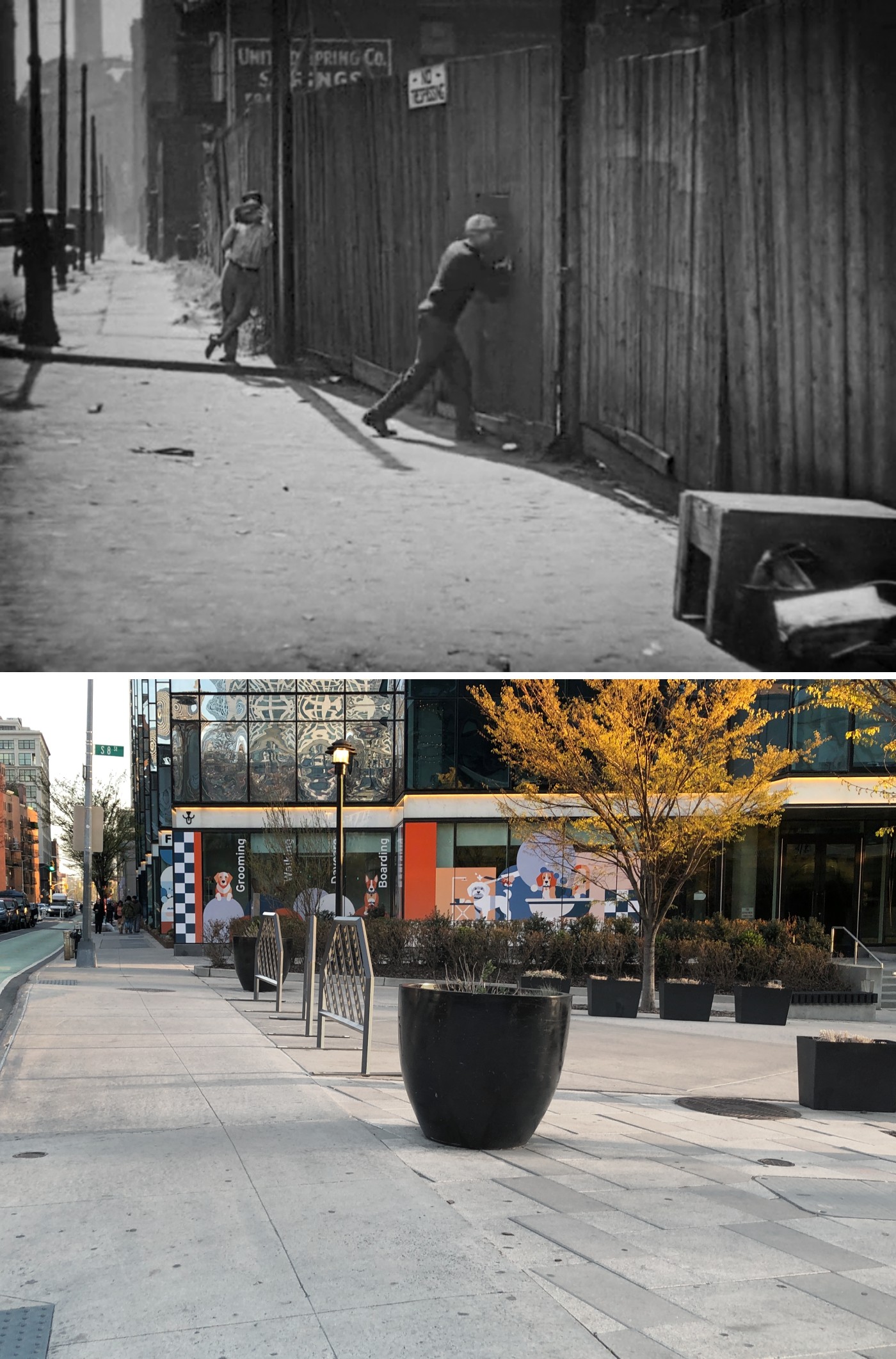
Escaping From the Hideout
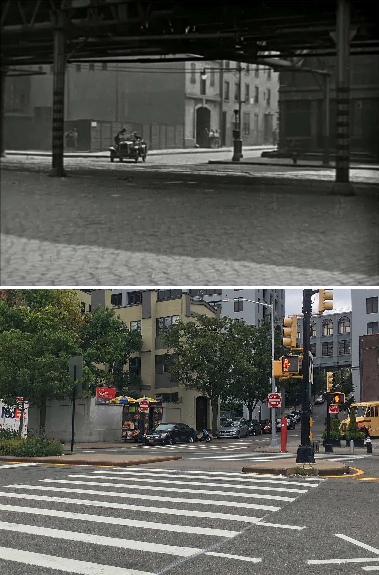
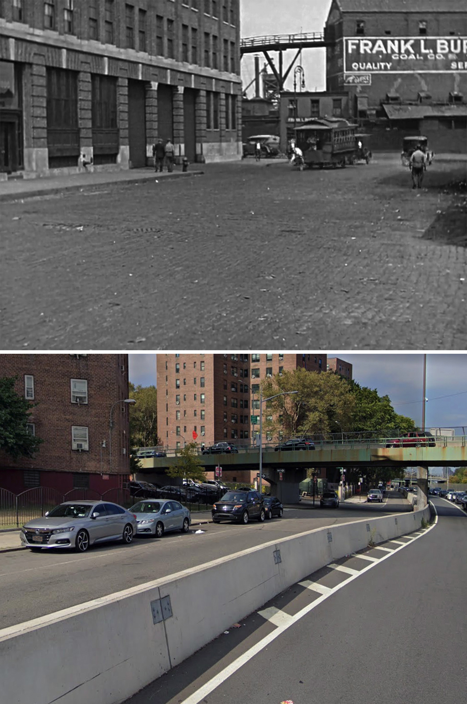
John found all but one of these locations. The only place he couldn’t find was the Frank L Burns Coal Company in the last shot. In his book, he postulated that it was “likely” the coal yard at the north end of Adams in Brooklyn, but admitted he couldn’t say for sure.
Luckily, when John reached out to me to help find it in 2020, Blakeslee and I had already done a lot of research on Burns Coal when searching for a location in The Rag Man (1925).
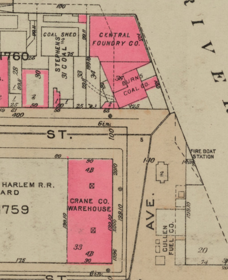
After consulting our notes and maps, we were able to determine that it was the Burns Coal Company’s 135th Street location on the Harlem River.
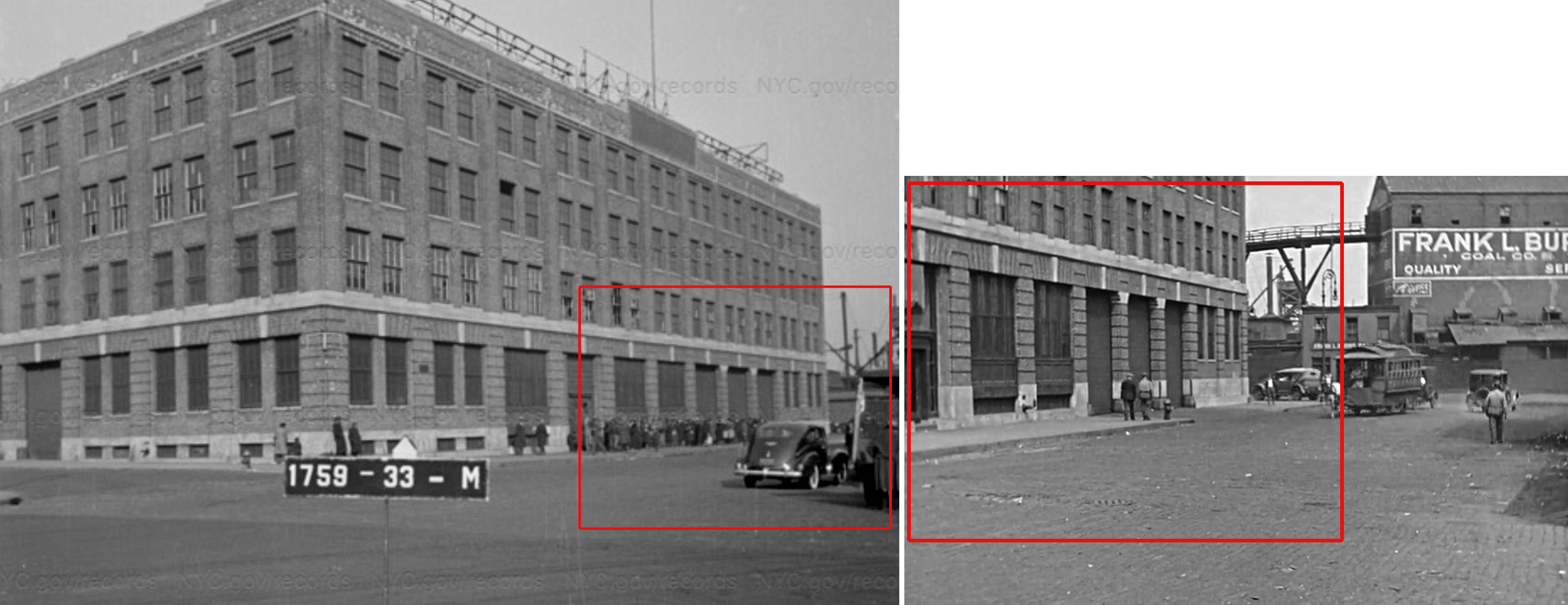
Of course, the area looks nothing like it did in 1927. But we were able to find a 1940 tax photo taken from almost the exact same angle, showing the same building in the foreground — the former Crane Co. Warehouse.
Stopping at the Blacksmith
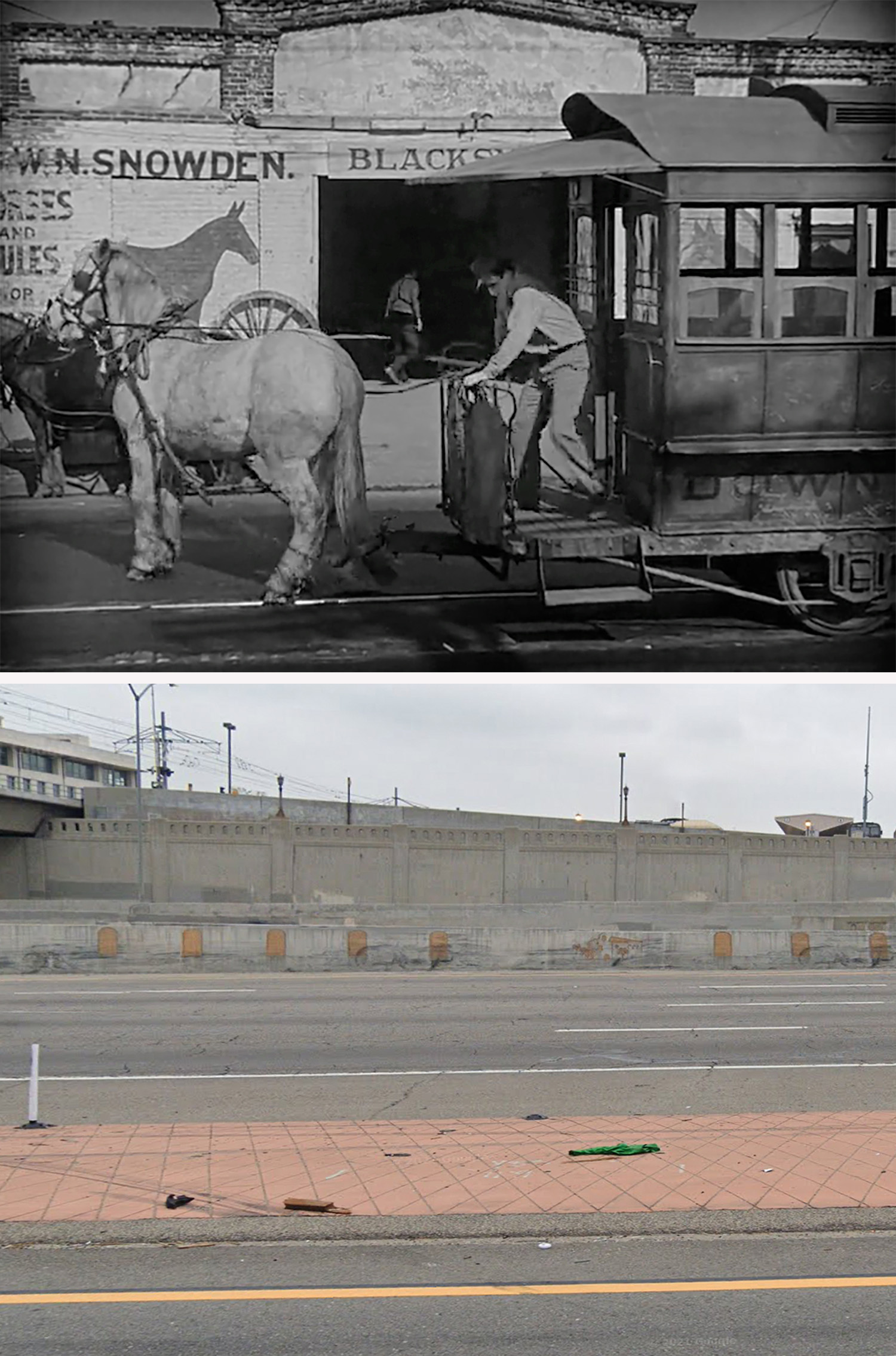
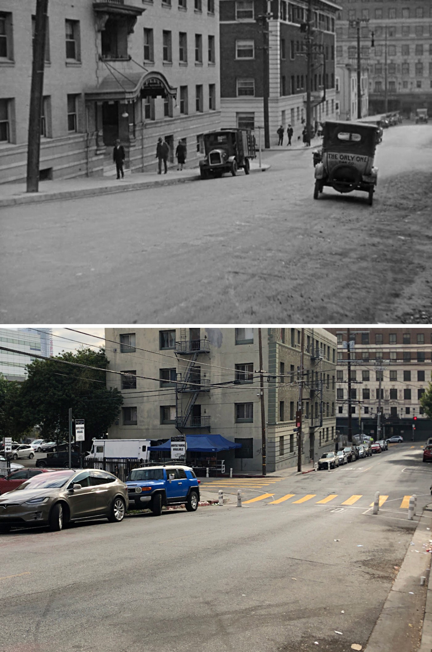
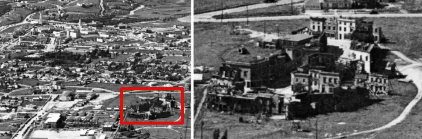
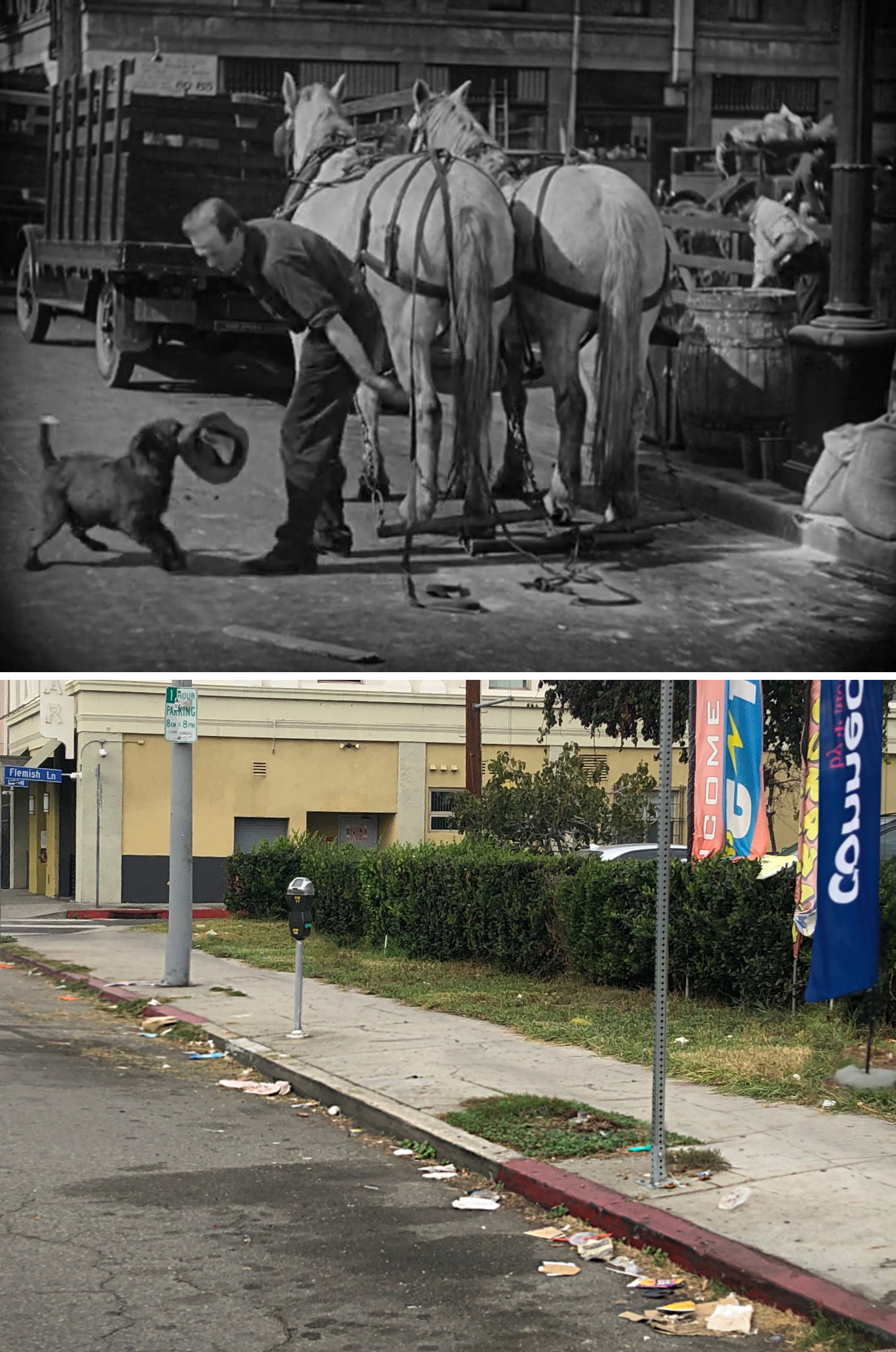
It goes without saying that John was the one who found the old stable in Los Angeles. How he was able to find it still amazes me, but I believe it was old satellite photos that helped him get there.
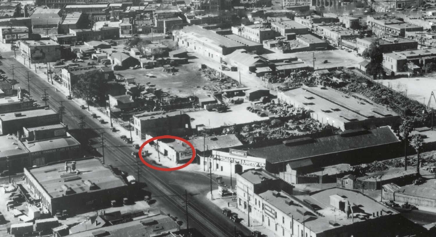
Back in the 1920s, Los Angeles had dozens of horse and mule stables east of downtown, especially near the former Chinatown neighborhood. Nearly all of the structures in the above photo were demolished to make way for the Union Passenger Terminal, which opened in 1939. The red oval marks the stables from the movie, whose entire block got flattened to make way for the 101 freeway.
Since most of the streets in that area are now gone or altered, I had to use a couple vintage maps to figure out the exact spot of William N. Snowden’s stables (within a fifty feet or so).
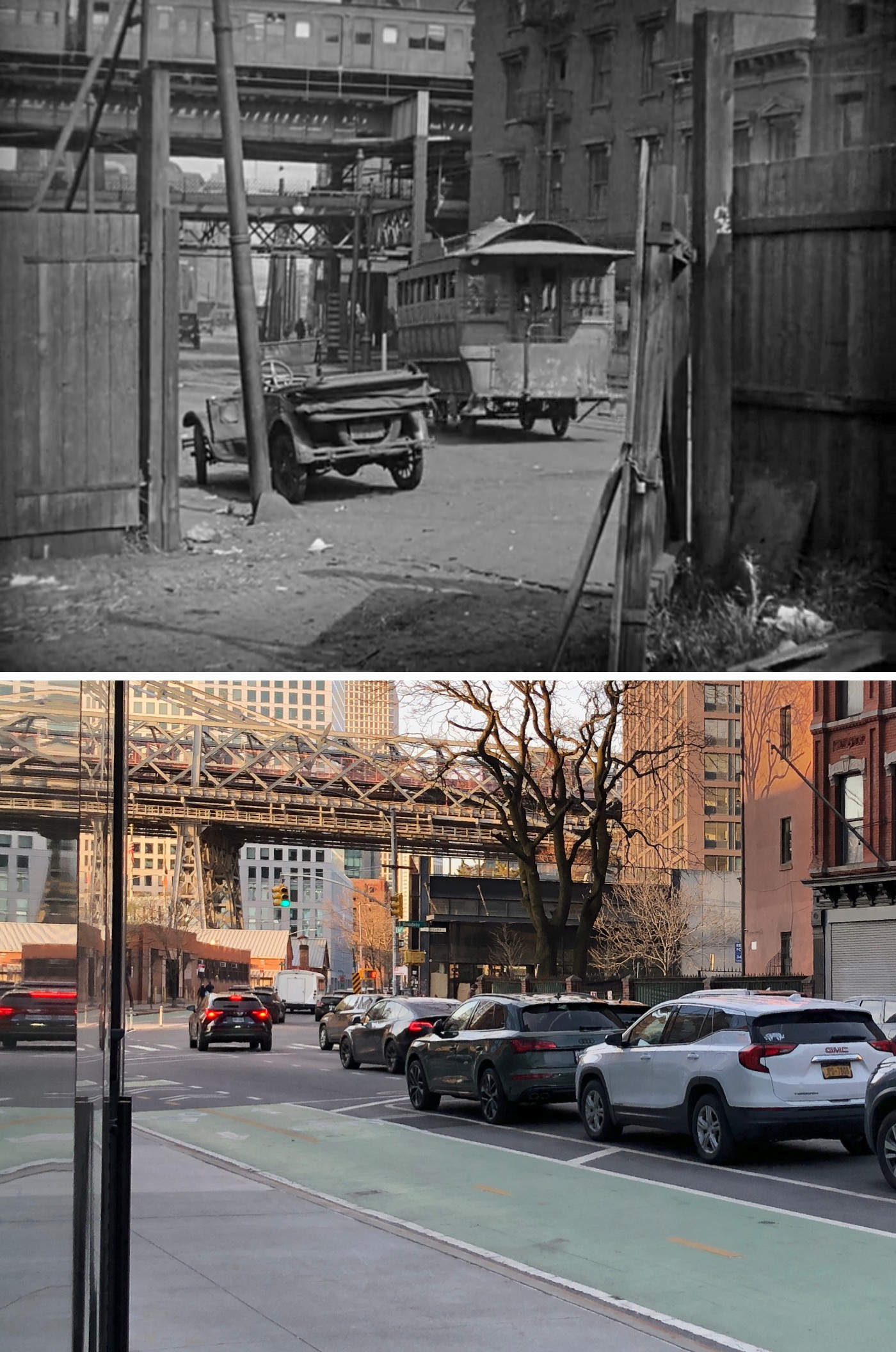
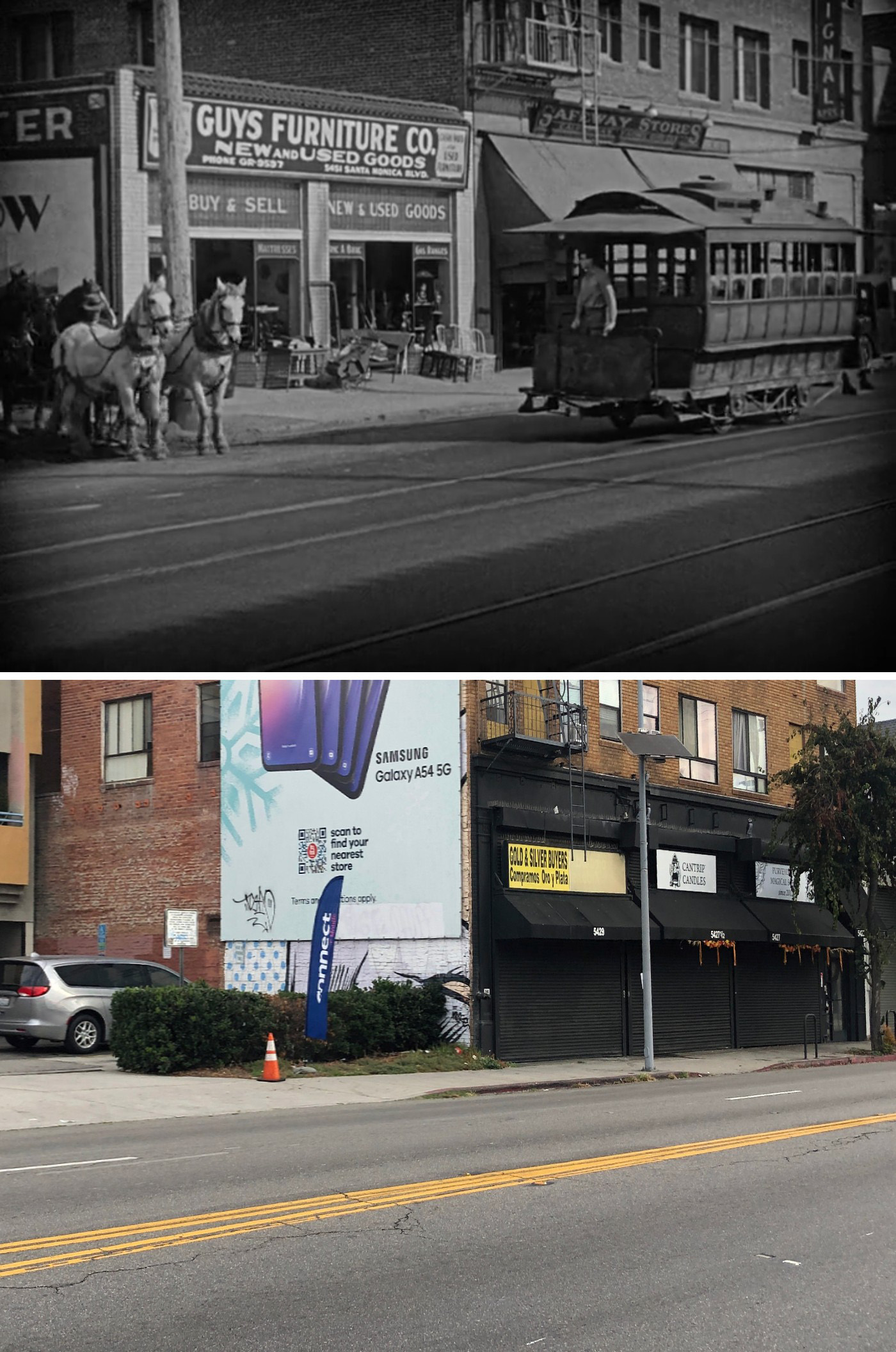
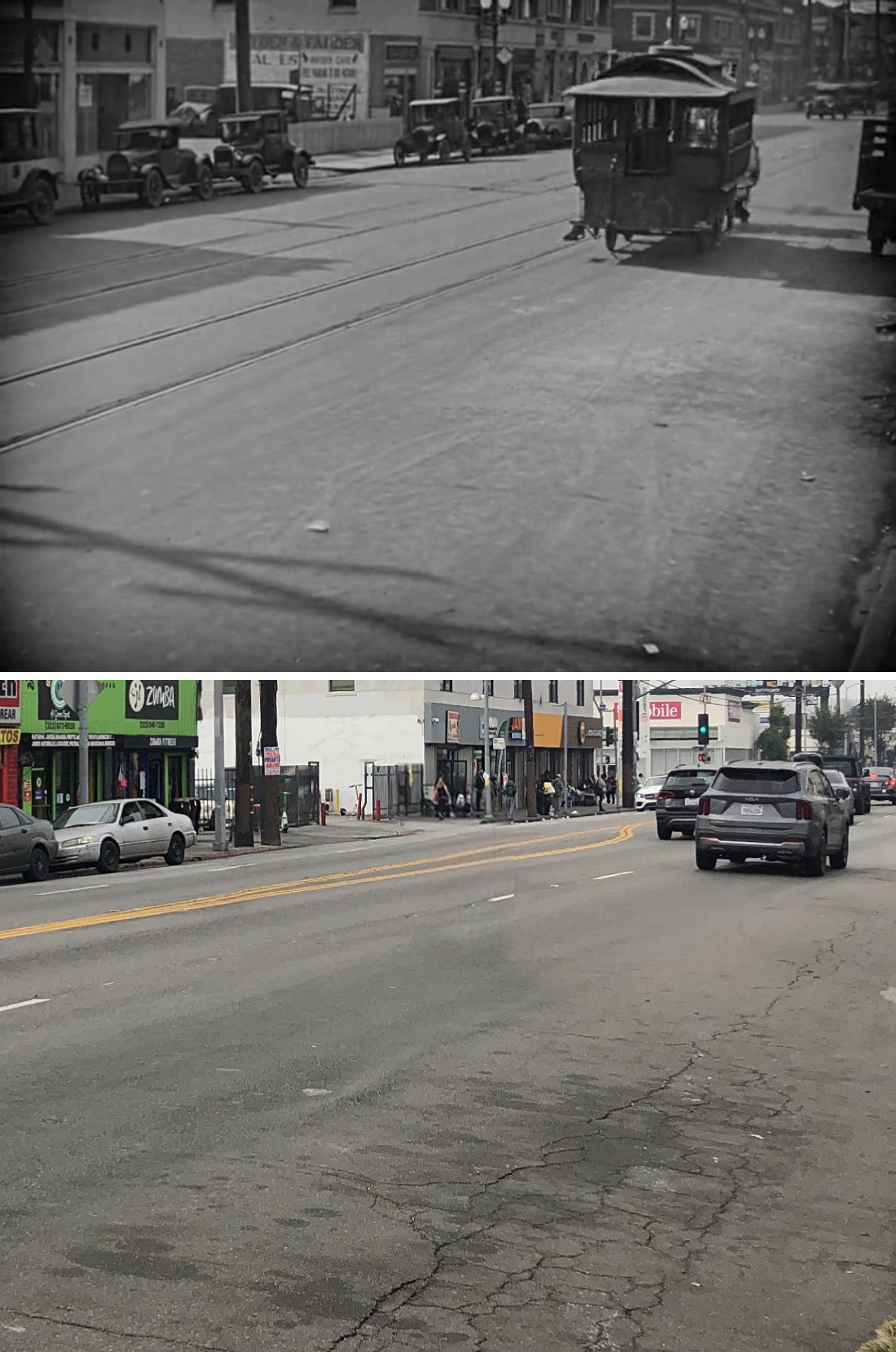
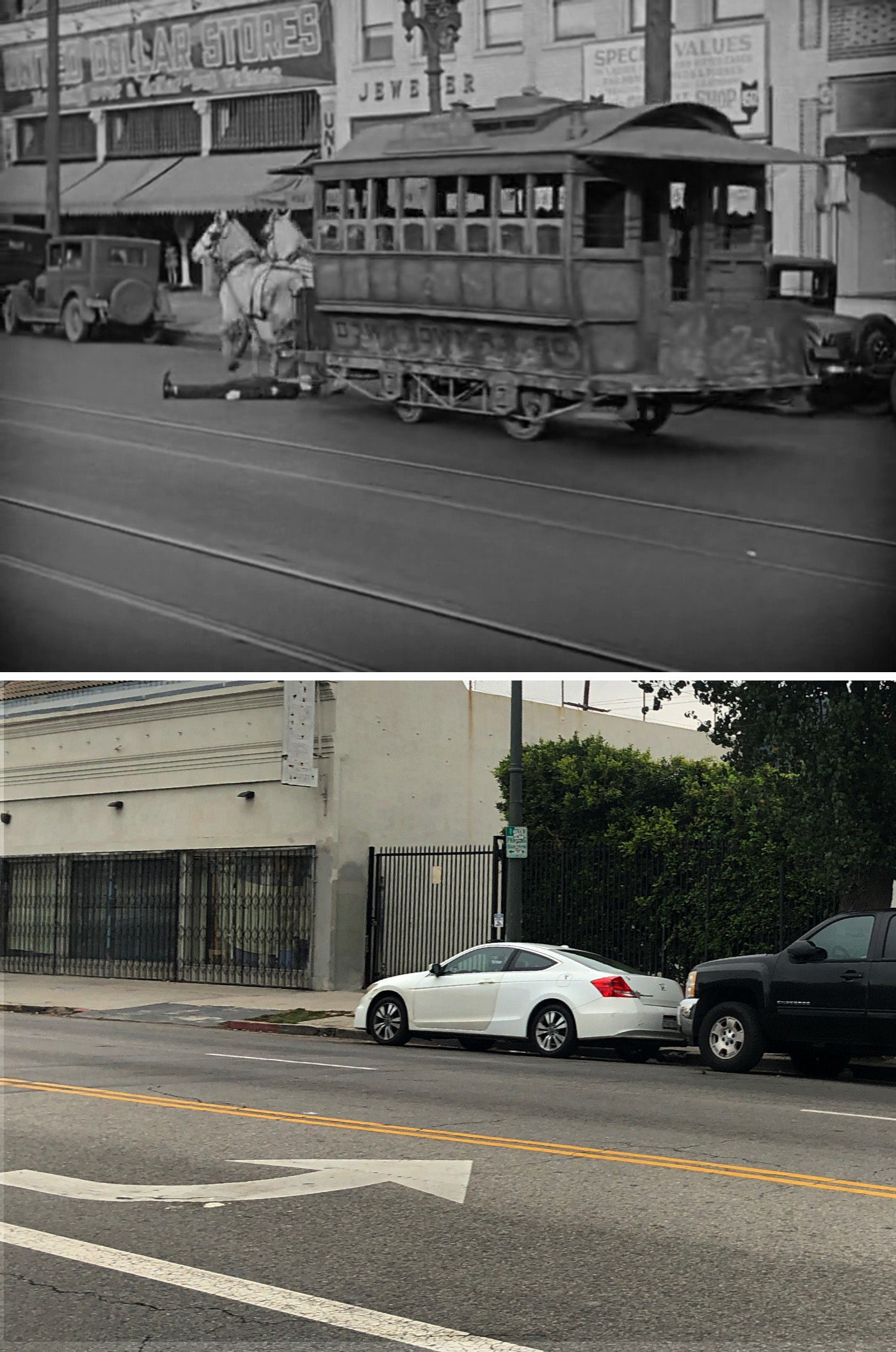
The location of the trolley “bumping” gag was one of the last things I figured out for this movie.
It ended up being easier to find than I thought it’d be. The big clue was the power supply tower (indicated with arrows in the image below) which I suspected was from the railway bridge on Randall’s Island. That would place the action near the East River somewhere between 100th-120th streets.
Since there were trolley tracks on the cross-street, I figured it was probably a wider, two-way street, so I went to 106th first, then 116th and almost immediately spotted matching elements.
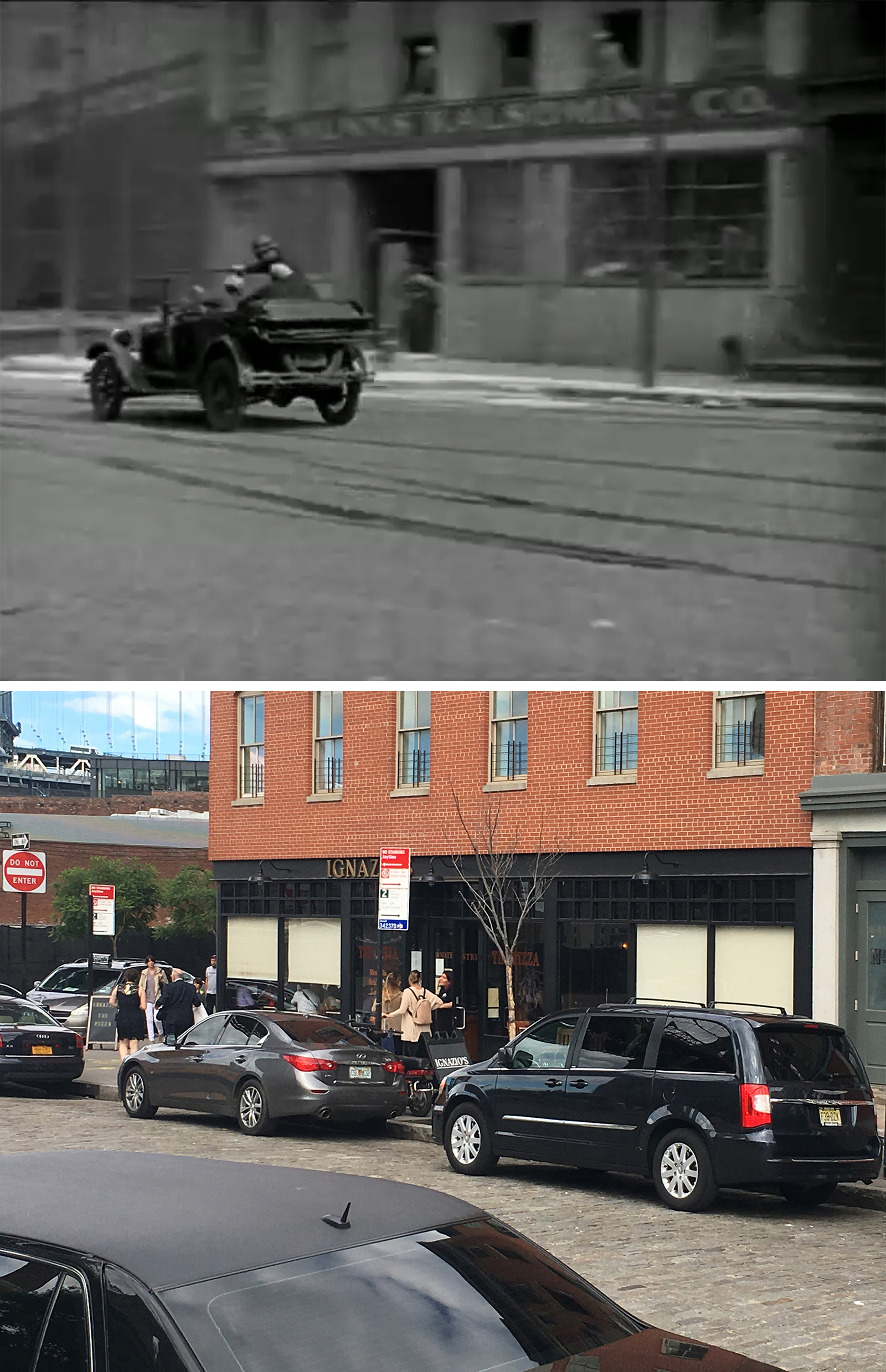
Towing the Horsecar
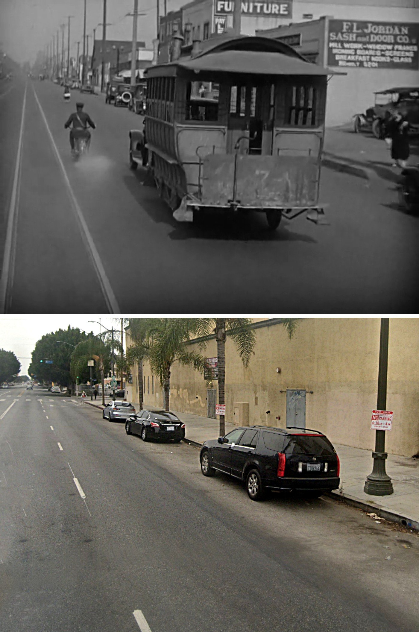
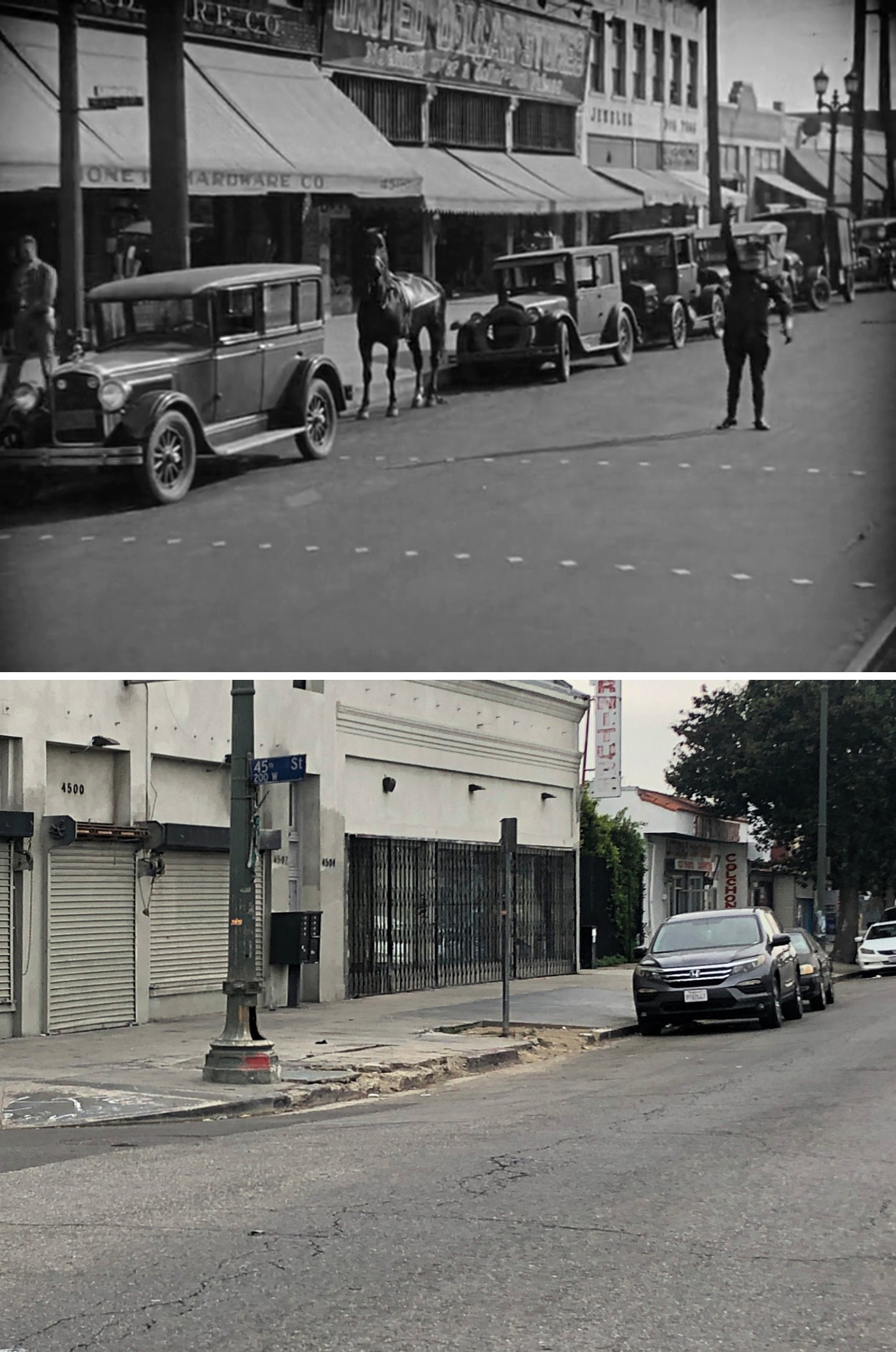
Ironically, all the New York footage was found by John Bengtson, while the one Los Angeles location was found by me.
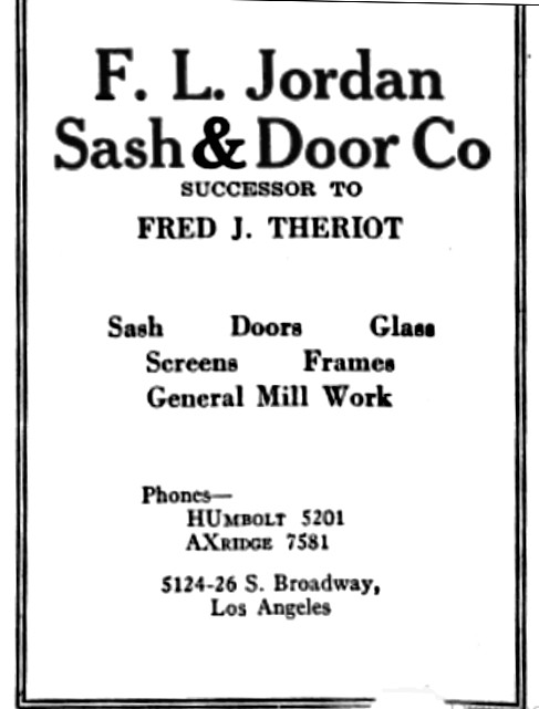
I found it by simply looking up the address of FL Jordan Sash & Door Company, whose large sign can be seen on the side of a building. I found multiple sources placing the business at 5124-26 S Broadway.
The block has been completely redone since 1927 and no matching buildings remain today. And so far, I haven’t been able to find any vintage photos of anything in that area. But I’m still pretty confident it’s the right place.
Obviously, a contemporaneous ad with an address is good proof, but the fact Lloyd shot other stuff on this same stretch of S Broadway was the big convincer for me.
Getting New Horses
Once again, John found this Hollywood location back in the 2000s for his Harold Lloyd book.
What’s wonderful is that many of the buildings that appear in this scene are still standing today. Having followed Bengtson’s blog and read all three of his books, I know how rare it is for a Los Angeles location from the silent era to have retained any of the elements that appeared on film.
Sure, things have been modernized and the denizens look dramatically different, but when I was at this location, I couldn’t help but feel an eerie connection to the 1920s.
Finding a Mannequin Cop
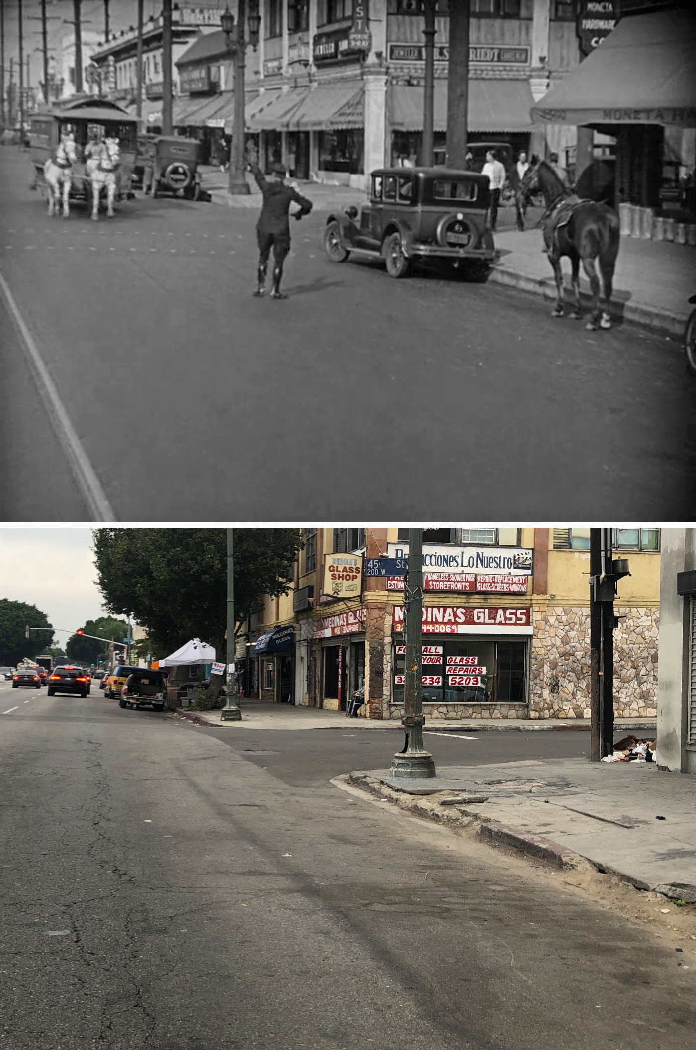
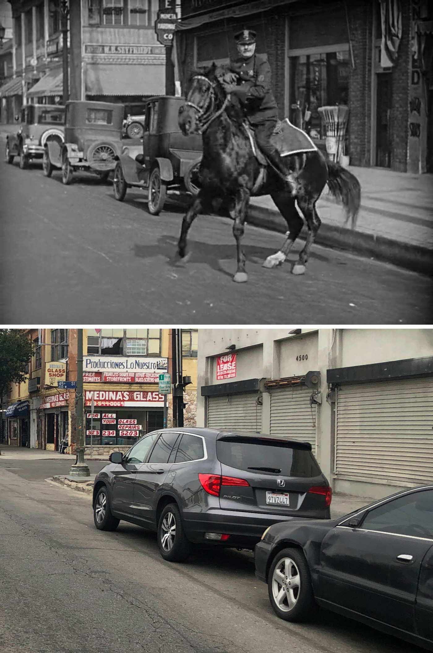
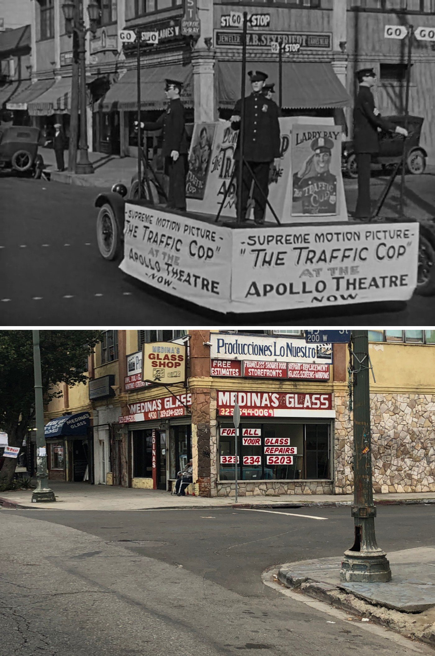
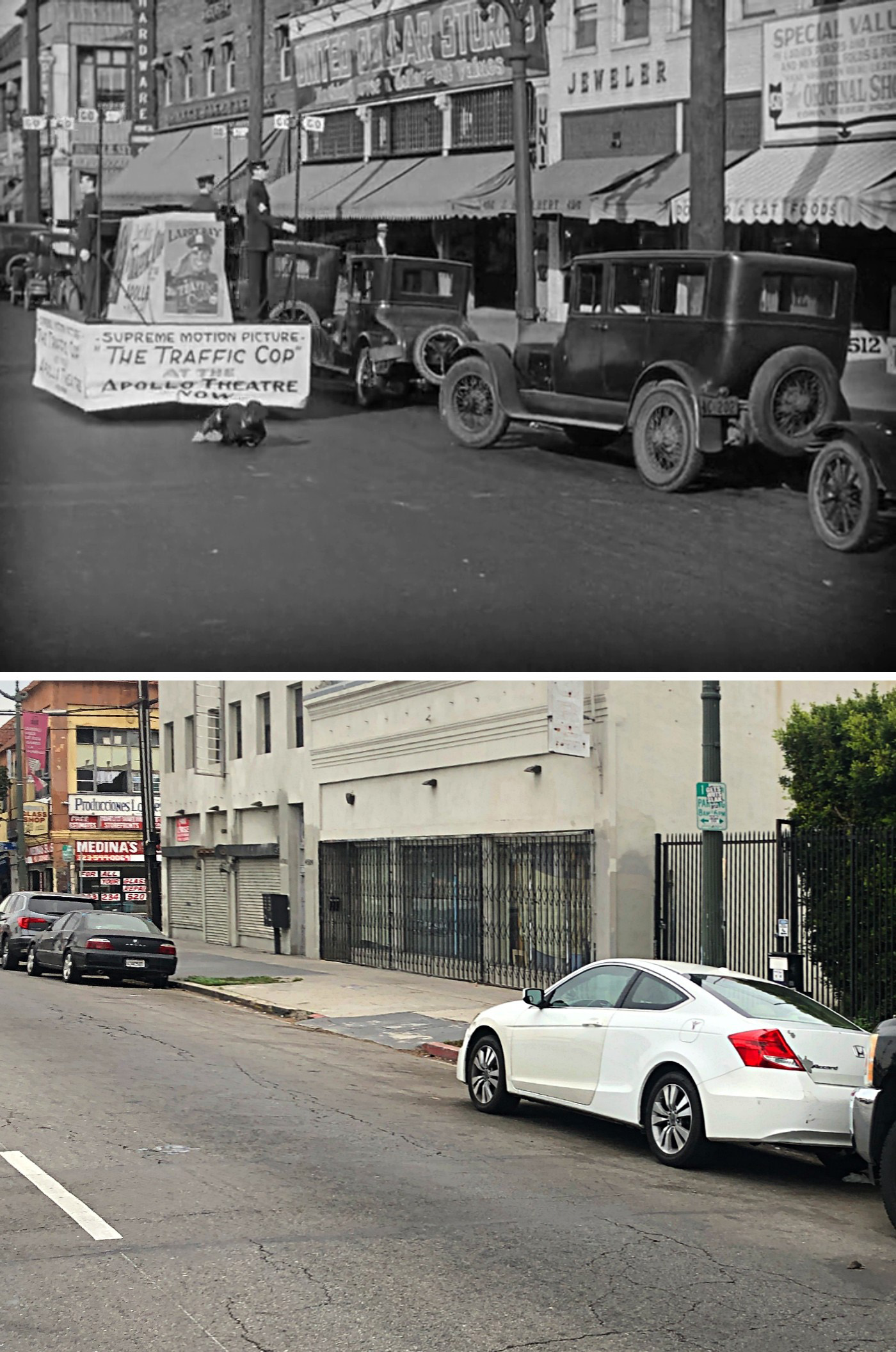
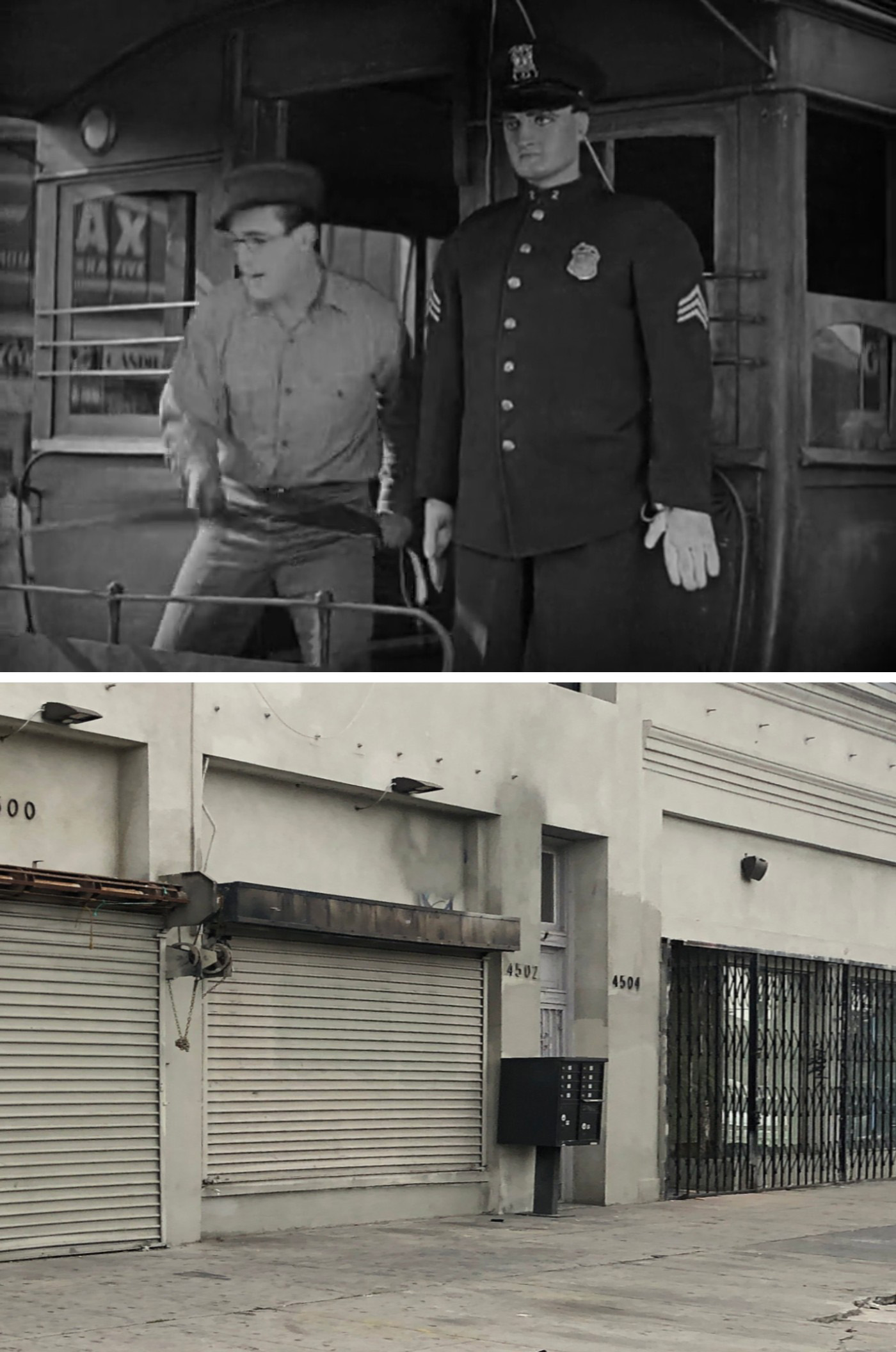
Like the previous scene, John found most of these filming locations years ago.
Once again, it’s cool to see that three prominent buildings featured in this sequence are still around. And what’s fascinating is how Lloyd kept filming in front of those same three buildings throughout this sequence, but by using different angles, made it look like different locations.
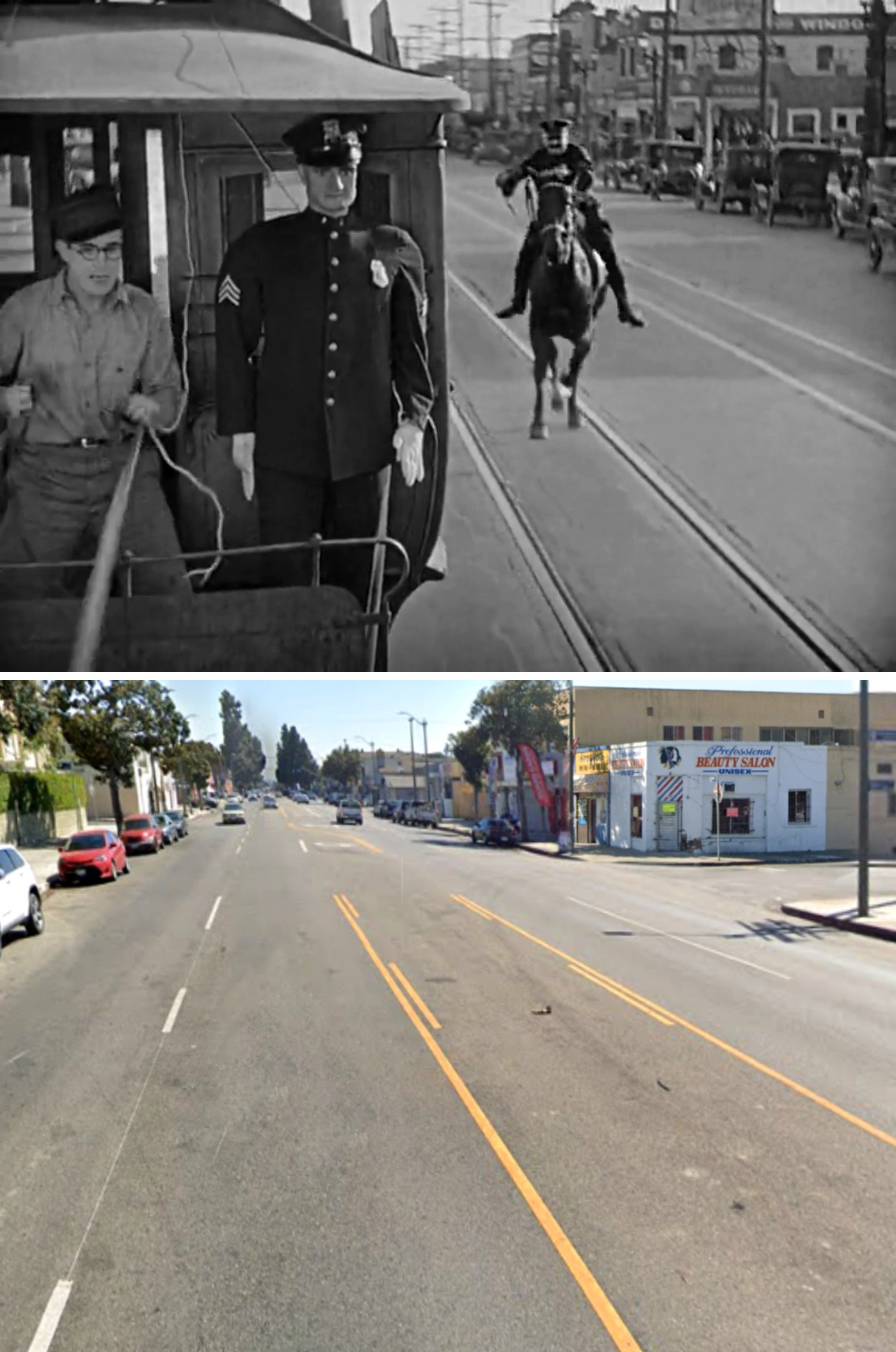
The only thing that was shot elsewhere was the part where the mounted police officer salutes the mannequin on the trolley. This also happened to be the only thing John hadn’t identified in his book.
The close-up was thankfully just a block away from where most of the action took place, making it fairly easy to find. But I could tell the wider shot of the mounted cop approaching the trolley was filmed somewhere else.
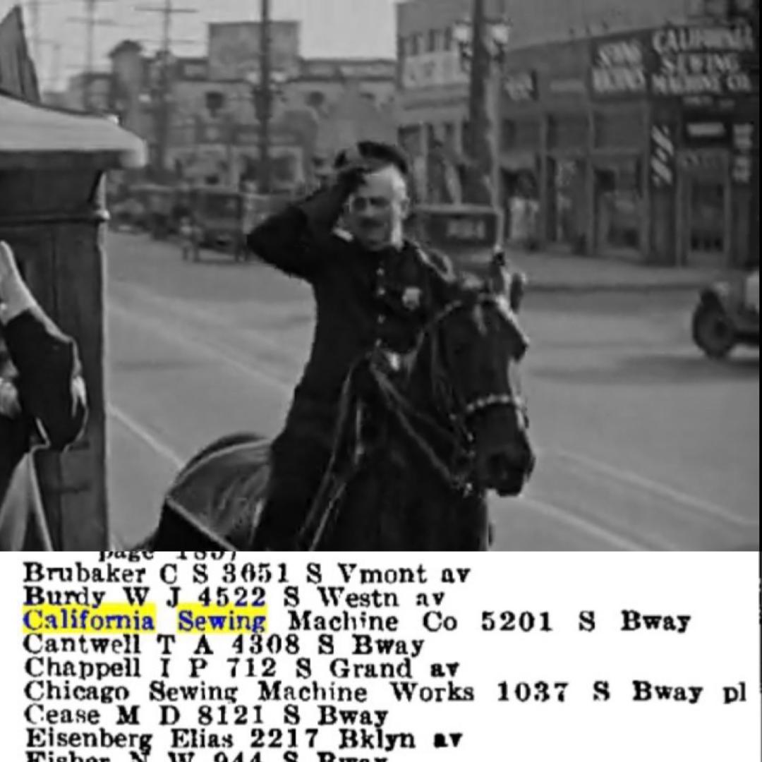
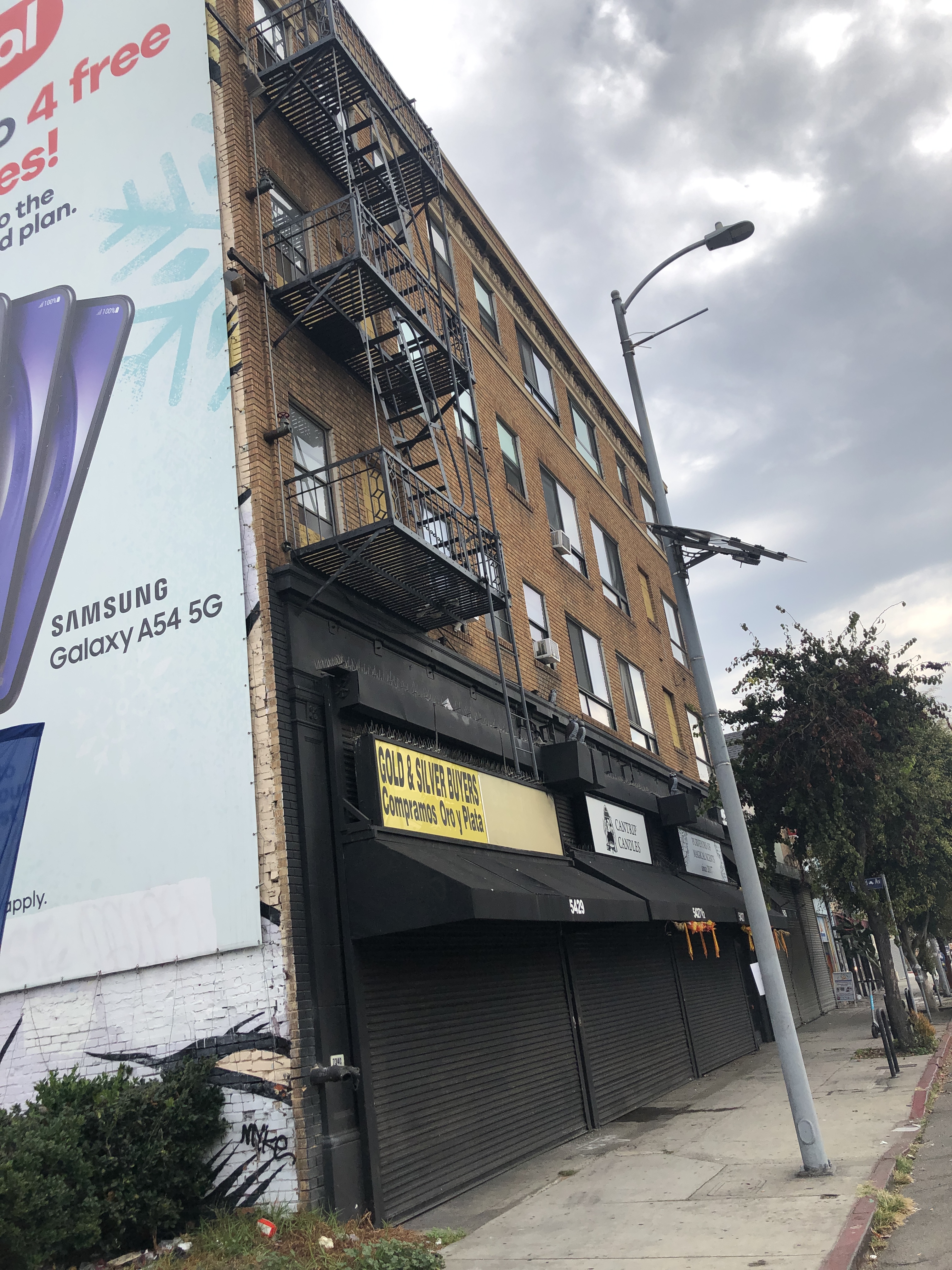
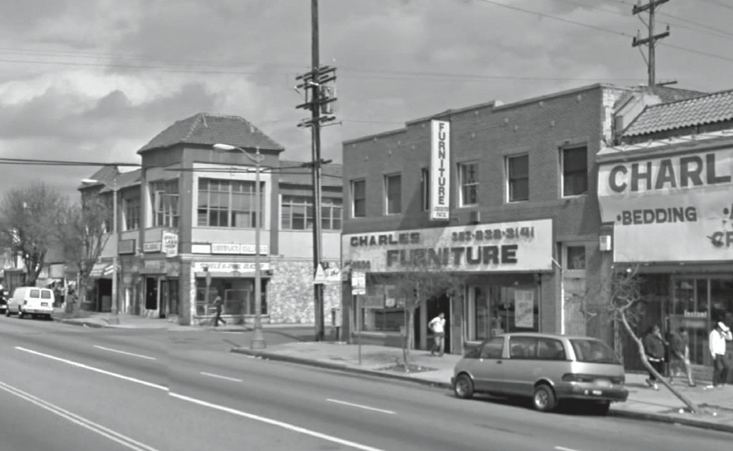
That’s when Blakeslee stepped in and helped me find that location. He did it by spotting a sign for California Sewing Machine Company (a sign that ruins the illusion we’re in NYC) and looking up its address in a 1930 trade magazine. As it happens, the sewing shop was basically across the street from the FL Jordan Sash & Door Company, which was featured in a previous scene.
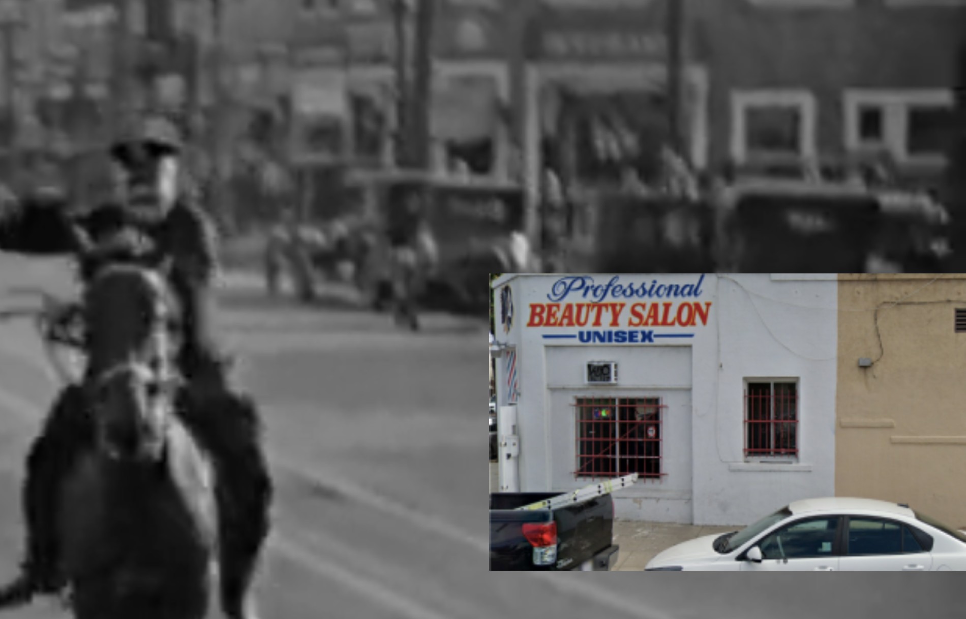
I was able to verify his findings by matching up an extant building on the corner of 53rd Place. Built in 1908, the one-story building is currently a beauty salon, and even though some of the windows have been bricked in, you can clearly see a matching pattern.
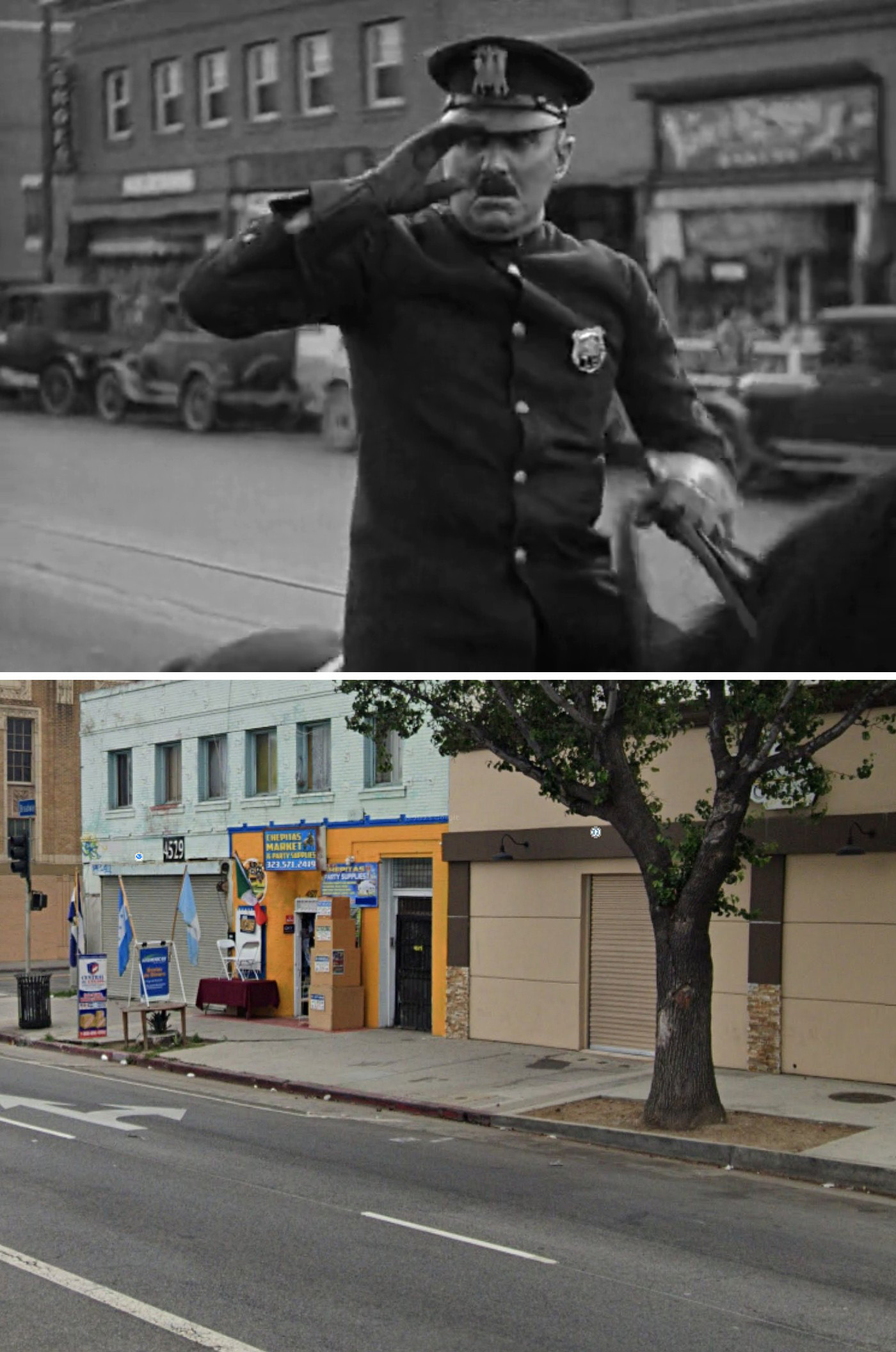
A Saluting Mannequin
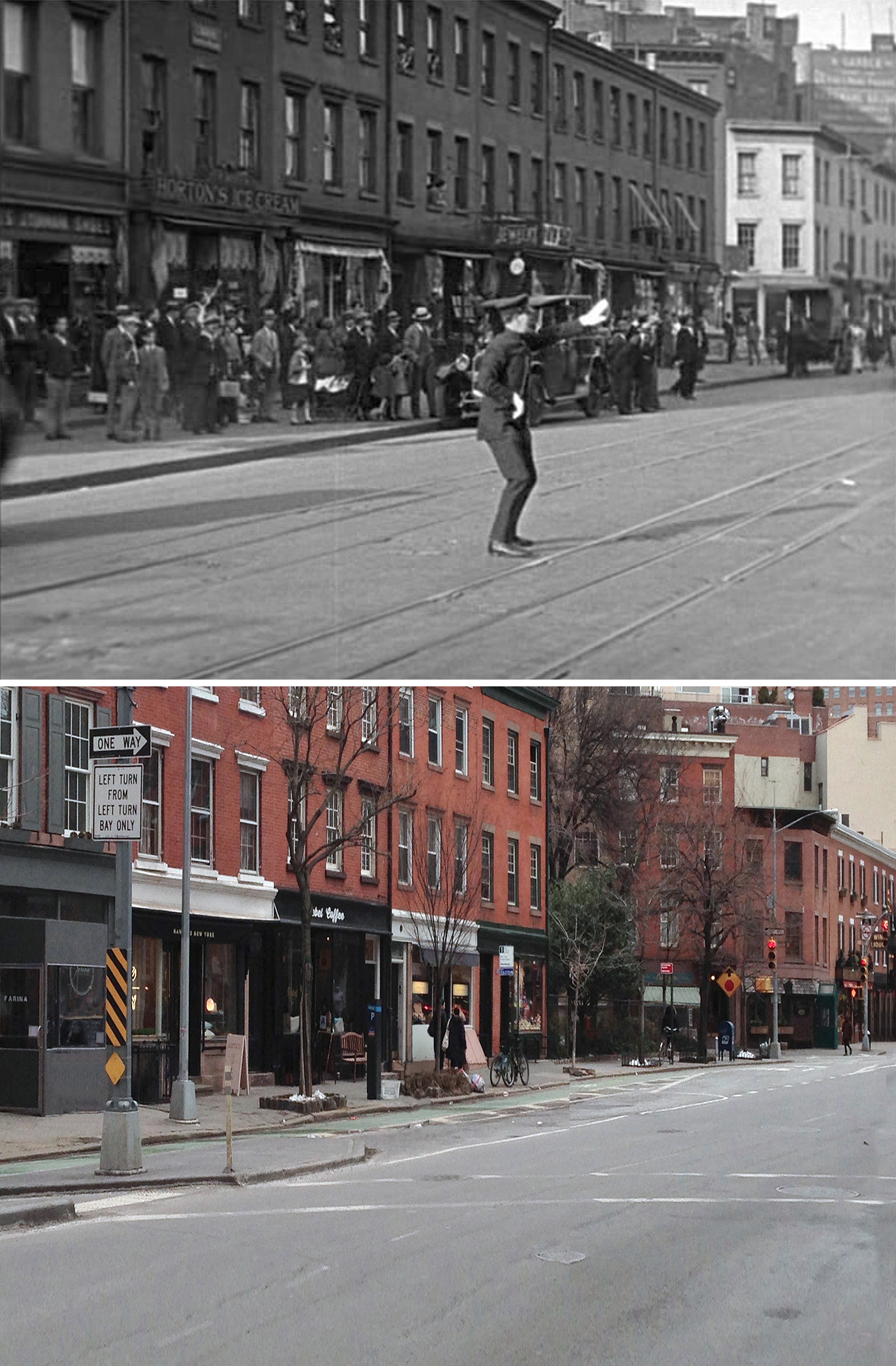
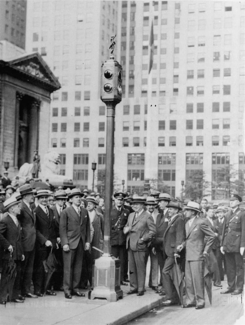
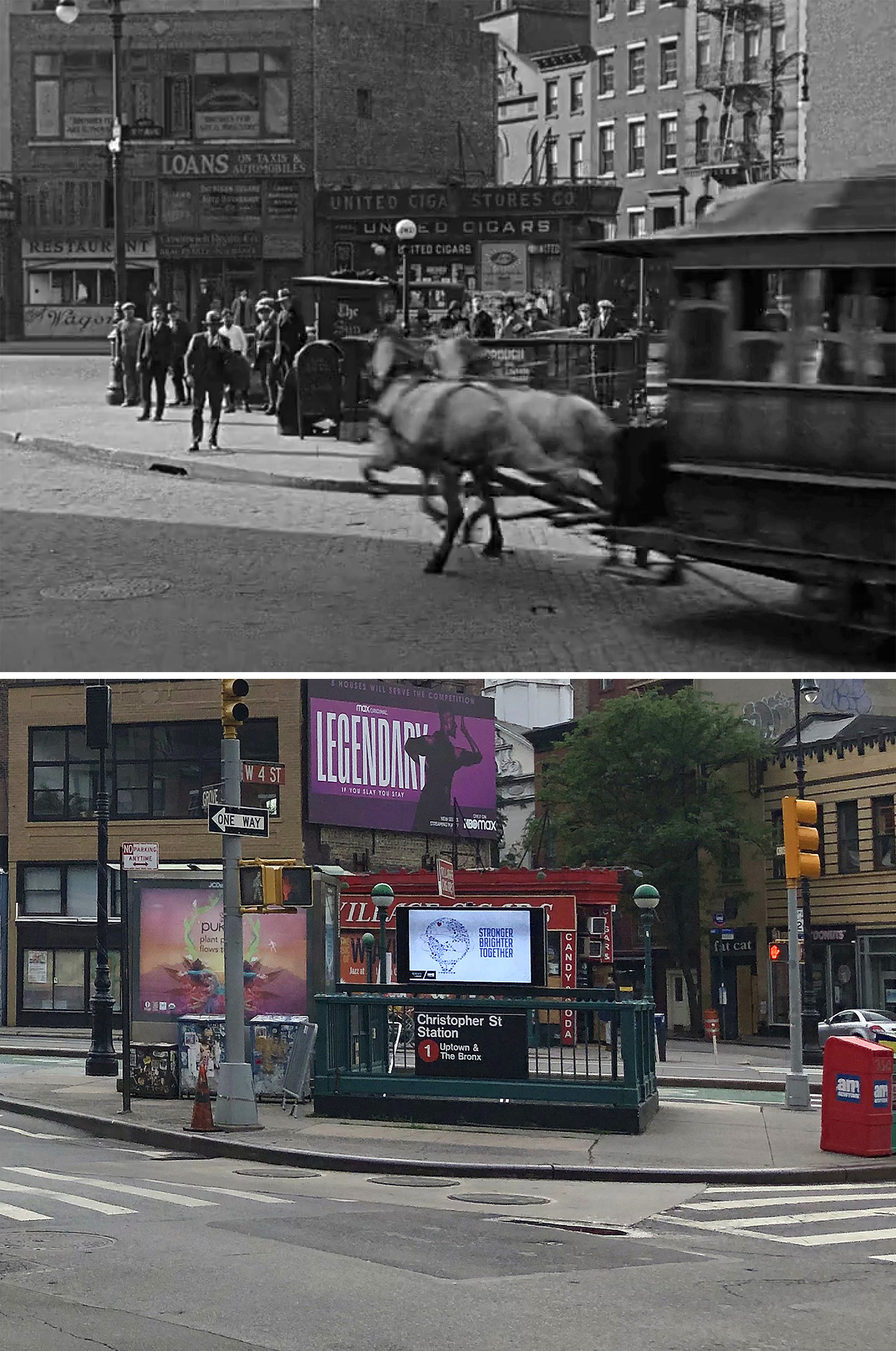
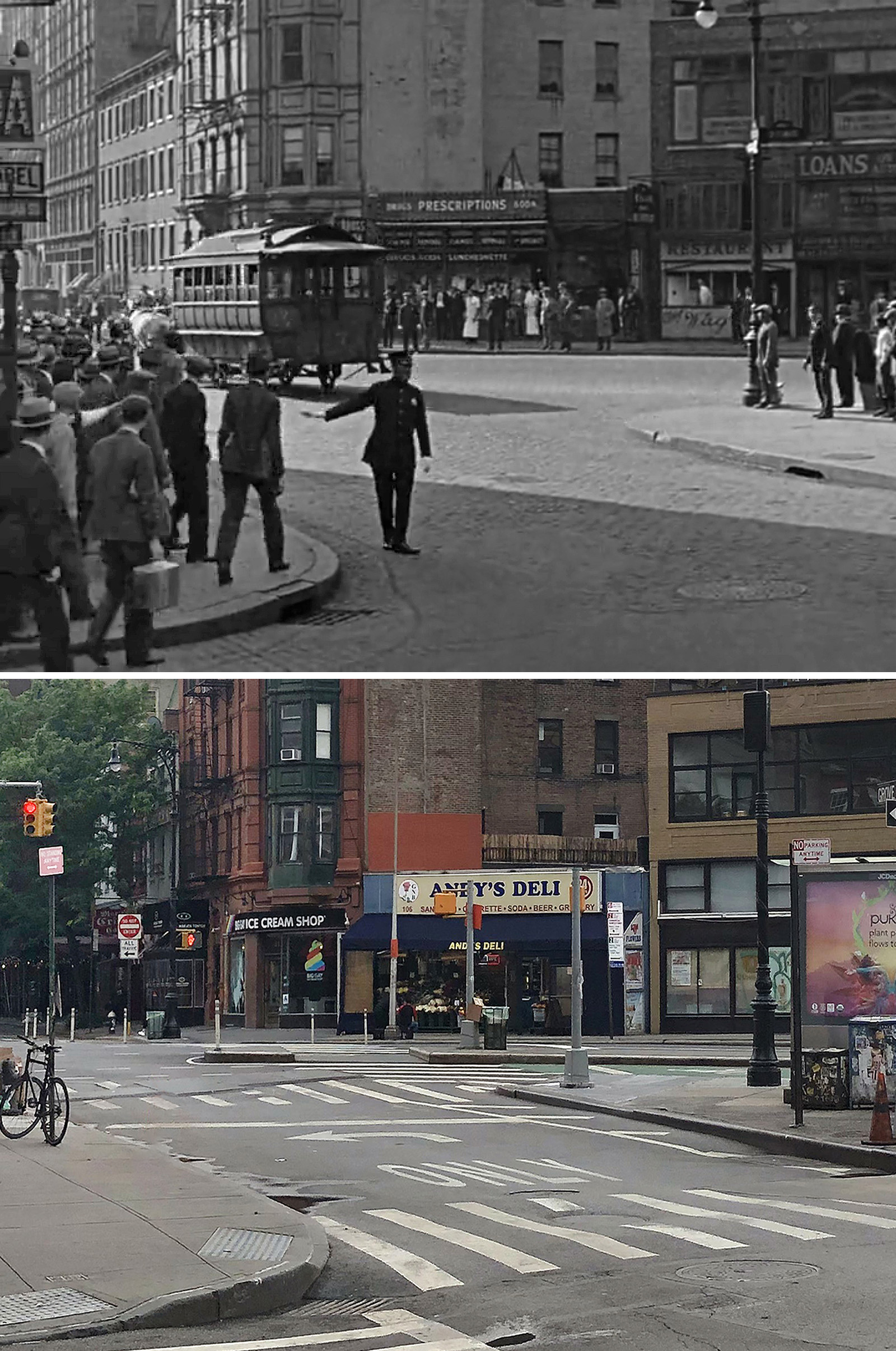
Almost all of these locations were found by John for his 2011 book. He found the first spot after reading an interview with Lloyd where he stated they filmed scenes near Sheridan Square in the Village. So he just looked around the area on Google Street View, focusing on streets that used to have trolley tracks.
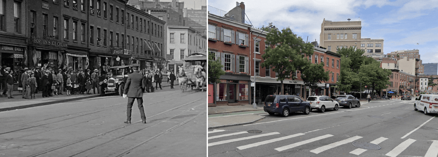
The search was probably made easy since most of the residential buildings pictured in the movie are still around today. The only ones missing are the corner buildings (rectangle in above image) near Jane Street. They were demolished some time ago and replaced with a tree-filled pocket park
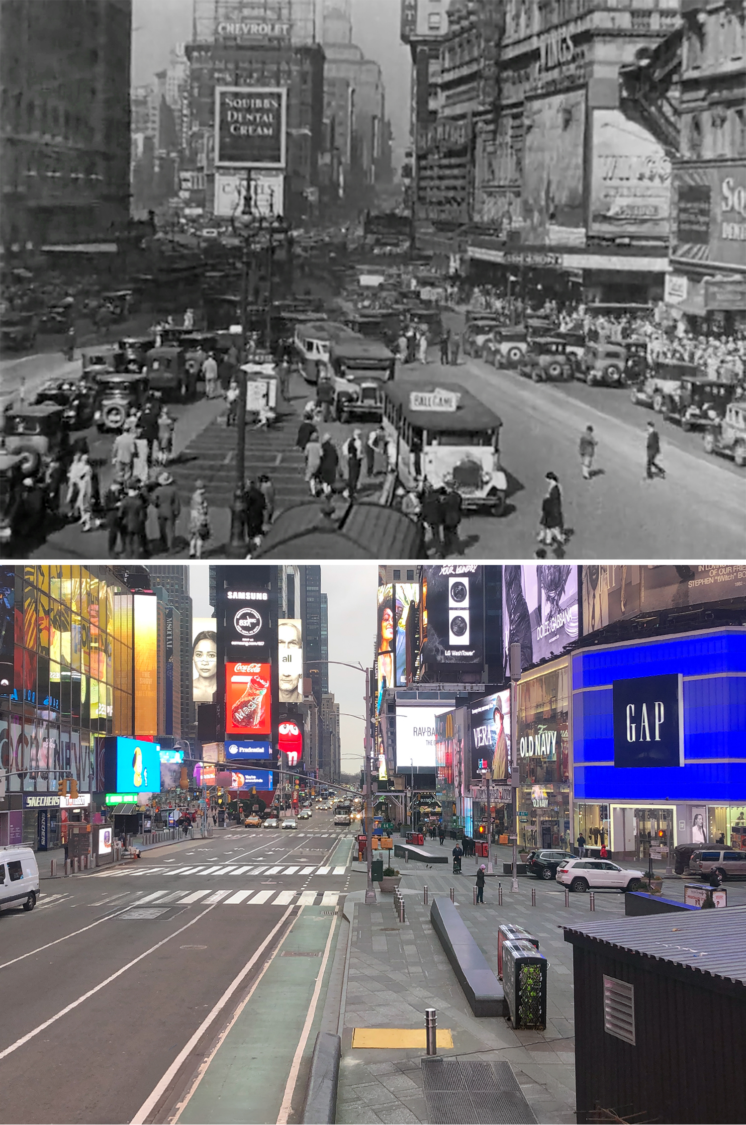
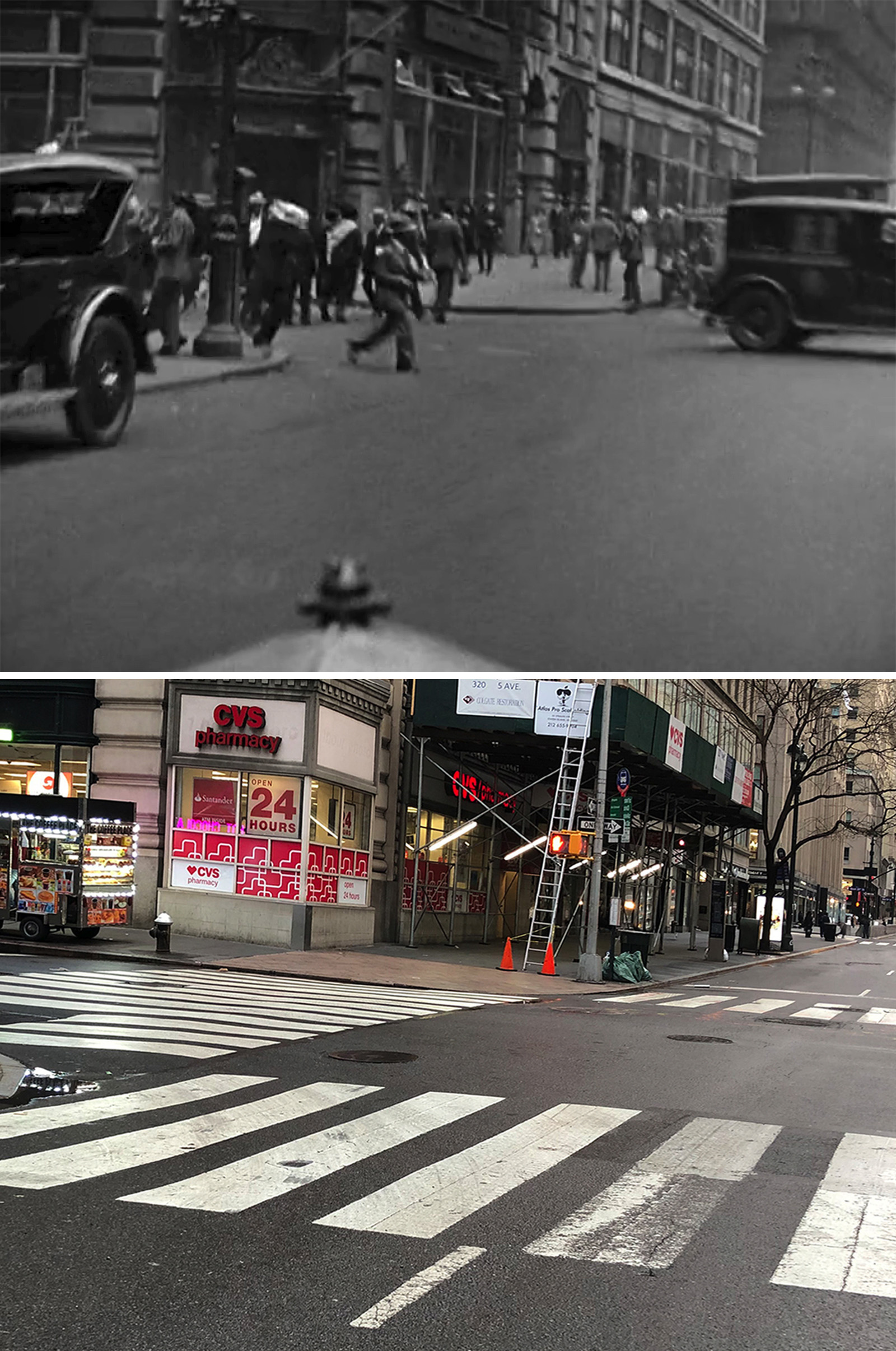
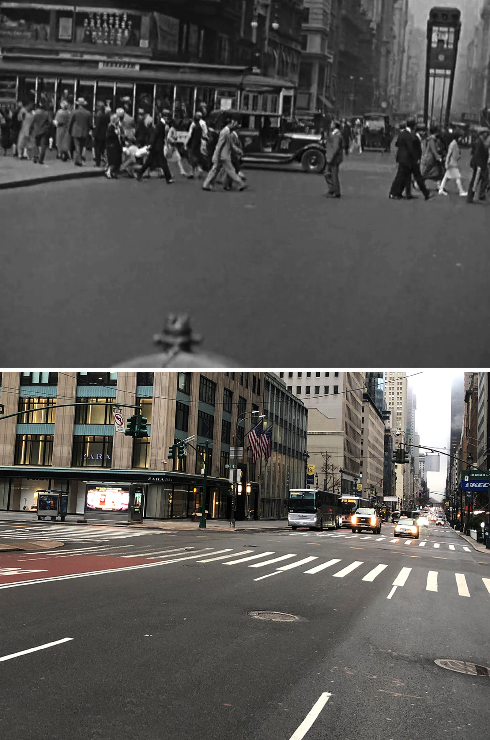
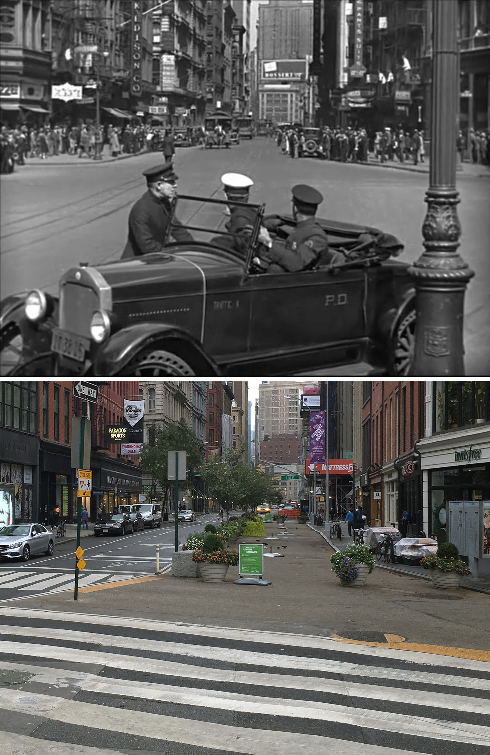
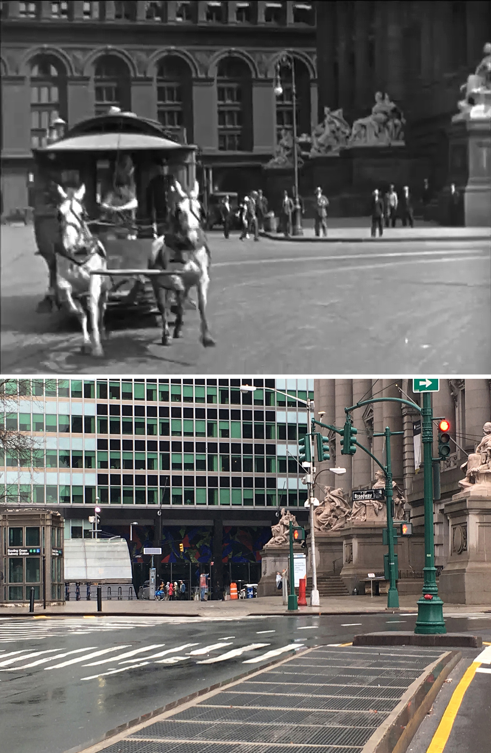
The Times Square shot was a pretty obvious location to identify, but I remember being very impressed on how John was able to identify the Union Square location since it’s not as apparent.
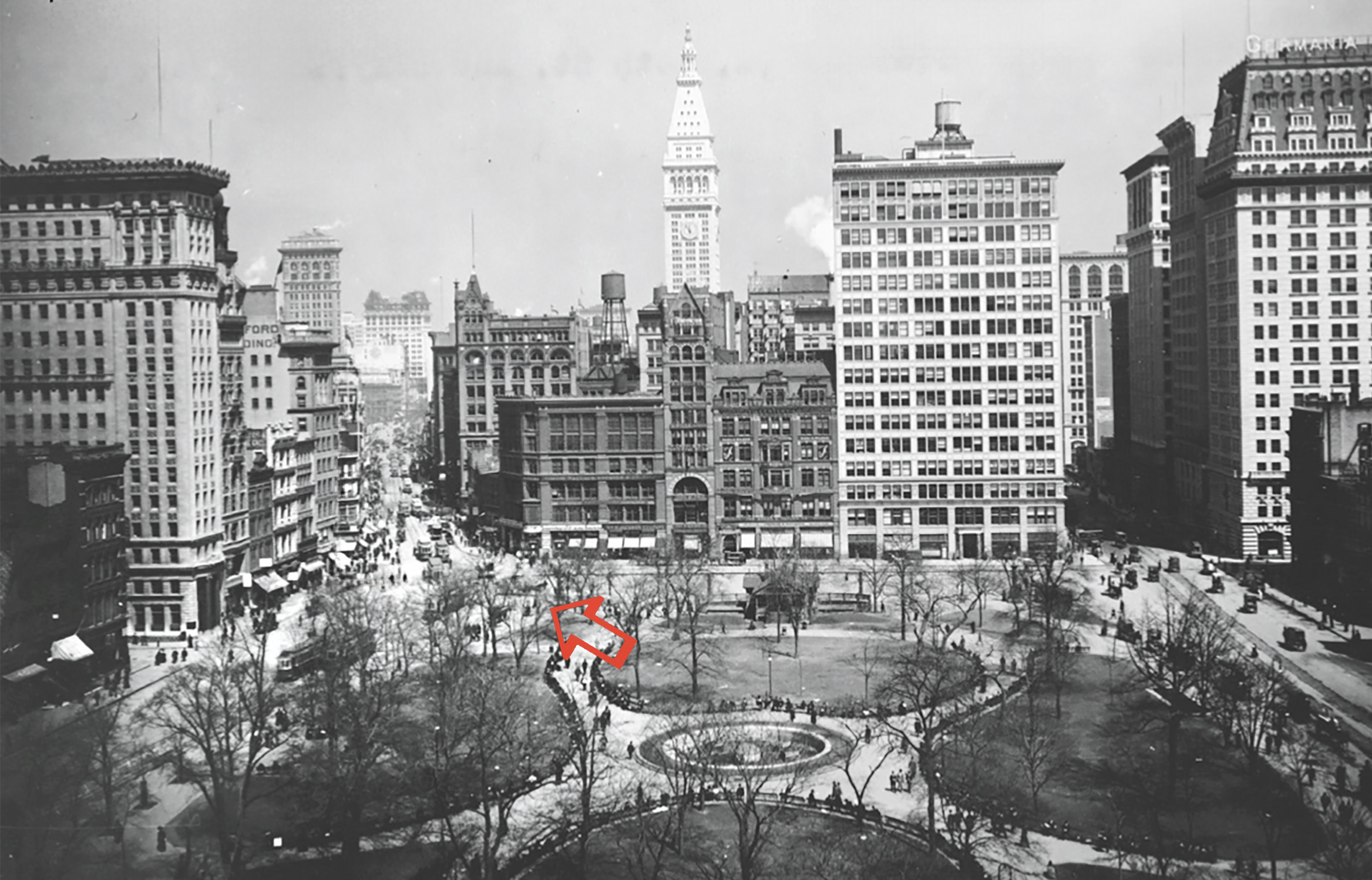
What got him there was the Worth Monument at 25th Street and Broadway, which you can see in the far distance in the movie.
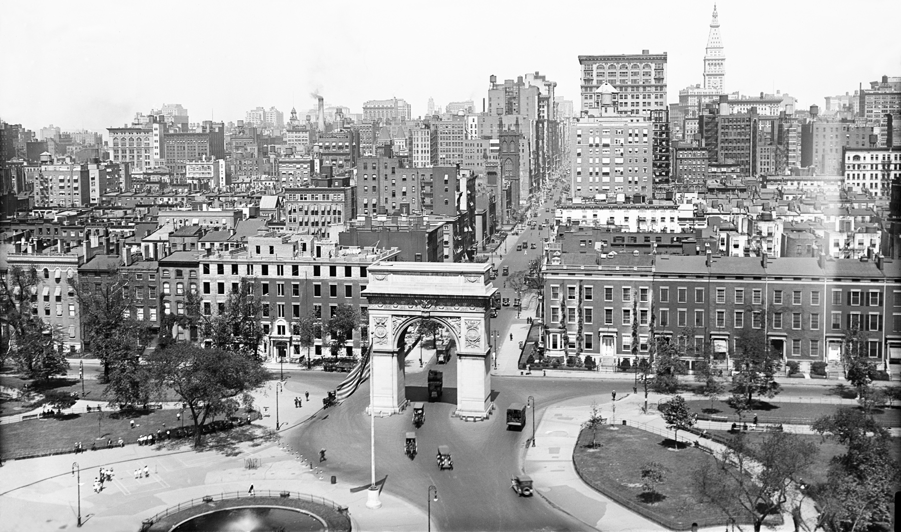
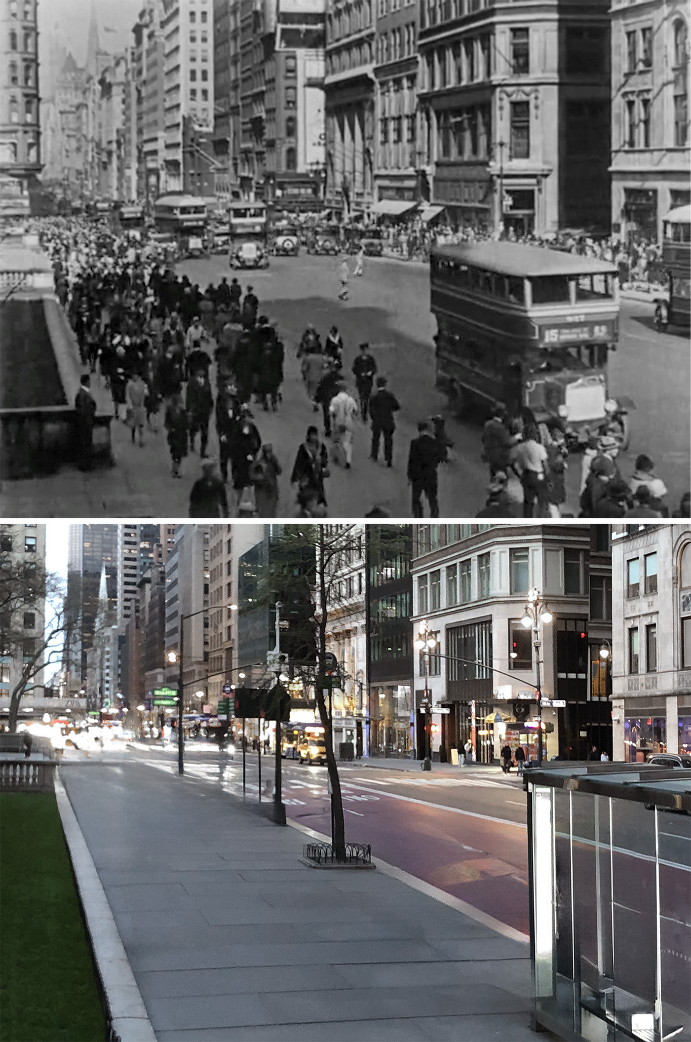
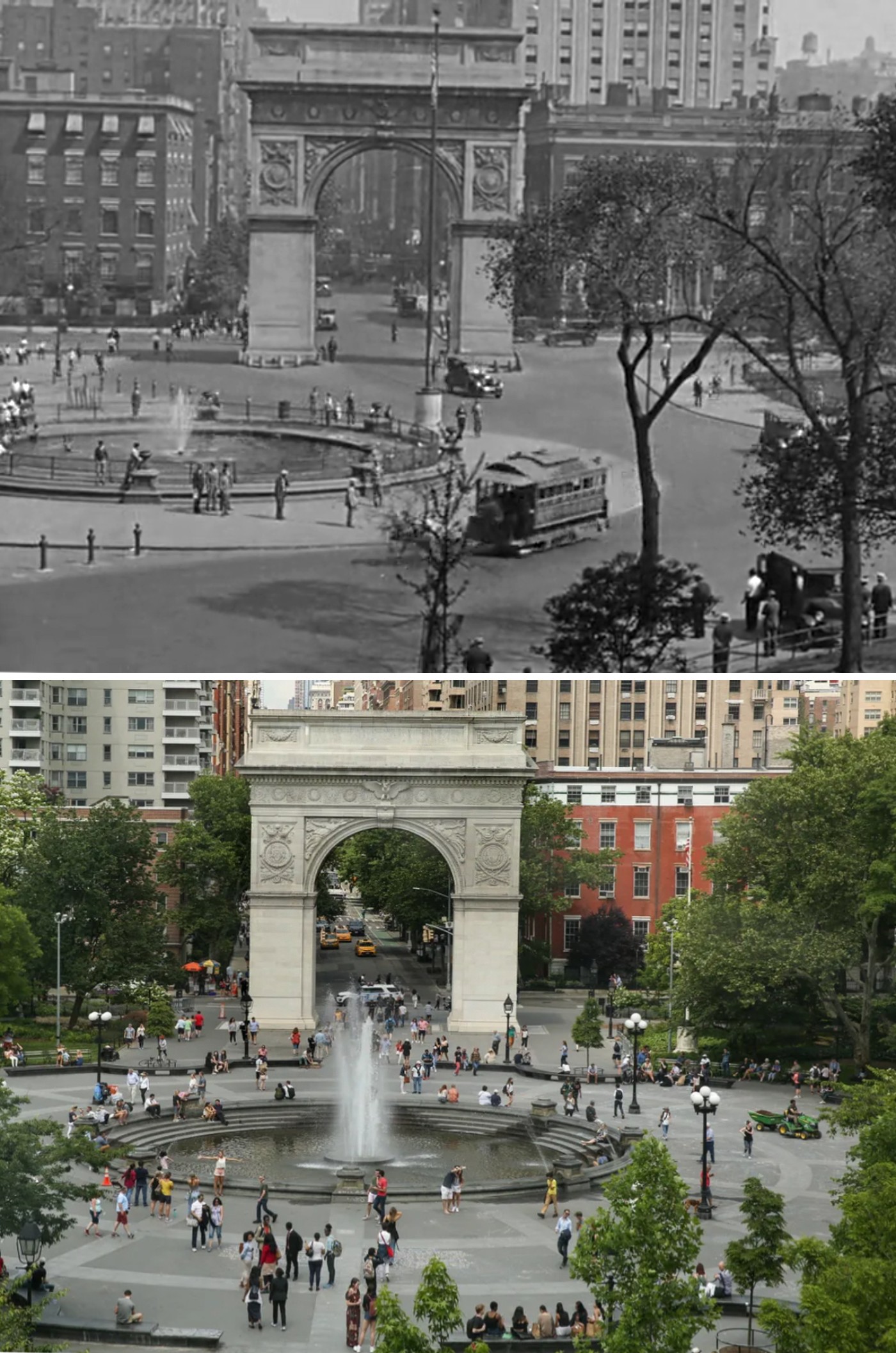
The Washington Square Park shot was another obvious location, especially with his large iconic Arch at the north end. What’s cool about that shot is that it shows how auto traffic used to flow directly through the park, traveling from Fifth Avenue to West Broadway (now named LaGuardia Place). It remained a busy thoroughfare for decades, until local activists who were campaigning against Robert Moses’ proposed four-lane highway through the park, got the city to officially close it to all traffic by 1959.
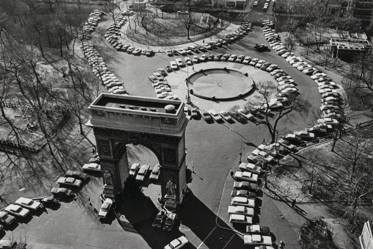
Frustratingly, shortly after that, Washington Square Park was essentially turned into Washington Square Parking Lot. For the next ten years or so, the Greenwich Village park operated as a parking lot, until cars were finally banished altogether in the 1970s.
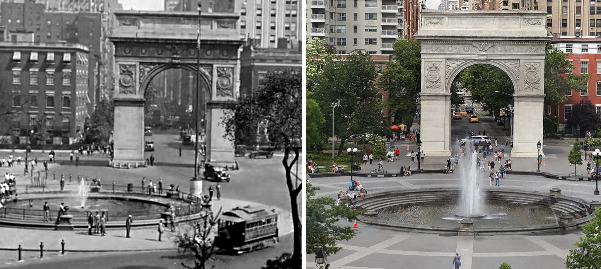
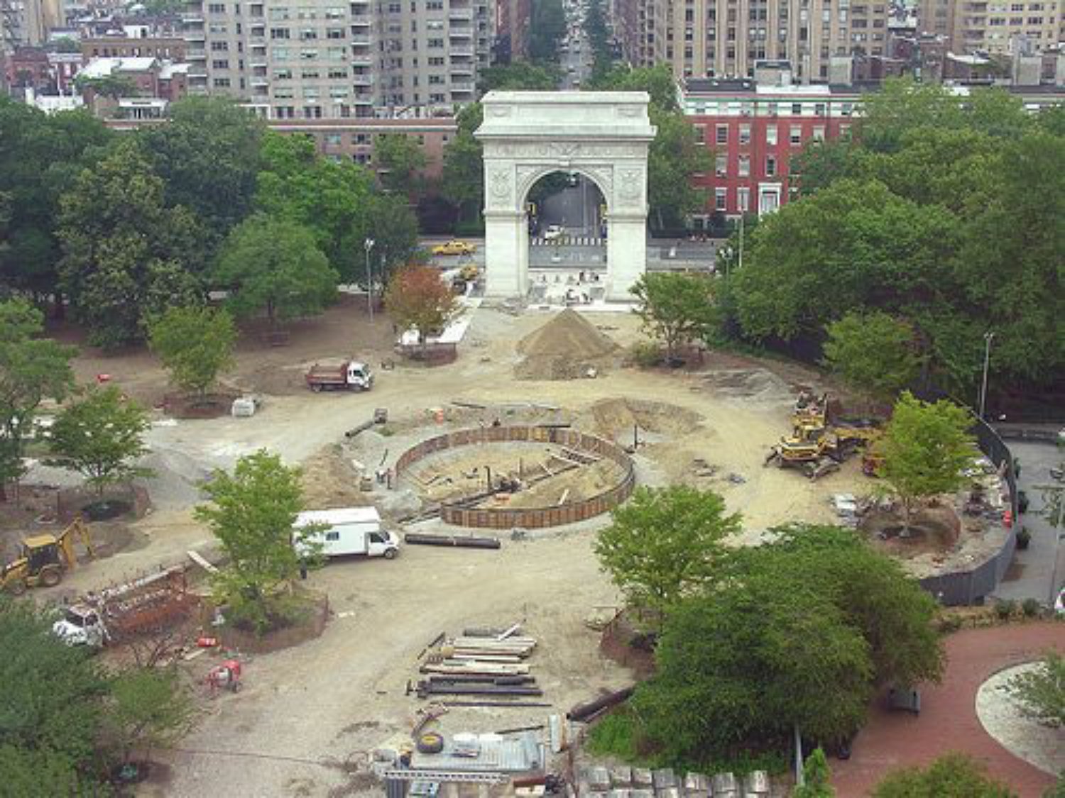
Another interesting thing you might’ve noticed in the “then/now” image of the park is the placement of the fountain. The original location of the fountain (as seen in the movie) was in the exact center of the park on its east-west axis. Then, after being situated there since 1871 —over 137 years— the fountain was moved 23 feet east to “align” with the Arch during the park’s controversial redesign in 2007-2014.
All of the locations from this sequence were found by John years ago, except for the one that appears in between Times Square and Union Square. It’s so fast, it’s easy to miss, and with the camera pointing downward, we don’t get to see much of the environs. However, there were a few clues.
You can sort of make out business signs on the left, but the ones I could read were too generic to go on (like “Hermanos Cigars” or “Chop Suey”). The one big clue was the large support posts in the background, which were most likely for an el train. In addition, the posts seemed to end about 100 feet from where the camera was placed, indicating that either the el tracks curved away, or they were at the end of the line.
After checking out a few spots where various el lines curved in Manhattan, I started leaning more towards the idea that we were looking at a terminus (especially since the posts seemed to stop mid-block). Right about that time, I noticed what looked like a theater marquee about ten feet in from where the posts stopped.
The marquee got me thinking about what elevated train terminuses looked like in the 1920s. Most of them were on the outskirts of the city and looked somewhat rural. But one place I thought might be more built up with retail shops and a theater was Astoria, Queens. So, I immediately zeroed in on the elevated N line which travels above 31st Street — a major Astoria thoroughfare that I knew had several movie theaters on it for most of the 20th century.
After checking out the N train’s last stop at Ditmars Blvd in Google Street View, I could see a few promising leads.
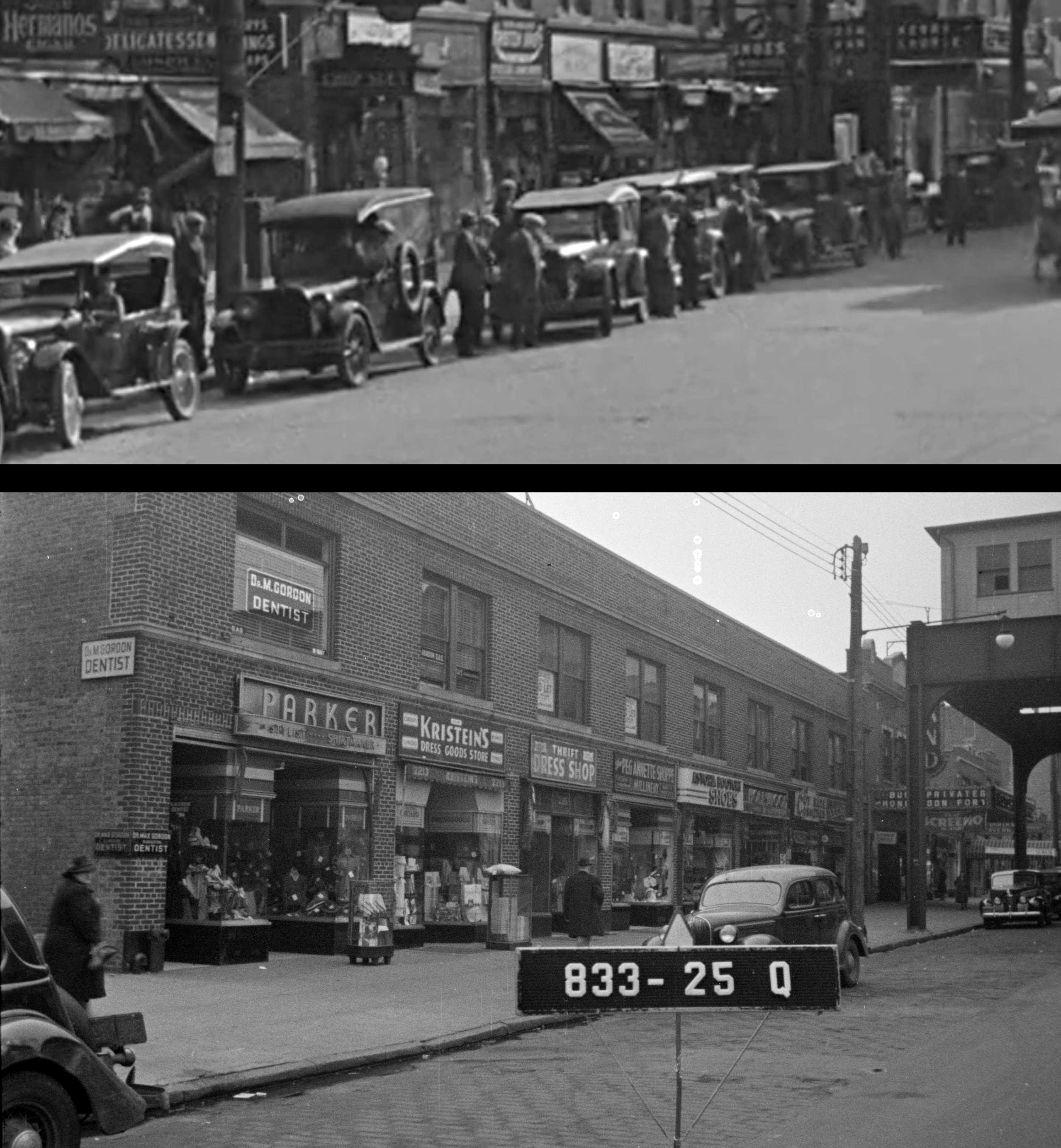
I then pulled a circa 1940 tax photo of the street and saw a few more promising things, including a theater marque that seemed to be the same shape and in the same spot as the one in the movie. Even though all of the retail signs had since changed since 1927, I thought the windows above the shops looked the same. A few other windows from another tax pic taken between the movie theater and the subway station also seemed to line up nicely.
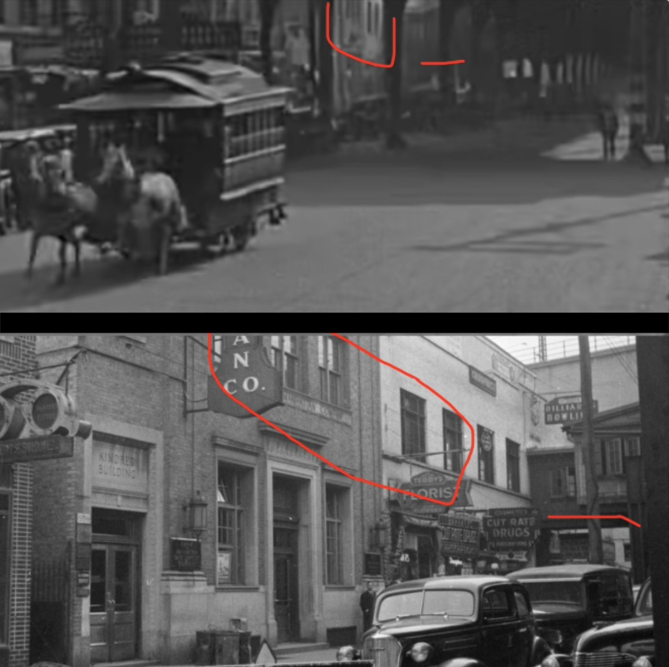
I was quickly becoming convinced I nabbed the right spot. Even the support posts, when viewed from the same angle as the movie, created the same pattern.
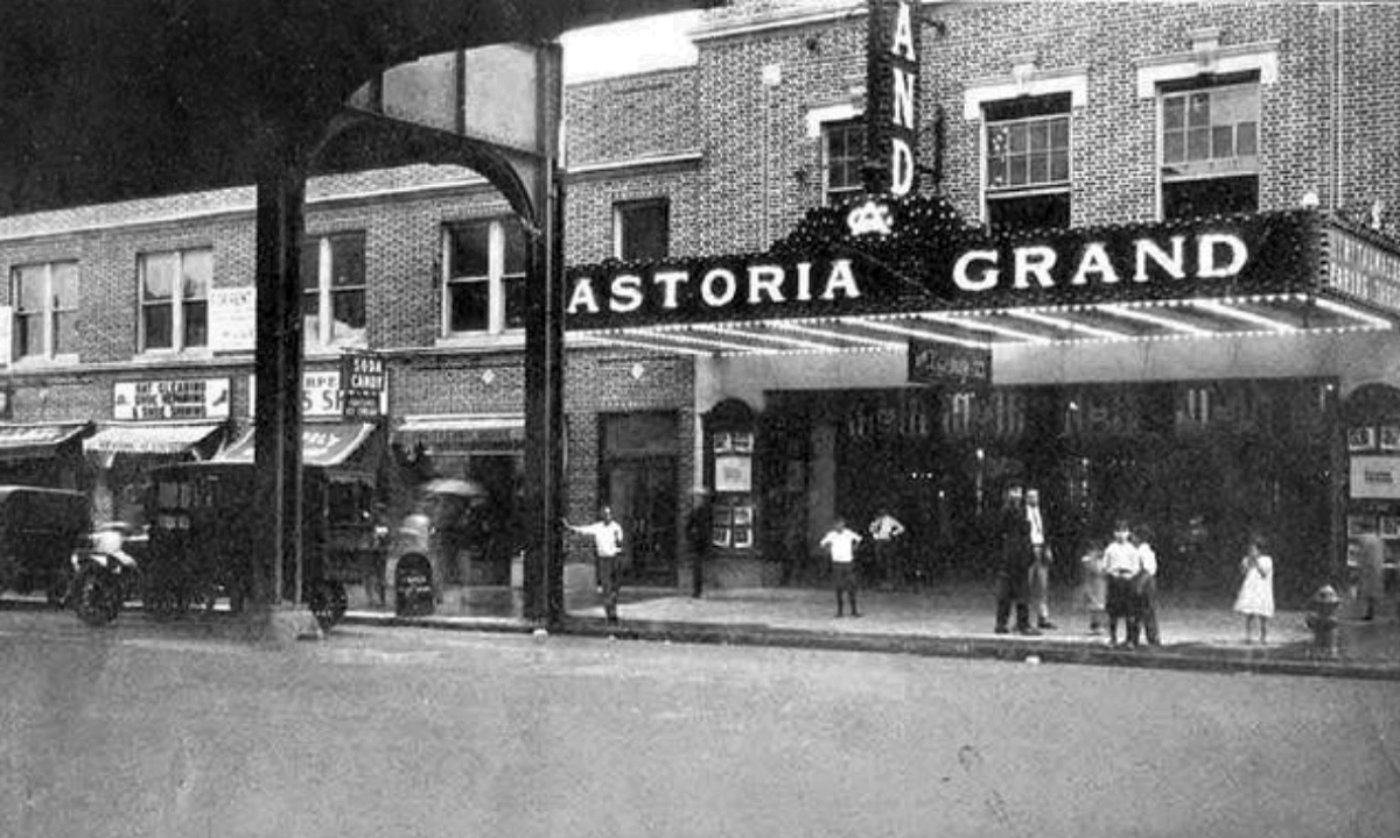
The marquee was for the old Astoria Grand movie theater, located at 22-15 31st Street. Operating as a movie theater from 1924 to 1960, the building remained standing until the spring of 2021 when it and its neighbors were torn down. A large shopping complex now sits in its place.
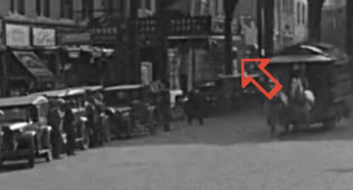
The Goons Close In
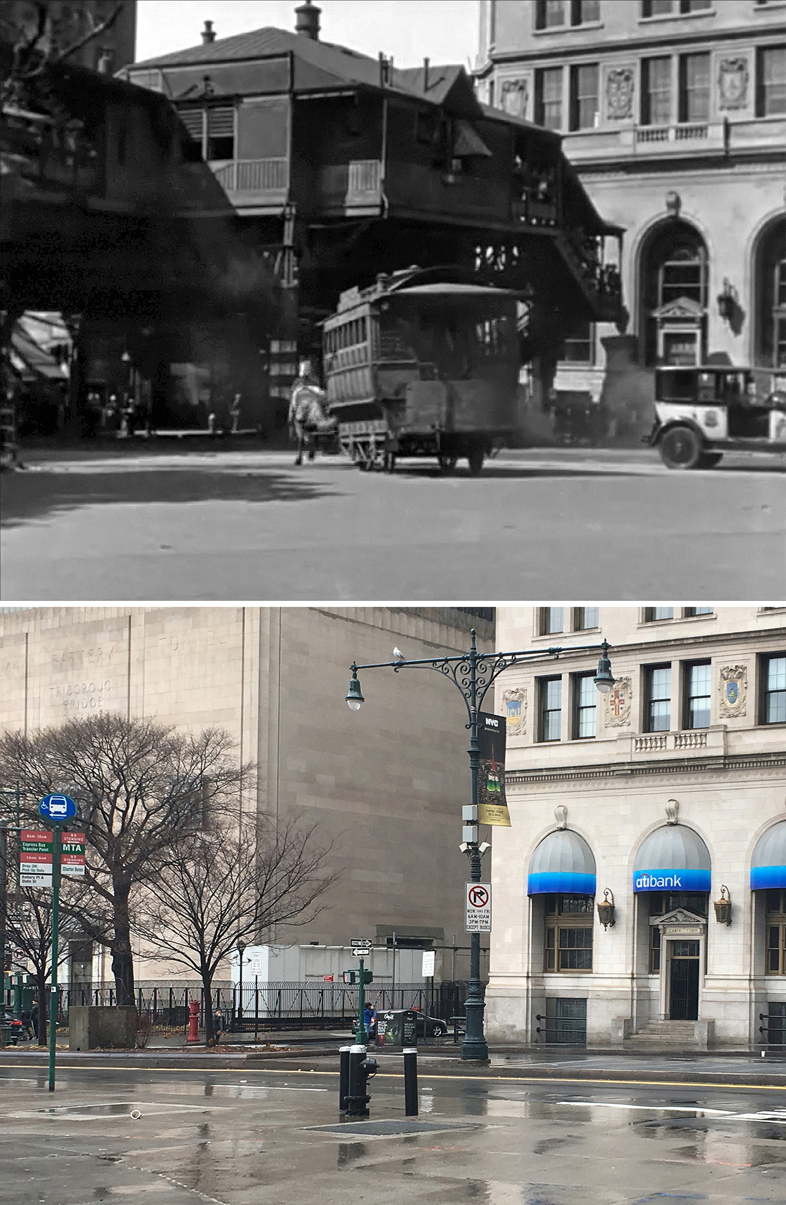
Jumping around from Manhattan to Brooklyn to the Westwood Location Ranch in Hollywood, all of these locations from the last sequence in the movie were identified in John’s 2011 book. But it would be about ten years later that he’d discover an oddity in the shot right before Harold crashes the trolley at Battery Place.
If you look closely, you can see the silhouette of a horse mannequin inside the trolley. According to John, in the original script, Harold put his first horse in the trolley to give it a rest. But that gag had to be scrapped after the trolley crashed into the el station’s support post — a real accident caught on film.
Lloyd knew that that footage was too good not to use and decided to incorporate it into the movie. Then, in order to spare audiences from worrying about the horse in the back, they cut (or never filmed) Harold putting it inside.
For a man who spent decades studying silent films, the fact John hadn’t come upon this horse mannequin story until 2024 might surprise some. But he was always discovering new facts and stories about the movies he loved. He’d also discover new mysteries to be solved.
For example, back in 2020, he sent me a publicity photo of a deleted scene from Speedy which he hoped I could find. Being such an inspiration to my taking on this “NYC in Film” project, I was always eager to help John whenever I could.
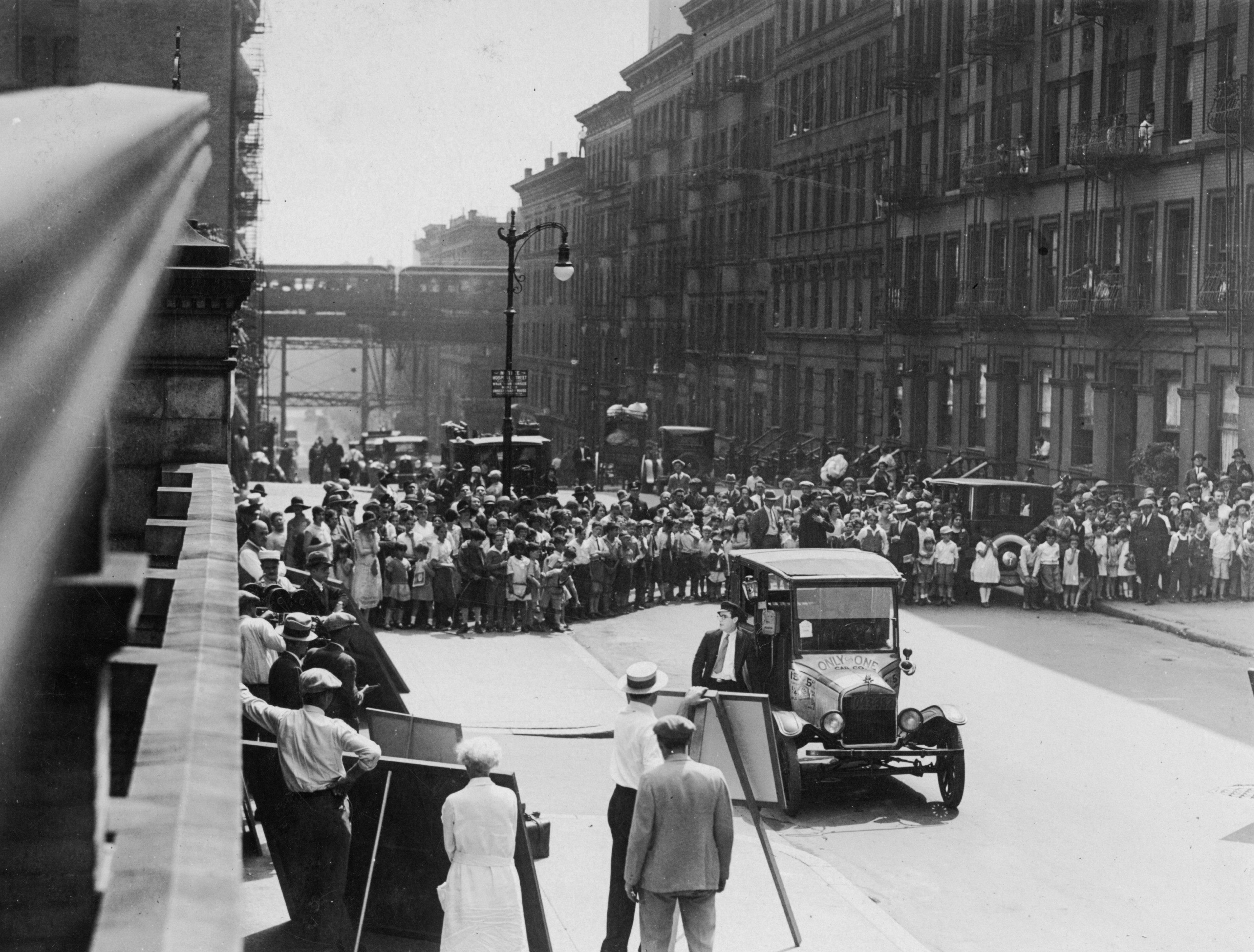
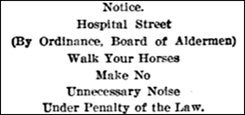
Thankfully, the photo was chock full of clues: a hill, an el train and what looked like a blank space about two blocks away. There was also a sign on a lamppost that said “Hospital Street” (as well as a notice to “Walk Your Horses”).
At first, I thought the blank space in the distance was the East River (leading me to a wrong location at East 92nd Street), but then I considered that perhaps it was Central Park. After that, I went through my mental map of Manhattan near the park and recalled that things got kinda hilly in the high 90s, low 100’s. From there, I checked out the Ninth Ave El route in the 1930 Bromley maps and spotted a Women’s Hospital on W 109th/110th streets.
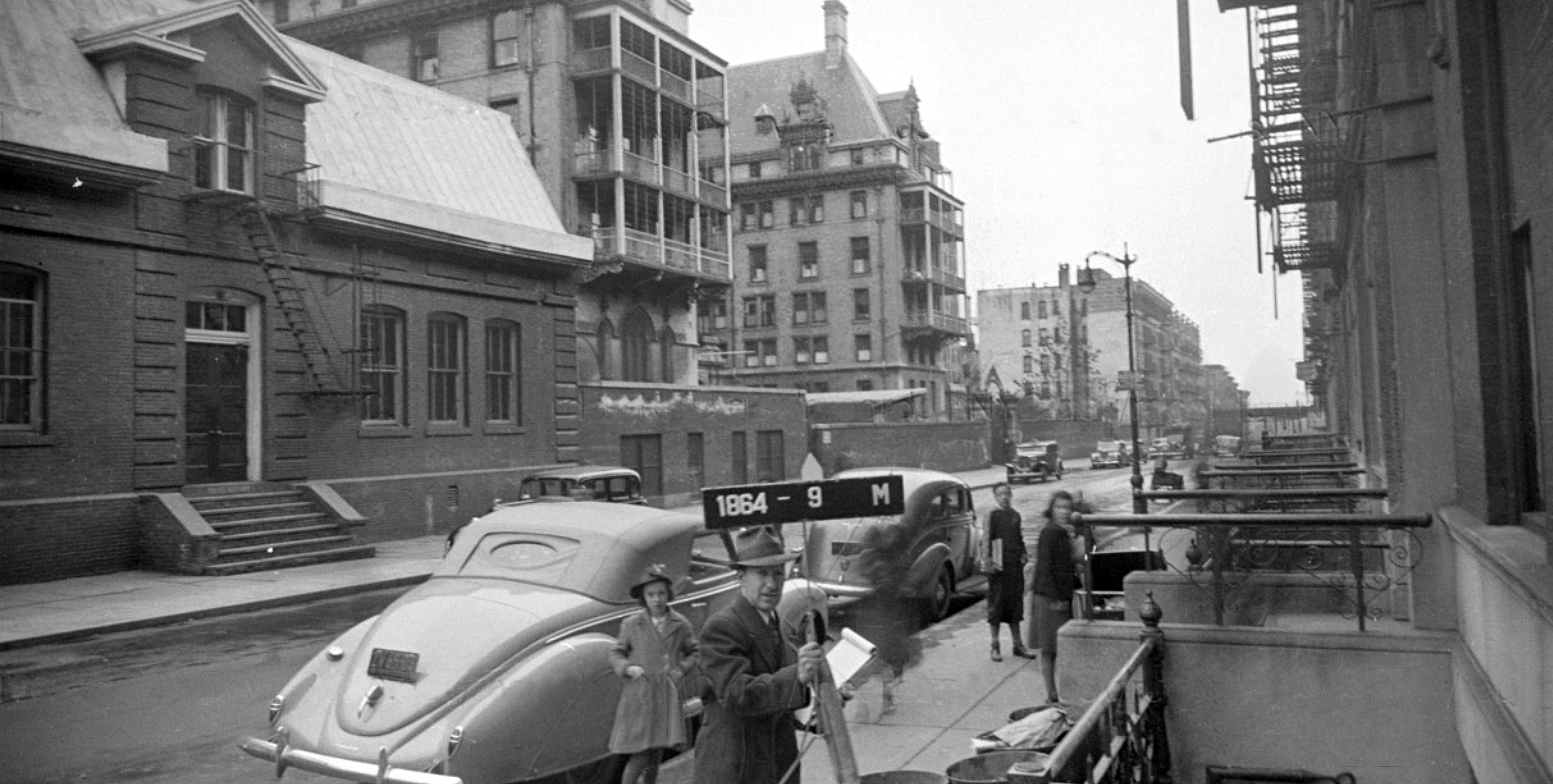
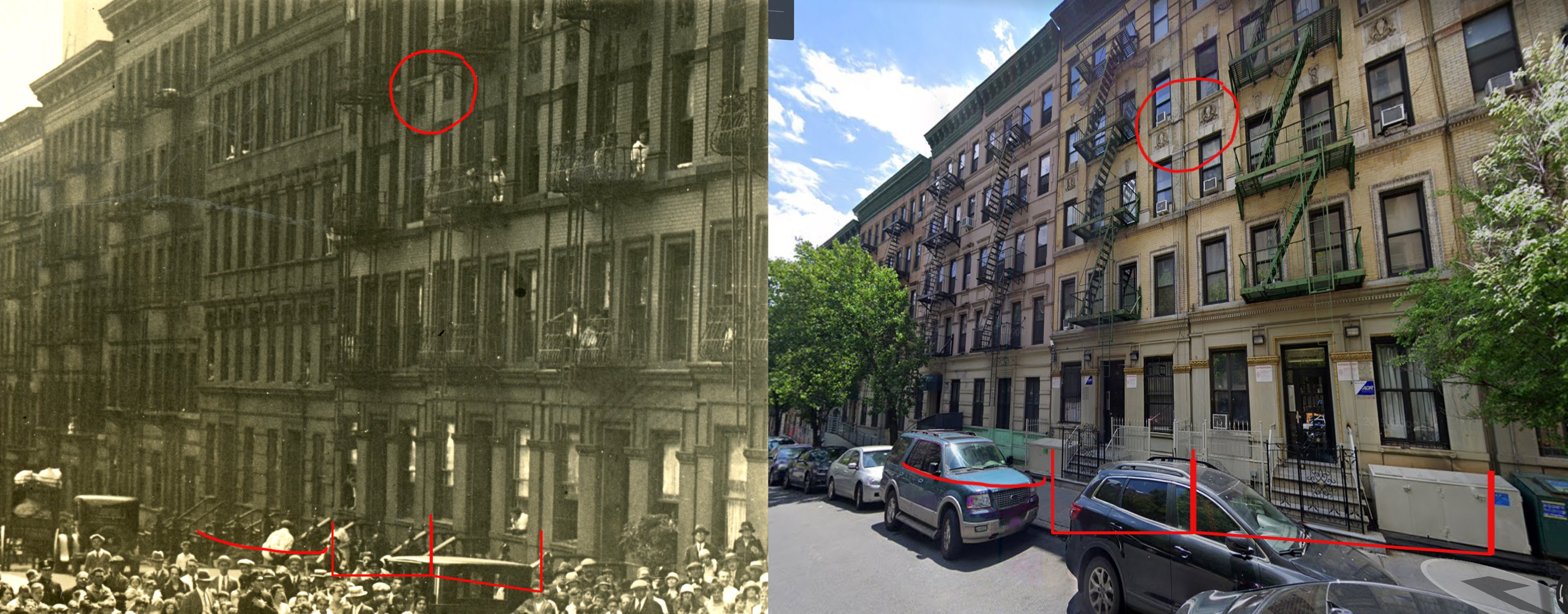
After a minute on Google Street View, I concluded the photo was taken on W 109th with the camera pointing east towards Columbus Avenue and the Ninth Avenue El. I was quick to verify it since pretty much all the residential buildings in the photo are still around.
It was always great when I could help John figure out some location mystery, and I was always grateful when he took the time to help me with some of my own. There are many people out there who knew John better than me, but I’d always thought of John as a kind, smart, and indefatigably curious fellow.
Speedy has always been my favorite Harold Lloyd comedy (partially because it was filmed in NYC), but if it wasn’t for John’s books, I might’ve never had the incentive to tackle all of its filming locations. (At this point, I’d say Speedy is pretty much 99% solved. There are still a few bits here and there that are unknown, but nothing major.)
I hope this post on Speedy is a fitting way to pay tribute to John Bengtson’s legacy as a film historian.
The movie is a superb example of Lloyd’s adeptness as a filmmaker and entertainer, and it also perfectly illustrates why John loved studying these old films. In every frame, we’re given a precious glimpse into a forgotten time and place, and sometimes, if you look closely enough, new and unexpected discoveries are revealed.
That’s what kept John going. He reveled in unraveling cinema’s past.
“When I discover a ‘new’ location, I’m privy to a fact that at one time only the star and the crew members knew,” John explained in 2020. “One hundred years later, I invite myself into their select group — I share in their once exclusive community of knowledge.”
