
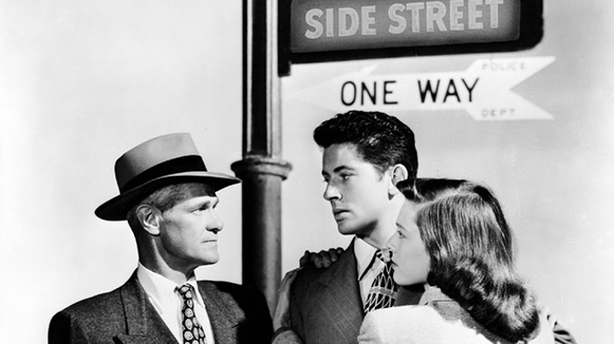
This is PART 2 of all the filming locations from the 1949 noir, Side Street, starring Farley Granger and Cathy O’Donnell. The majority of this section covers the movie’s extended car chase that takes place all over Manhattan Island.
To read PART 1 of my coverage of Side Street, CLICK HERE.
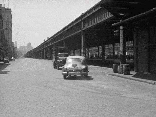
Taking Joe to the River
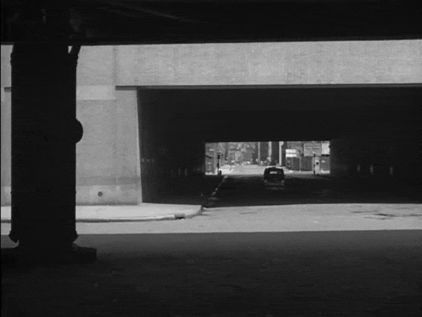
This was an easy location to find. Having lived in New York for many years, I was very familiar with the old St. John’s Rail Terminal at 550 Washington Street which had West Houston Street cutting through it like a tunnel. Constructed in 1934 by the New York Central Railroad, the large building was the terminus of the an elevated freight line along Manhattan’s West Side, best known as the High Line.
You might’ve noticed that in the “after” image above, you can see a couple news trucks parked on West Street. That’s because when I took the picture in October of 2017, they were there reporting a story of an Uzbek national who used a truck to plow through the Hudson River bicycle path, killing eight people and injuring 11.
Shortly thereafter, the DOT installed large cement barricades along the greenway to prevent a repeat attack.
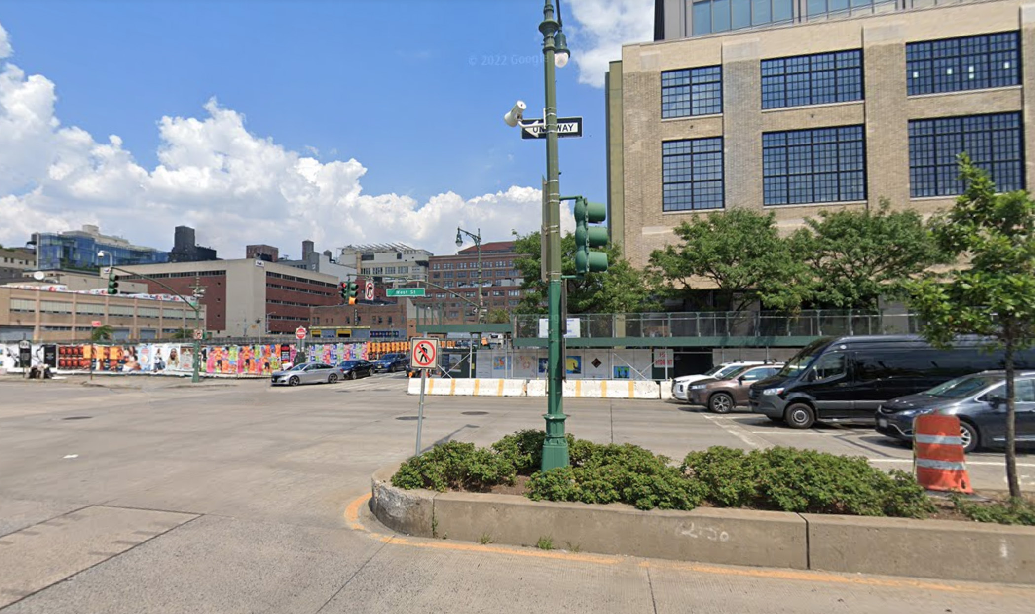
2022 UPDATE: About two years after I took the “after” pictures of this location, part of the St. John’s Rail Terminal at 550 Washington Street got torn down, eliminating the Houston Street “tunnel.”
This was part of huge redevelopment plan, which bagan back in 2013 when the majority stakeholder of the terminal sold his shares to three investment groups for a reported $250 million. Construction began a few years later which included the demolition of some sections, the repurposing other sections and a new vertical extension, creating a 232-foot-tall structure that will serve as the Hudson Square campus for the Google corporation.
All-Points Bulletin
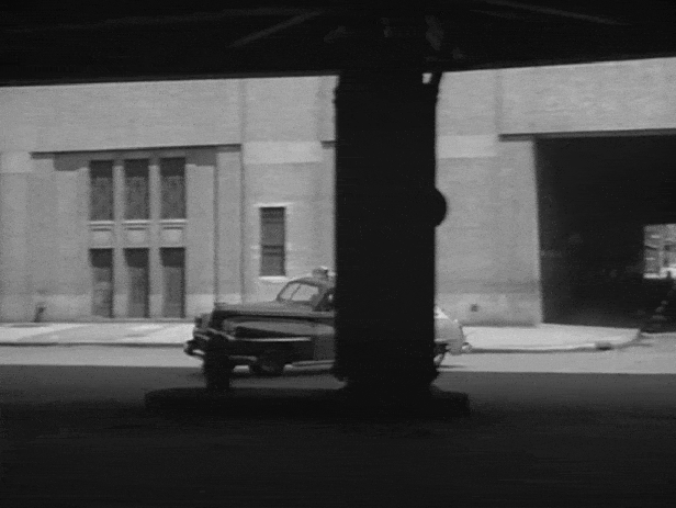
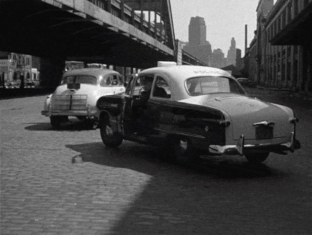
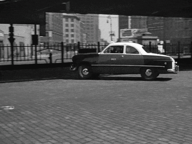
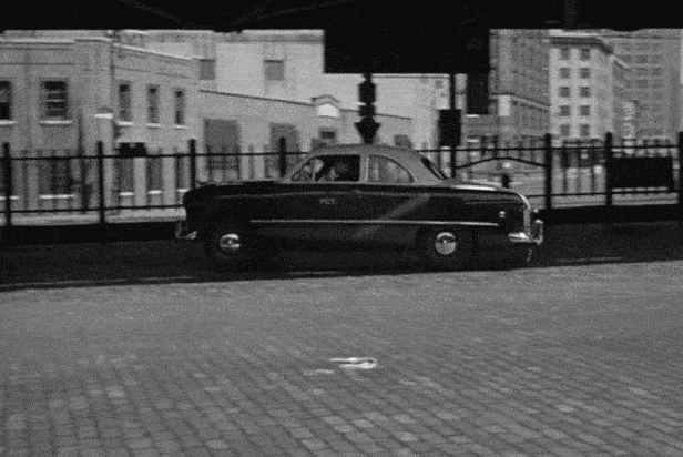
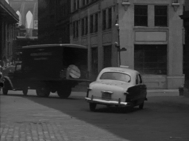
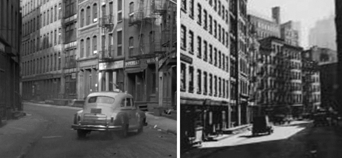
This location was puzzling me for a while until Blakeslee found a film-noir blog by film historian Max Alvarez that mapped out the final chase sequence from Side Street. The blog post was missing a few spots, and made a couple demonstrative mistakes, but it also identified a couple locations I hadn’t yet found, including this one. Alvarez describes this scene as follows:
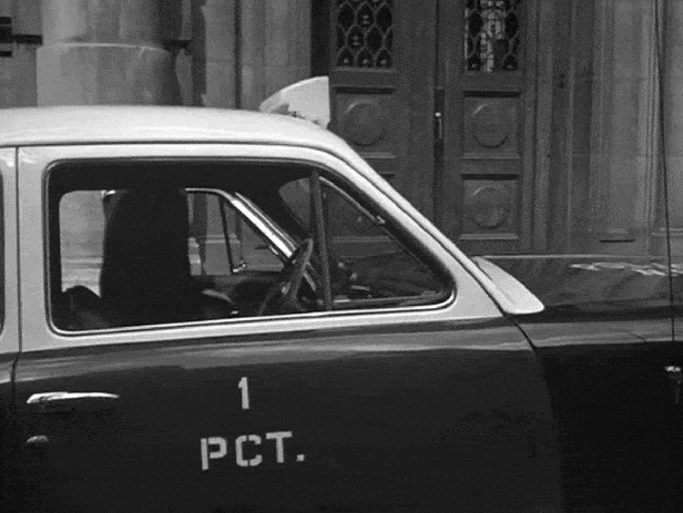
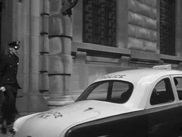
At this point, an all-points bulletin is issued to all police cars, and a radio car in an industrial part of lower Manhattan backs away from the camera to join in the chase. Cops are then seen getting into squad cars outside the police precinct overlooking South Street that presently houses the New York City Police Museum.
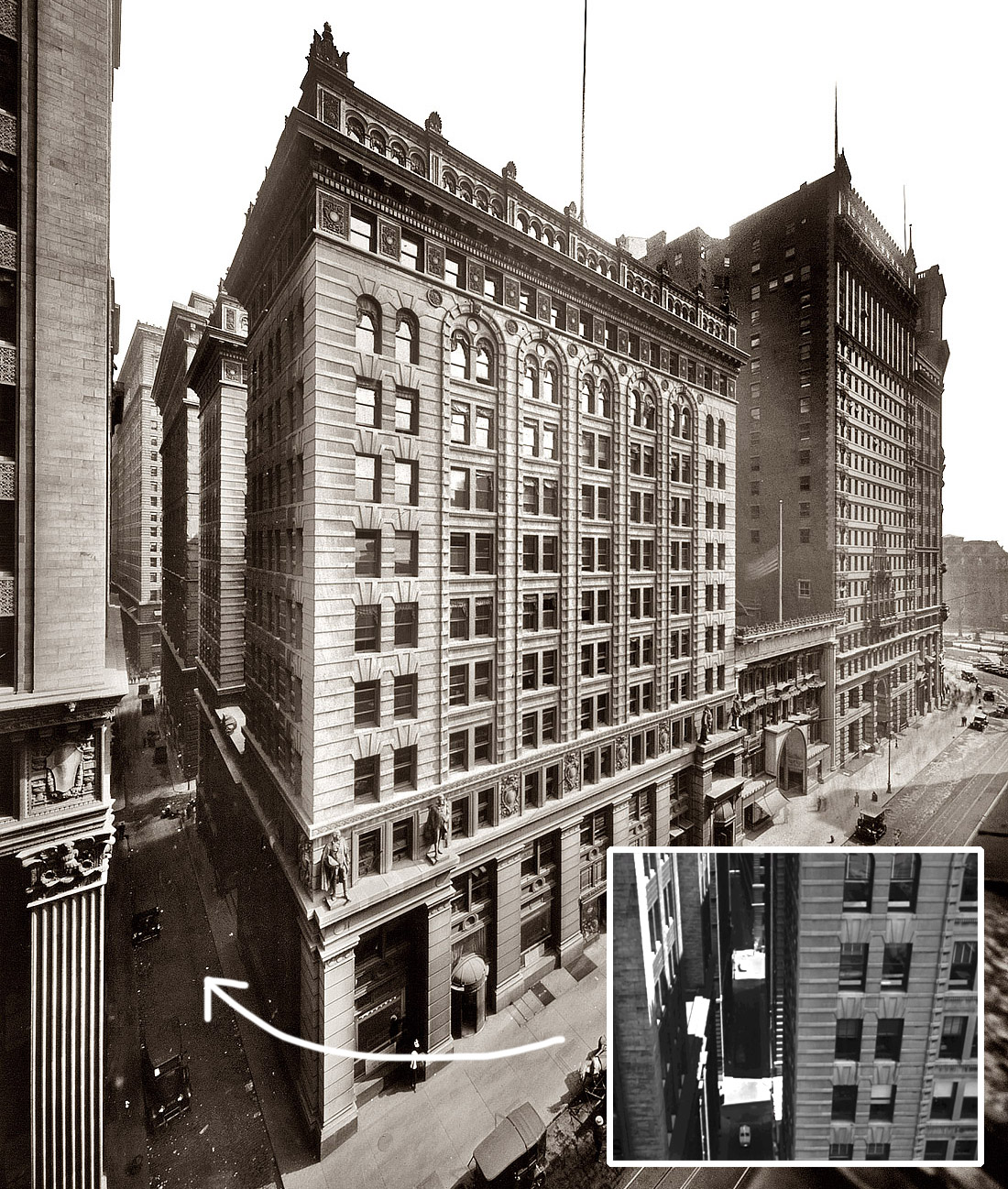
The description of the first shot was vague and didn’t offer any new insight. However, the description of the second shot was more precise, mentioning that they were in front of the New York City Police Museum. No address was given, but a quick internet search revealed the museum’s location used to be 100 Old Slip (before it was moved to Governor’s Island).
A few months later, I revisited this scene, determined to find the location of the first shot where the car backs away from the camera. Since the scene definitely looked like it took place in the Financial District somewhere, I figured those elevated tracks in the background were of the Third Avenue spur line that connected South Ferry to Chatham Square via Pearl Street. So, I just traced the El’s old path in Google Street View until I landed on Hanover Square, where I found a couple buildings that matched the ones in the background of that first shot.
Turns out, Hanover Square is just one block away from Old Slip, meaning they used the exact same location for both “All-Points Bulletin” shots, they just simply pointed the camera in opposite directions.
I can only guess that either Alvarez didn’t know that both shots were filmed at the same location, or he did know, but simply glossed over it in his description.
At the River
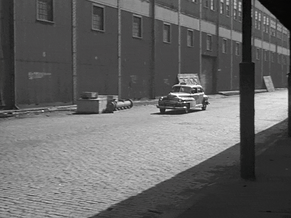
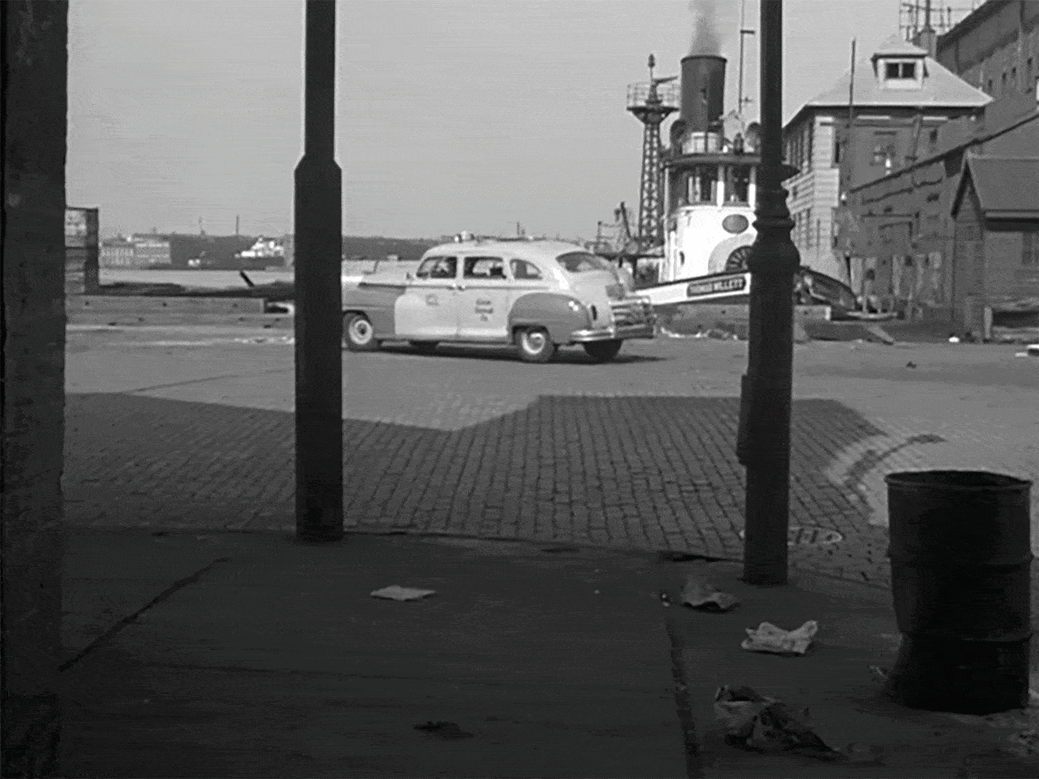
Finding this location wasn’t easy, although at first glance I thought it would be. The main reason was because unlike other scenes, this one had a clearly marked street sign reading, “12TH AVE“
However, after spending countless hours sifting through tons of vintage photos of 12th Avenue from the NYPL Digital Archives, I couldn’t find anything that remotely looked like what was in this scene. Disheartened, I decided to leave this scene alone for a while and focus on other locations, but I couldn’t help revisiting it from time to time.
For example, when Blakeslee and I were looking for the location of a riverfront coal yard for the film The Rag Man, as I searched vintage photos for a coal yard, I’d also keep an eye open for any clues that might lead me to this Side Street location. In particular, I was looking for a long, industrial building that ran the entire span of the street leading up to the river. It looked like a dilapidated warehouse or a shipping pier, and I figured the window arrangement would be the best way to identify a match.
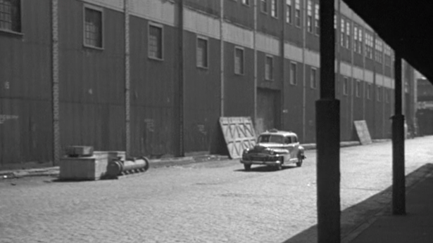
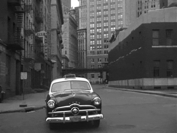
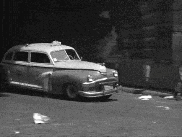
However, after I re-watched the scene, I noticed something I hadn’t noticed before. That long industrial building didn’t end at “12th Avenue,” it continued on into the Hudson river, which meant that it was most likely a pier. And since it extended into the river, it actually created a sort of cul-de-sac with the road.
Armed with this new perspective, I hit the maps again, seeing if I could find any street that ran north-south along the Hudson that had a dead end. Almost immediately, I focused on a little, one-block peninsula near Gansevoort Street whose street layout matched that criteria.

Even though every map I found of this peninsula labeled the waterfront avenue as “13th” (instead of “12th”), I wasn’t necessarily discouraged. There could be several explanations for this variance in names, and I thought it was definitely worth investigating.
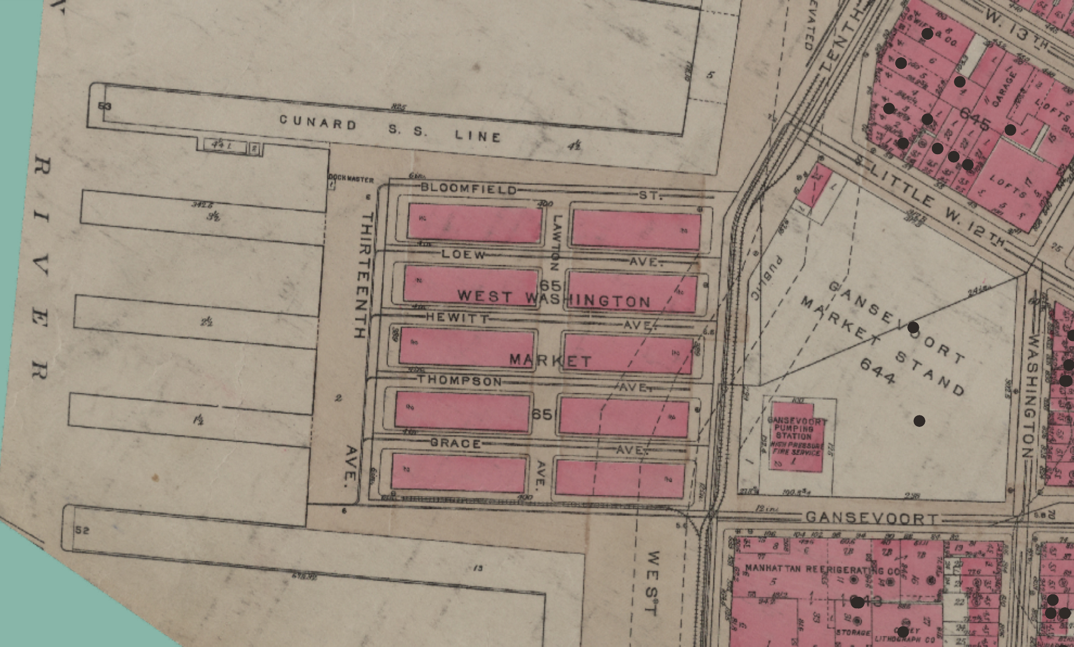
In addition to 13th Avenue, the peninsula was bounded by other two streets — Gansevoort and Bloomfield. So I decided to search the NYPL digital archives for any photos with those names, and almost immediately hit pay-dirt.
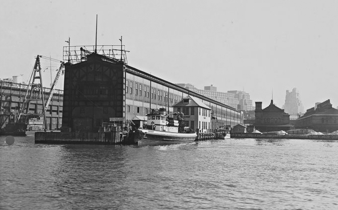
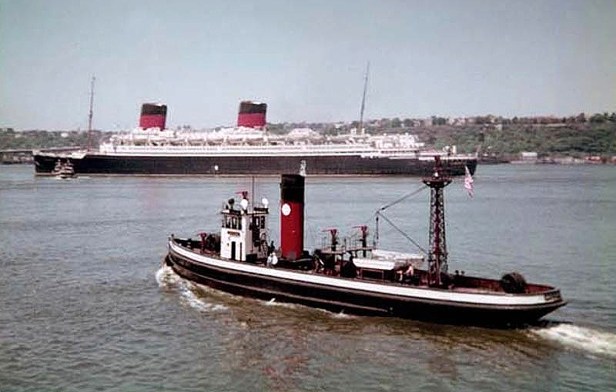
The photograph I found —labeled “Gansevoort Street-Bloomfield Street”— was from 1933 and was actually a shot of the Manhattan coastline taken from the Hudson River. Despite the photo being taken from the reverse direction, I was still able to recognize several matching structures from the movie. This included a white wooden river house and that large industrial building that extended into the water, which I determined was a pier for Cunard ocean liners.
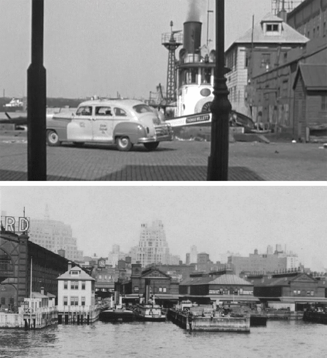
Once I was fairly confident this scene took place on the river between Gansevoort and Bloomfield Streets, I was able to do a more refined search online and found a photo of the Cunard Pier that clearly showed it was the same long industrial building seen in the film.
One curious thing that I noticed kept popping up in these vintage photos was a small tugboat docked next to that white wooden house on the fiver. To my surprise, the very same boat actually appeared in this scene. Turns out this watercraft was a perennial fixture —a fireboat called the Thomas Willett that was operated by the FDNY from 1908 to 1951. (You can tell it’s a fireboat by the small metal tower seen near the stern.)
After finally figuring out this location, I became somewhat intrigued with the history of that tiny peninsula along the Hudson River which contained the relatively-unknown 13th Avenue.
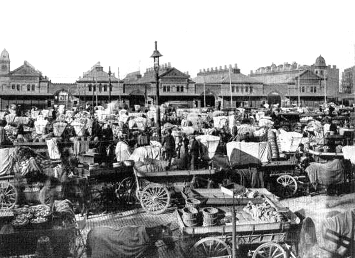
Apparently, 13th Avenue had a rather brief and tumultuous history. Established in 1837, this coastline-thoroughfare was added to the Manhattan grid when the state passed a new bill allowing entrepreneurs to buy water-logged “lots” along the Hudson River and fill them with landfill in order to establish a “permanent exterior street for the city.” The purpose of this new avenue was to help facilitate the rising number of water vessels coming to the city of New York.
The original plan was to have 13th Avenue run all the way up to 135th Street, and by the late 19th century, it had already become a somewhat developed roadway, although the surrounding neighborhood left a lot to be desired — described as a chaotic jumble of such inhospitable things as lumber yards, garbage dumps, shabby factories, squatter settlements and unruly saloons. An 1883 New York Times article labeled it a “dreary waste,” which after nightfall became a desolate, unsafe thoroughfare that even the police would scrupulously avoid.
Despite the roughness associated with the avenue, the city was steadfast in making it a solid fixture of the Big Apple, having it paved with Belgian block in 1874.

However, by the end of the century, the need to provide piers for a new breed of big luxury liners not only halted the expansion of the avenue, it actually started reversing things. Basically, as larger ships like the Lusitania and the Titanic started to become more common, the city needed to create longer piers to accommodate them. The only problem was, they couldn’t expand these piers without encroaching too much into the Hudson River. So instead, they went in the other direction and began cutting out chunks of the newly-created landfill, and in the process, decimating 13th Avenue.
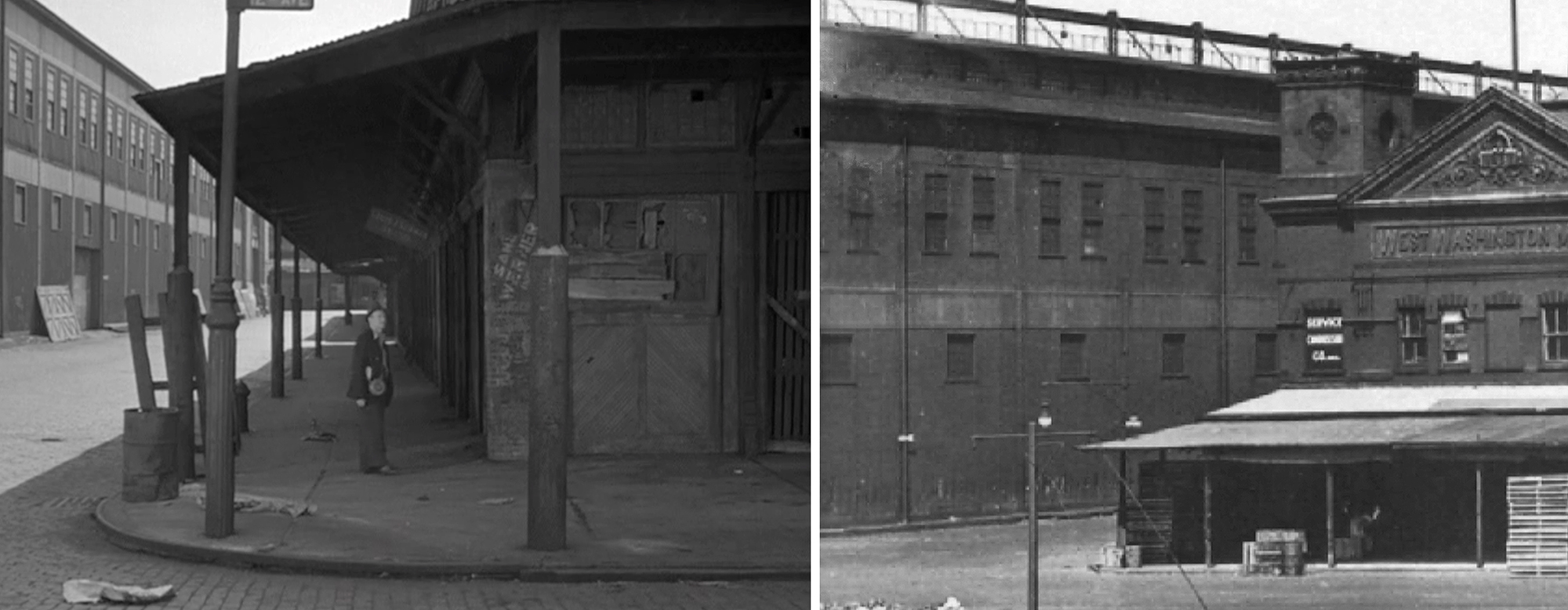
By the early 20th century, most of 13th was long-gone, however, one block between Bloomfield and Gansevoort did survive,. mostly because it was home to the then-active West Washington Market.
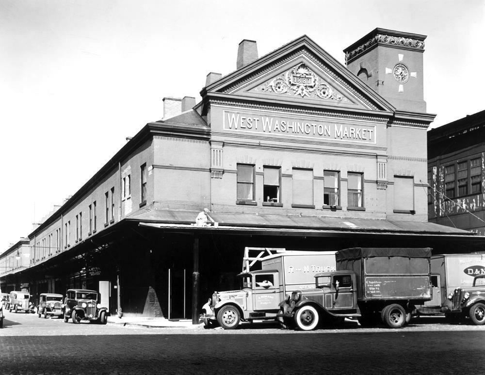
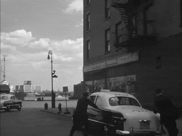
You can see one of the buildings from the declining West Washington Market in this “River” scene when the hoods notice a dock watchman.
The West Washington Market eventually shut down in 1954, but the meager piece of land known as Gansevoort Peninsula, where the market once stood, survives today.
2024 UPDATE: For the longest time, the property on Gansevoort Peninsula was controlled by the sanitation department, but shortly after I published this article, it was announced the city would turn it into a public park.
After several years of planning and execution, the peninsula was opened to the public in late 2023. This gave me the opportunity to finally get some clean and properly framed images of the location from this scene. (Up to this point, all I was able to do was take distant shots from West Street.)
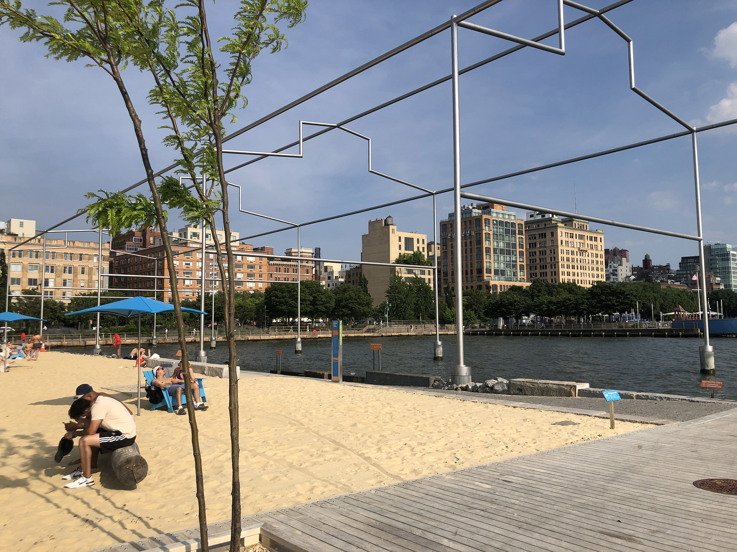
The new park is pleasant enough, with plenty of places to relax, including an area on the south side that functions as Manhattan’s only official beach. In addition, the park pays tribute to the old Meatpacking District waterfront with a metal frame that was installed to show the old position of Pier 52. And of course, the new one-block promenade along the western edge of Gansevoort Peninsula has preserved the very last remnant of the long-forgotten 13th Avenue.
Oncoming Truck
After finally figuring out the location of the river scene, I was able to deduce a couple other locations that appear immediately after that.
I always knew this quick shot of an oncoming truck was somewhere on West Street because of the elevated highway. But once I had Bloomfield and 13th Avenue as a reference point, I spent more time studying the buildings in that general area, eventually finding the extant building at 45 West Street which appears in the above shot on the far left side.
Using that building as a reference point, I estimated that the cab had the run-in with the truck on West Street between Gansevoort and Horatio Streets. What’s nice is that it makes perfect geographical sense, since they were coming from the old West Washington Market on Gansevoort Peninsula.
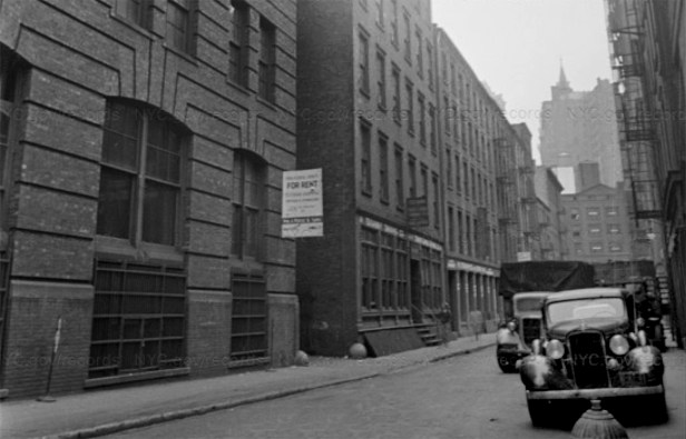
Making a U-Turn
This is another location I found within hours of confirming the river location on Bloomfield Street.
Like the “Oncoming Truck” scene, I had already guessed that this scene took place on West Street, due to the elevated highway. (According to the blog by Max Alvarez, the police’s roadblock was set up on Pearl Street, but I quickly assessed that that was incorrect.)
After surveying a 1955 map of West Street, I concluded that Canal was the only cross street that had a wide enough opening that could match what appeared in the film. But when I went to Google Street View, I couldn’t find any matching buildings — that is, until I checked the older street views.
In the 2011 Google Street View, you can see the old 2-story sanitation garage at 553 Canal Street, right before it got replaced with the new 67-foot-tall “Salt Shed.”
And the 2-story garage from 2011 matched the building that appears in the film perfectly. From there, I studied the outlying buildings along Canal and discovered several other matches, thus conclusively resolving the “U-Turn” location.
Chase – Washington Market
In order to find this filming location, I first focused on the large sign on the side of a building at the top of the sequence, which said, “J.J. Fisher, Inc.” At first, I thought the sign was on the actual store building, but it turned out it was just an advertisement and “Fisher” was at a completely different location.
In the end, I figured out this location after doing research for the 1963 film, Love with the Proper Stranger which had a scene taking place at the former Washington Market in Tribeca (not to be confused with West Washington Market that appears in the “River” scene above). After looking through a bunch of vintage photographs of Washington Market, I thought the structures on Reade Street looked similar to the ones that appeared in this scene. Then by sheer luck, I found a couple photos that were taken at almost the exact same angle as the first shot from this scene.
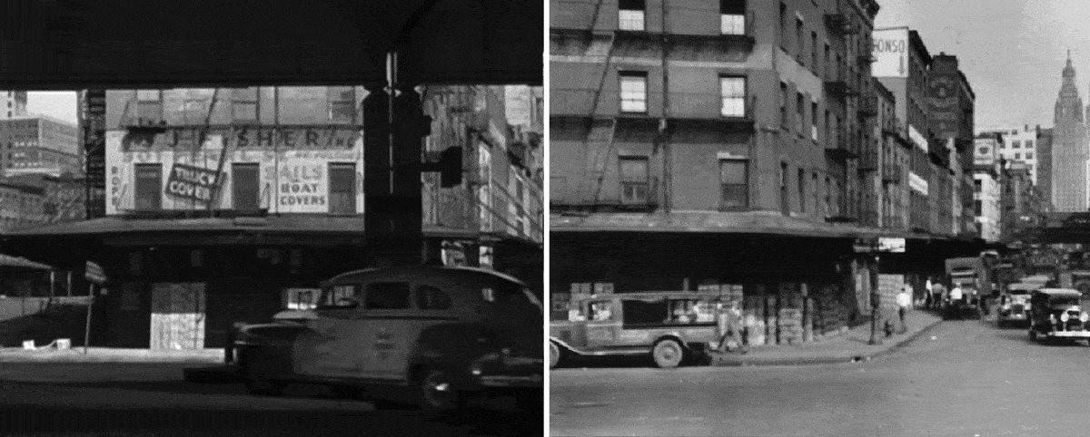
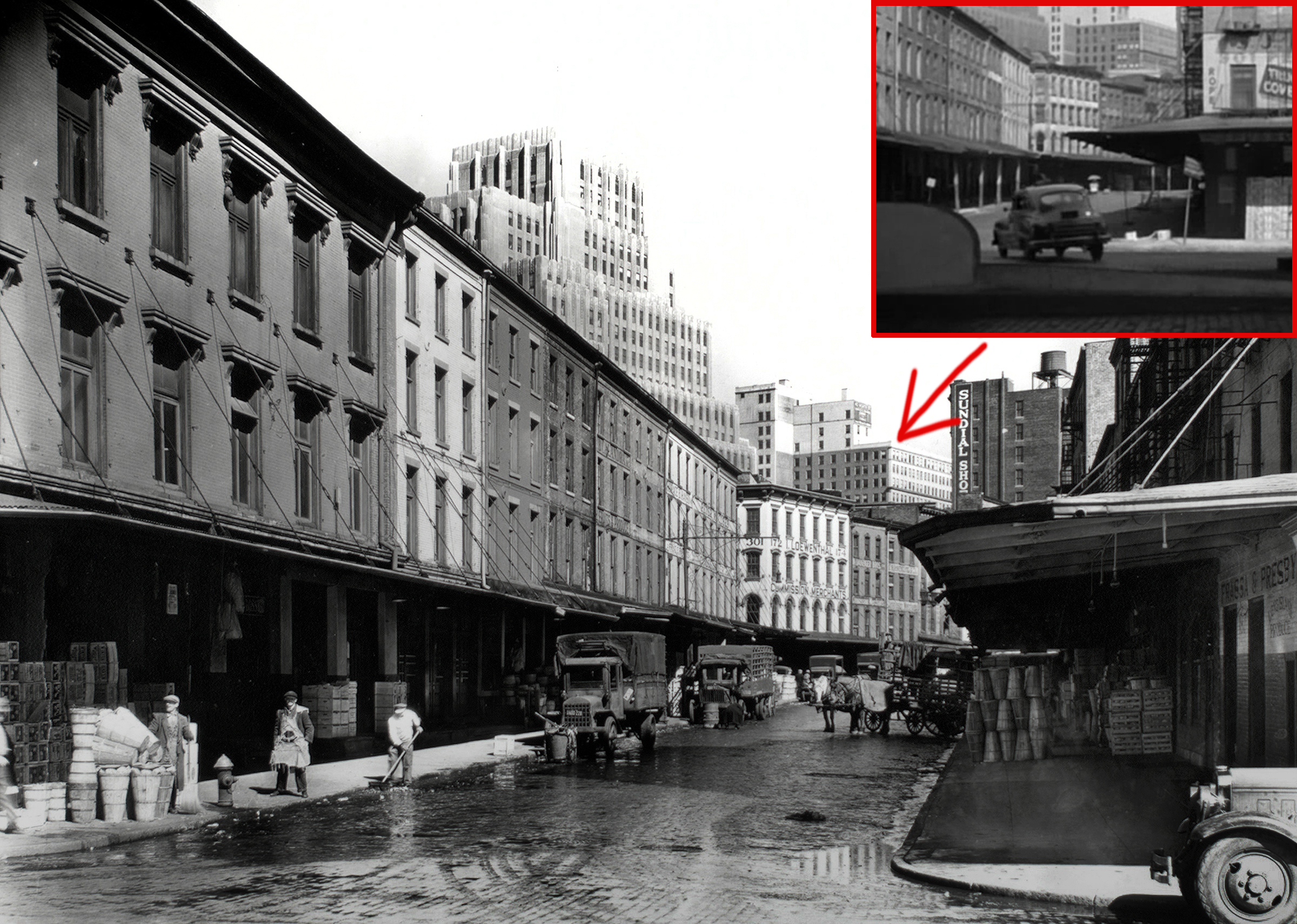

Once I figured out the first exterior shot of this scene took place at the intersection of West and Reade, I then had to figure out where the next exterior shot took place. It looked like it was still in the Washington Market in Tribeca, but I had a little difficulty figuring out where exactly since a lot of the marketplace structures looked the same.
Eventually I found a photo of Washington Street and Chambers from 1936 on the NYPL digital archives that looked like it could be a match from the film.
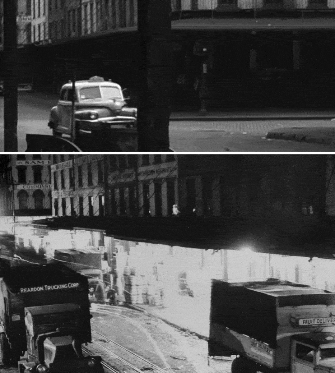
It took a little studying, but I found enough similar elements to confirm that the second shot of the taxicab in the Market was on Washington and Chambers. Of course, since the Washington Market and most of its streets were razed nearly 50 years ago, it was a little difficult to match up the scene with modern maps, but I was pretty sure I got the proper orientation.
After turning east on Reade in the first shot, the taxicab (in theory) turned south on Washington Street for two blocks, before turning east again on Warren.
After the 1940 tax photos were released online in the fall of 2018, I was able to find several more photographs of the area and used them to double-check my conclusions, which turned out to be correct.
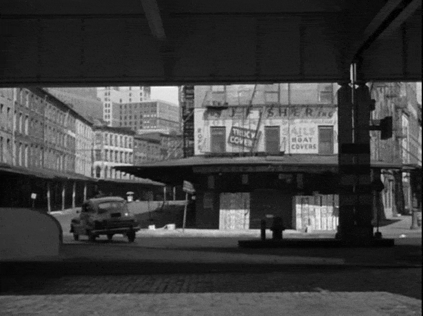
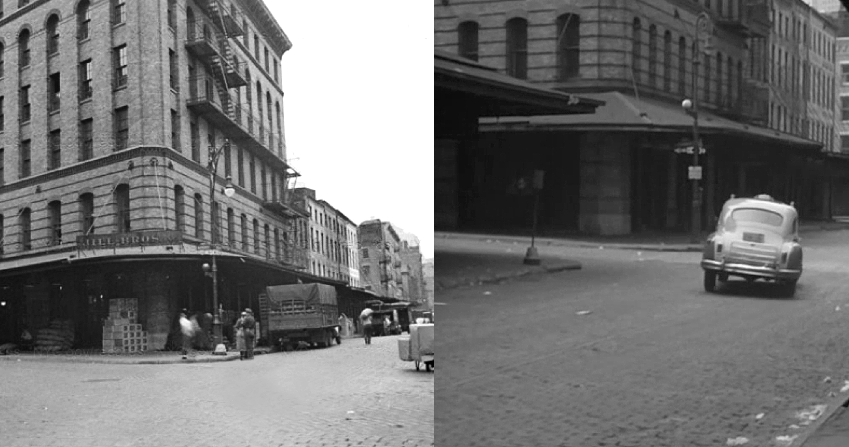
Chase – Dave’s Auction
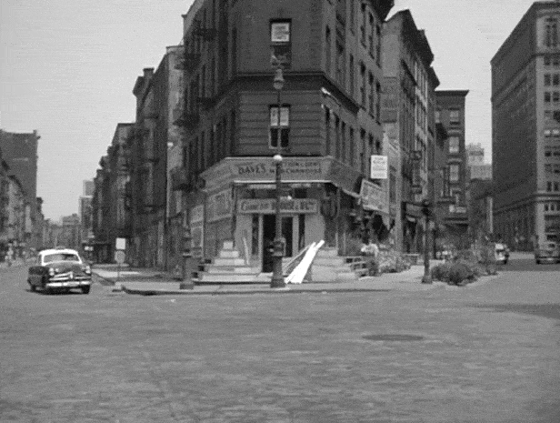
Like the location of the “All-Points Bulletin” scene, the location to this “Dave’s Auction” scene was eventually discovered through Max Alvarez’s film-noir blog.
Before discovering the blog, I spent a great deal of time searching maps of lower Manhattan to see if I could find a spot where two streets merged at a triangle (as they do in this scene). And for one reason or another, this spot at West Broadway and Greenwich Street had eluded me. So, I next went to the library to see if I could find a listing for Dave’s Auction in a 1949 phone directory. But I couldn’t find anything (which didn’t wholly surprise me since an informal “auction house” seemed like something that might be off-the-grid, so to speak).
Months later, once I found the 70 Vesey Street address on Alvarez’s blog, I looked for any vintage photographs that might’ve offered better views of that curious “Dave’s.” Unfortunately, at the time, I couldn’t find any old photos of that intersection, but I still knew it was the correct spot. Despite some major changes since 1949, I was able to spot two extant structures from the scene — the Post Office building (seen on the far right of the second “before/after” picture above) and the 1921 Tribeca House, located one block north at 53 Park Place.
It wasn’t until the release of the 1940 tax photos in 2017 that I finally had a chance to get some alternate views of the area.
In one of the photographs, you get a nice clear shot of the building at 70 Vesey Street, but this was apparently before “Dave’s Auction & General Merchandise” moved in. But what’s marvelous about this photo is that it offers a rare view of the Ninth Avenue El (NYC’s first elevated railway line) shortly before it was shut down and dismantled.
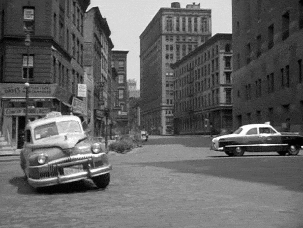
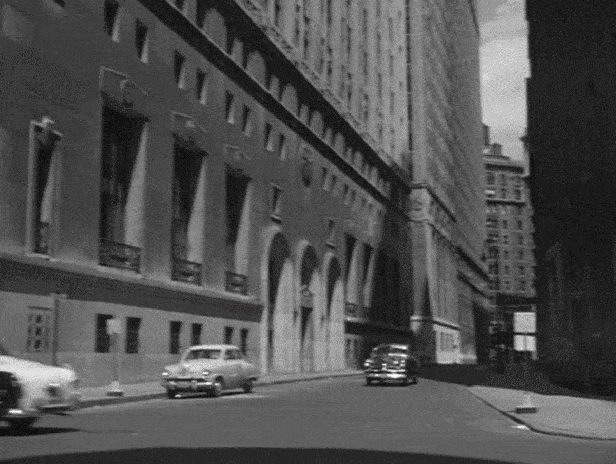
Chase – Mobil Gas Station
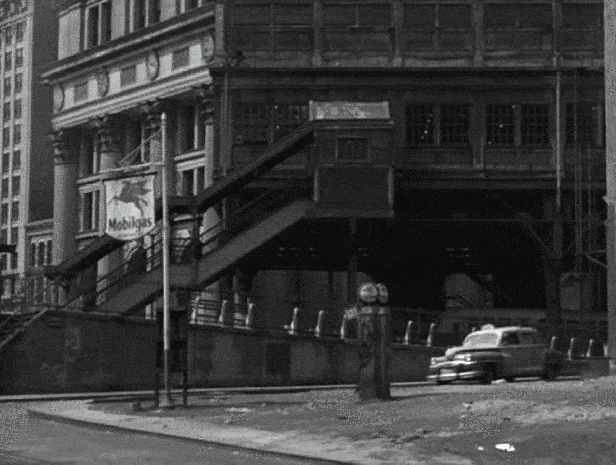
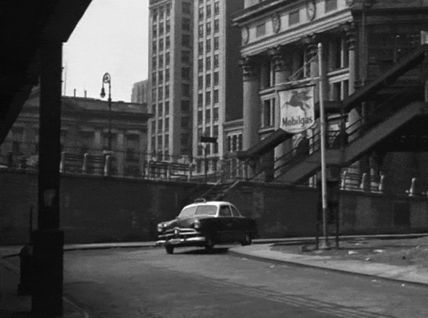
This scene was on the top of the list of Side Street locations I wanted to find. Seeing a vintage Mobil gas station in what looked like the heart of downtown Manhattan intrigued me. I was also interested in those unusually long stairs and finding out where they went to. Maybe they led to an elevated train station or to some unseen promenade above, or perhaps they led to an upper-level entrance to the adjacent columned building.
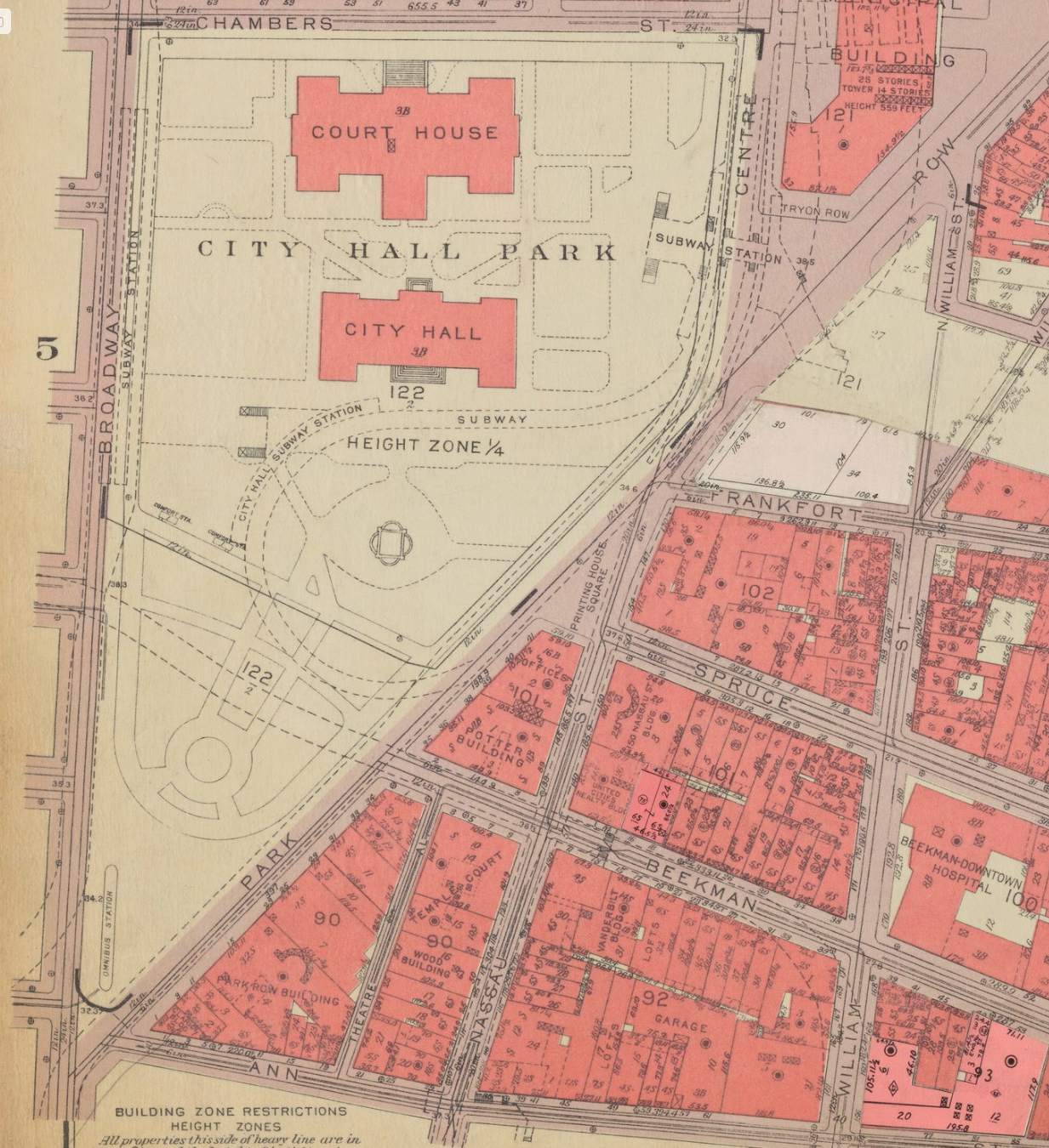
I figured, since I successfully identified the locations of two scenes using the phone directories at the 42nd Street Library, I decided to make use of that resource again. Searching through the 1949 yellow pages, I was able to find a listing for a Mobilgas at 18 Park Row — but this address ended up throwing me off the track for a short while.
When looking at both modern and vintage maps, I couldn’t find anything marked as “18 Park Row,” but I estimated that it would’ve probably been just south of City Hall Park where Broadway intersects with Park Row.
I eventually figured out that this estimation was wrong, so I rewatched the scene looking for some other clues. The one thing I noticed was an eatery called Merritts Foods that could be seen in the background after the cars pass the gas station and enter a short tunnel.
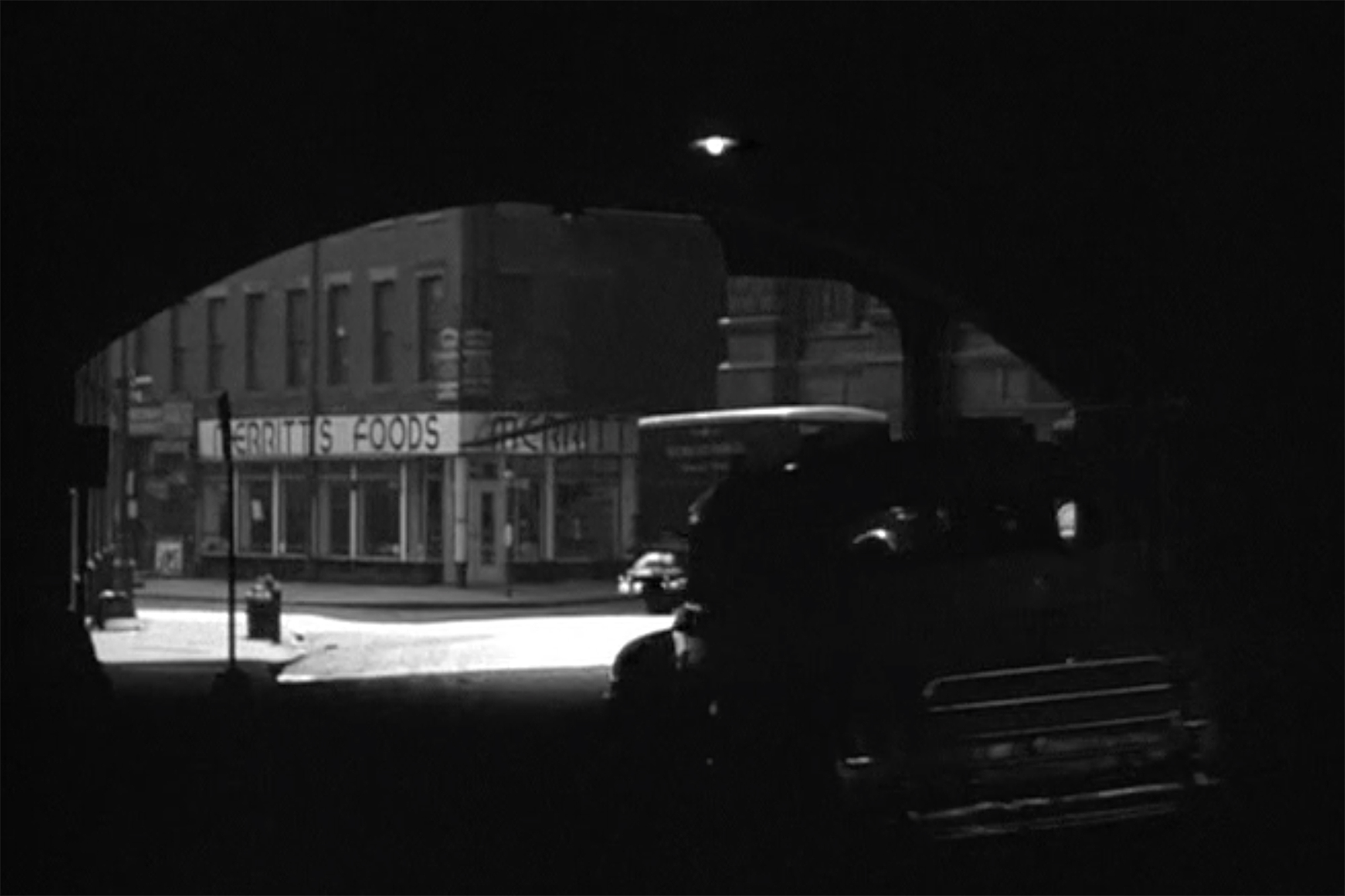
Hoping this might help me figure out the location, I searched online for any reference to a “Merritts” in downtown Manhattan. Unfortunately, the only thing I could find was a woodcut print of the corner food shop by 1960’s artist, Ted Davies. So, it was back to the library to look up “Merritts” in the phone book.

After consulting the 1949 Manhattan white pages, I found a listing for a “Merritts Coffee Pot” on William Street. Even though the name didn’t match perfectly, I had a feeling I found the correct establishment.
Using a 1955 vintage map as my guide, I could see that just north of that Williams Street address was the Brooklyn Bridge, so I gathered that the “tunnel” the two cars traveled through was actually a passageway under the bridge. That would mean the Mobilgas station would’ve been just north of that passageway on William, which is the current location of the Park Row on-ramp for the bridge. That’s when I realized that the columned building in the film was the large Municipal Building (now named after former mayor, David N Dinkins).
After that, everything else fit into place. I identified the tall H-shaped building in the distance to be 51 Chambers Street (formerly known as the Emigrant Industrial Savings Bank Building), and the shorter building to be City Hall. As soon as I matched up all the buildings, a warm feeling enveloped my entire body, as it always does once I’ve gotten my bearings.
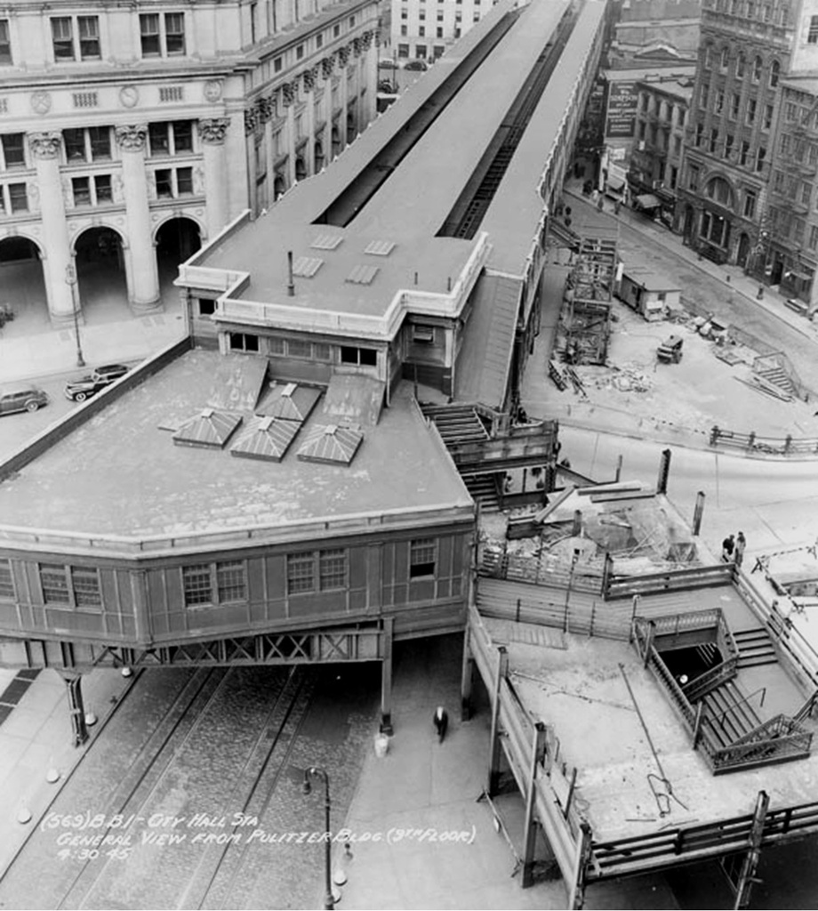
Also, once I became confident of the exact location of this scene, I did a little more research and figured out that those long stairs behind the gas station led to the City Hall station for the Third Avenue El, which was the remaining elevated line still in operation in Manhattan at the time.
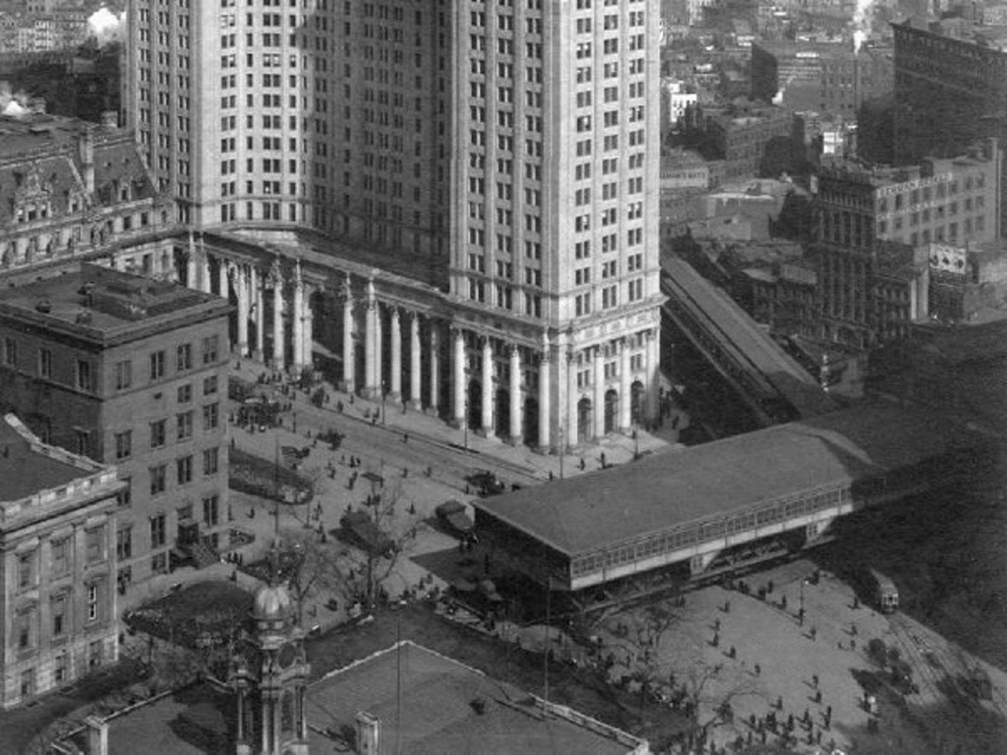
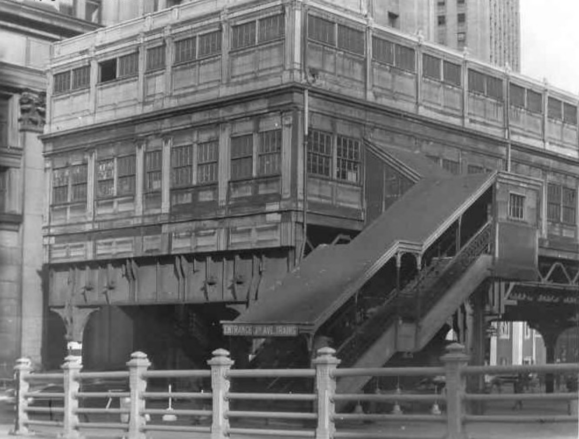
The elevated spur line that went to South Ferry, along with this City Hall station, permanently shut down just a few months after this scene from Side Street was filmed. The main El line along Third Avenue in Manhattan stayed in operation for a few more years, finally ending service in 1955.

After I finally confirmed the location of this scene, I was curious to see what used to be at the intersection of Park Row and Broadway, where I originally thought the Mobilgas station was situated.
According to a 1932 map of the area, that oddly-shaped plot of land on Park Row and Broadway was home to a building I had never heard of before — the former City Hall Post Office and Courthouse.
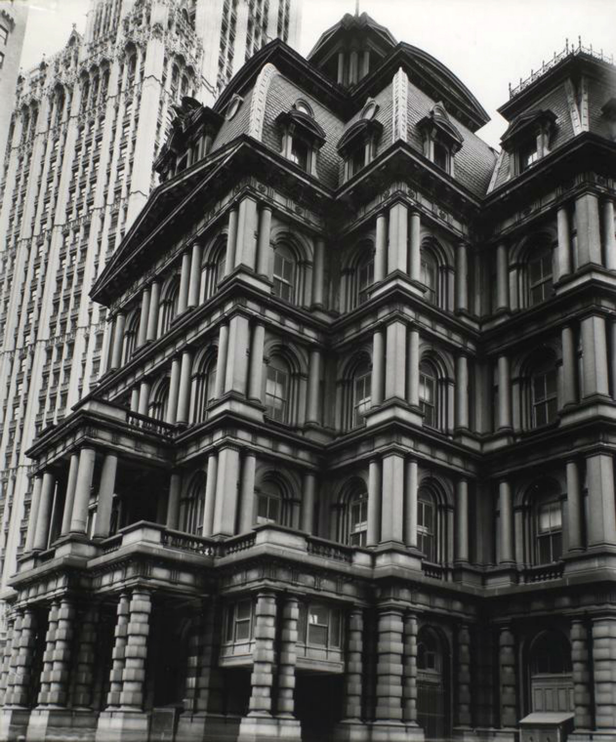
Designed by Alfred B. Mullett, and completed in 1880, this Neo-Baroque building with its mansard roof was considered by contemporary critics as a failure in design. It was described in a 1912 New York Times article as an “architectural eyesore” and “unsatisfactory to the Postal Service and the Federal Courts beneath its roof.”

Torn down in 1939, this former post office and courthouse epitomized the extravagance in design that was prevalent in New York City during the turn of the 20th Century. Personally, I always felt that these examples of outrageous edifices were truly wonderful, and are what makes many of the photographs from this era look like they were taken at some bizarre world’s fair. These structures are a far cry from what’s happening today, where unimaginative glass and metal boxes are being erected on every other block without any purpose other that maximizing profit.
Today, Mullett’s grand edifice is barely remembered —even by most NYC historians— but if you want to get a feel of what the building was like, you can visit Mullett’s Eisenhower Executive Office Building in Washington DC, which is a similar example of monumental French Second Empire architecture.
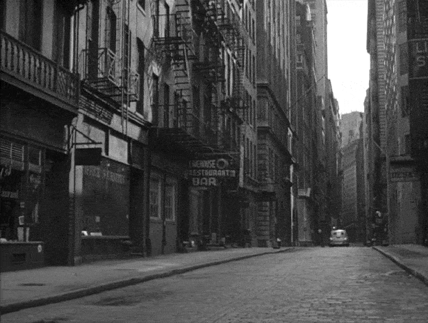
Chase – Frankfort Street
Strangely enough, I found this location before I found the Mobilgas location, not realizing that it was pretty much a continuation of that scene and was more or less staying geographically accurate. Turns out, this scene took place just a few yards away from the gas station.
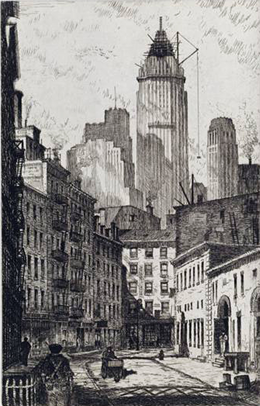
This was basically another scene I found by looking up an address in an old phone book. I could already tell they were the Brooklyn Bridge, but to find the exact spot, I hoped the large sign that said, “I. Lippman…Sole Leather” would be of some help.
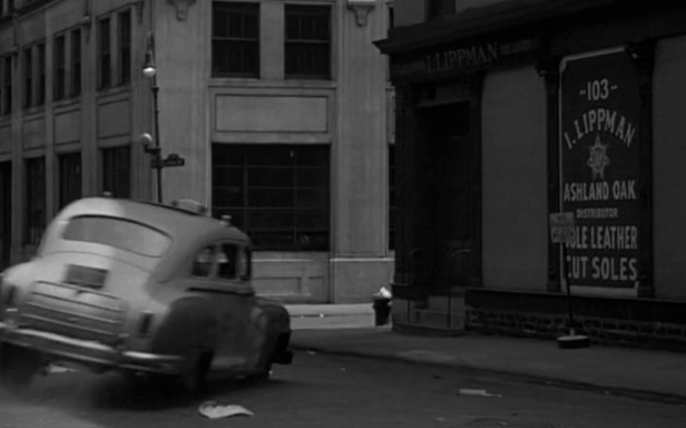
When I went to the library, I looked up “Lippman” in a 1949 phone directory and found a listing for 103 Gold Street, which made sense since the sign also had the number 103 on it. And after consulting a map, the address made even more sense, as 103 Gold turned out to be right next to the Brooklyn Bridge on the corner of Frankfort.
Unfortunately, none of the structures seen in the film are around today, except of course, the Brooklyn Bridge.
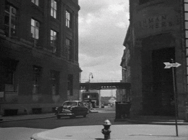
Shooting the Cabbie
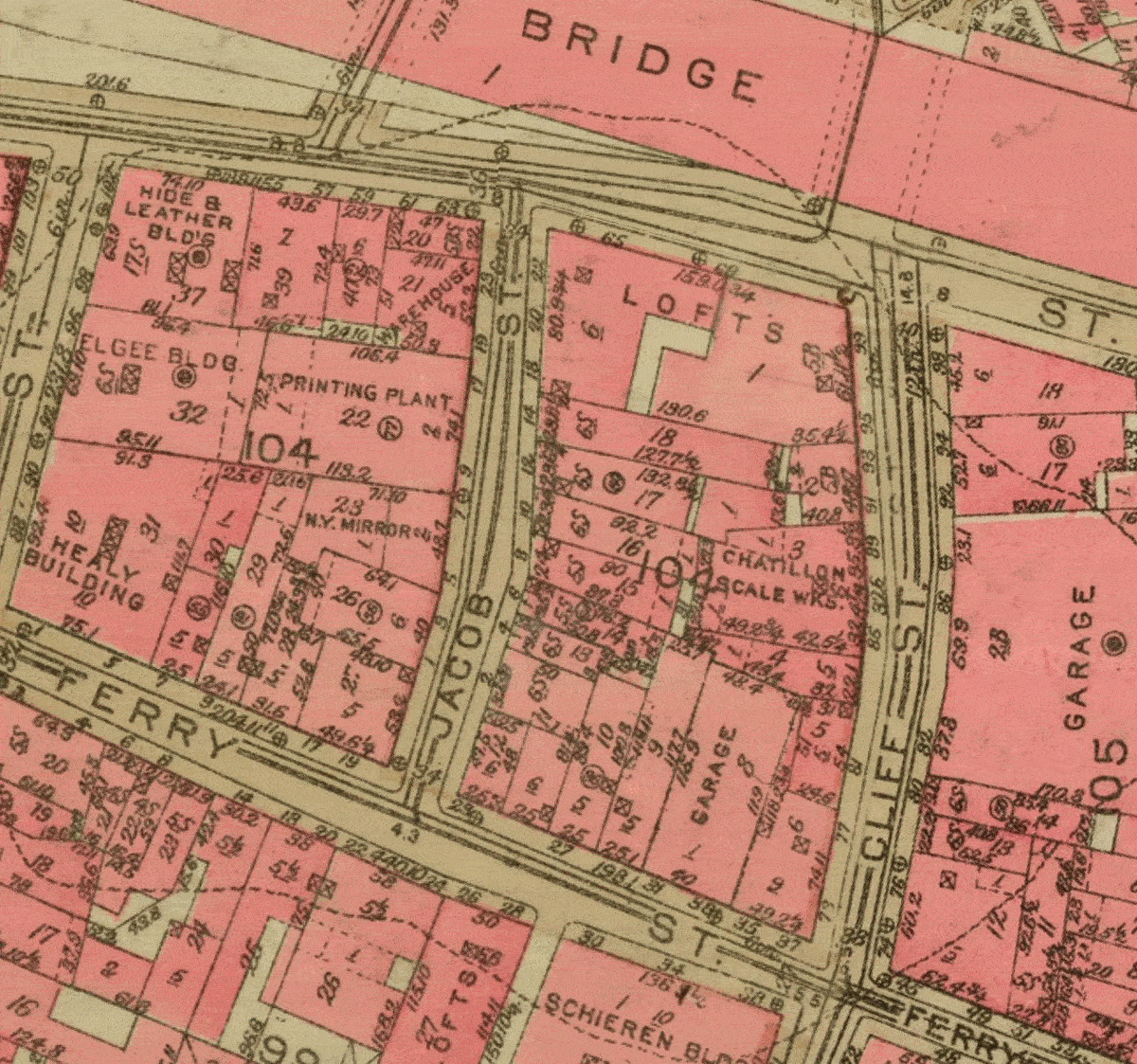
I found this location by first looking up an address in the phone directory for “Armour Leather,” whose sign is visible in the shot right after the cabbie is killed. Whenever I look up an address at the library, and find a match, there’s always a momentary jolt of excitement, especially when the address in the directory sounds correct. This happened when I found the leather shop address. It was listed in the directory as 5 Jacob Street, a location that wasn’t familiar to me, but sounded like something in lower Manhattan.
When I got home and looked up Jacob on Google Maps, I came up with nothing, but after doing a general internet search, I discovered that Jacob is a former block-long street that used to be just south of the Brooklyn Bridge.
Turns out it was located in a tiny neighborhood that used to be known as a leather and tanning district, and was once nicknamed, “The Swamp.” This four block area in lower Manhattan got this somewhat unflattering moniker because, naturally, it used to be an actual swamp.
Originally the streams and ponds were used by the leather merchants to treat and process the raw hides brought in by ships, but by the 19th century, some ambitious entrepreneurs decided to use the running spring underneath Jacob to open up a spa. With a reputation that the spring water had health-giving minerals that could cure ailments and diseases, hopeful New Yorkers came to Jacob Street every morning to take a drink, at a cost of sixpence a glass.
However, this spa enterprise didn’t last very long, as it was soon discovered that the “remarkable healing properties” of the water were due to the old tan pits that ran through the springs. After the decline of Jacob’s health spa, a handful of leather merchants and orienting houses remained in the neighborhood until the whole area finally got razed in the late 1960’s to make way for the large housing complex, “Southbridge Towers.”
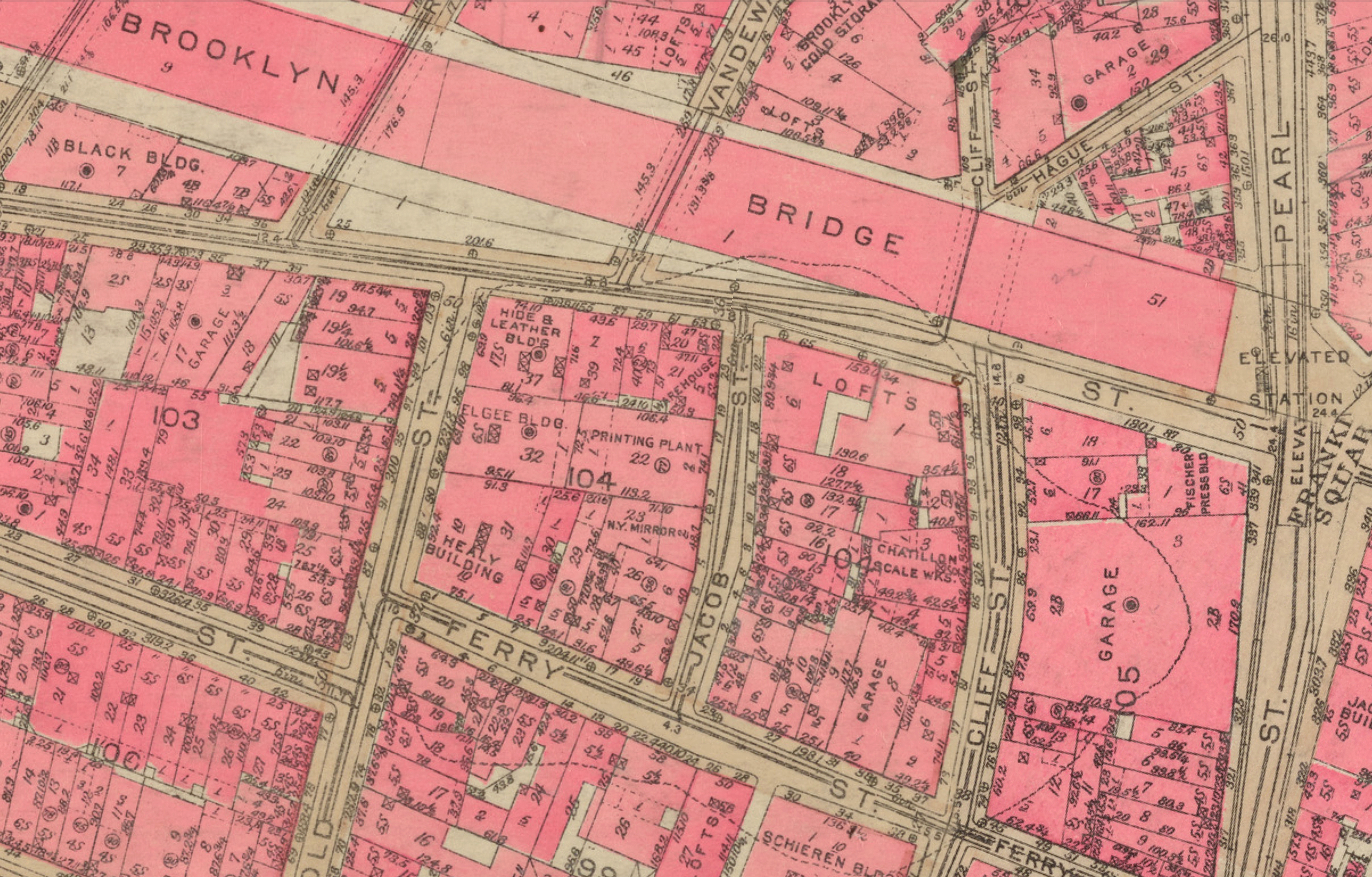
Disappointed that the streets from the film no longer existed, I still wanted to figure out roughly where the shooting took place and get the perfect orientation of the scene. Fortunately, since Jacob was only one block long, there were only a couple options that could’ve taken place.
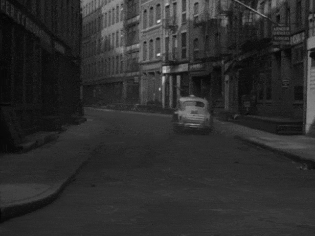
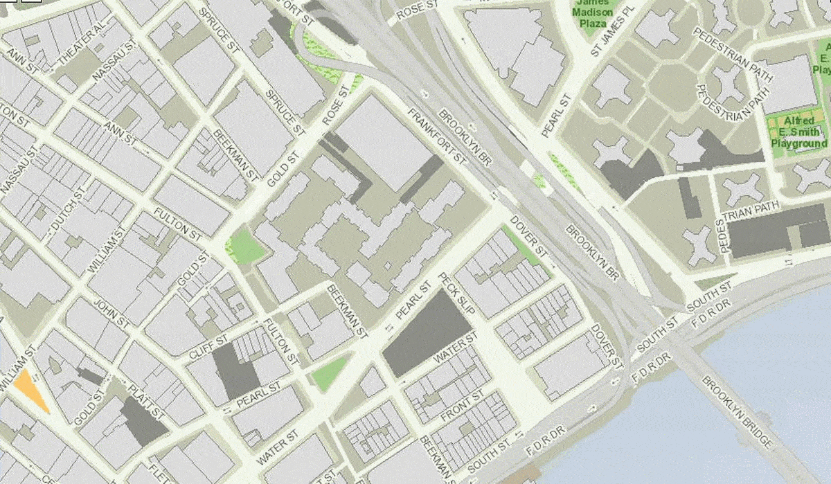
The first shot in this scene showed an elevated train in the background about one block away, so I figured that must had been the South Ferry spur line that ran along Pearl Street. With that as a starting point, it didn’t take long to figure out where the rest of the action took place. Basically, the taxicab came from Cliff Street, turning right onto Ferry Street (which was more or less a continuation of Peck Slip), and stopped at the alley between nos. 28 and 30. It was there that Garsell killed the cabbie (although the close-ups were filmed on a studio set), followed by the taxicab continuing west on Ferry Street and making a right onto Jacob.
At this point I was satisfied I got the location pretty much settled. However, after discovering Max Alvarez’s film-noir blog, I saw that his street descriptions were similar, but not exactly the same. So I decided to try to dig up some vintage photos of the area and make sure my conclusions were correct.
In my first go-round, I found a photo of Jacob Street on Robert Egan’s thoroughly fascinating website, PopSpots, that was analyzing a photo of Bob Dylan appearing on a 1966 cover of The Saturday Evening Post. As described by Egan, the photo of Dylan was looking south on Jacob Street and he used a vintage photo of the street he found on the NYPL archives as a comparison. Even though the image was low-resolution and taken from the other direction, I could match up several buildings that appeared in Side Street.
Months later, after the 1939-41 tax photos were released online, I was able to find a few better vintage shots of the area, including of both Ferry and Jacobs Streets. Strangely, almost all the photos I found happened to have been taken from the reverse angle, but I did find one that was nearly identical with the film.

Even though most of the tax photos were taken from reverse angles, they clearly showed the same buildings that appeared in the scene, confirming my original conclusions to where the action took place. Plus, they offered a nice glimpse into a long-gone area that used to be affectionately known as “the Swamp.”
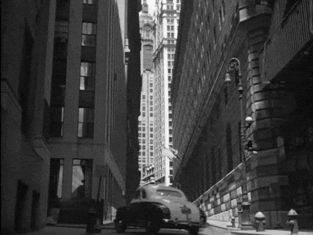
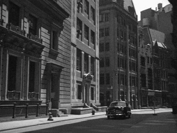
Chase – Exchange Place
This was another scene that fortunately had a storefront included in one of the shots which led to the filming location.
After the cab crosses the main intersection, you can see a store that has a sign that says, “Walker & F______ Tailors.” Even though I couldn’t read the second name on the sign, I was still able to find the tailors address in the 1949 yellow pages, which was at 52 Broadway. That meant the taxicab traveled east on Exchange Place, crossed Broadway, and continued on towards (the very snappy sounding) New Street, where you can see the edge of the extant building at 30 Broad Street.
As far as I could tell, the only other extant building I could find from this scene was 42 Trinity Place (which you can see at the end of Exchange Place in the first “before/after” picture above), But that didn’t last long, as the building ended up getting demolished shortly after I took that picture in 2017.
But later on, I discovered that the building that’s at 52 Broadway today is technically the same one that appeared in this scene. I discovered this while trying to figure out the location of one of the most spectacular shots from the film — the first overhead shot from this chase sequence where you can see a tiny taxicab a couple hundred feet below being pursued by several police cars — which turns out, took place at the same intersection of Broadway and Exchange.

I got lucky when it came to figuring out the location of this overhead shot. Blakeslee spent a good amount of time searching through vintage photos of Lower Manhattan looking for matching buildings, without any luck. But after I identified the narrow Exchange Place in the street-level shot, I thought the equally-narrow street in the overhead shot could be the same place.
In search of any matching buildings, I started with 52 Broadway, which I discovered had a construction date of 1897. However, when I looked at a modern picture of the building, the facade looked nothing like what was seen in the film, and yet, it also didn’t look like anything from 1897. That’s because the building —formerly known as the Exchange Court Building— was rebuilt and restored in 1980-1982, where its facade was completely “modernized” and its height was raised from 12 to 20 stories.
Knowing that 52 Broadway of today looked nothing like it did in 1949, I searched for a vintage photo of the building and was pleased to discover that it looked exactly like the foreground building in that high-angle shot.
Chase – William Street
This location was found through straight-out perseverance.
When I first decided to tackle this quick scene, I already had access to Max Alvarez’s film-noir blog, which identified this shot as being on Warren Street. But after looking up and down Warren in Google Street View, I couldn’t find anything that looked similar to what was seen in the film. And it wasn’t as if the buildings on Warren were new — almost all of them date back to before 1949.
Next, I looked up “Livehouse Restaurant and Bar” (whose sign you can see on the left side of the street in the scene) in a 1950 phone directory, but couldn’t find anything. At one point I became worried that perhaps this was another scene that was shot on a street that has since been razed, but I tried to remain positive and decided to attempt one last tactic.
In the scene, if you look down the street, you can see it eventually runs up against a large building, then jogs a little to the left. Even though this wasn’t a completely unique street-layout for this area of Manhattan, it did narrow down the possibilities. So I just started looking on Google Maps for any street that had a slight jog to the left, finally landed on William Street where I spotted several corresponding matching elements, including the fire escape that’s on the building next to “Livehouse.”
After finally confirming I found the right spot, I could’t figure out why the blog inexplicably listed this location as being on Warren Street, when it was clearly on William. Perhaps it was simply a typo.
Chase – Liberty Street
The thing that helped me find this location was the presence of the prominent Federal Reserve Bank of New York on the corner of William Street and Liberty — a building that would be a pivotal location in a couple other films, including 1974’s The Taking of Pelham One Two Three and 1995’s Die Hard with a Vengeance.

Interestingly, I discovered some alternate footage of this location in the Side Street trailer, showing a much wider shot of Liberty Street. In it, you can see the former Great American Insurance Company Building, as well as a sign for Legion Memorial Square.
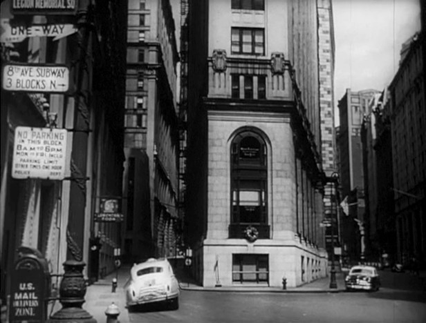
Having never heard of Legion Memorial Square before, I learned that it was named in 1933 in recognition of the American Legion — the largest veterans’ organization in the United States. But the reason I’ve never heard of it before is because this open space on Liberty Street was turned into a small park in 1978 and renamed Louise Nevelson Plaza (after the Russian-born sculptress), making it the very first plaza in NYC to be named after an artist.
But before this triangular block was an open plaza, it was home to the Great American Insurance Company Building — a 20-story “Flatiron” style building that was completed in 1908.

Originally called the German American Life Insurance Building, the company changed its name in 1918, after an anti-German sentiment developed in the United States during World War I. The building was demolished in 1971, a few years before the open space was renamed Louise Nevelson Plaza.
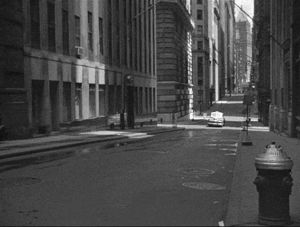
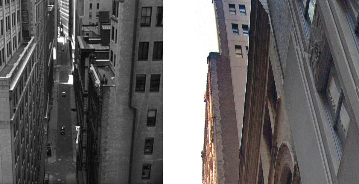
Chase – Pine Street
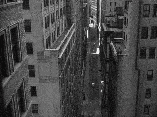
Blakeslee is the one who found this filming location. Unlike Exchange and Broadway, this high overhead shot on Pine Street had puzzled me for a long time. In fact, even after Blakeslee told me of the location, I had trouble finding matching buildings. The one matching element that helped him originally find it was the long spire that sits in the cemetery at Trinity Church on Broadway.
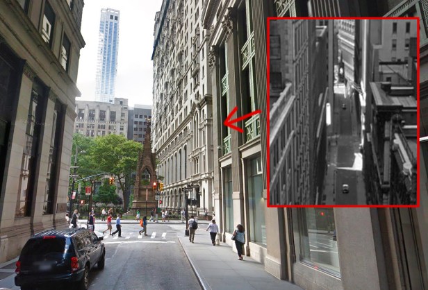
After he pointed out the spire, I was convinced it was the correct location, but because several buildings on Pine had either been replaced or remodeled, it took me a while to get a fix on where exactly the camera was set. Eventually, I came to the conclusion that the camera was on top of a building on Pine Street, looking west, somewhere between William and Pearl Streets.
The only unfortunate thing about overhead shots like these is that it’s practically impossible for me to capture an “after” picture from the same vantage point.
Chase – South William Street
I found this location by looking up the address of the Lehman Brothers building which appears in the second “before/after” image above.
Even though I knew what intersection was used in this scene, it took me a minute to figure out the exact orientation. The thing that helped me get my bearings was the presence of the nearby elevated tracks for the South Ferry spur line, which predominantly ran along Pearl Street.
Coincidentally, the set of the tracks that appears in this scene is the same set of tracks that appears in the “All-Points Bulletin” scene when the camera is pointing towards Hanover Square. In fact, when the camera is pointing towards the Lehman Brothers building, you can see the former New York City Police Museum in the far distance.
Chase – Final Car Crash
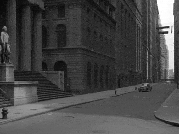
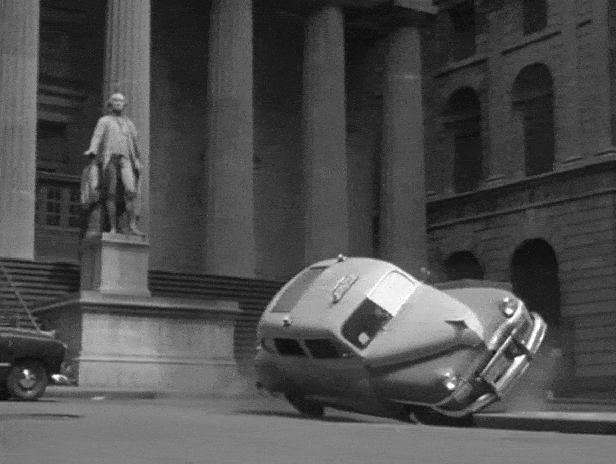
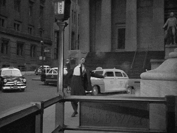

Even though this is the last scene in the film, this was one of the first locations I was able to confirm. In fact, when Blakeslee and I first watched this film in 2001, we immediately recognized the location because we were already familiar with the Federal Hall building with its iconic statue of George Washington. Back in the early 2000’s, we were both starting to expand our knowledge of New York history and architecture, and Federal Hall was a place we had just done a bit of research on.
Once I began this “NYC in Film” project, I quickly discovered that many, many movies have used this location at the intersection of Broad and Wall Streets, and hopefully I will have the chance to cover many of them at some point in this blog.
As my research for 1949’s Side Street came to a close, I decided to map out the entire chase sequence from the film’s climax and turn it into a short video. You can see how wacky the chase gets towards the end.
Side Street Chase Map from Mark E. Phillips on Vimeo.
Side Street has always been one of my favorite film noirs, long before I became interested in identifying NYC movie locations. Although it doesn’t have an incredibly strong script, the film does tell the classic noir story of a “good guy” getting drawn into a dark world of crime and murder.
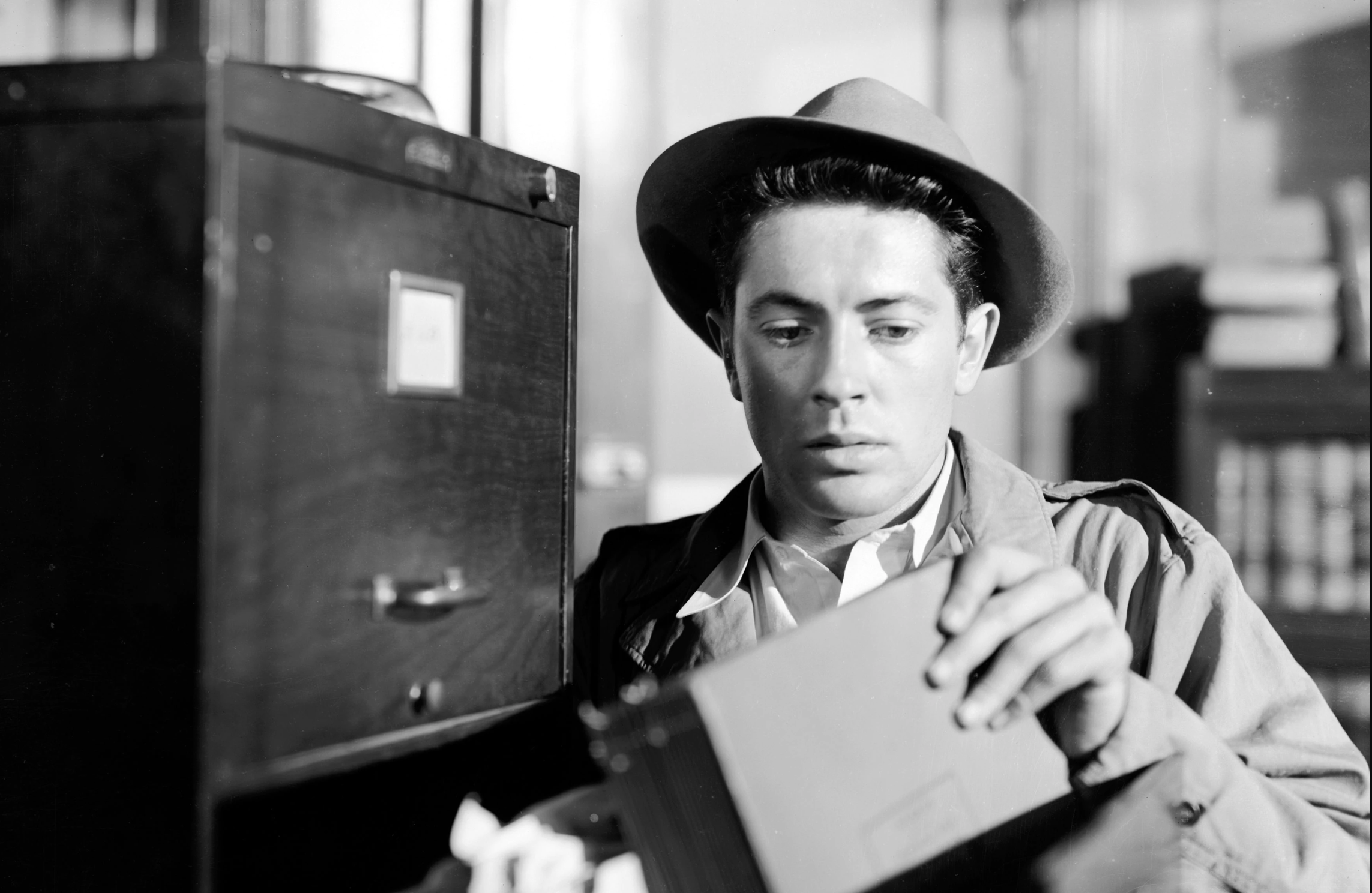
Aside from Joe acting so guilty and suspicious in many of the scenes, my biggest problem with the film are the motivations for some of his actions. For example, I’m not sure why a man would leave $30,000 in cash with a bartender — although I love the performance by Edwin Max who plays the slippery barkeep.
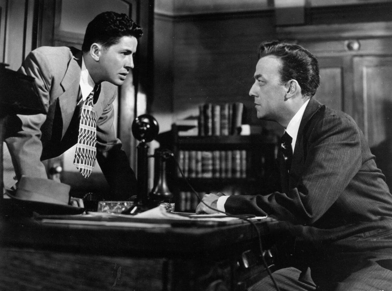
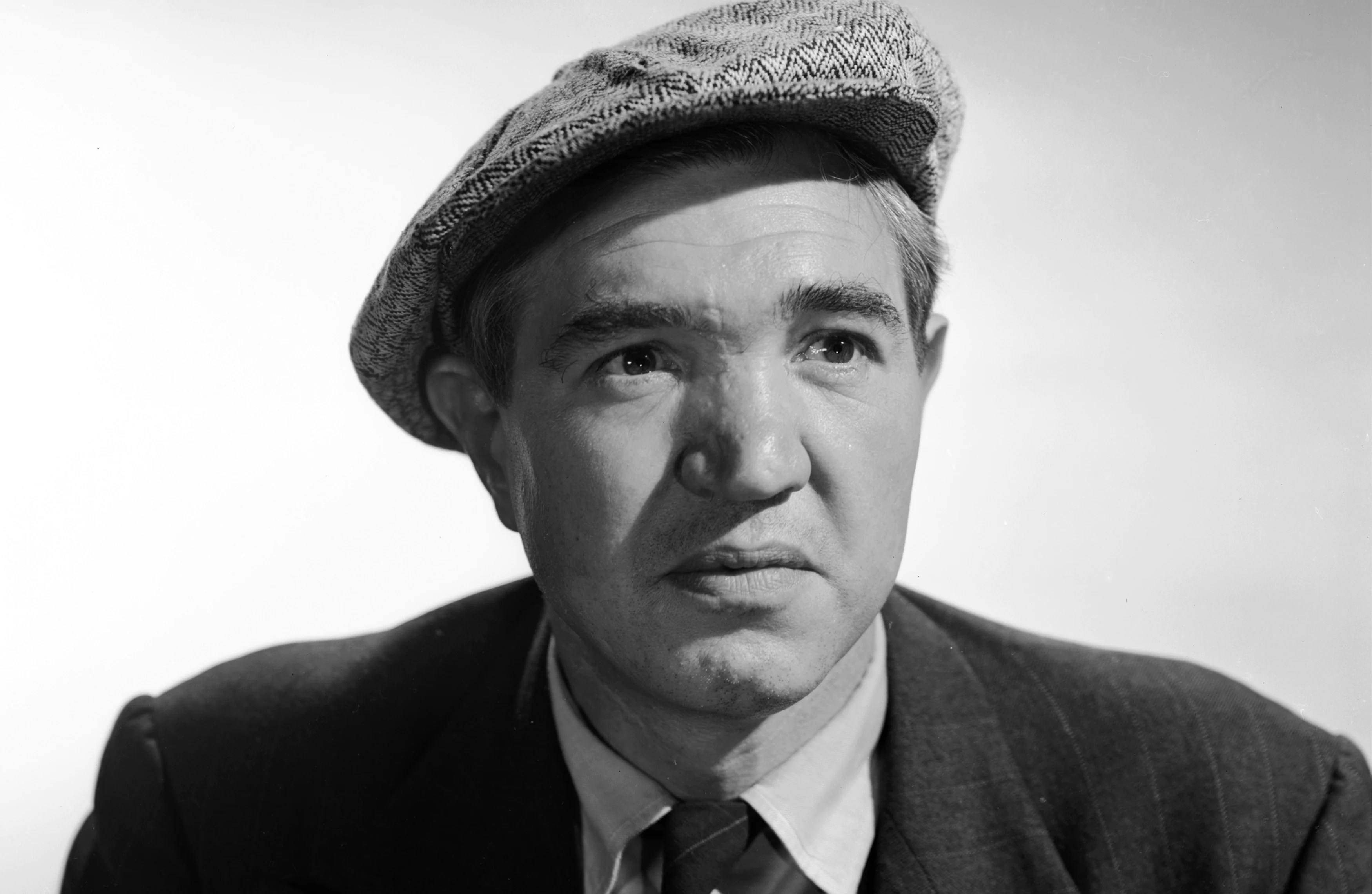
In fact, pretty much all the performances in Side Street are wonderful, from the jittery bank teller to the street-smart police captain, everyone is good in their parts each of them adding unique touches to their characters. When it come sto the three main criminals, Edmon Ryan and James Craig are serviceable as a corrupt lawyer and his hired muscle, but it’s New York actor Harry Bellaver as the crooked cabbie that is most memorable. His mix of ruthlessness and nervous caution creates a fun, irresolute character.
But out of all the secondary characters, the stand-out performance comes from actress Jean Hagen, who plays a lowend nightclub singer and Garsell’s ex-girlfriend. What could normally be a throwaway role is played with subtle grace, giving us a fully-developed, complex character with visceral feelings of ambivalence towards herself and her thuggish ex-boyfriend.
Hagen would later give equally memorable performances in the crime thriller, The Asphalt Jungle, and the musical comedy, Singin’ in the Rain, which earned her a nomination for Best Supporting Actress. Surprisingly, her film career never really took off, and most of her acting gigs ended up being small guest spots on television.
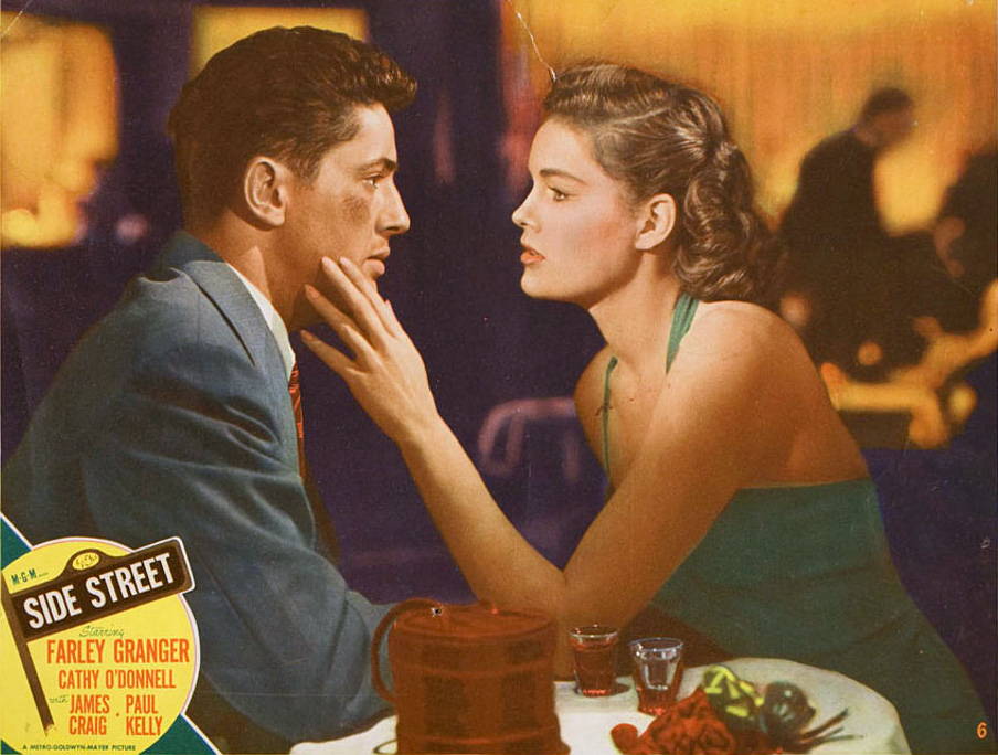
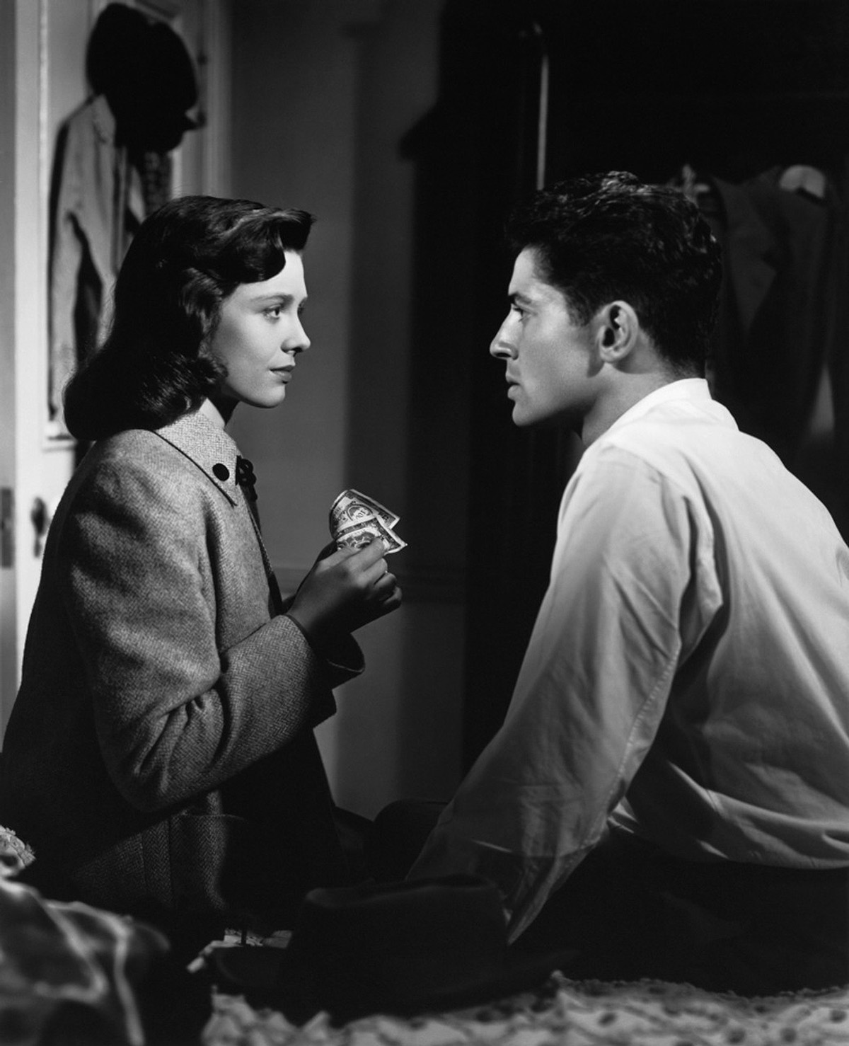
The weakest acting link in SIde Street probably comes from Cathy O’Donnell who’s pretty humdrum as Joe’s faithful wife. Although, to be fair, she isn’t really given very much to do in the film except look worried from afar as Joe goes off and makes trouble for himself.
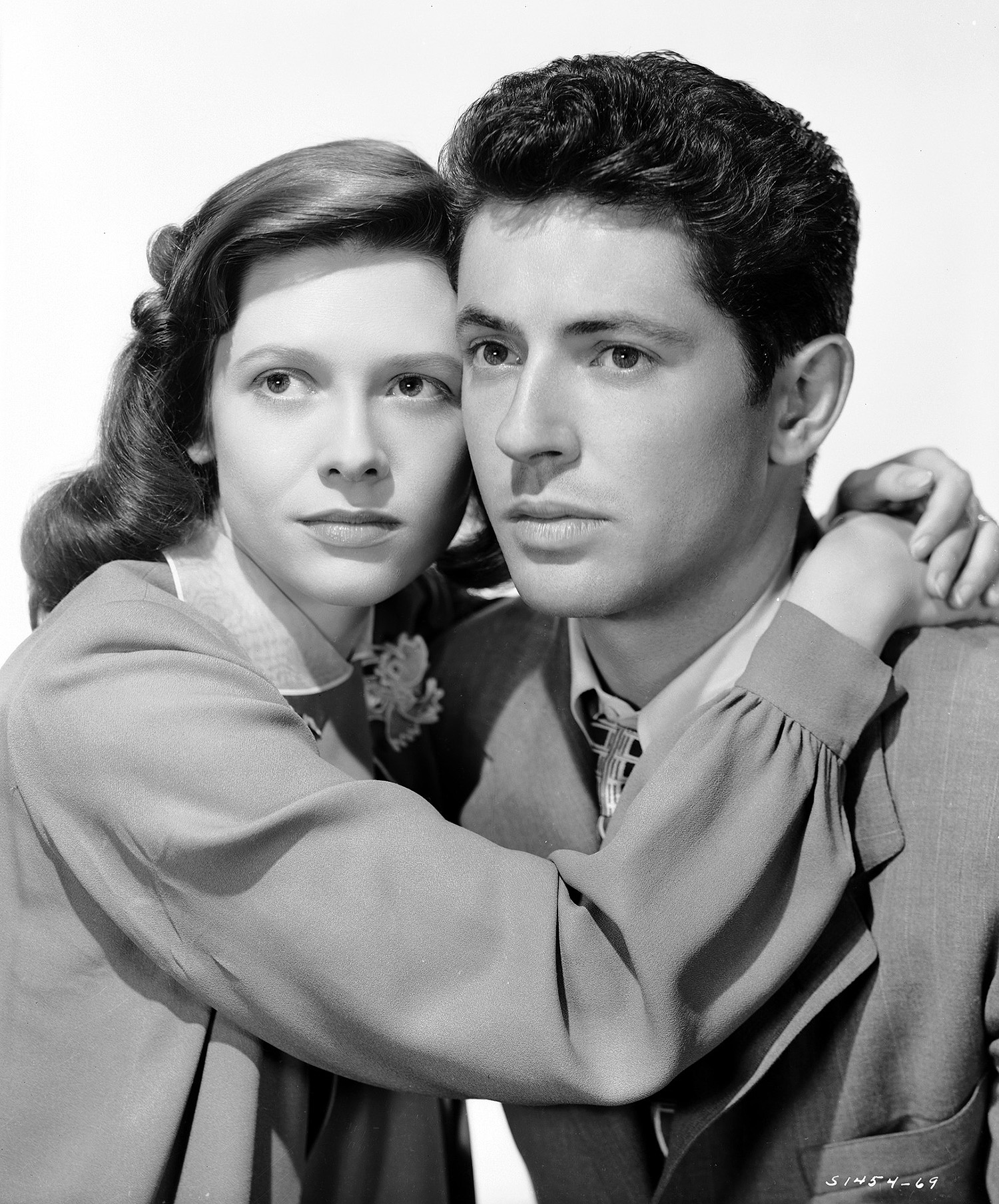
And while Farley Granger is fine as the main protagonist, his constant guilty nervousness throughout the story gets a bit tiresome by the end. Not to mention, his chemistry with O’Donnell is pretty much nonexistent, and it’s hard to buy into their passion for each other, no matter how many times director Anthony Mann staged a drawn-out kiss between the two.
Of course the biggest star of Side Street is New York itself. But to be clear, I don’t want to be accused of ascribing to the old cliché, “the city becomes one of the characters.” I’m just saying the filmmakers made a concerted effort to showcase NYC, giving us a good sense of what the metropolis looked like in 1949.
With a larger budget than most noirs received during this period, director Mann was able to offer a very detailed and specific vision of the city, filming the majority of the exteriors on location — something that hadn’t really been seen before.
While 1948’s The Naked City was probably the first film from this era to have almost all of its footage shot on location in New York, it lacked any real dramatic flair and consisted mostly of shots resembling something you’d see in a newsreel.
But with its combination of on-location shooting, dramatic lighting and over-the-top acting, Mann did something very unique. He created a film that was both a dark melodrama and a semi-documentary police procedural. 
Sure, Side Street isn’t perfect, but it has probably more unique filming locations than almost any other film I’ve seen (hence such a long post). And if nothing else, the extended car chase is easily one of the best to ever be put on film.
Pages: 12

Like!! Great article post.Really thank you! Really Cool.
LikeLike
Wonderful piece! Lower Manhattan is changing at an accelerated pace the last few years. The north half of the St John’s Terminal came down in 2019, with West Houston now uncovered by West Street. Very weird!
LikeLiked by 1 person
Yeah looks like I grabbed a pic of that location in the nick of time. I just walked past that part of Houston last week and didn’t even recognize it. I will miss that tunnel.
LikeLike
I didn’t realize there were so many nyc locations used in this film. Incredible time capsule!
LikeLike
I saved your article on Side Street until after I watched the movie. What a fantastic bit of investigation! Having been to NYC recently I was able to identify many locales myself, and your background information e.g. 13th Ave, is fascinating. Your hard work is very much appreciated!
LikeLiked by 1 person
Amazing!
LikeLike