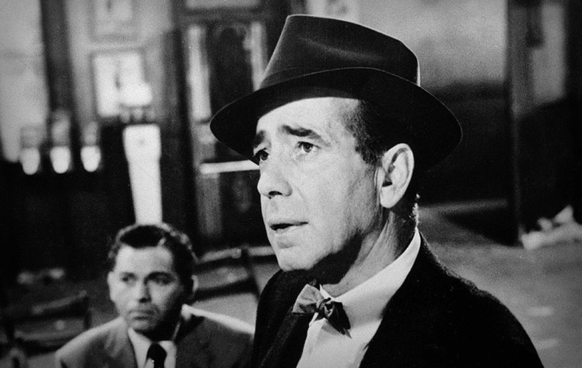
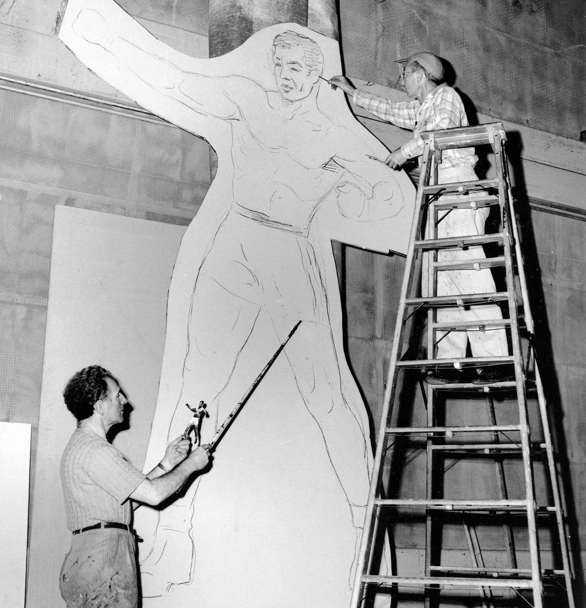
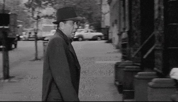
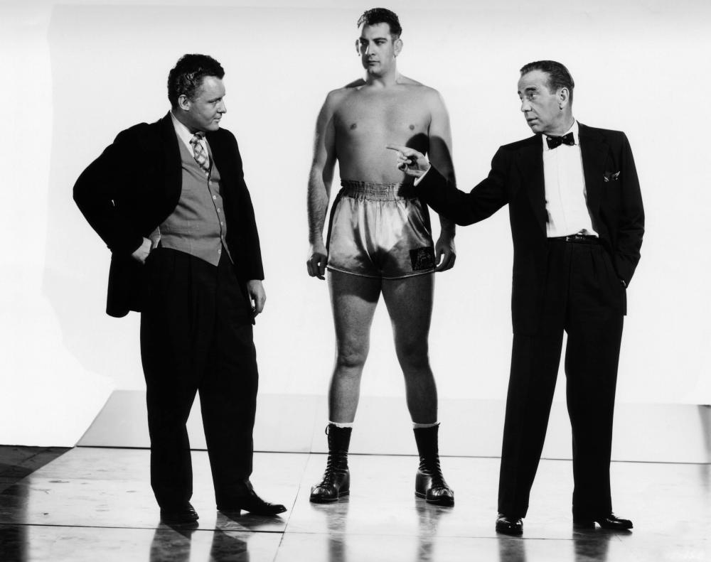
In his final film role, Humphrey Bogart plays Eddie Willis, a washed-up, out-of-work sportswriter who sacrifices his integrity to take a job from an unscrupulous boxing promoter, Nick Benko (Rod Steiger), acting as the press agent for a naive 6’8” fighter from South America named Toro (played by wrestler Mike Lane).
Filmed on location in NYC (as well as Los Angeles, Las Vegas and Chicago), The Harder They Fall is a brutal indictment on the ethicality of boxing. While another boxing movie released that same year, Somebody Up There Likes Me, used real-life locations to emphasize the dark, gritty world of a boxer, The Harder They Fall’s director Mark Robson used mostly benign locations to capture the pragmatic realism that surrounded the corrupt business-side of the sport.
One of the pleasures of tracking down these locations was having the rare opportunity to stand in the footsteps of a legend of the Silver Screen — Humphrey Bogart. Born and raised in Manhattan, Bogart appeared in numerous films whose stories took place in New York City, but as far as I can tell, he never performed on-location until the end of his career, when he appeared in Billy Wilder’s 1954 film, Sabrina, and this 1956 film.
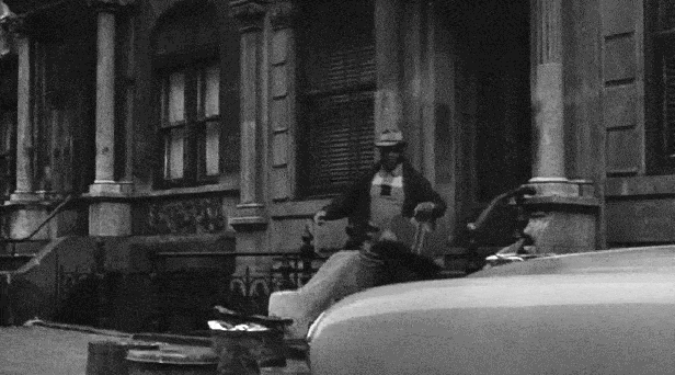
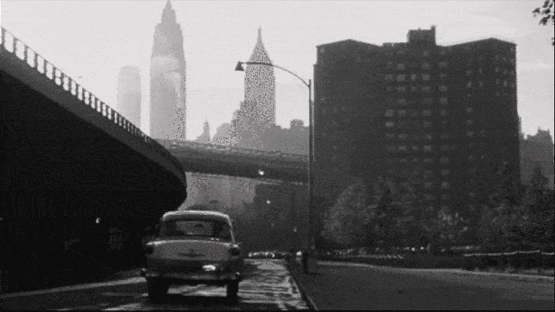
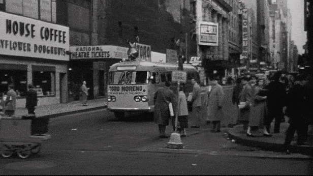
Toro Arrives
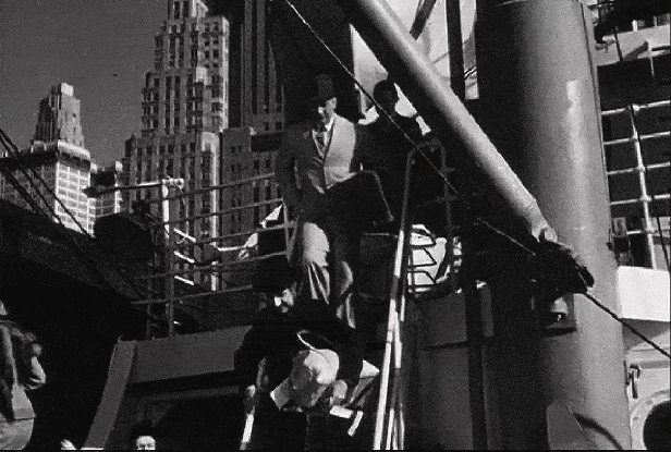

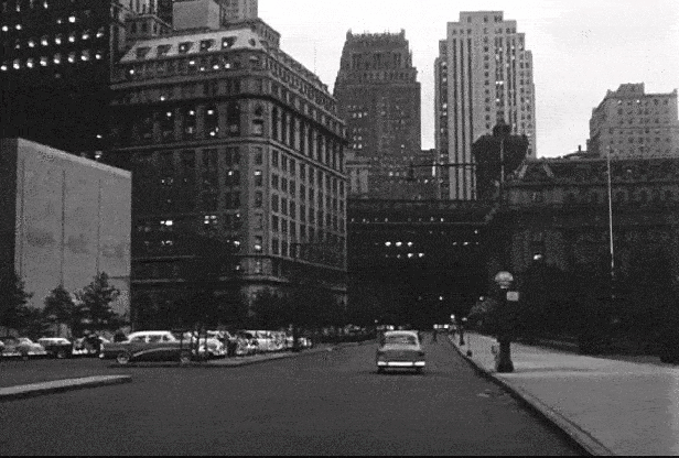
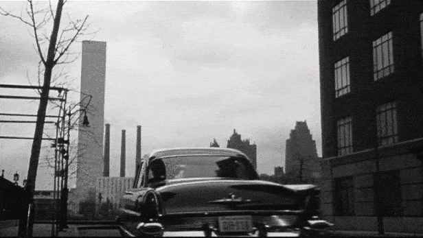
I easily identified the location at the end of this scene to be Battery Place in Lower Manhattan, however, I initially had trouble figuring out the location of the building Toro exits at the top of the scene. The thing that threw me off was the sign on the building behind the men which referenced a street corner at “Morris and West 5th.”  Having spent many years working at Steiner Studios in Brooklyn, I immediately thought of Morris Avenue at the adjacent Navy Yards, which intersects a 5th Street not too far from a dry dock. However, I soon abandoned this line of thinking when I couldn’t find any buildings at the Brooklyn Navy Yards that matched the one they exit in the film.
I then figured the tall buildings that appeared in the reverse shot was my best bet in figuring out this location and I enlisted the help of my research partner, Jeff Blakeslee. A few hours later, he came back to me with the intersection of Morris Street and West Street in Manhattan, which offered a view of some tall buildings that lined Trinity Place, which matched the ones seen in the film.
After studying vintage maps and old aerial photographs of the area, I concluded they came out of Pier 3, whose entrance was just north of where Morris Street intersected West Street. (This, of course, was when West Street still ran directly along the Hudson River; about twenty years before landfill would be added to the shoreline to allow for the development of Battery Park City.)

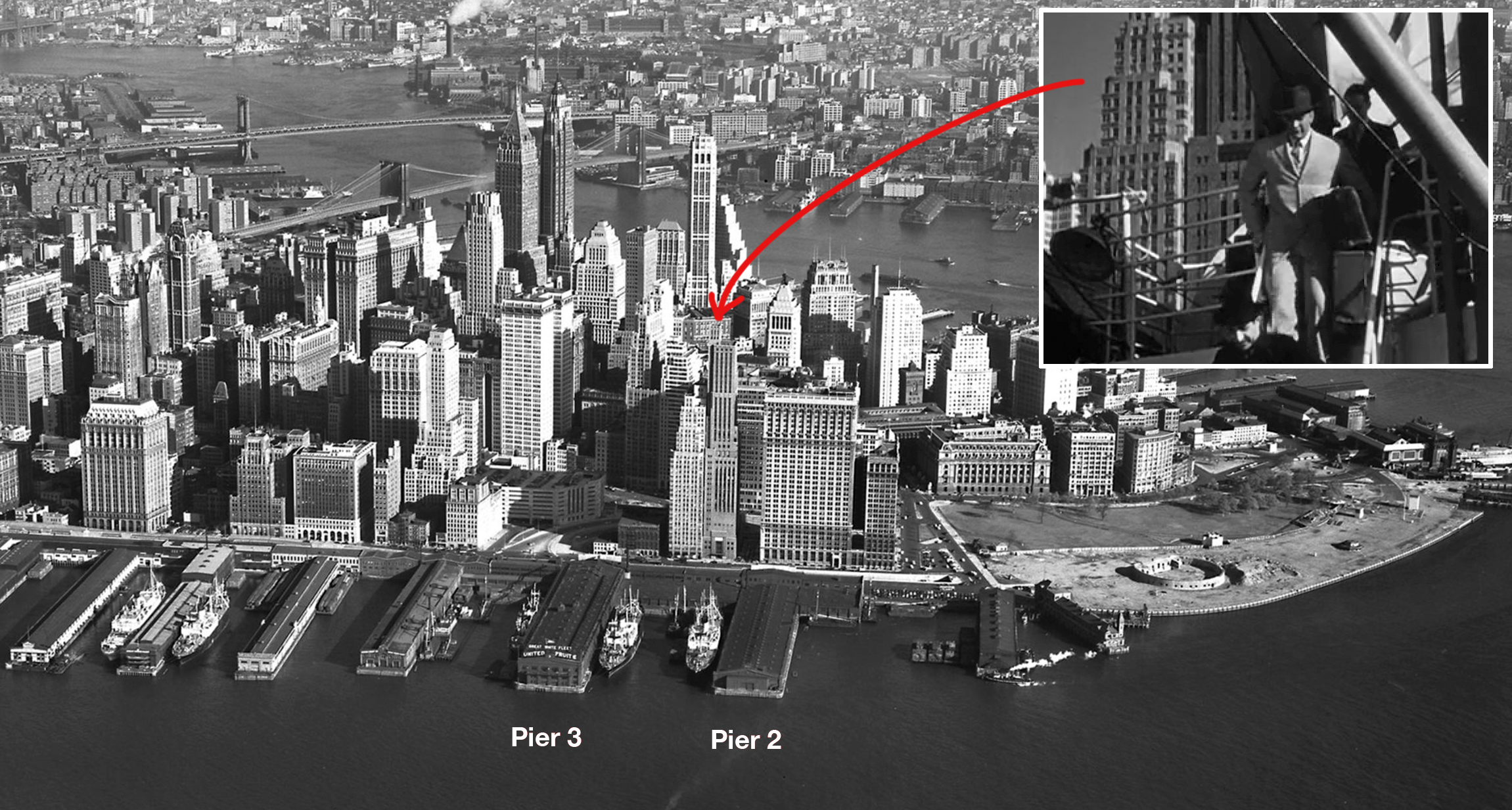
After studying the tax photos from c 1940, I found an image of Pier 3 that seemed to match the film. The tax photo was a fairly wide shot so it was hard to match the details, but the layout and facade looked correct. However, the one thing that puzzled me was that, according to all maps and photos, these piers were occupied by a United Fruit Company, which I assumed operated cargo ships exclusively.
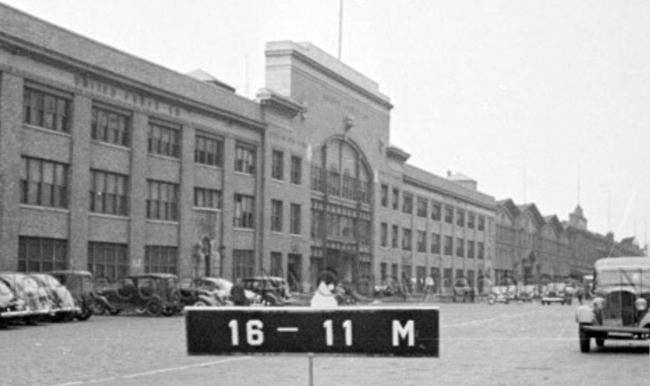

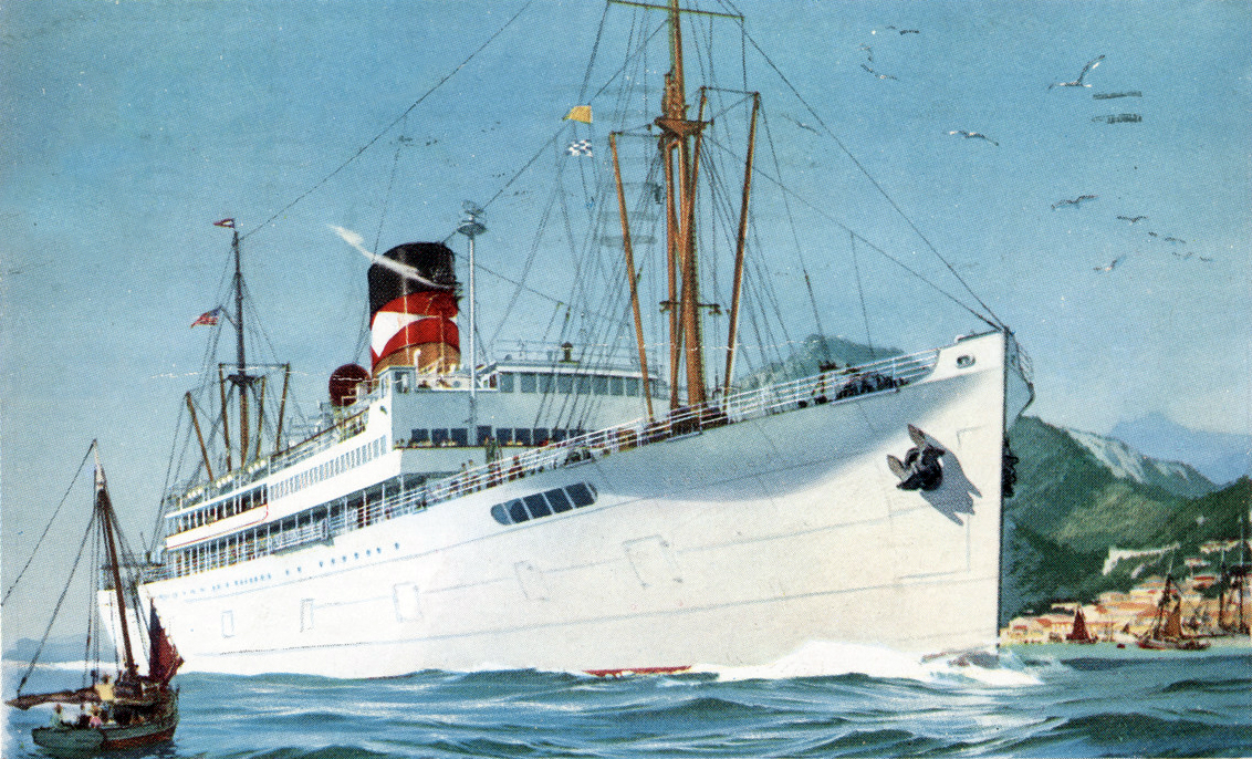
But after a little digging around, Blakeslee and I discovered that the United Fruit Company had a line of steamships (under the “Great White Fleet” banner) that would carry both bananas and passengers between their South American and U.S. ports. And several sources confirmed that United Fruit Company used Pier 3 in Manhattan for their Great White Fleet.
Although these ships were originally designed to only transport cargo, the company realized that by making accommodations for passengers, they could increase their profits with each voyage. This fleet of cargo-liners, sometimes nicknamed “banana boats,” were instrumental in establishing Central and South America as vacation destinations. But it was the people traveling in the reverse direction —South Americans immigrating to the United States or England— which led to the derogatory phrase, “to come off a banana boat.”
Surprisingly, this fleet of cargo-ships continued carrying passengers all the way into the 21st century.
In 2007, after over 100 years of operation, Chiquita Brands International (the successor to United Fruit Company) sold their remaining 12 refrigerated freight vessels to Eastwind Maritime Inc. for $227 million, under the condition that they’d be able to lease them back. But this arrangement didn’t last long, as Eastwind filed for bankruptcy two years later.
Even though The Harder They Fall was nominated for an Academy Award for Best Black and White Cinematography, when it came to the locations used, I always felt most of them were somewhat uninspired… with the exception of this one. I find it absolutely fascinating to get a glimpse of what the Manhattan shoreline used to look like, when it was dotted with hundreds of docks and piers, and when the boat was still a competitive form of travel in the world.
A few years ago, the late-journalist Pete Hamill recalled his days in NYC when piers still lined the river:
When I first went to work on a newspaper, which was in the summer of 1960, at the NEW YORK POST, it was located on West Street, 75 West Street. And the owners, being not particularly generous, had no air-conditioning in the place, so the windows were opened all night as we worked on the night shift. And I would type and slap, type and slap, type and slap. The thing I was slapping at were insects, and they were flying into the newspaper because right across the street was the United Fruit Company pier. It was one of a whole string of piers that ran all the way up the North (Hudson) River until it began to hit the passenger liner piers in midtown. That sense of the thriving, noisy, dirty, exuberant waterfront is gone now.
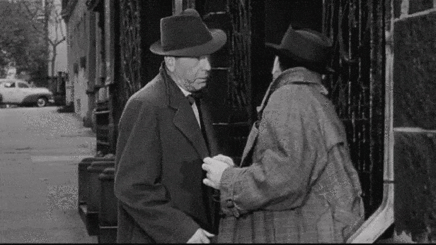
Picking Up George

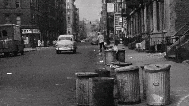
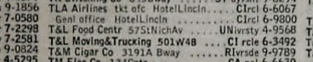
Blakeslee helped me find this location as well. He surprised me by being able to decipher the name of the corner store that appears on the left side of the frame as the car drives away. When I looked at the sign above the entrance, I couldn’t make heads or tails of it, but he was able to make out “T & L.” Afterwards, I realized what my problem was — I thought the black shapes above the entrance were the letters, when in fact it was white serif letters inside a single black shape.
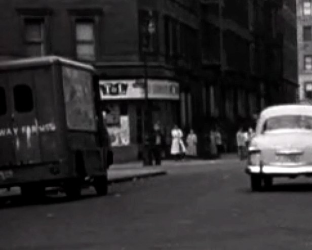
From there, we looked up the name in a 1946 Manhattan phone directory (available online here) and found a T&L Food Center at 57 St Nicholas Avenue in Harlem.
After consulting Google Street View, we discovered that the corner store was still there (under a different name) and that the row of Renaissance-style apartment buildings on W 113th Street matched the ones in the film. After a little triangulation work, we concluded George (played by former heavyweight champion, Jersey Joe Walcott) emerged from building number 107.
Interestingly, when I went to Harlem to take my “after” pictures for this scene, I noticed the facades and storefronts looked very much like they were still in the 1950s. That’s because a film crew was prepping the area for some location shooting for Steven Spielberg’s remake of West Side Story, which takes place around the same time Harder was made.


Needless to say, it was a bit bizarre taking pictures in 2019 of a street corner that was set-dressed to look like the 1950s, for the purpose of comparing those pictures to a film that was actually made in the 1950s. I almost wanted to walk up to the production designer and explain to him that they were crossing meta-paths with Bogart’s last film, but I’m sure my enthusiastic rant would’ve simply been met with a blank stare.
Nick’s Home
Naturally, the 39-story United Nations Secretariat Building was the main clue in identifying this scene, placing it somewhere north of 44th and 1st Avenue.
With an elevated vantage point of the UN, I figured they shot this scene on Beekman Place in Turtle Bay, which sits on a promontory overlooking 49th Street. As you can see from the above “before/after” image, the spectacular view of the UN headquarters in 1955 is now obstructed by an apartment tower at 860-870 United Nations Plaza.
Just two blocks long, Beekman Place is an interesting little oasis — an out-of-the-way piece of elevated land, nestled between First Avenue and the East River. It’s named for Dutch immigrant William Beekman, who served a long life in public office during the late 17th century, including Mayor of New York City, and Governor of both Delaware and Pennsylvania. William’s descendant, James Beekman, eventually built a mansion on this tiny Manhattan hillside and named it Mount Pleasant. The Beekman estate would figure prominently in American history when the British occupied the house during the Revolutionary War. During this time, Nathan Hale, American soldier and spy for the Continental Army, was temporally imprisoned on the property shortly before his execution. Some accounts claim Hale was hanged there as well, but it has never been substantiated.
The Beekman mansion survived until 1874, when it was torn down and eventually replaced with luxury apartment buildings, providing a private enclave for wealthy New Yorkers.
Even though the shot of the car driving away was definitely filmed on Beeckman Place in NYC, I suspect the reverse shot of Rod Steiger exiting his building was done in Hollywood. I could tell it was shot someplace else because the facade didn’t match any of the buildings that are on that street today (I even checked the 1940 tax photos to make sure there weren’t renovations made over the years).
It’s possible they filmed the reverse shot at another location in NYC, but that seems a bit pointless since the entrance to One Beekman Place would have easily sufficed. Regardless of whether it was done in LA or NYC, the likelihood of finding the location seems rather slim… unless I get extremely lucky.
Eddie’s Apartment

This is one of those rare moments when a movie shows both the name and number of an actual address — 8 Peter Cooper Road, located in Peter Cooper Village on the east side on Manhattan. Even without checking Google Street View, I was already pretty confident that the address shown was correct, but I still went to the location in person to confirm it. Once there, I noticed the entrance to 8 Peter Cooper Road had changed since 1956, but there was enough other matching evidence to conclude that they did indeed shoot there.
The reverse shot of the cab driving away did confuse me briefly, until I realized they must have filmed it somewhere else — I was just surprised how far they went to do it. I suppose the director felt a shot down near Catherine Slip would be more exemplary, showcasing the Brooklyn Bridge and the picturesque Financial District skyline. Since both locations had post-World War II residential developments next to an elevated highway, I imagine the production figured the two would intercut smoothly.
Now don’t get me wrong, I’m glad I was able to confirm this filming location, but to be honest, I find these “modern” housing complexes like Peter Cooper Village to be extremely boring subjects (although I’m sure they were probably still considered unique and innovative back in 1955). In addition to being architecturally boring, the fact that the construction of these post-War buildings ended up destroying countless numbers of historic, culturally-rich neighborhoods, I can’t help but sort of resent them.
But it was still pretty cool to be able to pinpoint the exact spot where one of my favorite movie stars, Humphrey Bogart, once stood.
Feldman’s Gym

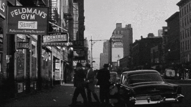

As far as I can tell, there never was an actual “Feldman’s Gym” in New York City. There’s no listing in the 1946 phone book and there’s no reference to it on any sports websites. I think they ended up using a fake gym name for the same reason the studio had to build its own boxing arena for all the fight sequences. According to producer/screenwriter Philip Yordan, private sporting arenas throughout the nation were “not available” when the studio sought permission to use their space for filming. That’s because it was already known that Columbia Pictures, which exposed dock corruption in 1954’s On the Waterfront, was seeking to do the same to the world of boxing and fight-fixing. So it only made sense that the cooperation of arena owners —as well as local gym owners— would not be very forthcoming.
Since there was no reference to an actual “Feldmen’s Gym” online, I figured out this location by identifying the John Golden Theatre on West 45th Street. Fortunately, I was able to easily read the large GOLDEN banner on the side of the theater that appears in the background, and calculate that the “gym” entrance was at 721 Eighth Avenue.
Unfortunately, the building got demolished around 1960, but many of the buildings across the Avenue and along 45th Street are still around. However, I’m not sure how much longer those tenements on Eighth Avenue are going to last. The last time I walked by that block, two of the remaining buildings were covered in scaffolding, which means they’re either being repaired or prepped for demolition — and the latter option seems more likely.
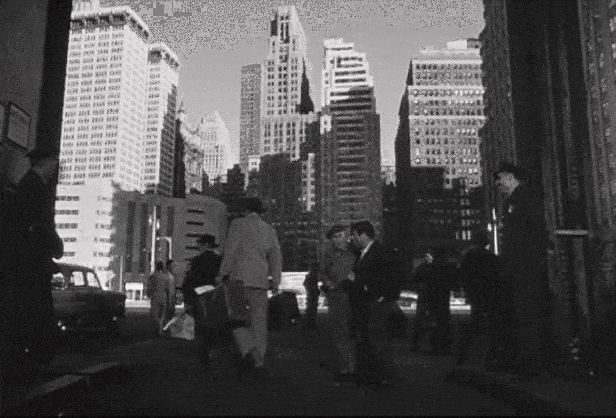
Tour Bus
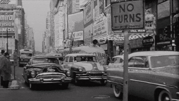
There’s not much needed to be said about this scene. It was pretty obvious by the landscape that they shot it in Times Square. Even though there’s not much left in Times Square today to compare with the film (as most buildings have since been demolished or radically remodeled), I was pleased to see that the Lyceum Theater that appears behind the bus on West 45th Street has more or less remained the same.
It night be noted that this movie was made back in the days when many of the avenues in Manhattan were still running both ways. And even though most of Seventh Avenue was carrying southbound-only traffic at the time of filming, the portion near Times Square was still carrying two-way traffic (until 1957), thus, the tour bus was able to head north through Times Square.
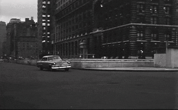
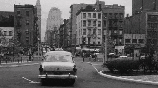
Switching Cars
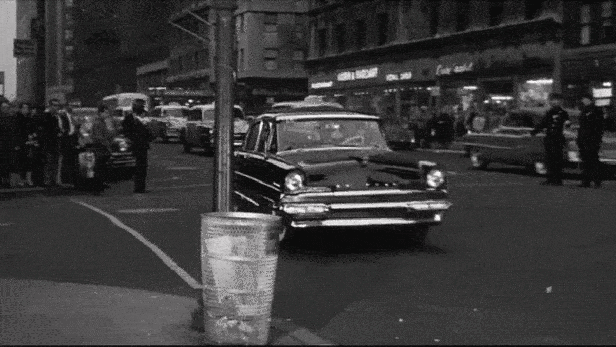
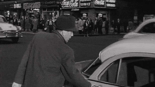
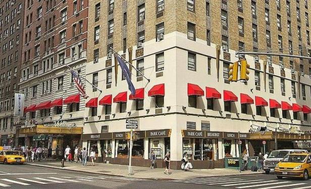
This scene, like many others in the film, looked like it was shot in midtown Manhattan. Also, at the very beginning of the scene, it appeared as though the skyline opened up in the background, indicating that they were probably not too far south from Central Park.
With that, it was just a matter of looking around in Google Street View in that general area in search of any matching buildings.
Even though it’s hard to tell by the messy-looking “modern” images above, there are a lot of extant buildings from that scene (including the Hotel Wellington with the flag poles). Hopefully, once the construction has cleared out, I can take a cleaner picture and make lining up the buildings a little easier.
One interesting thing about this scene is that it contains a recurring theme involving taxicabs. Whenever Eddie is seen traveling around NYC, he does so by taxi, opposed to Nick and his cohorts, who travel in private cars. And this scene really exemplifies this point by having Eddie make a concerted effort get out of Nick’s car and switch to a taxicab before heading home.
Eddie’s reason to use taxicabs might simply be an economic one, but I’m guessing director Mark Robson was also showing that the Eddie character was a man of the people and independent of Nick’s corrupt boxing syndicate.
But, of course, I could be just reading into this way too much.
Hotel Victoria
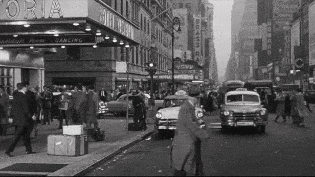

 Naturally, the large marquee from the Hotel Victoria let me know where this scene took place. However, I couldn’t find much information about the hotel (which has since been demolished), and most contemporaneous promo pieces simply listed its address as “51st Street and 7th Avenue.”
With such a vague address, the hotel could have been on one of four different corners, which led me to a little trouble figuring out the orientation of the scene.
Finally, once I was able to identify the Winter Garden Theater which appeared behind Bogart in one shot, I concluded that the hotel had to have sat on the east side of Seventh Avenue. From there, I was able to identify the extant Hotel Taft building, located between 50th and 51st Streets, placing the Hotel Victoria between 51st and 52nd Streets.
Completed in 1928, the 25-story Art Deco building had 1,000 guest accommodations, and was originally called the Abbey Victoria Hotel. Then in 1939, the space was divided into the Abbey Hotel and Victoria Hotel for the World’s Fair. They remained as two separate entities until 1966, when they merged back together to share operating costs.

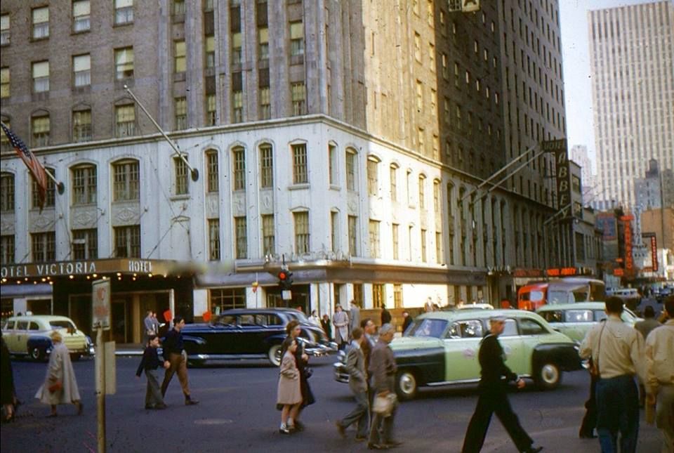
After that, the business remained as the merged Abbey Victoria Hotel until 1982, when the 270-foot building was demolished to make way for the expansion of the headquarters of the Equitable Life Assurance Society, connecting it to their 42-story building at 1285 Sixth Avenue. The building now houses the headquarters for Axa Financial, and was the site of a fatal helicopter crash in June of 2019, which led to an official ban on non-emergency helicopters flying over Manhattan.
St. Eustace Church
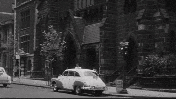
In the previous scene, when one of Nick’s cohorts tells Eddie the name of the church Toro went to, I had trouble understanding what the character said. Fortunately, Blakeslee, being much better versed in Catholic Saints, understood the character to be saying, “St. Eustace Church,” which turned out to be a fake name.
So, the next step was to search Google Images for “Manhattan churches,” and amazingly, I got very lucky, with the Church of the Incarnation showing up at the top of the results. Looking at the picture, I could tell the Church of the Incarnation clearly matched the one in this scene. Thankfully, like most Manhattan churches, it still remains standing today, and as an added bonus, the buildings that appear behind the cab as it travels north on Madison Avenue are still around as well, and look relatively unchanged.
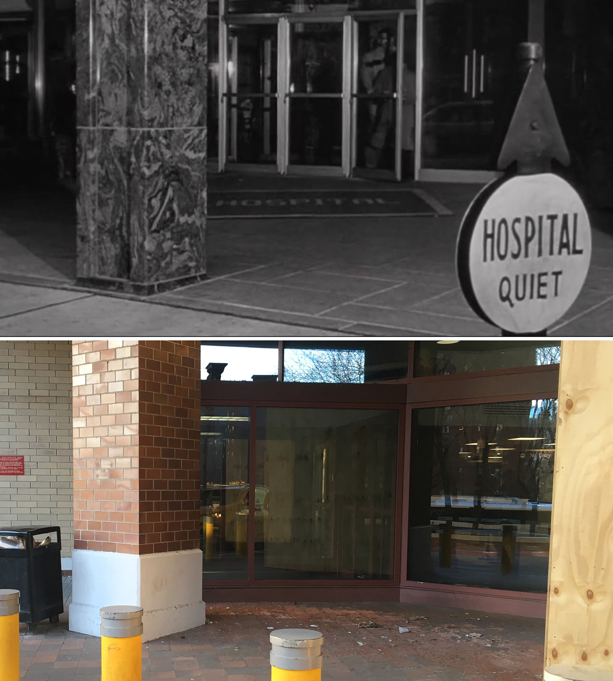
Leaving the Hospital
The big clue in figuring out this location was the Met Life Tower, seen in the distance as the taxicab drives off. I was already familiar with this perspective of the tower from my previous research of the funeral parlor scene in 1950’s Side Street, and it didn’t take me long to figure out this scene took place at the Veterans Hospital on 1st Avenue.

However, when it came to taking modern pictures of the location, it was impossible to match the angles from the film since the hospital built an addition in 1989, covering up the parking lot and driveway that appear in this scene.

While researching another location for this film, I stumbled upon a fascinating blog by Jack Davis, called Brotherly Love, that had a post about this filming location. After reaching out to Jack, he was kind enough to forward along a picture from 1989 when demolition/construction began along the 1st Avenue side of the hospital (where this scene was filmed) before the new building went up.
Even though the First Avenue entrance is now gone, you can still go to the entrance around the corner on 23rd Street and get a sense of what the layout used to look like.
Driving Toro to the Airport
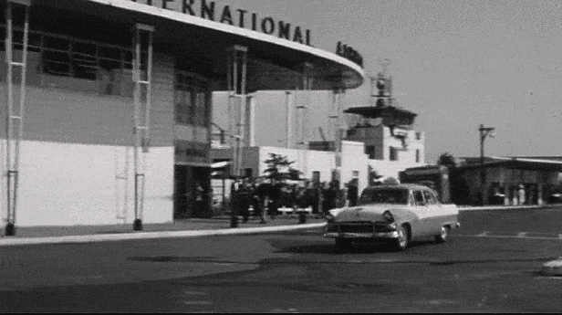
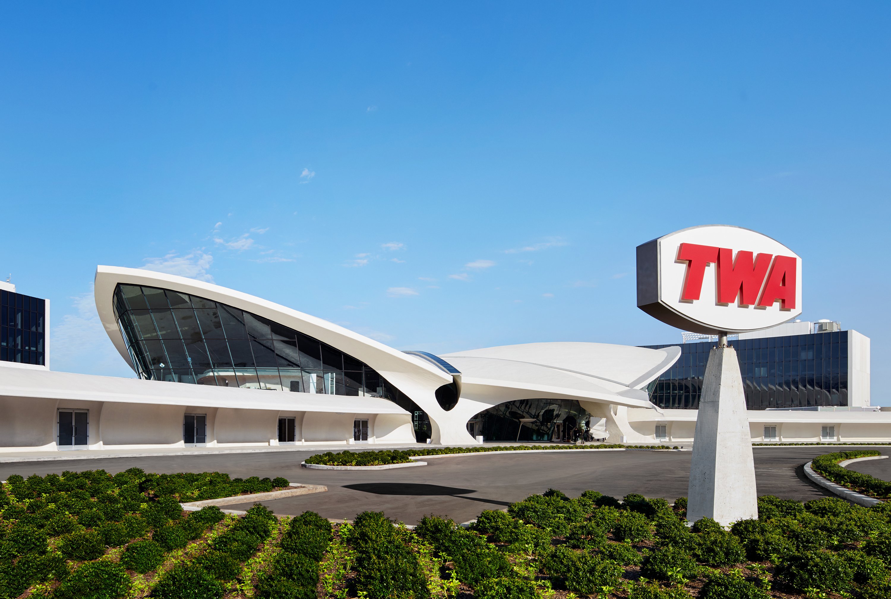
This was obviously filmed at JFK Airport in Queens, which was called the New York International Airport back in 1956, but was more commonly known as Idlewild. The trick was finding where the terminal seen in the film would be situated in the modern airport that exists today. As far as I can tell, all the original structures for New York International have been demolished, and the oldest structure that still exists today is the former TWA terminal, built in 1962 and since converted into a hotel.
Apparently, the terminal they drive past in The Harder They Fall was the first to be built, and was originally intended to be only temporary, but was instead expanded and upgraded when they had to handle the rapid increase in customer volume. Used as a self-contained, fully-functional facility, the passenger terminal included the original air traffic control tower, check-in counters, an observation deck, shops, and a small bar on the roof.

At the time this film was made, construction was already on its way to create the first permanent passenger terminal at Idlewild. It was clear they needed to expand the facilities since projections estimated that passenger traffic would grow to 11 million by 1965, compared to their first year of full operation in 1949, when they handled just over 200,000.
By 1960, the airport had built four permanent domestic terminals (each one dedicated to a single airline), in addition to the International Arrivals Building. It was also right around this time that the original passenger terminal seen in this film was torn down.
Luckily when it came to figuring out where that original terminal would be situated today, I had a couple great online resources — AirportHistory.org, which offered a nice pictorial history of JFK, and NYC.gov, which provided a series of aerial photos of NYC taken over the 20th and 21st centuries.
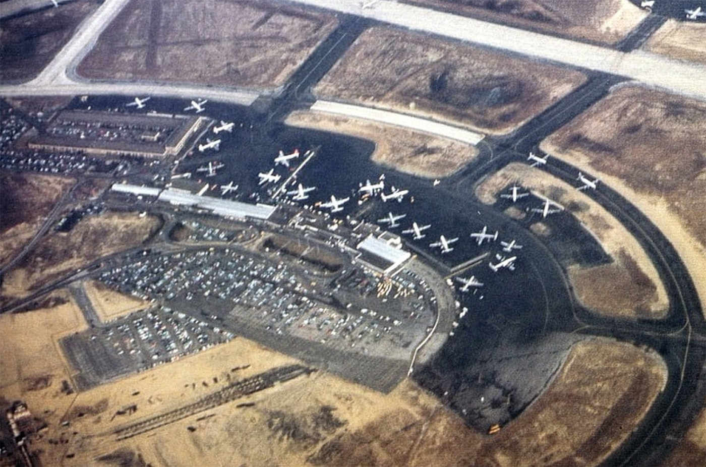
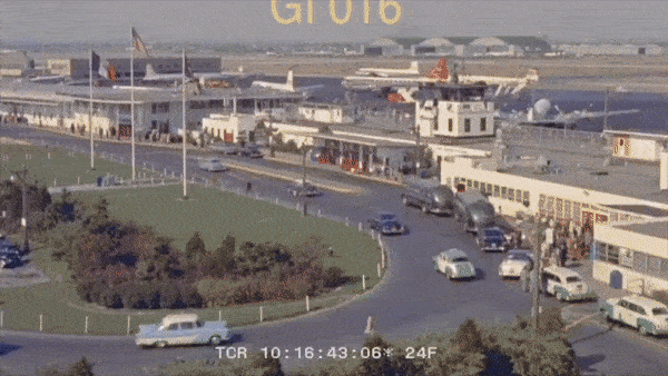
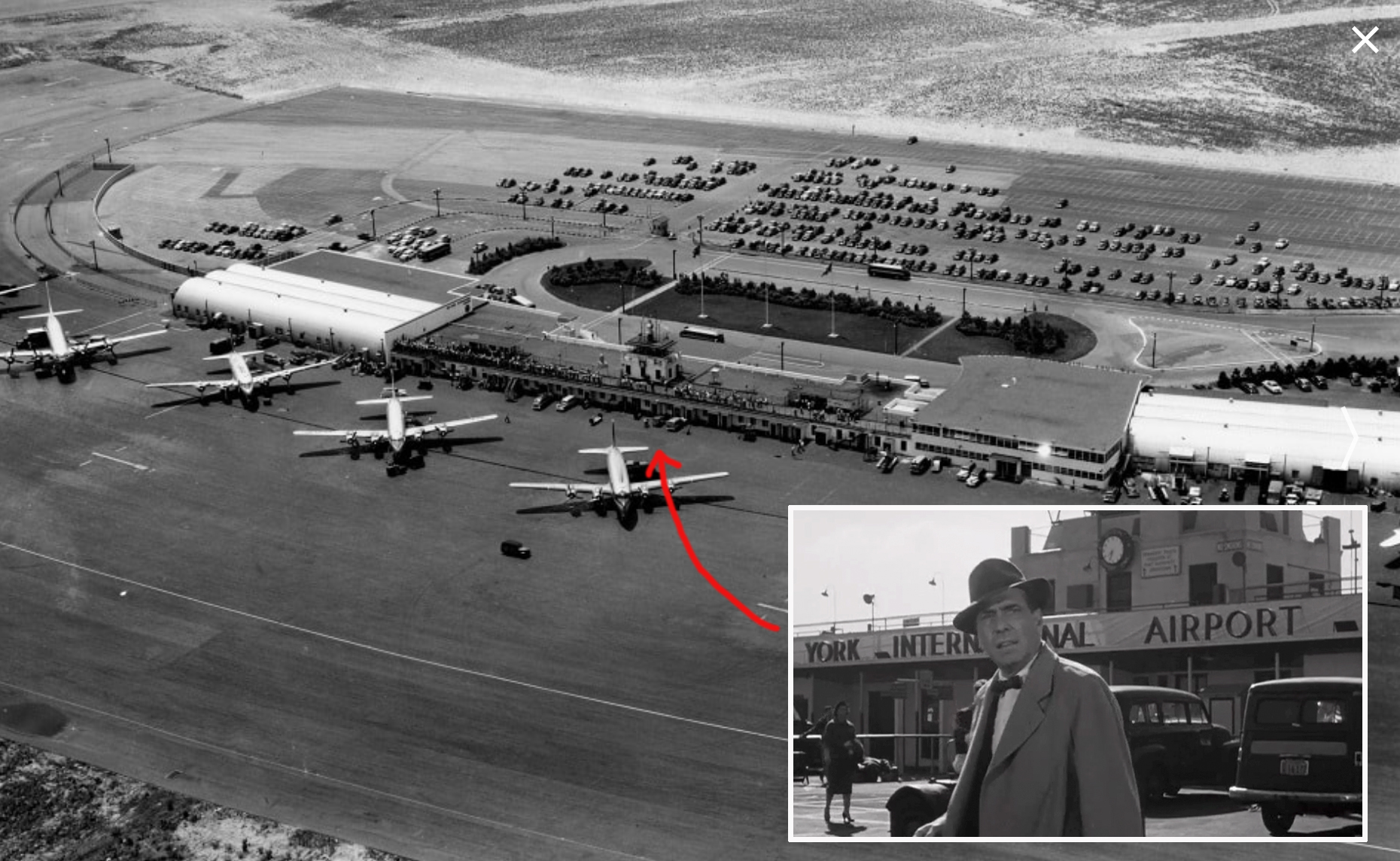
Once I got a fix on what the airport’s layout was like in 1955, I could compare it to a 1951 aerial photograph of the area to figure out the location of the terminal. The one landmark I found most useful in confirming the terminal’s location was a large oval-shaped lawn that was out front where the cars would drive by. Once I pinpointed the right spot on the 1951 aerial, I could then compare it to a 2012 aerial, and estimate the location of this scene.
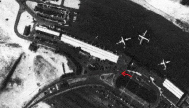
Since the road layout is completely different today, it was a little hard getting a perfect match, but I think I got a pretty accurate “before/after” depiction. It’s a shame they didn’t keep at least part of Idlewood’s original terminal in place, giving it some sort of nominal function, like a taxi stand or gift shop.
Nick Goes to Eddie’s Apartment
Like I mentored earlier, I never found the locations used in this film particularly enthralling, but the The Harder They Fall serves as a useful document of several places in NYC that have changed or disappeared since the 1950s. But the main reason I’d recommend seeing this film is for Bogart’s fine performance. It’s satisfying knowing that his final performance was a worthy one.
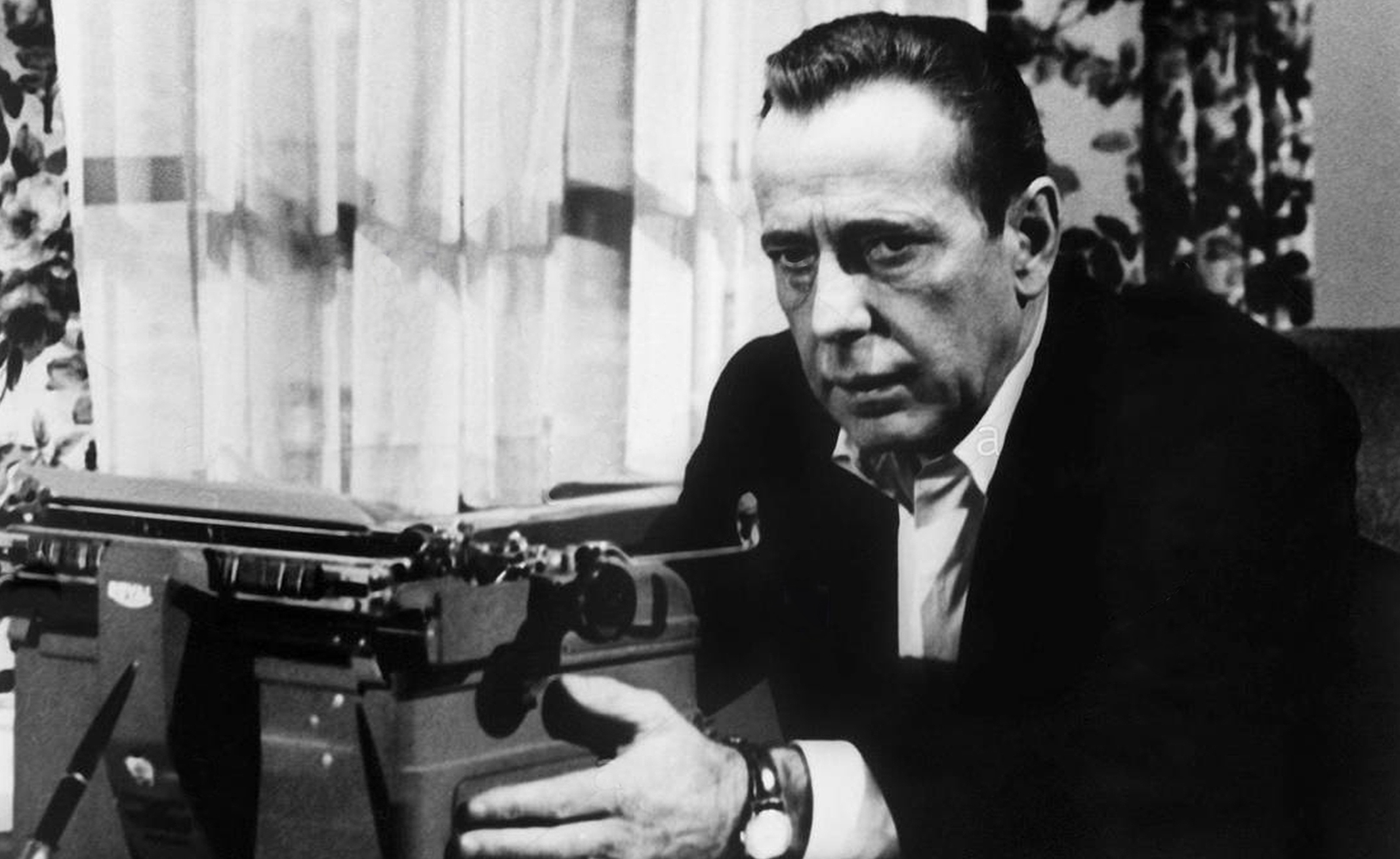
The Harder They Fall was photographed in late 1955, just a little over a year before Bogart’s death, and according to several sources, he was already feeling ill at the time of filming. But it doesn’t really show. Even if he wasn’t feeling very healthy, it worked well for the role of a cynical, has-been newspaper man. His understated, downtrodden performance was a great asset to the film, and served as a perfect counter-balance to Steiger’s bigger-than-life acting style.
I think the best scenes are the ones where the paternal Eddie comforts the childlike Toro, speaking to him from the heart. but knowing that in reality, he’s being dishonest to him. Bogart infused these scenes with just the right amount of sentiment, without becoming sentimental.
All in all, The Harder They Fall may not be a knock-out movie, but it holds its own, and it’s most certainly a respectable finale to a legendary career.

Hey Mark. Great post! Very exhaustive. Glad I could help you out on the new VA Outpatient Clinic construction date (1989, construction began). Love all the research you did!
LikeLiked by 1 person
I just saw the first half of this movie last week. Good Bogie. Good Rod. El Toro is a little TOO spastic. I was interested in the ads within the gym. None of the (four) addresses check out…but they ALMOST do. One for a restaurant on 262 W. 61st St. is curious in that the “tax photo” shows the addresses ending at 242. (BTW the “arrival of El Toro” was completely cut out. The movie I saw starts with the descent on the gym and it was tight.) Keep up your crazy work.
LikeLike
Amazing work for this underrated film, thank you.
LikeLike